AGENDA
Ordinary Council Meeting
5 March 2019
|
Time: |
6pm |
|
Location: |
Administration and Civic Centre 244 Vincent Street, Leederville |
David MacLennan
Chief Executive Officer
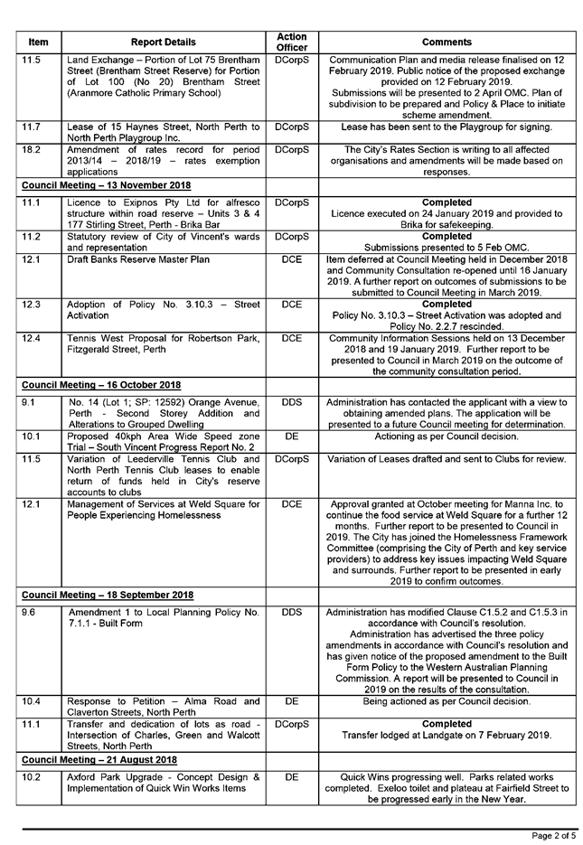
AGENDA
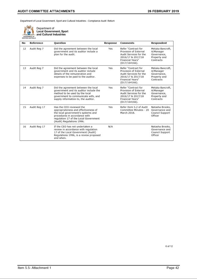
Ordinary Council Meeting
5 March 2019
|
Time: |
6pm |
|
Location: |
Administration and Civic Centre 244 Vincent Street, Leederville |
David MacLennan
Chief Executive Officer
Ordinary Council Meeting Agenda 5 March 2019
DISCLAIMER
No responsibility whatsoever is implied or accepted by the City of Vincent (City) for any act, omission, statement or intimation occurring during Council Briefings or Council Meetings. The City disclaims any liability for any loss however caused arising out of reliance by any person or legal entity on any such act, omission, statement or intimation occurring during Council Briefings or Council Meetings. Any person or legal entity who acts or fails to act in reliance upon any statement, act or omission made in a Council Briefing or Council Meeting does so at their own risk.
In particular and without derogating in any way from the broad disclaimer above, in any discussion regarding any planning or development application or application for a licence, any statement or intimation of approval made by an Elected Member or Employee of the City during the course of any meeting is not intended to be and is not to be taken as notice of approval from the City. The City advises that anyone who has any application lodged with the City must obtain and should only rely on WRITTEN CONFIRMATION of the outcome of the application, and any conditions attaching to the decision made by the Council in respect of the application.
Copyright
Any plans or documents contained within this Agenda may be subject to copyright law provisions (Copyright Act 1968, as amended) and that the express permission of the copyright owner(s) should be sought prior to their reproduction. It should be noted that Copyright owners are entitled to take legal action against any persons who infringe their copyright. A reproduction of material that is protected by copyright may represent a copyright infringement.
PROCEDURE FOR PUBLIC SPEAKING TIME
The City of Vincent Local Law Relating to Meeting Procedures prescribes the procedure for persons to ask questions or make public statements relating to a matter affecting the City, either verbally or in writing, at a Council meeting.
Questions or statements made at an Ordinary Council meeting can relate to matters that affect the City. Questions or statements made at a Special Meeting of the Council must only relate to the purpose for which the meeting has been called.
1. Shortly after the commencement of the meeting, the Presiding Member will ask members of the public to come forward to address the Council and to give their name and the suburb in which they reside or, where a member of the public is representing the interests of a business, the suburb in which that business is located and Agenda Item number (if known).
2. Public speaking time will be strictly limited to three (3) minutes per member of the public.
3. Members of the public are encouraged to keep their questions/statements brief to enable everyone who desires to ask a question or make a statement to have the opportunity to do so.
4. Public speaking time is declared closed when there are no further members of the public who wish to speak.
5. Questions/statements are to be directed to the Presiding Member and are to be made politely in good faith and are not to be framed in such a way as to reflect adversely or be defamatory on a Council Member or City Employee.
6. Where the Presiding Member is of the opinion that a member of the public is making a statement at a Council meeting, that does not affect the City, he may ask the person speaking to promptly cease.
7. Questions/statements and any responses will be summarised and included in the Minutes of the Council meeting.
8. Where practicable, responses to questions will be provided at the meeting. Where the information is not available or the question cannot be answered, it will be “taken on notice” and a written response will be sent by the Chief Executive Officer to the person asking the question. A copy of the reply will be included in the Agenda of the next Ordinary meeting of the Council.
9. It is not intended that public speaking time should be used as a means to obtain information that would not be made available if it was sought from the City’s records under Section 5.94 of the Local Government Act 1995 or the Freedom of Information (FOI) Act 1992. The CEO will advise the member of the public that the information may be sought in accordance with the FOI Act 1992.
RECORDING AND WEBSTREAMING OF COUNCIL MEETINGS
· All Ordinary and Special Council Meetings are electronically recorded except when the Council resolves to go behind closed doors;
· All recordings are retained as part of the City's records in accordance with the General Disposal Authority for Local Government Records produced by the Public Records Office;
· A copy of the recorded proceedings and/or a transcript of a particular section or all of a Council meeting is available in accordance with Policy No. 4.2.4 – Council Meetings – Recording and Web Streaming.
· Ordinary Meetings of Council and Council Briefings are streamed live on the internet in accordance with the City’s Policy – 4.2.4 - Council Meetings Recording and Web Streaming. It is another way the City is striving for transparency and accountability in what we do.
· The live stream can be accessed from http://webcast.vincent.wa.gov.au/video.php
· Images of the public gallery are not included in the webcast, however the voices of people in attendance may be captured and streamed.
· If you have any issues or concerns with the live streaming of meetings, please contact the City’s Manager Governance and Risk on 08 9273 6538.
Ordinary Council Meeting Agenda 5 March 2019
1 Declaration of Opening / Acknowledgement of Country
2 Apologies / Members on Leave of Absence
3 (A) Public Question Time and Receiving of Public Statements
(B) Response to Previous Public Questions Taken On Notice
4 Applications for Leave of Absence
5 The Receiving of Petitions, Deputations and Presentations
7 Announcements by the Presiding Member (Without Discussion)
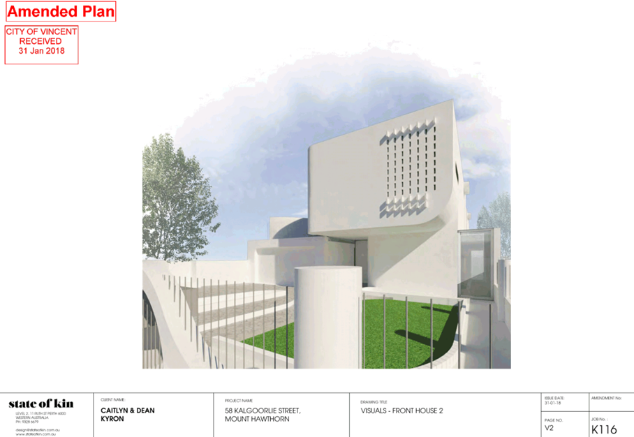
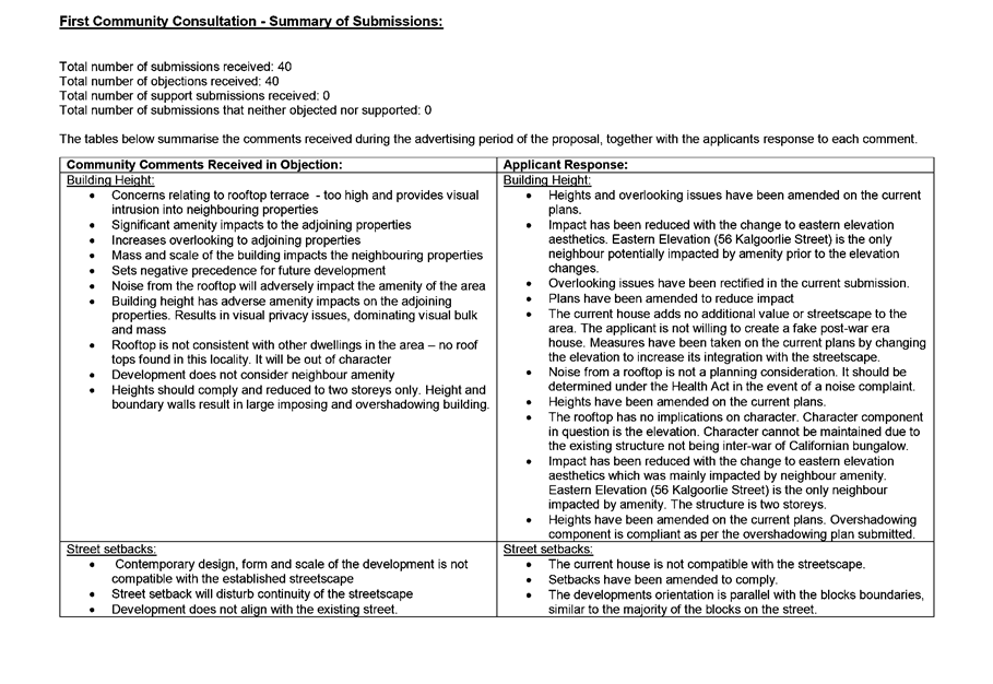
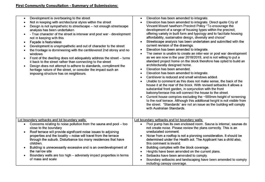
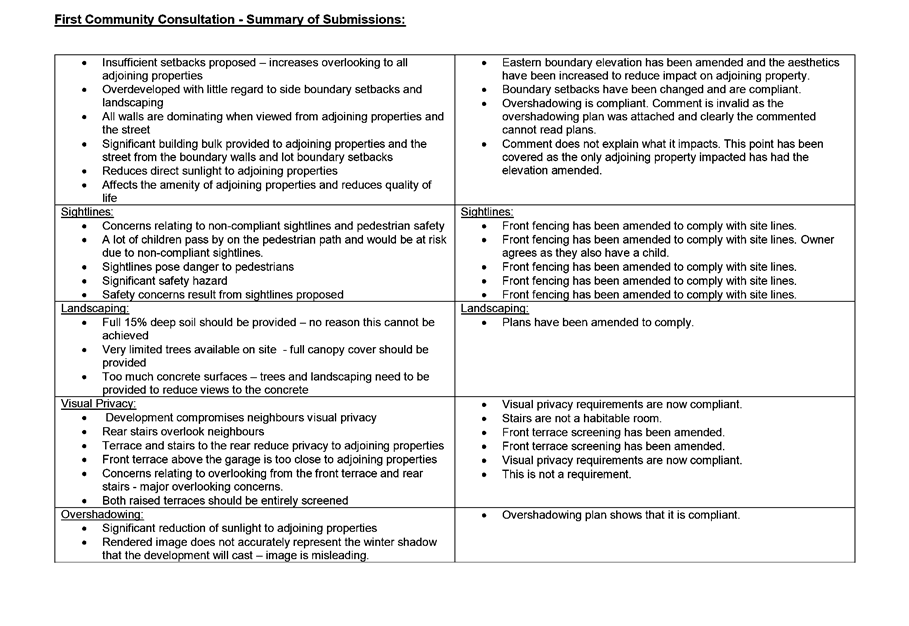
9.2 No. 377 (Lot: 162; D/P: 2630) Walcott Street, Coolbinia - Four Multiple Dwellings
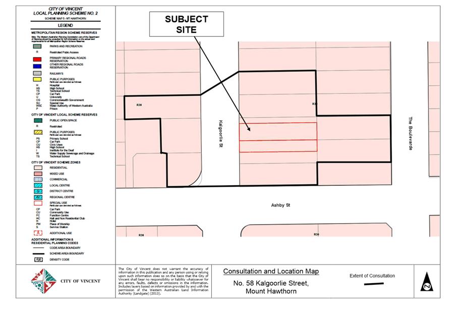
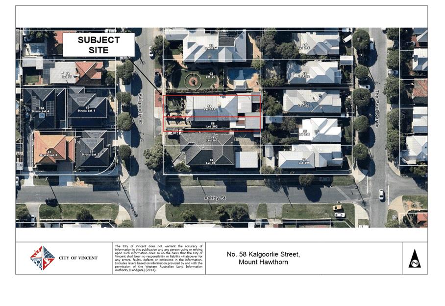
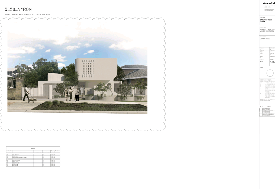
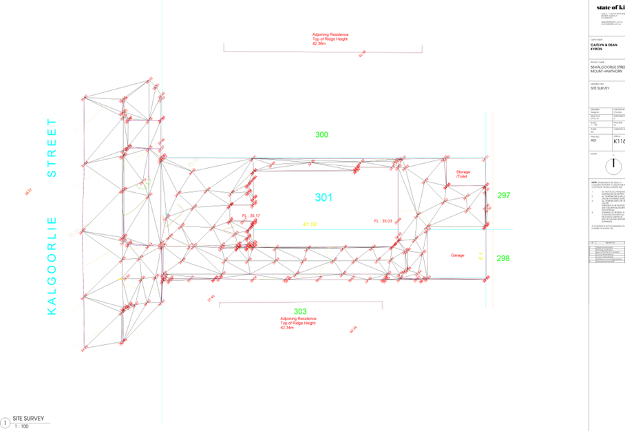
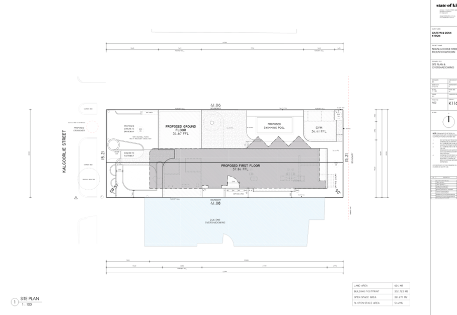
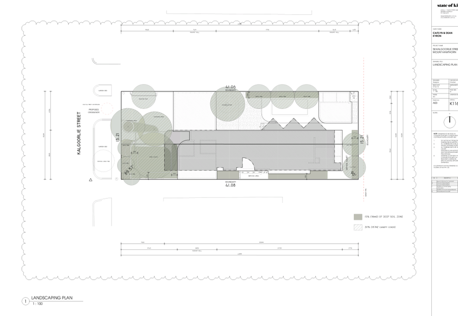
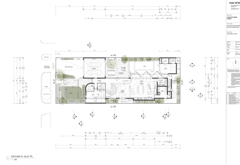
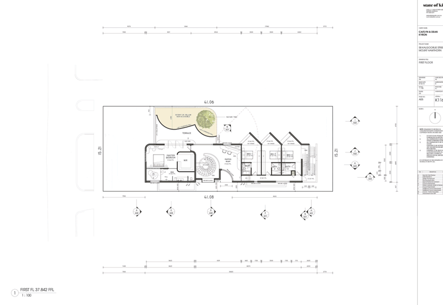
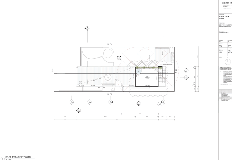
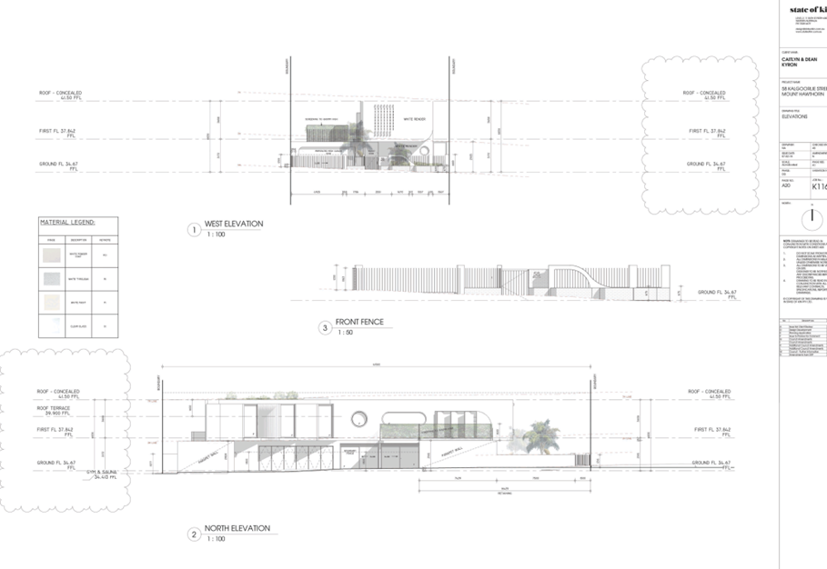
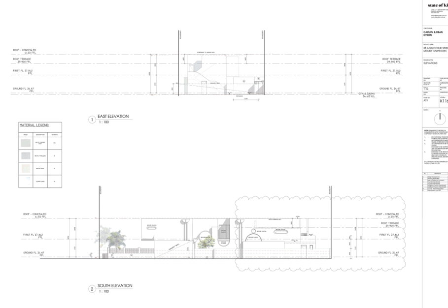
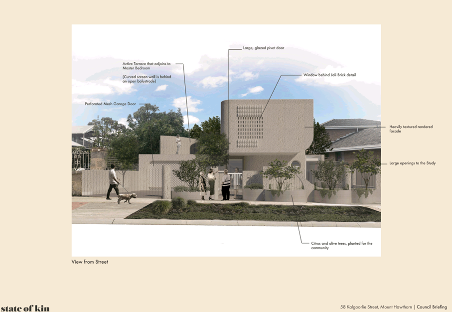
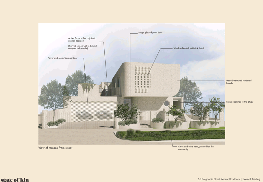
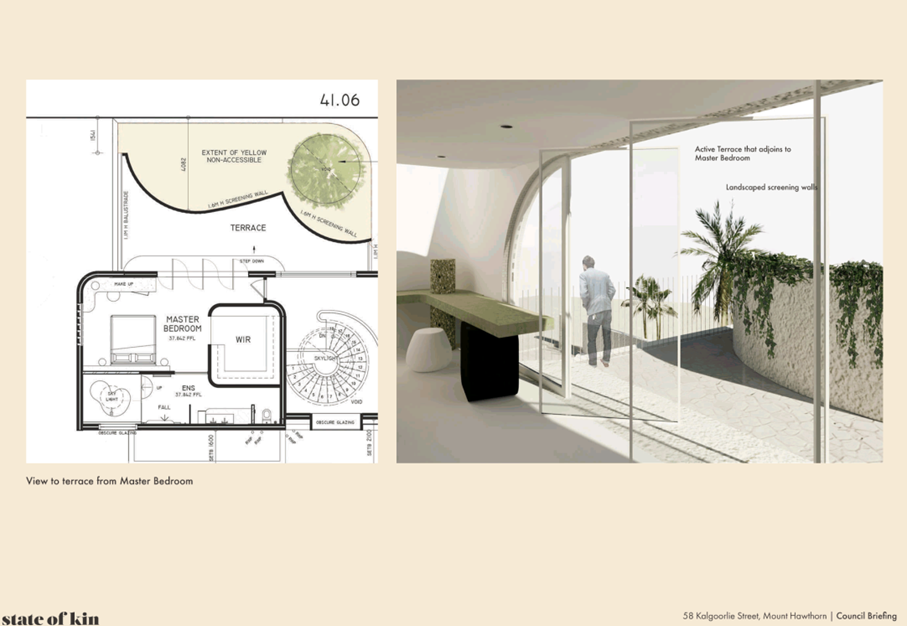
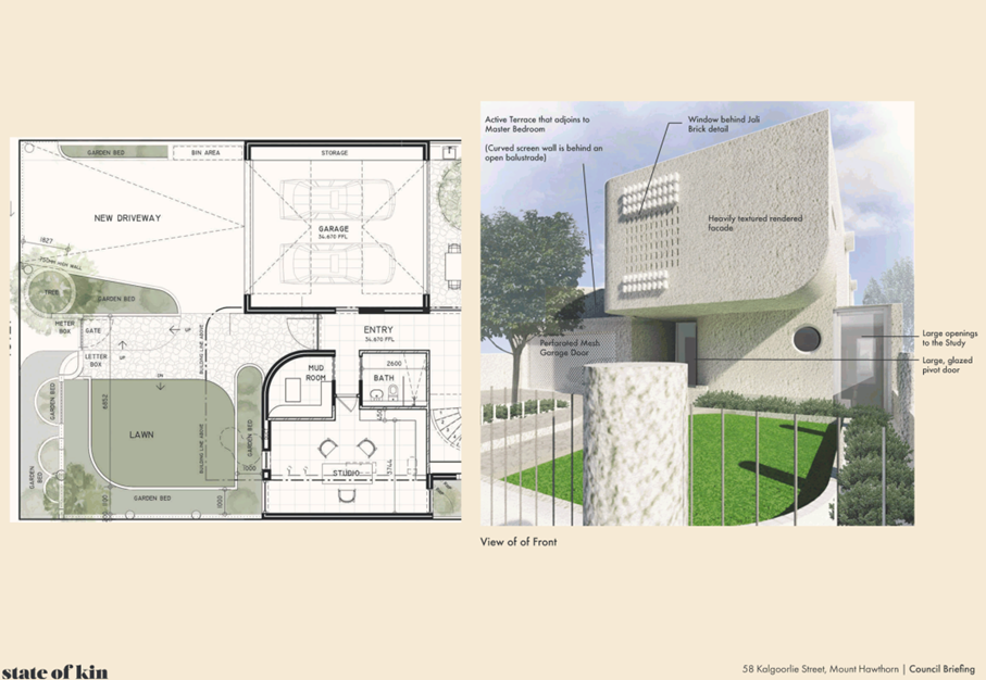
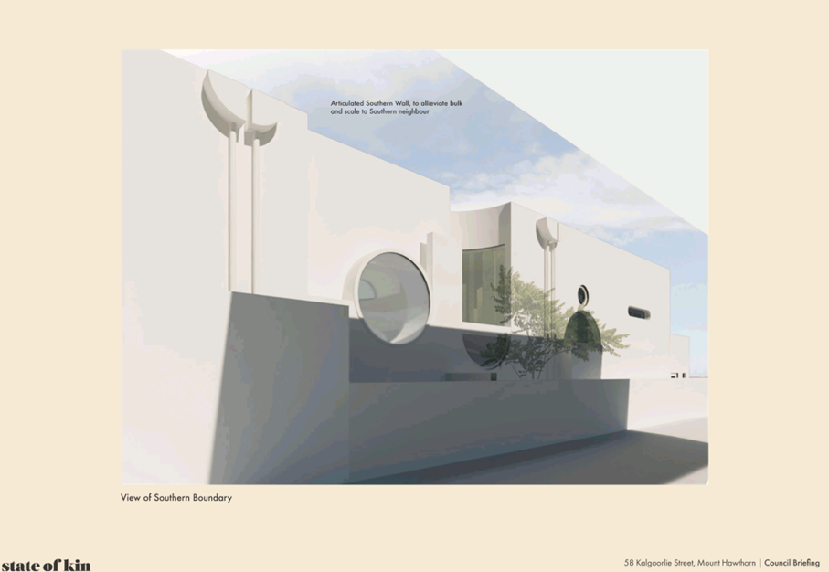
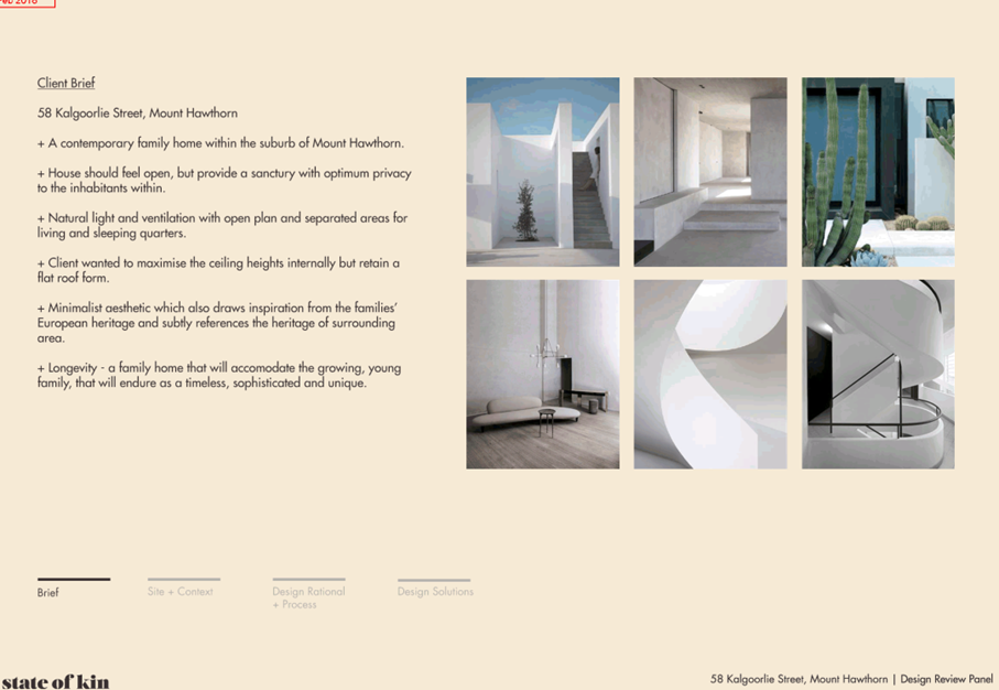
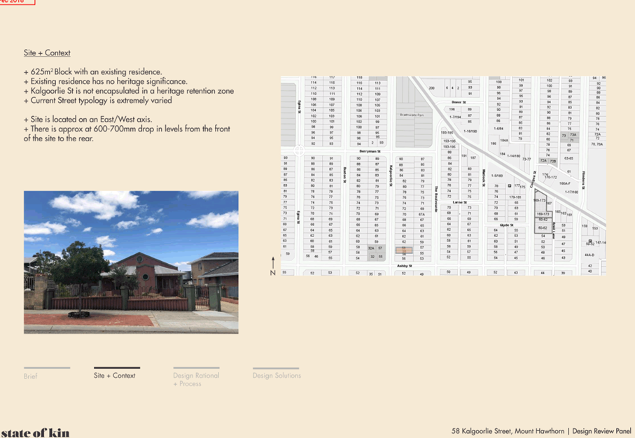
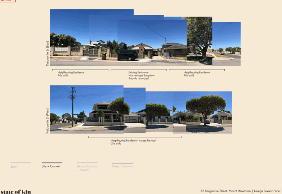
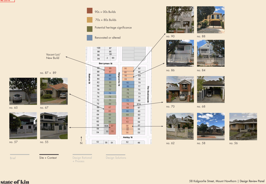
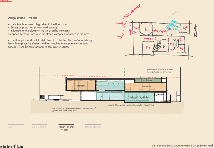
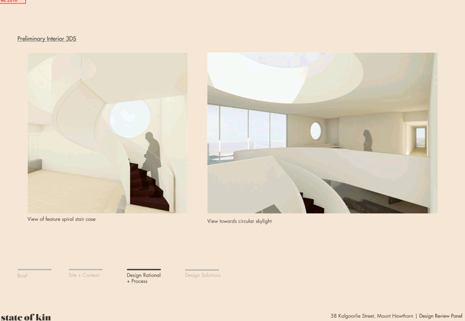
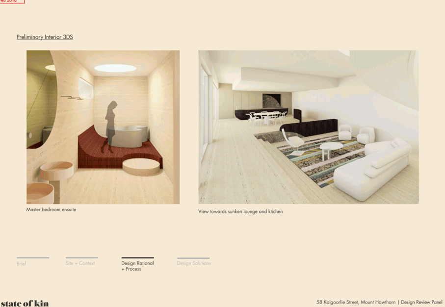
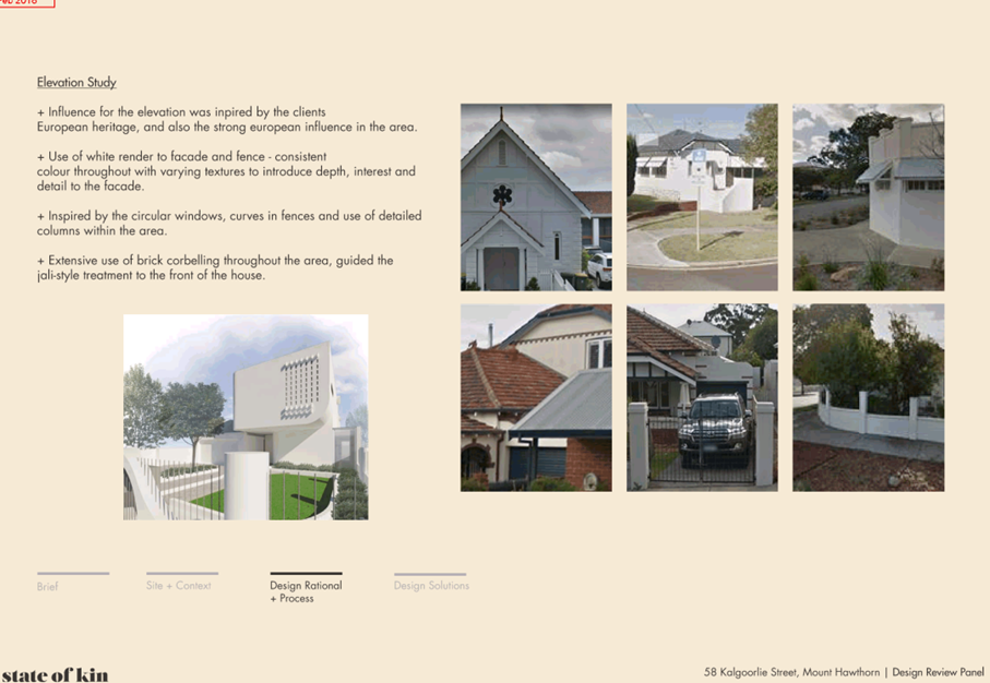
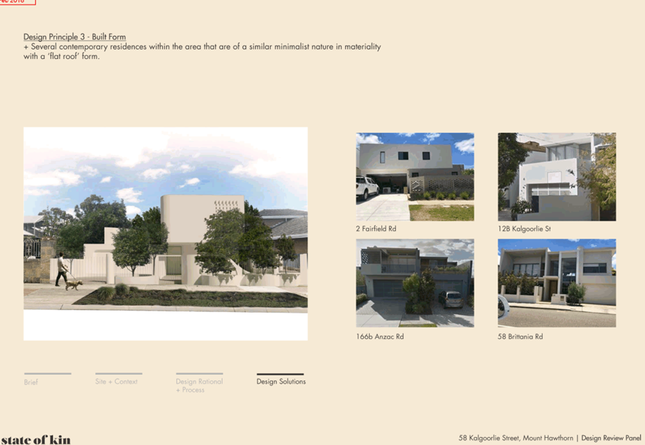
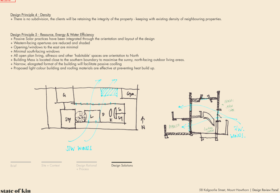
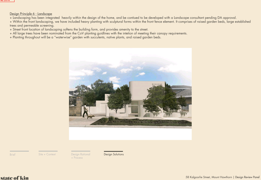
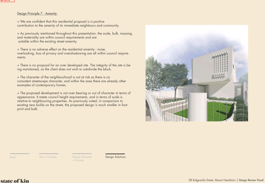
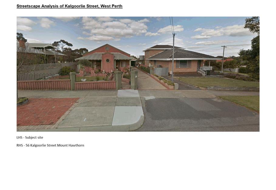
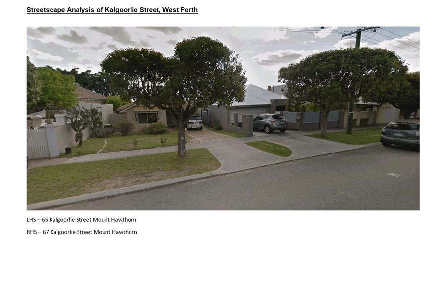
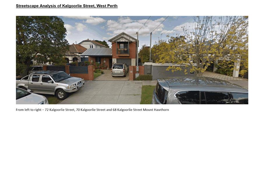
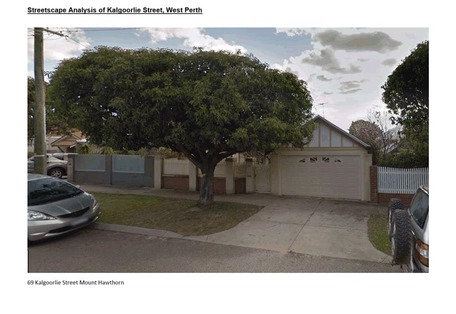
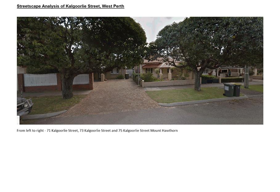
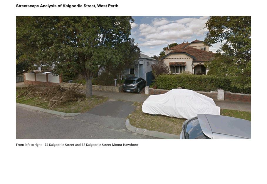
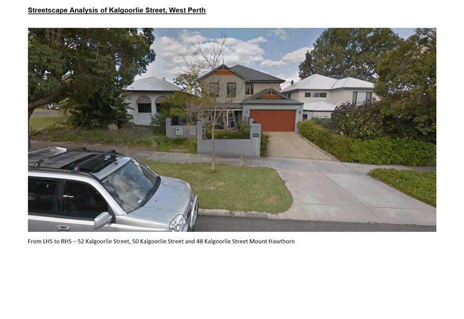
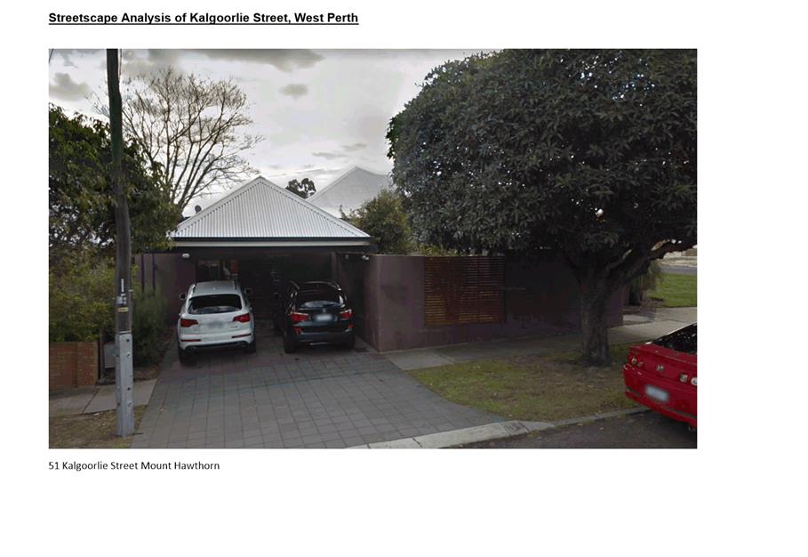
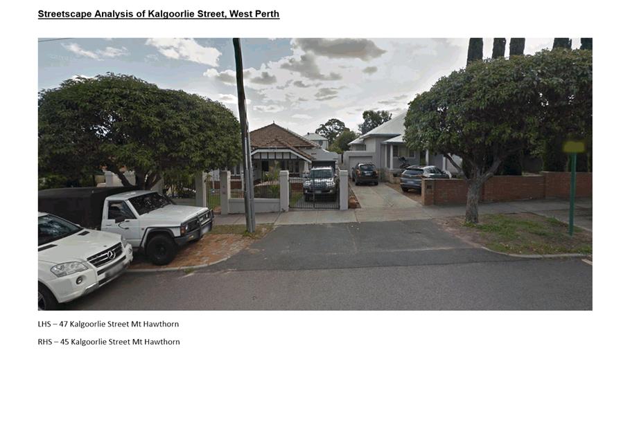
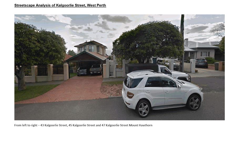
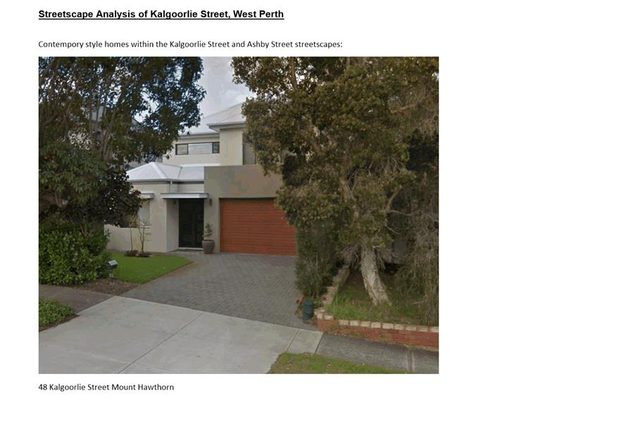
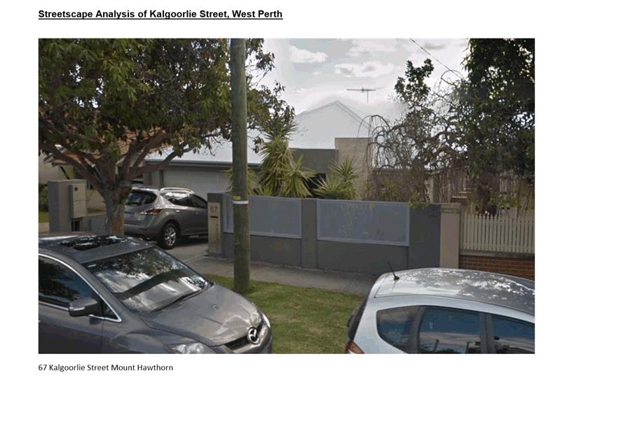
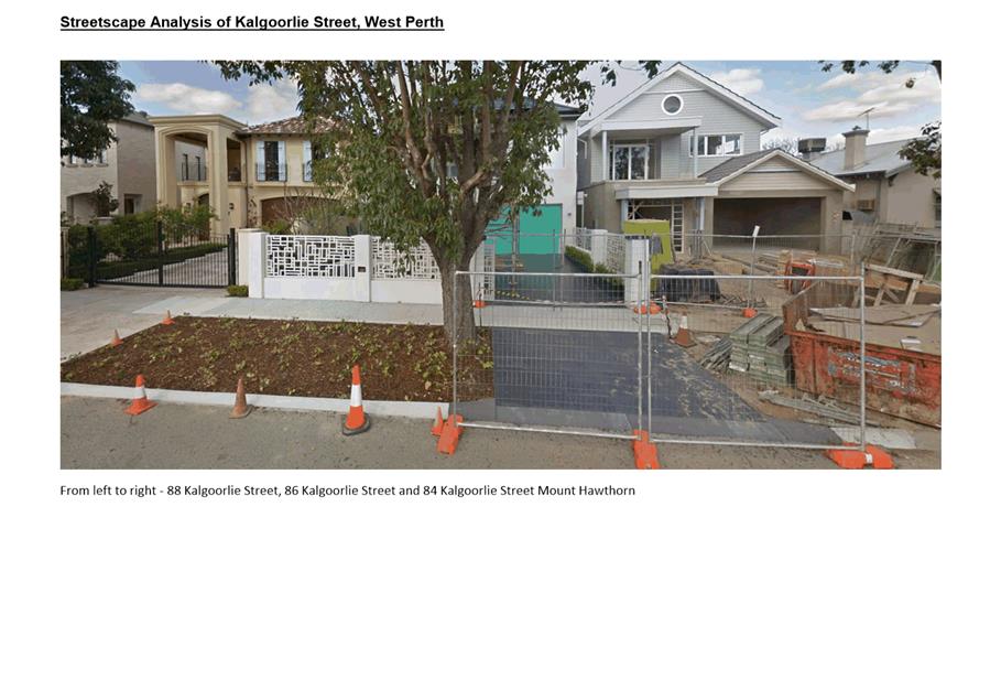
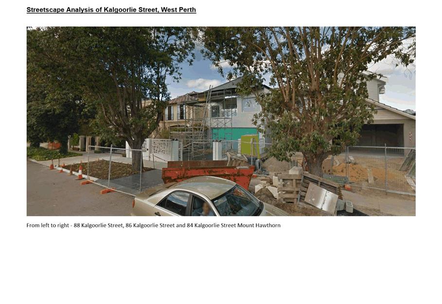
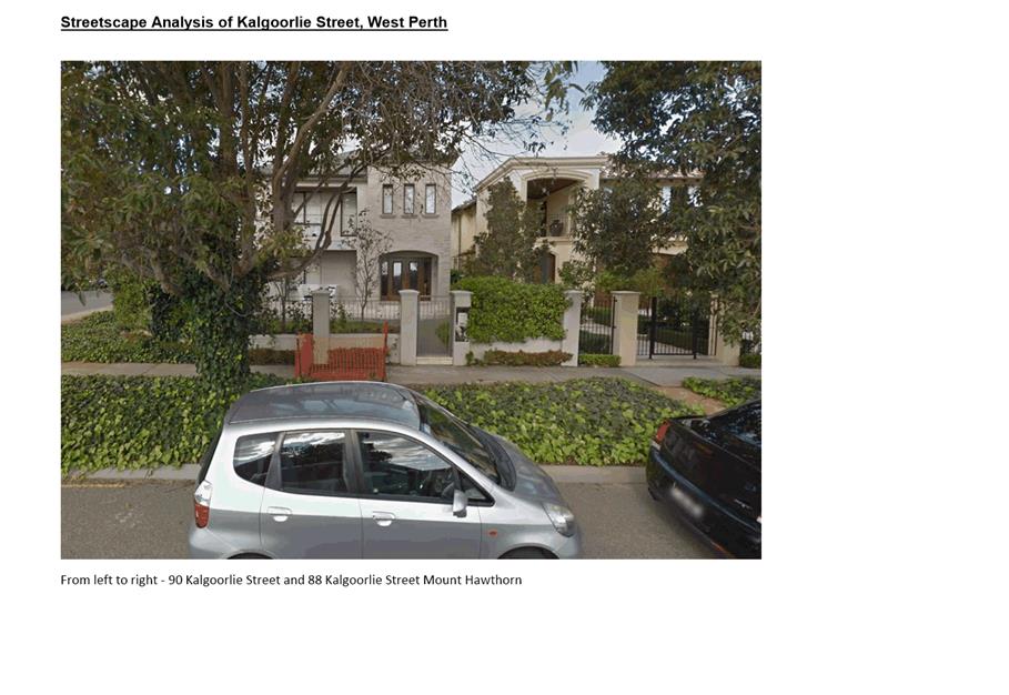
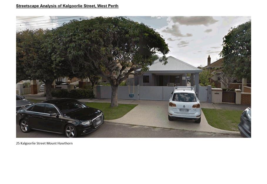
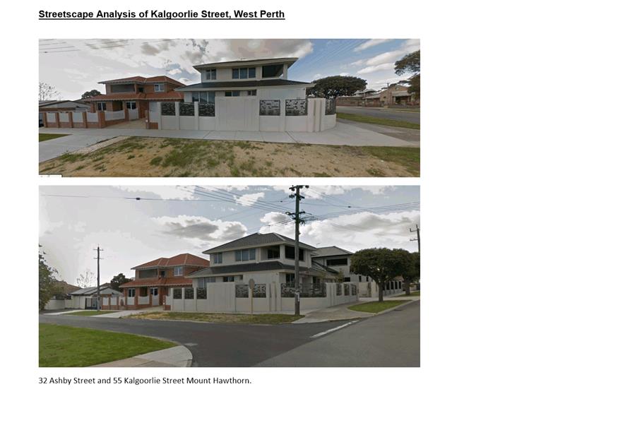
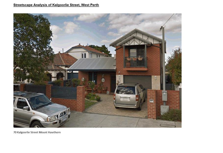
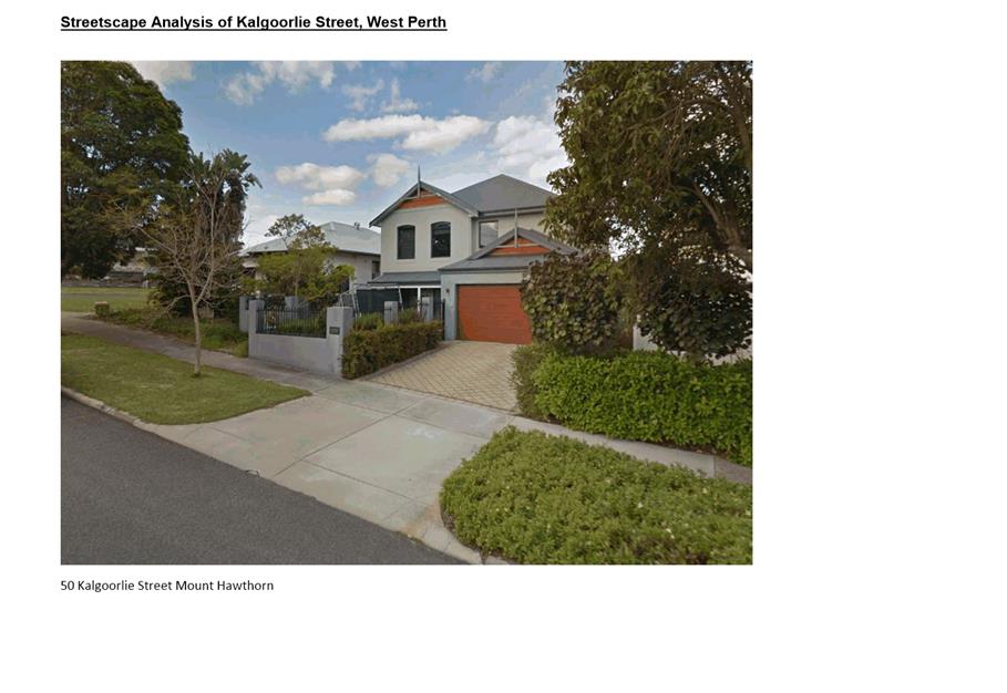
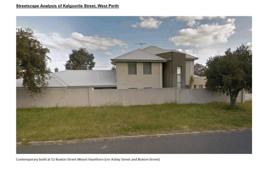
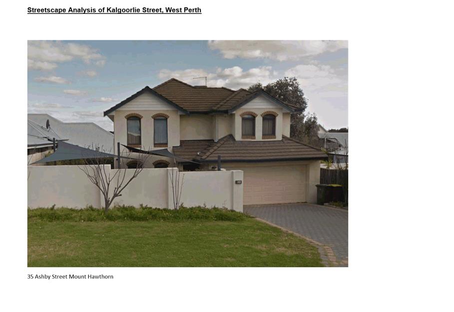
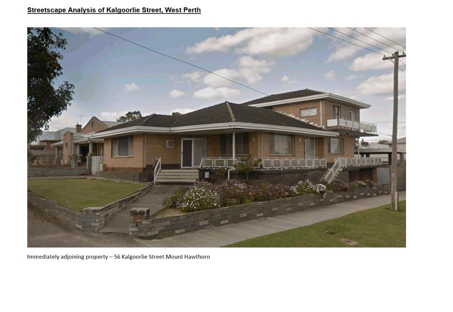
9.7 No. 58 (Lot: 301 & 302; D/P: 34680) Kalgoorlie Street, Mount Hawthorn - Single House
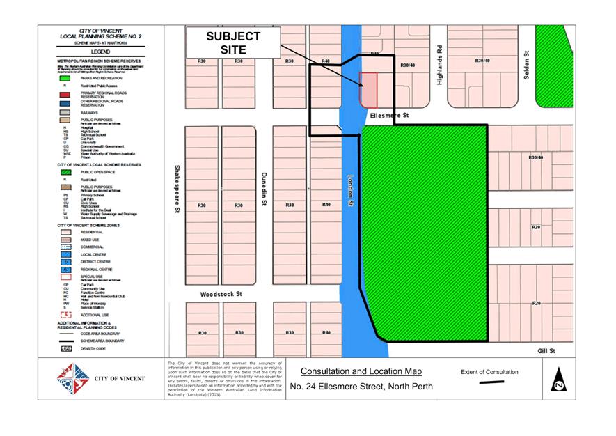
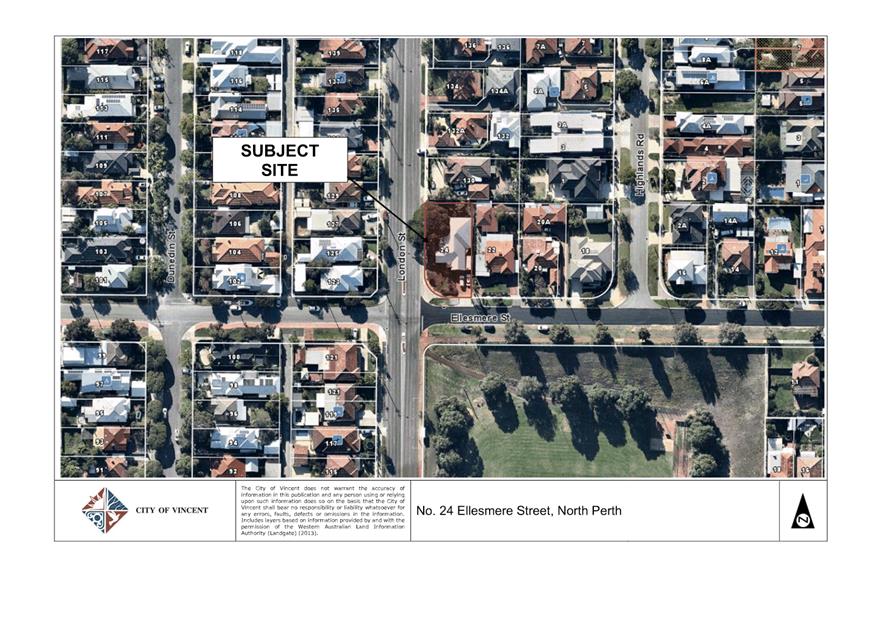
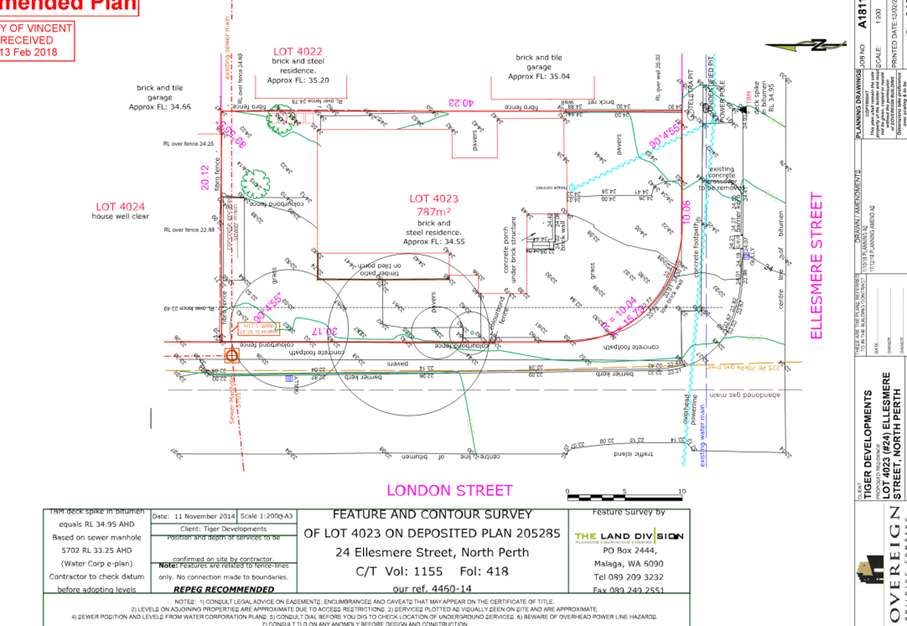
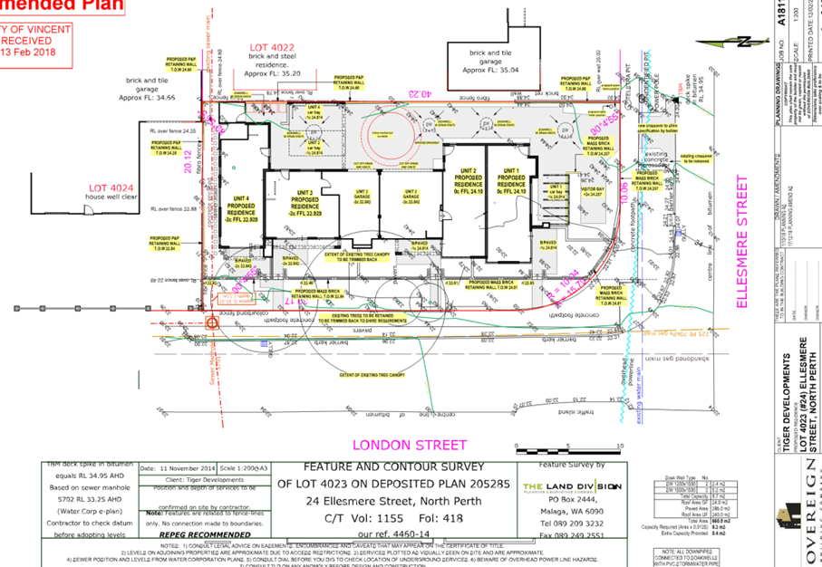
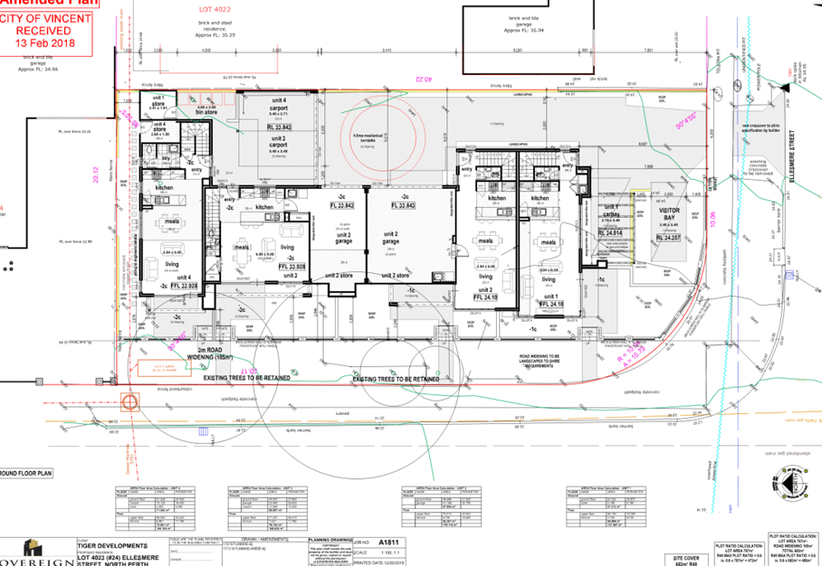
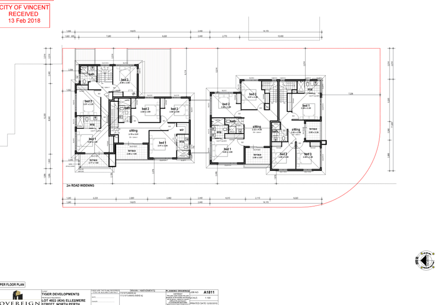
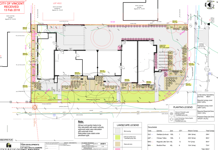
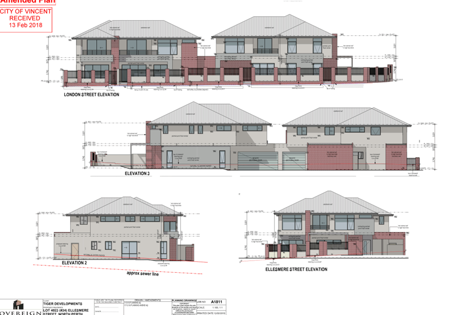
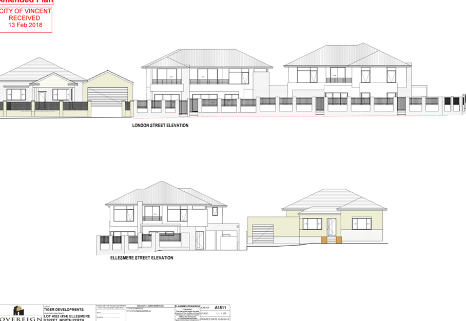
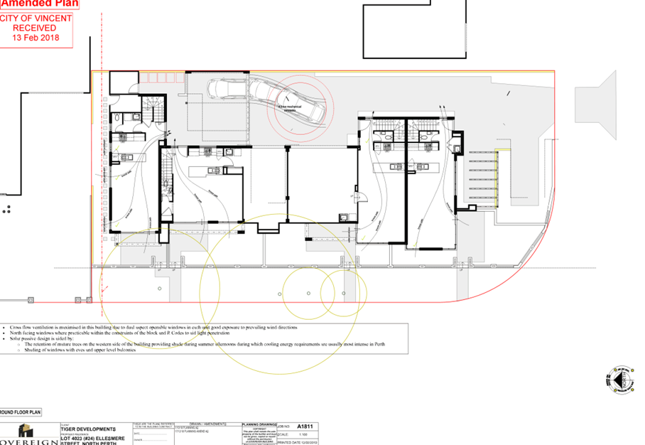
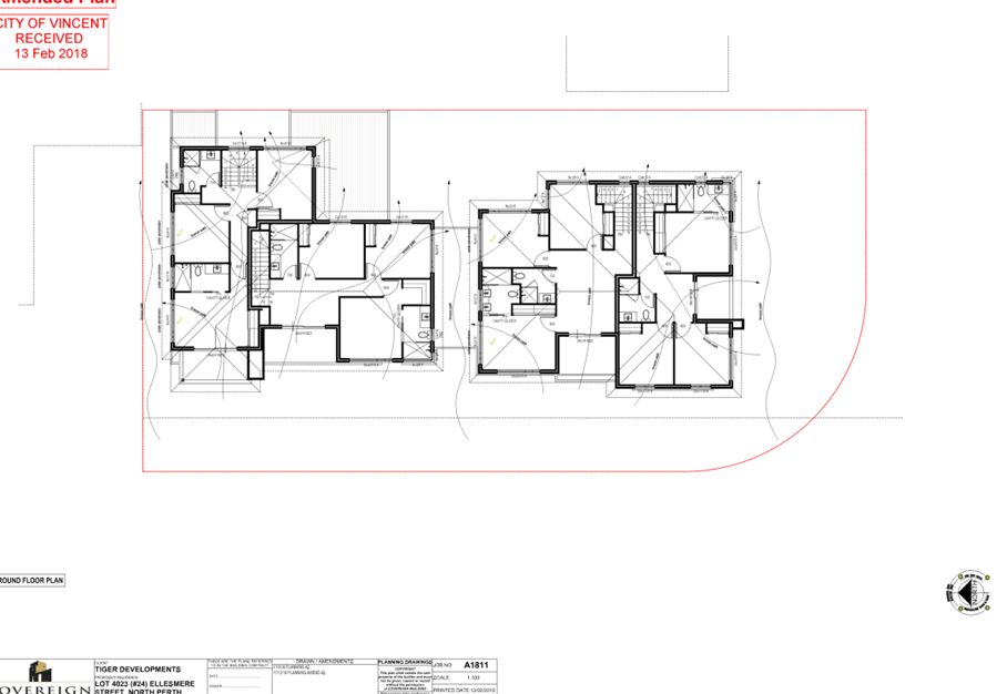
9.8 No. 24 (Lot: 4023; D/P: SWAN) Ellesmere Street, North Perth - Four Multiple Dwellings
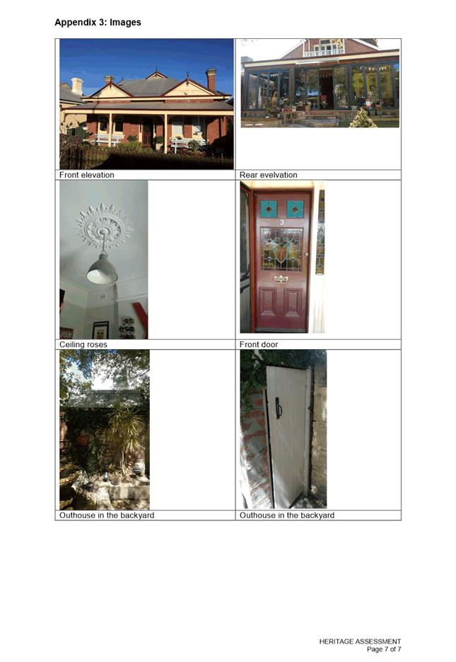
9.9 Amendment to Municipal Heritage Inventory - No. 3 (Lot: 18) Mignonette Street, North Perth
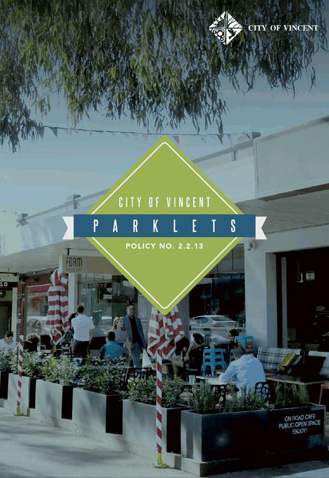
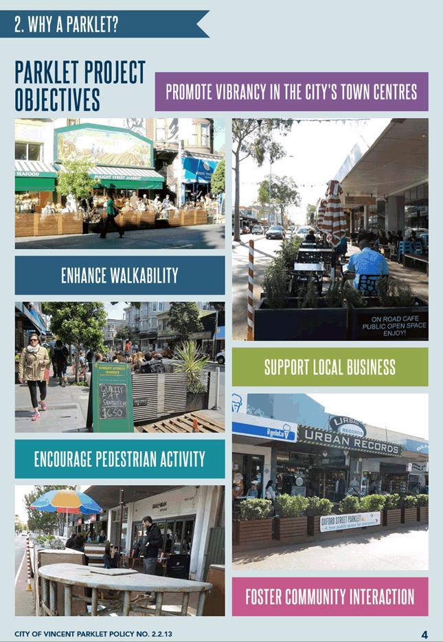
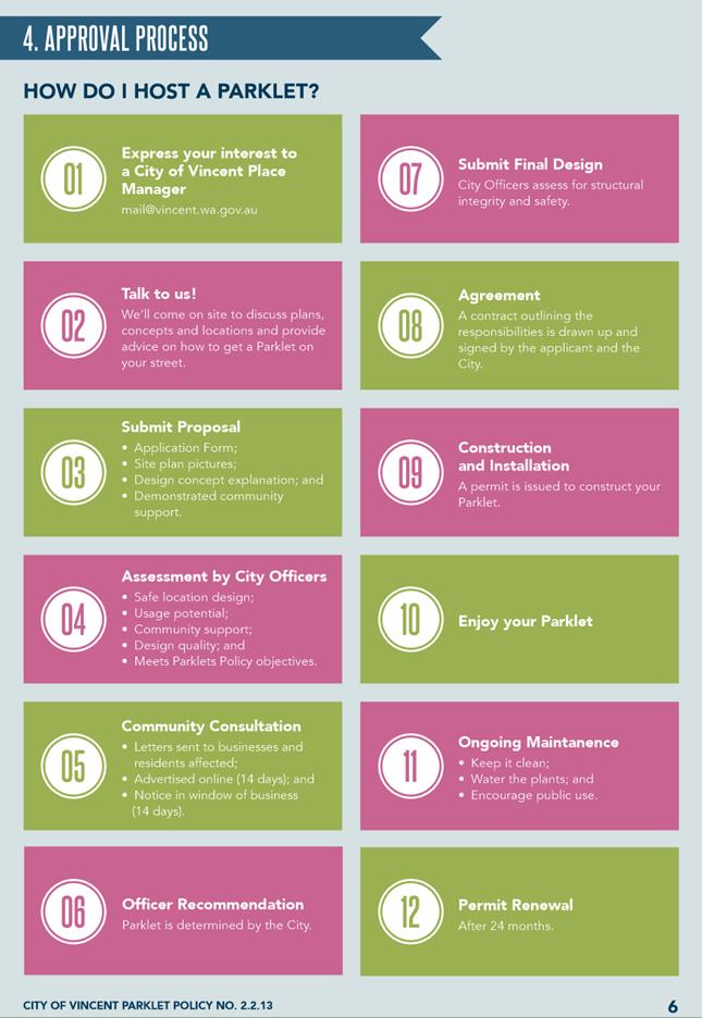
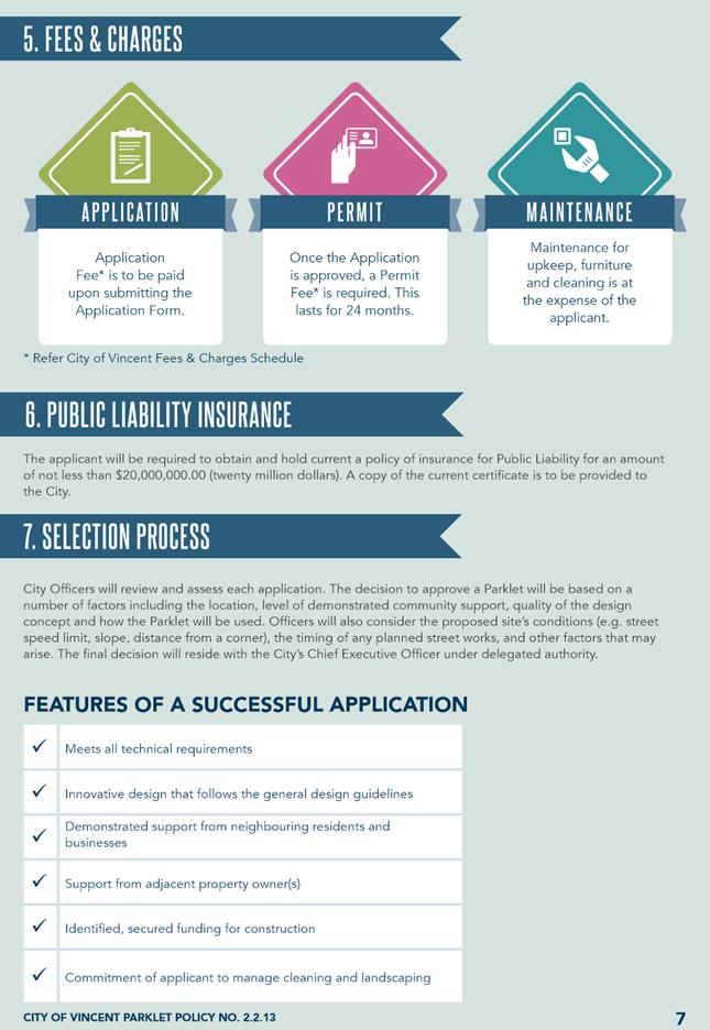
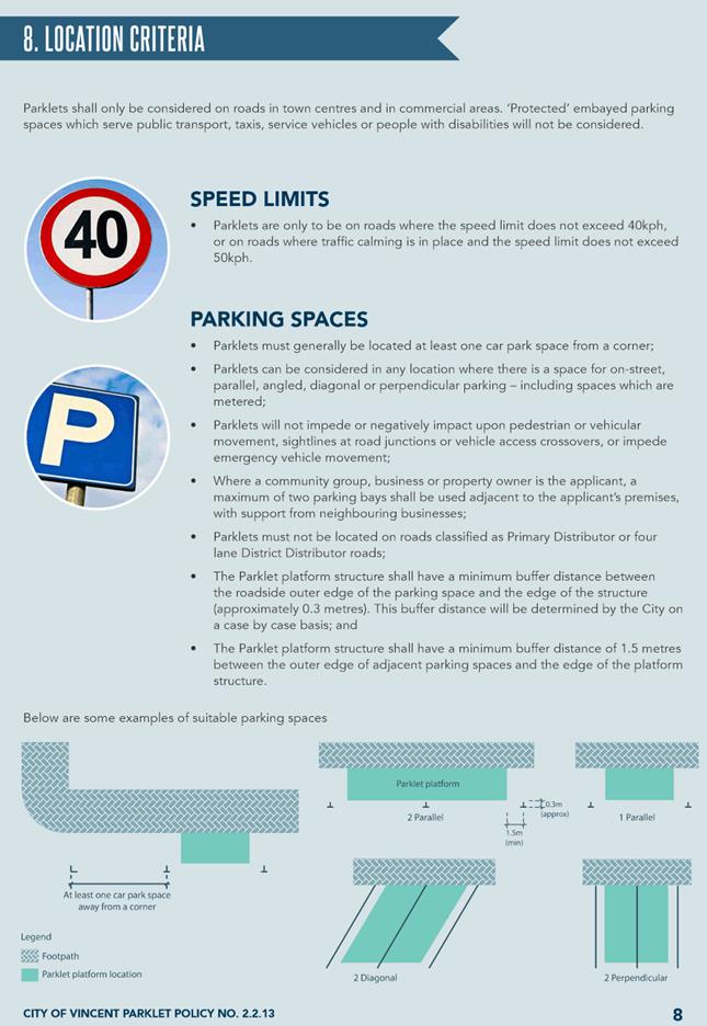
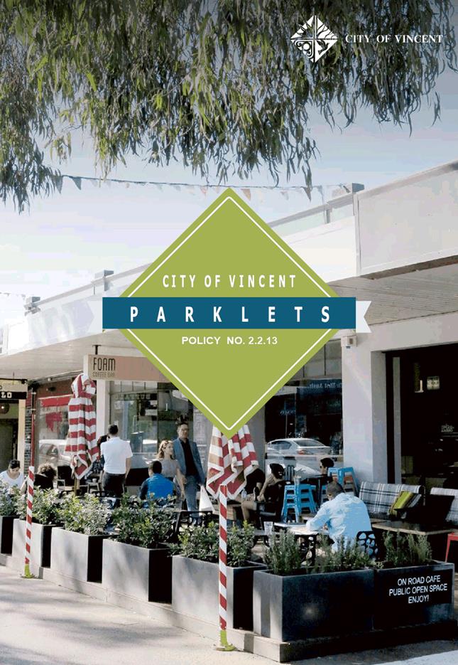
9.10 Amendment to Policy No. 2.2.13 - Parklets
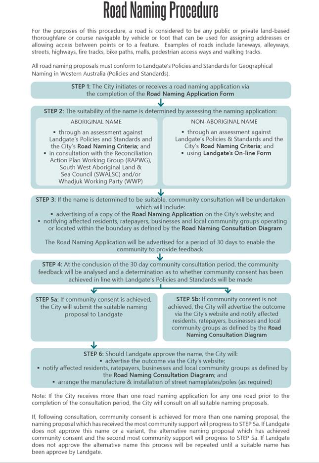
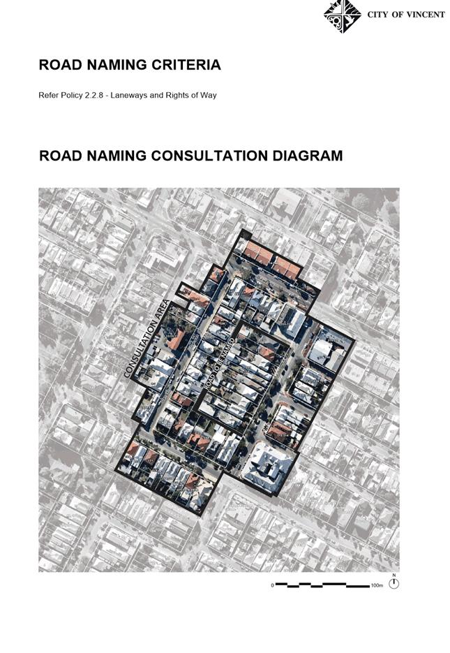
9.11 Amendment to Policy No. 2.2.8 - Laneways and Rights of Way
10.1 Business Case for the Adoption of a Three Bin Food Organic/Garden Organics System
11.1 Minutes and motions from Annual General Meeting of Electors held on 29 January 2019
11.2 2019/2020 budget process timelines and separate waste charge
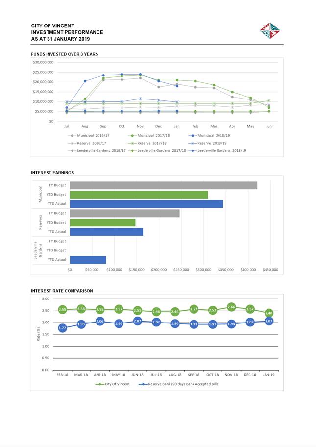
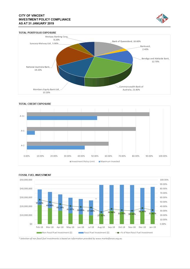
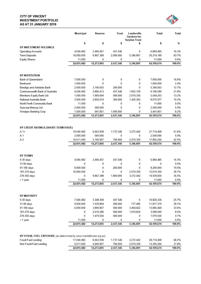
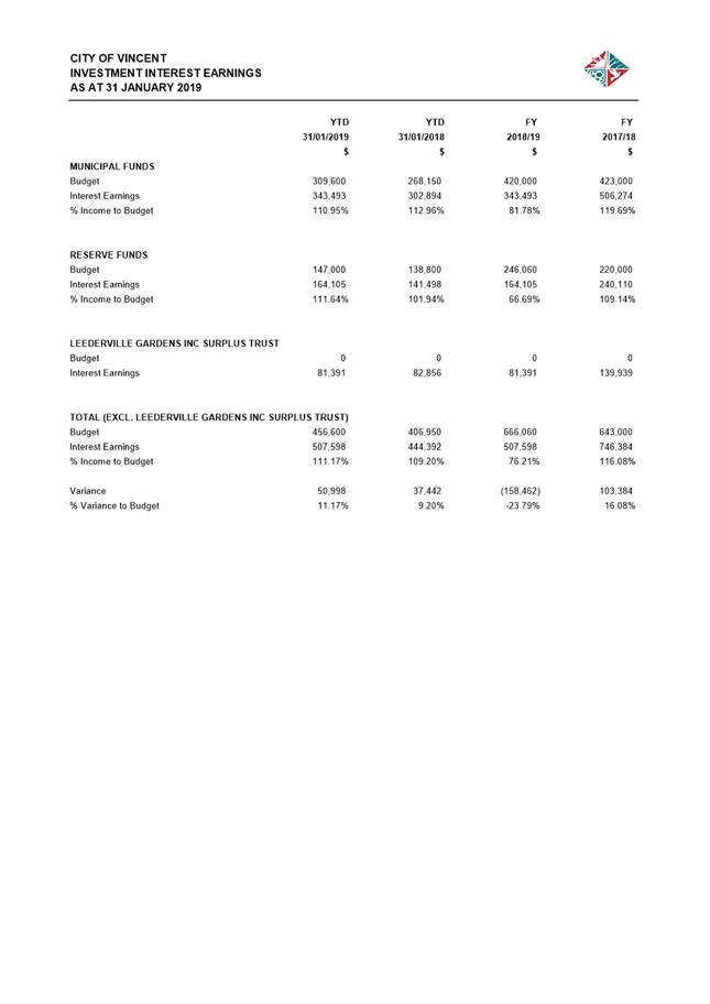
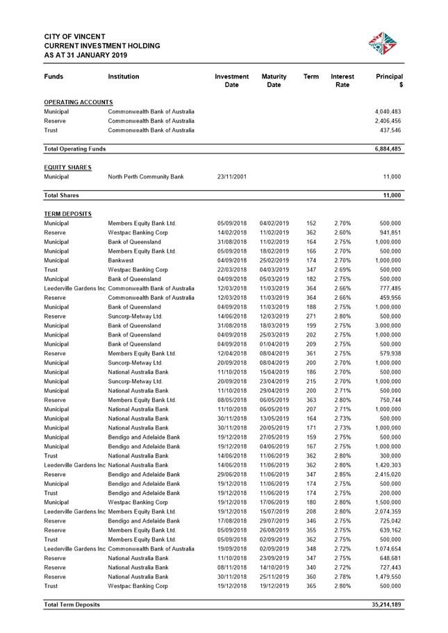
11.3 Investment Report as at 31 January 2019
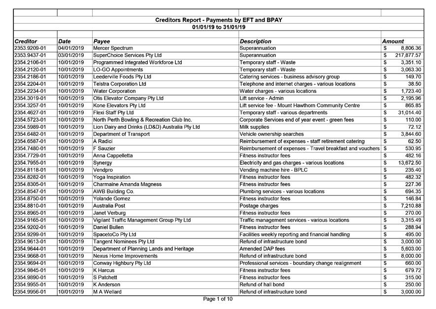
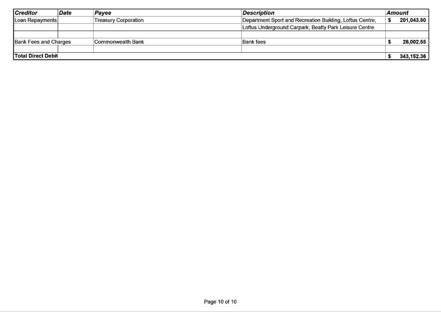
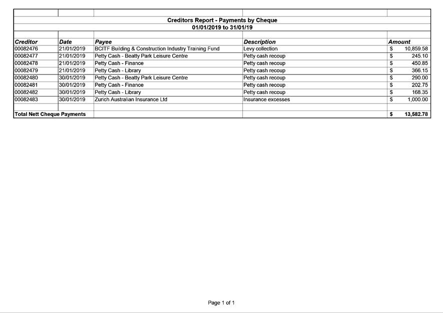
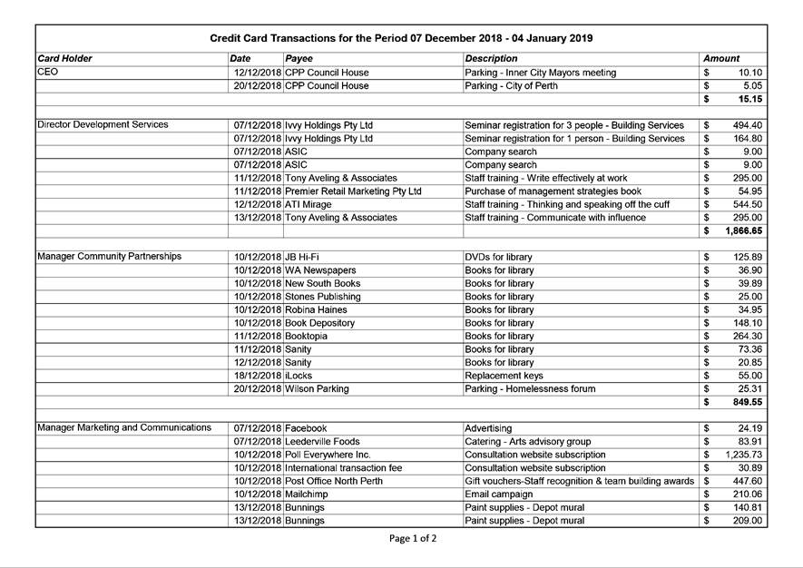
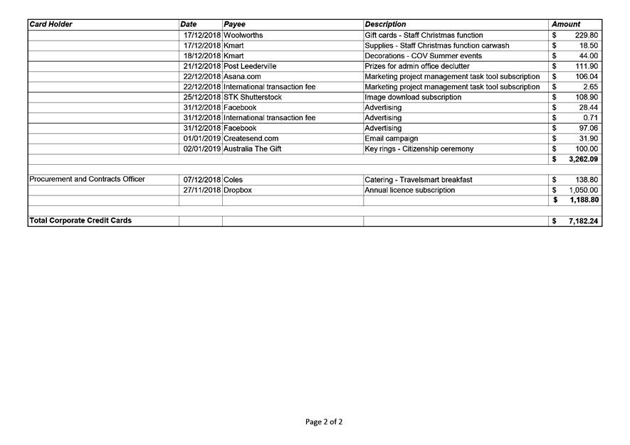
11.4 Authorisation of Expenditure for the Period 01 January 2019 to 31 January 2019
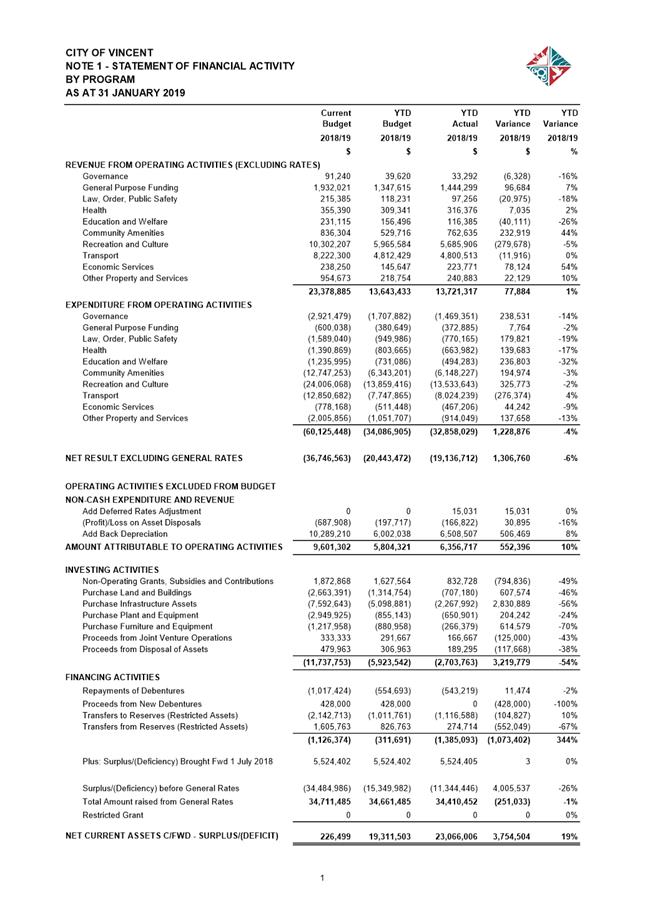
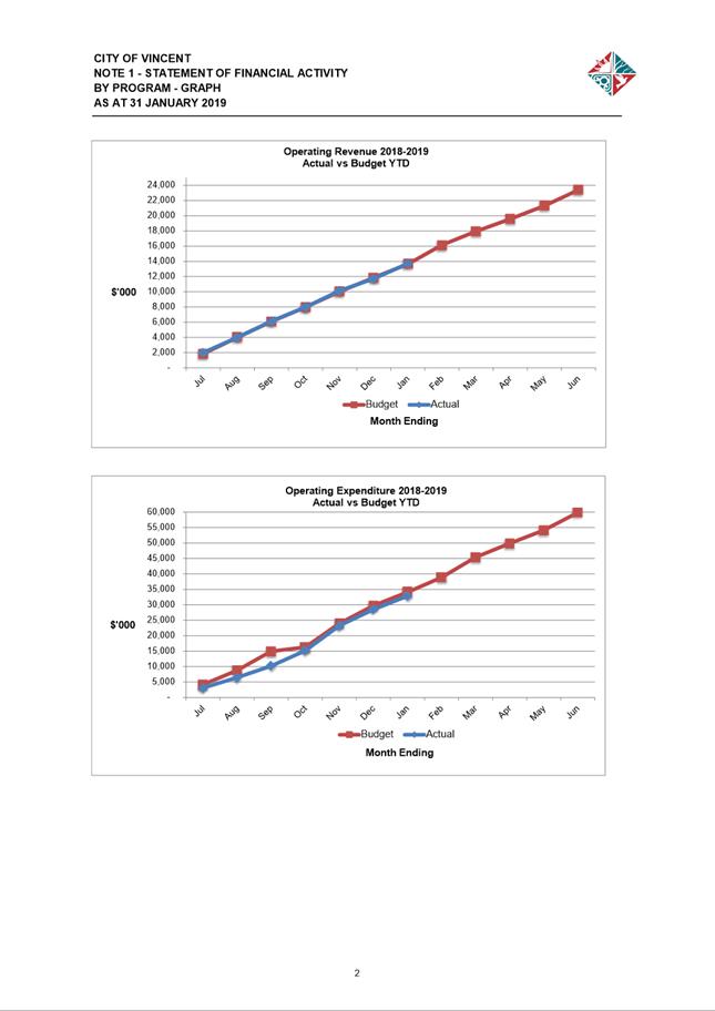
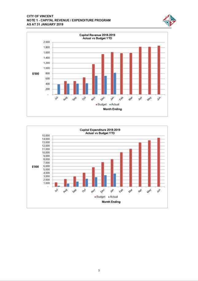
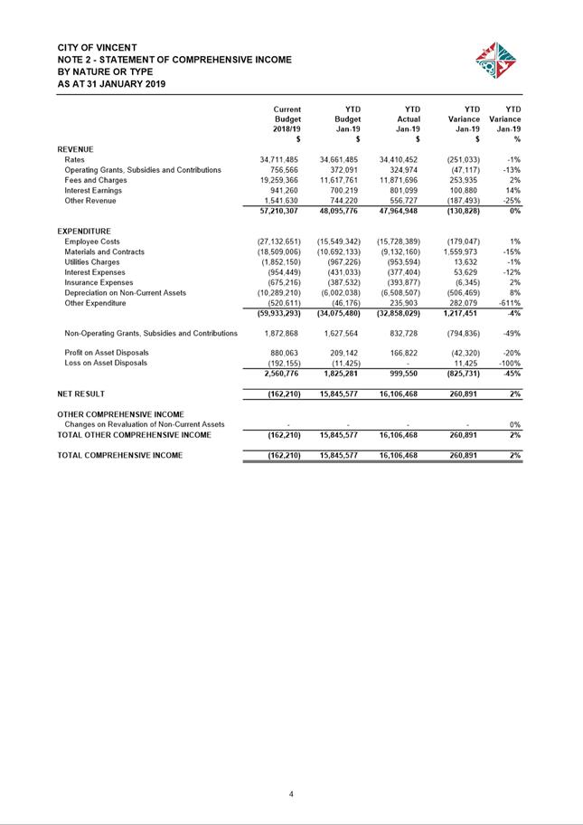
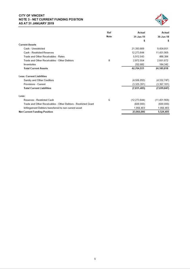
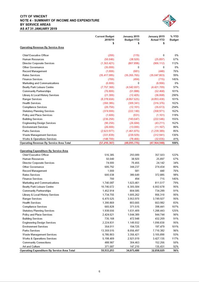
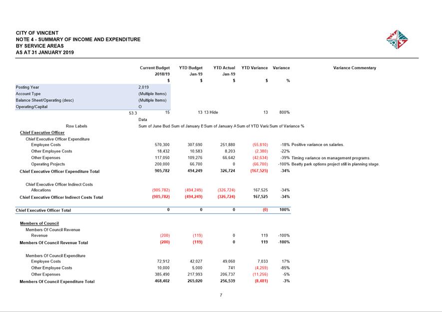
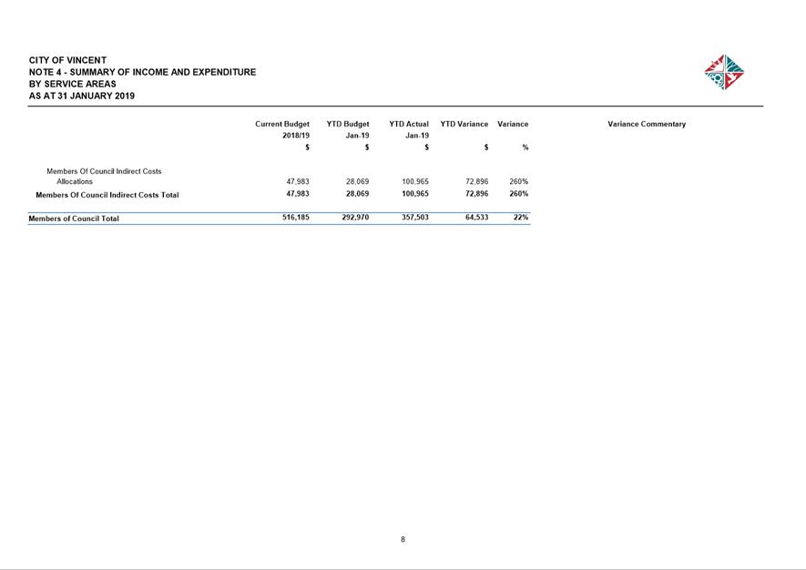
11.5 Financial Statements as at 31 January 2019
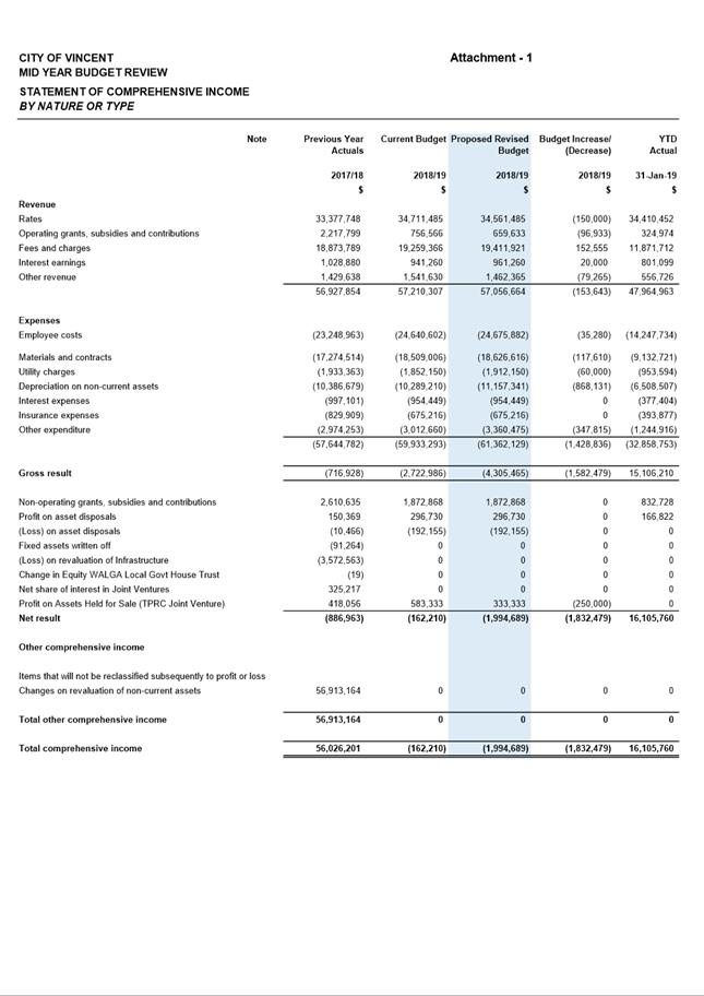
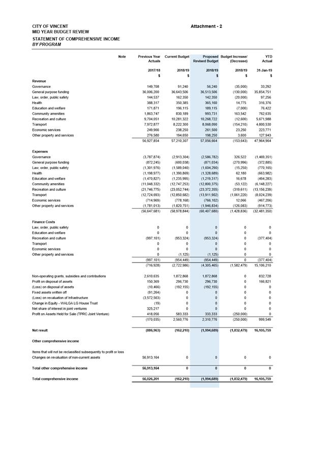
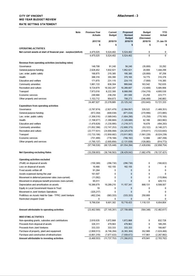
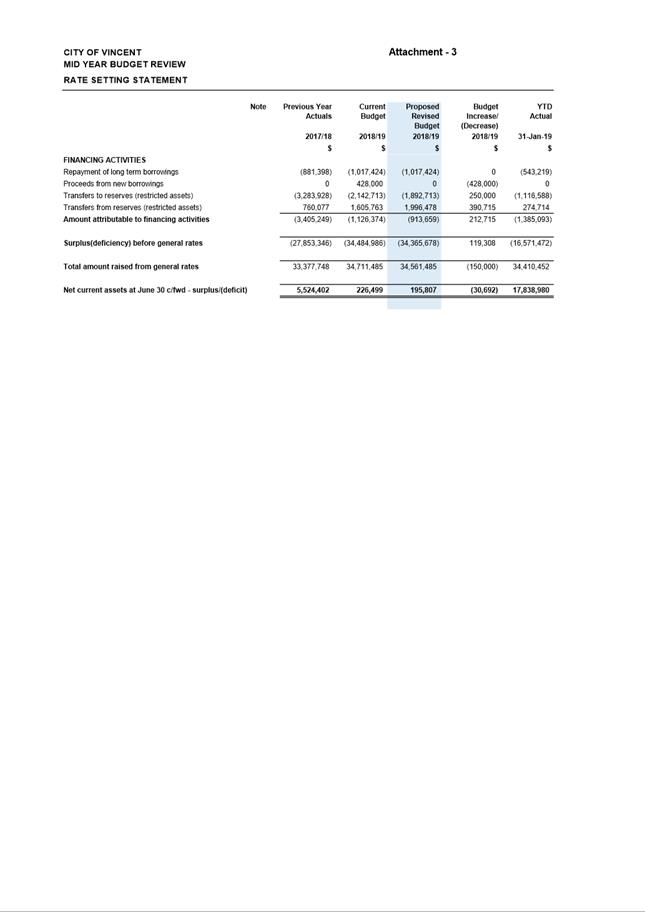
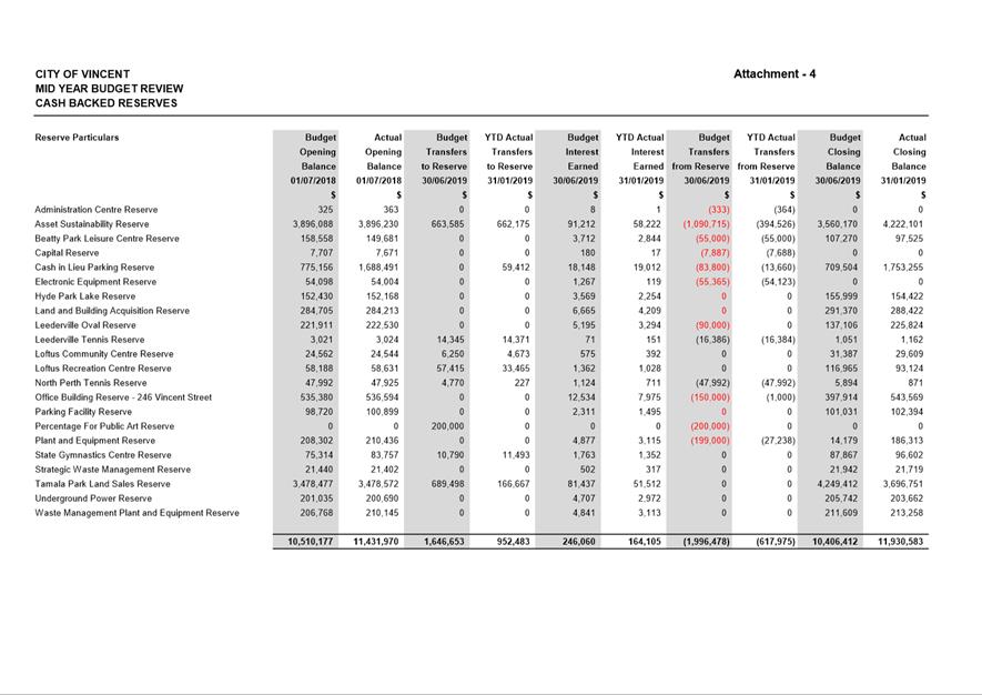
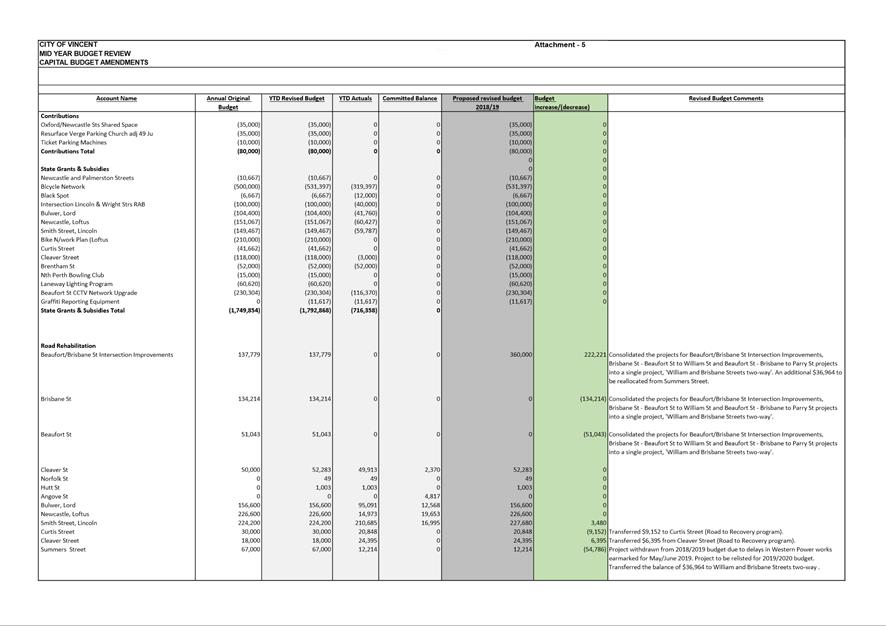
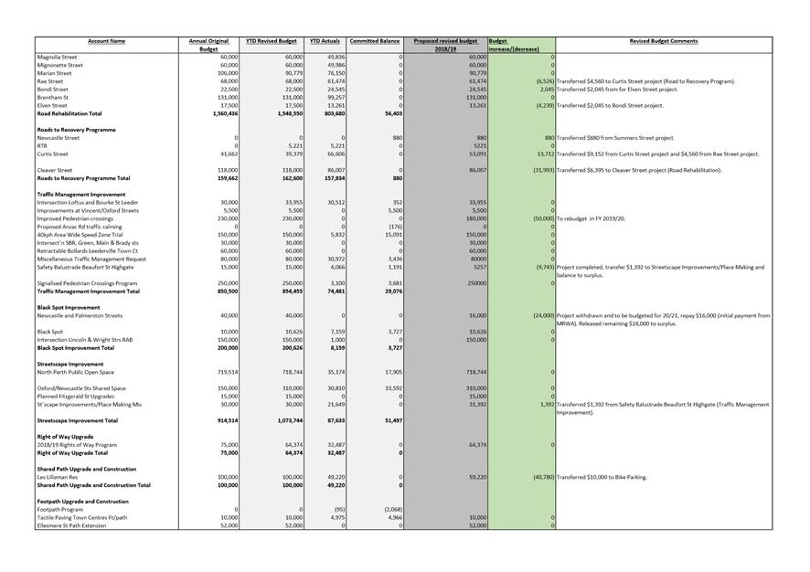
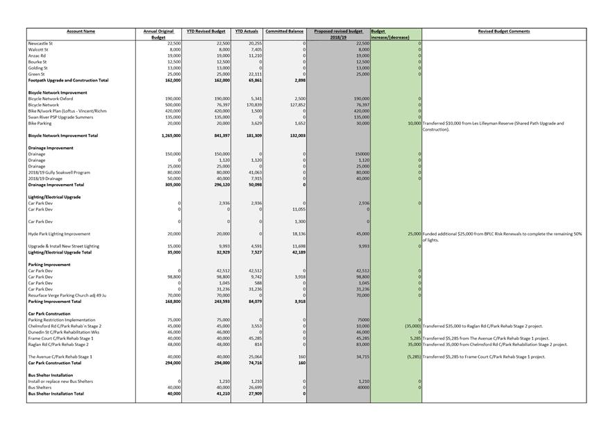
11.6 Mid year budget review 2018/2019 [ABSOLUTE MAJORITY DECISION REQUIRED]
11.7 Local Government Statutory Compliance Audit Return 2018
11.8 Report and Minutes of Audit Committee Meeting held on 26 February 2019
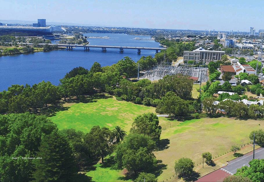
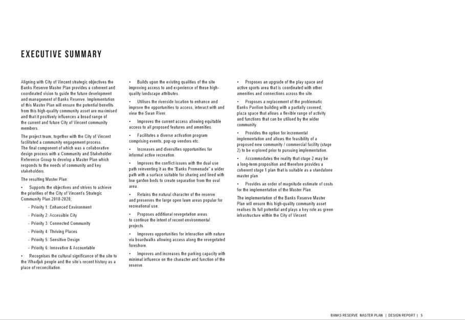
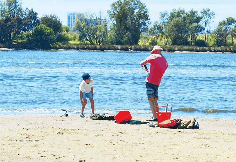
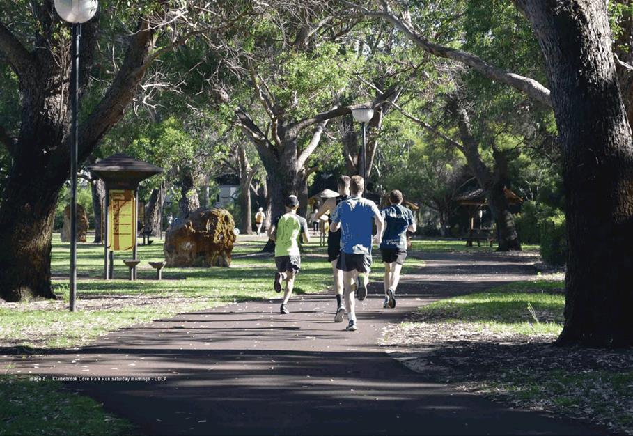
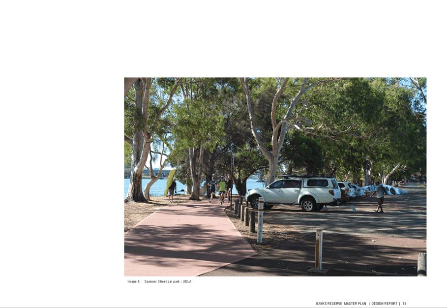
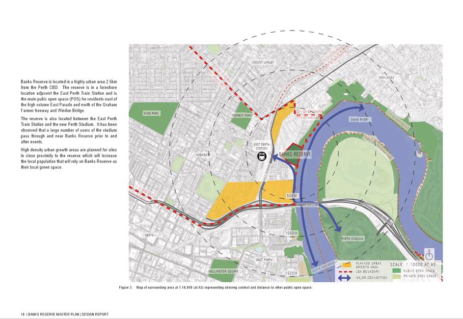
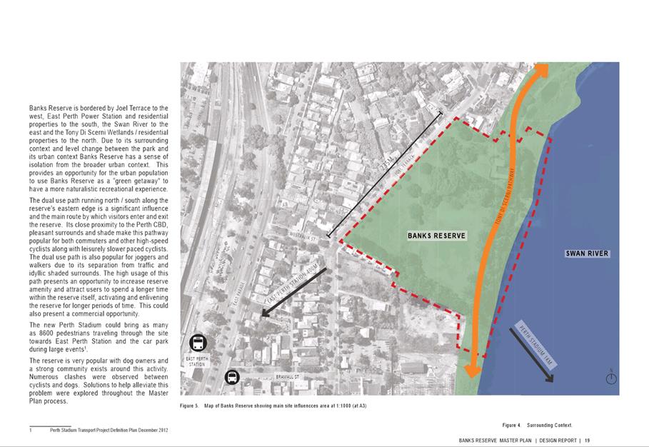
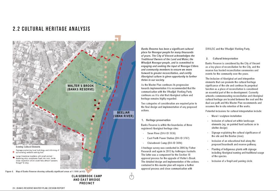
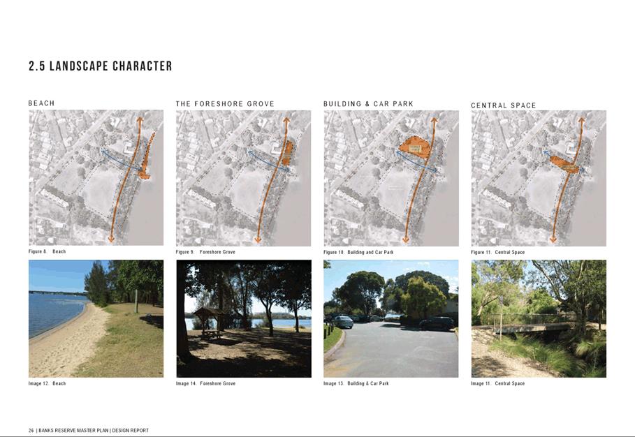
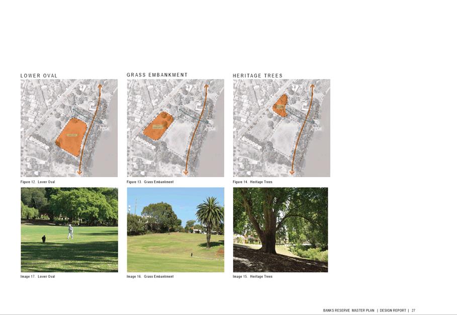
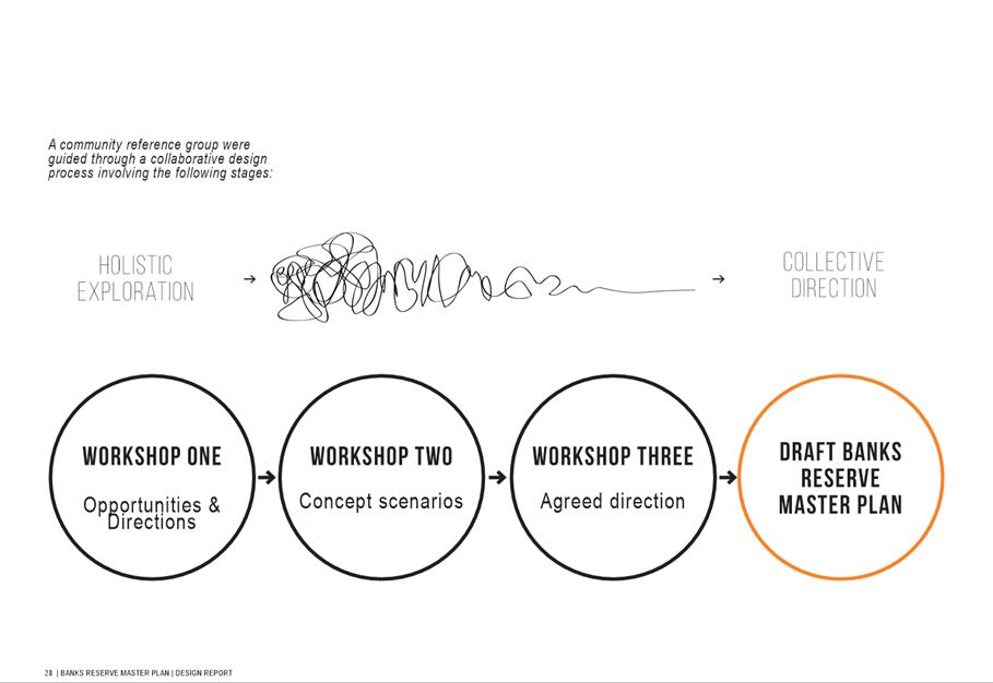
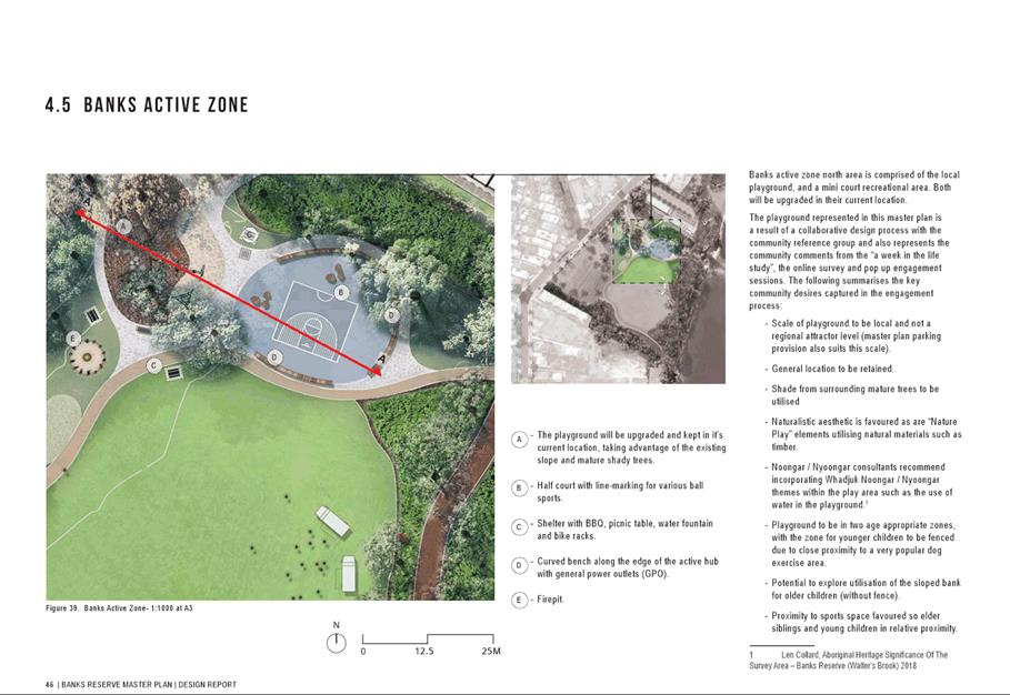
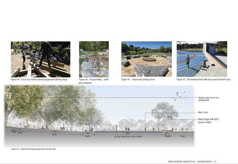
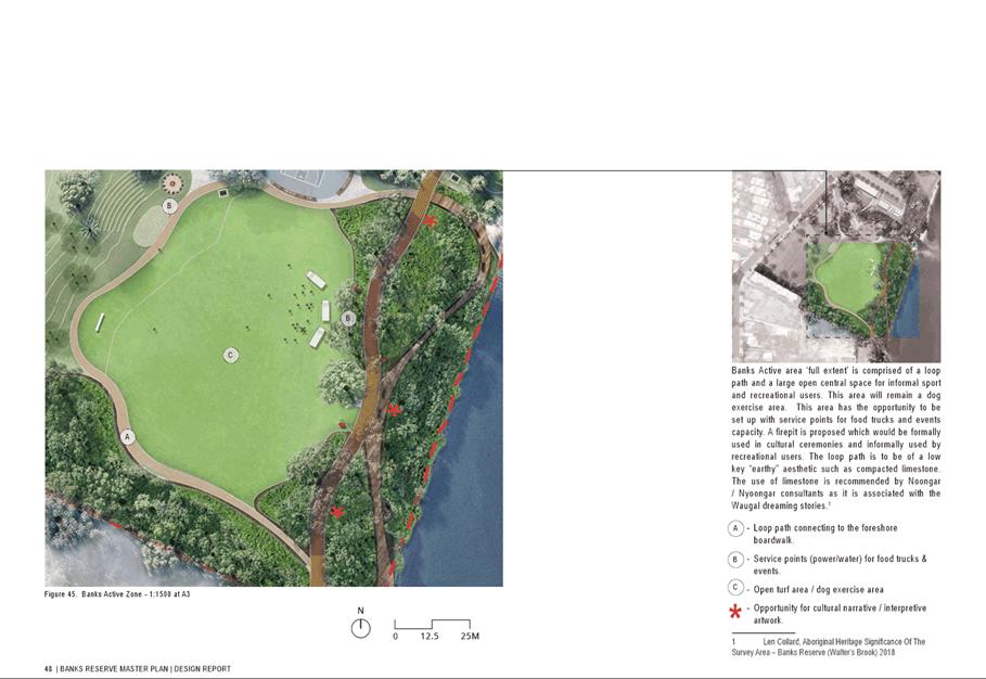
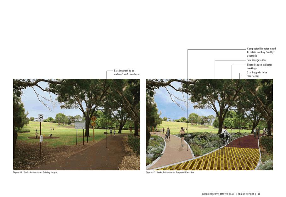
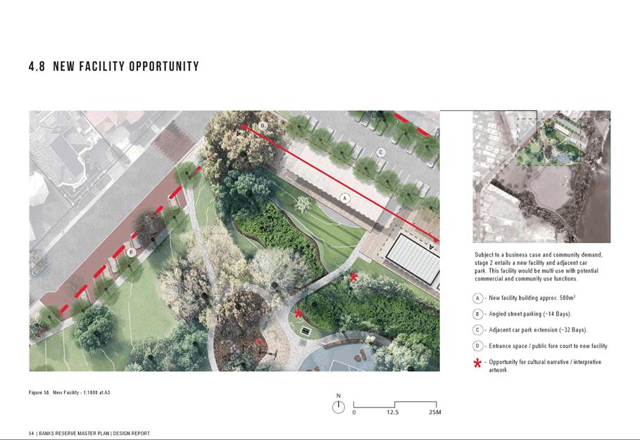
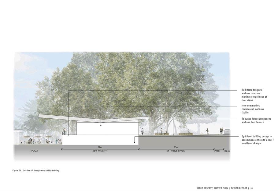
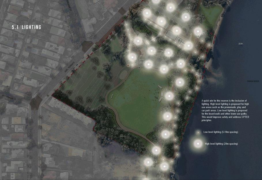
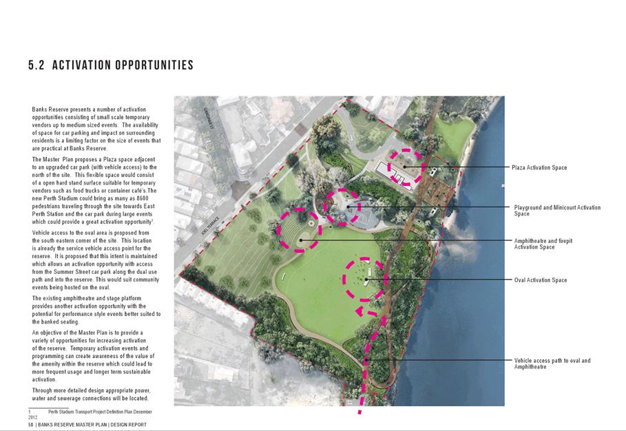
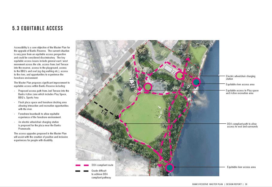
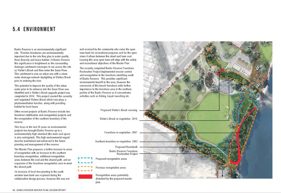
12.1 Draft Banks Reserve Master Plan Extended Public Comment Feedback
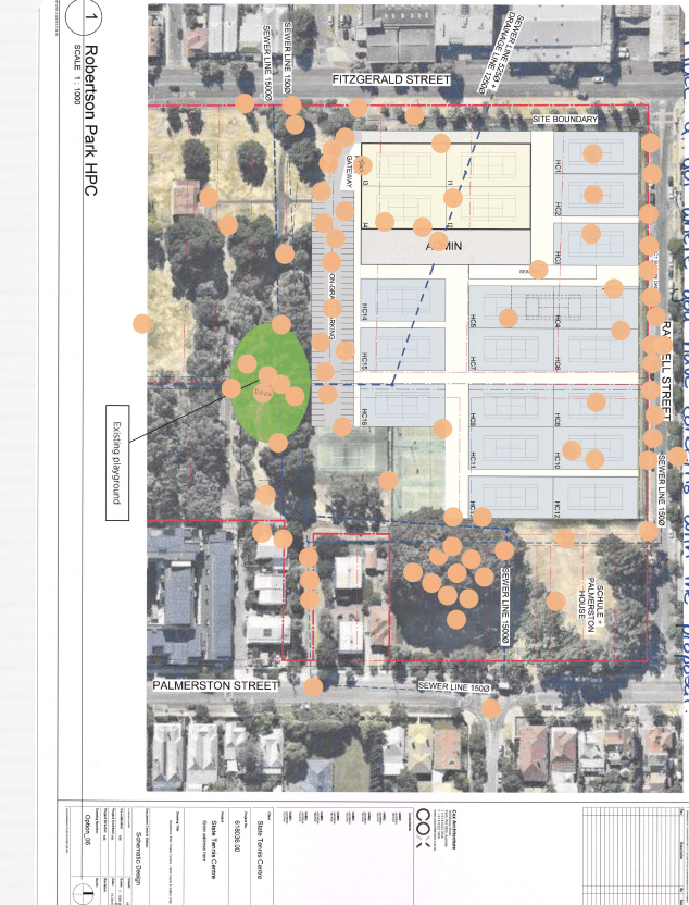
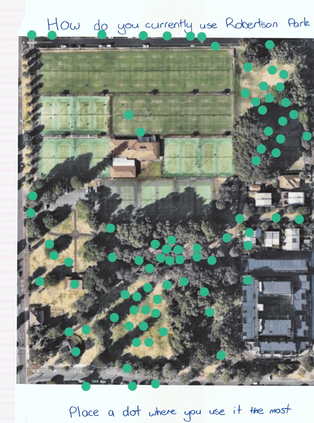
12.2 State Tennis Centre Proposal for Robertson Park - Community Consultation Outcomes
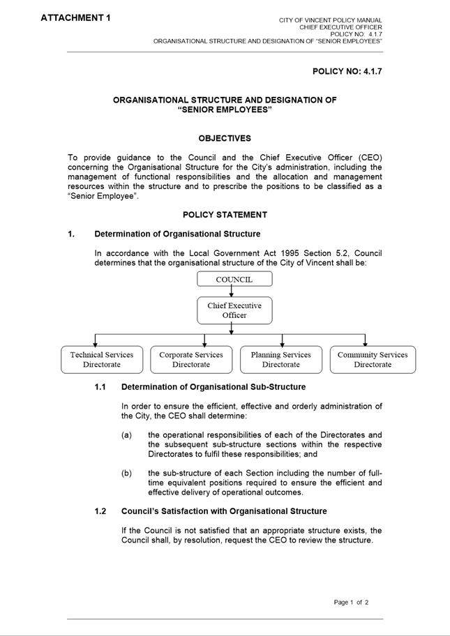
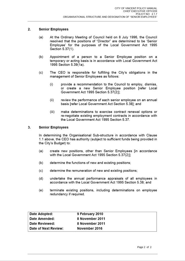
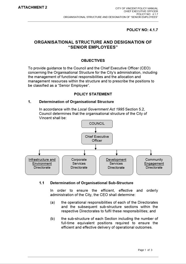
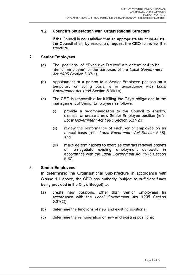
13.1 Organisational Structure and Designation of "Senior Employees" Policy No: 4.1.7
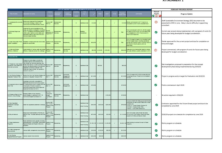
13.2 Corporate Business Plan Progress Update
14 Motions of Which Previous Notice Has Been Given
15 Questions by Members of Which Due Notice Has Been Given (Without Discussion)
16 Representation on Committees and Public Bodies
18 Confidential Items/Matters For Which The Meeting May Be Closed
“The City of Vincent would like to acknowledge the Traditional Owners of the land, the Whadjuk people of the Noongar nation and pay our respects to Elders past, present and emerging”.
2 Apologies / Members on Leave of Absence
Nil
3 (A) Public Question Time and Receiving of Public Statements
(B) Response to Previous Public Questions Taken On Notice
4 Applications for Leave of Absence
Cr Alex Castle requests a leave of absence from 17 April 2019 to 29 April 2019 due to personal commitments.
5 The Receiving of Petitions, Deputations and Presentations
Ordinary Meeting - 5 February 2019
7 Announcements by the Presiding Member (Without Discussion)
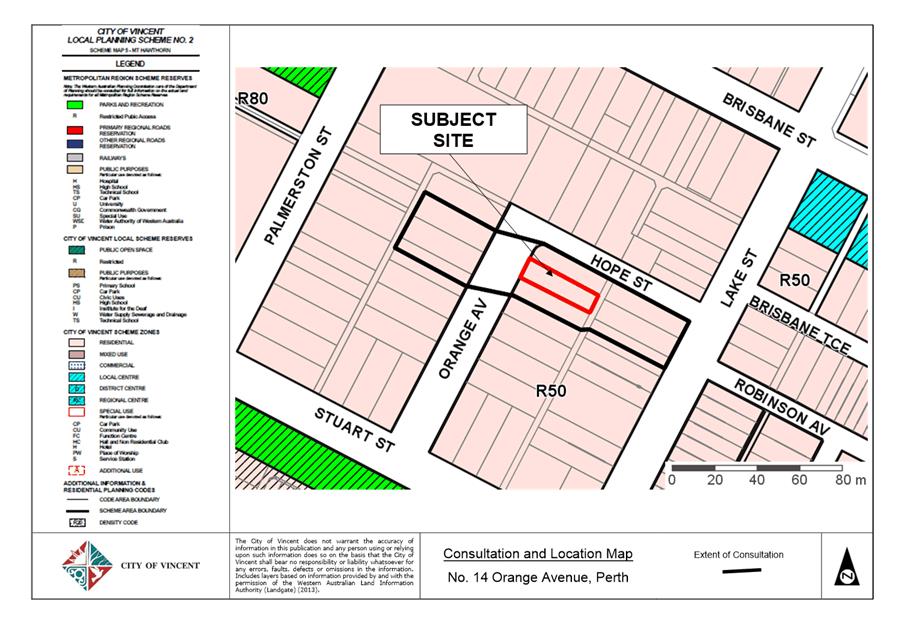
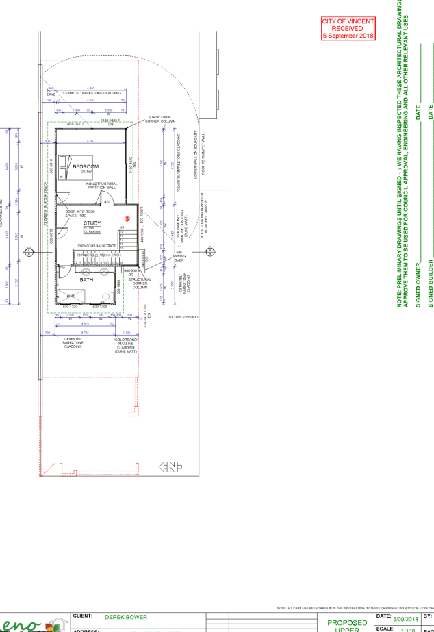
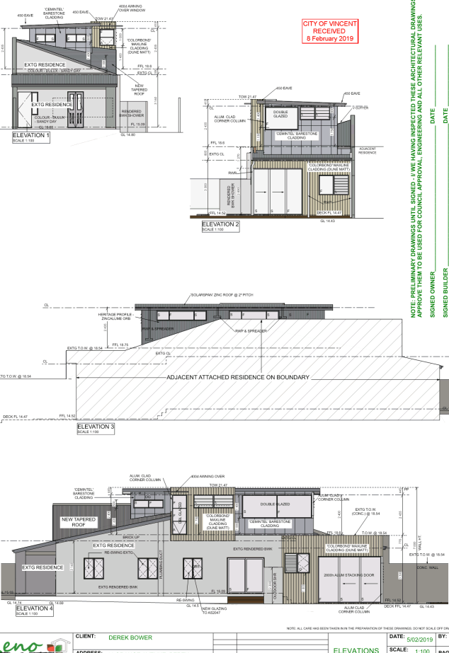
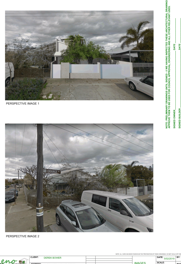
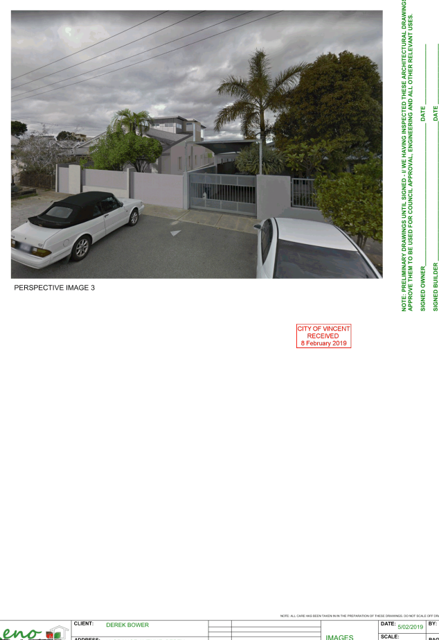
9.1 No. 14 (Lot: 1; SP: 12592) Orange Avenue, Perth - Second Storey Addition and Alterations to Single Dwelling
TRIM Ref: D19/10580
Author: Stephanie Norgaard, Urban Planner
Authoriser: John Corbellini, Director Development Services
Ward: South
Attachments: 1. Attachment
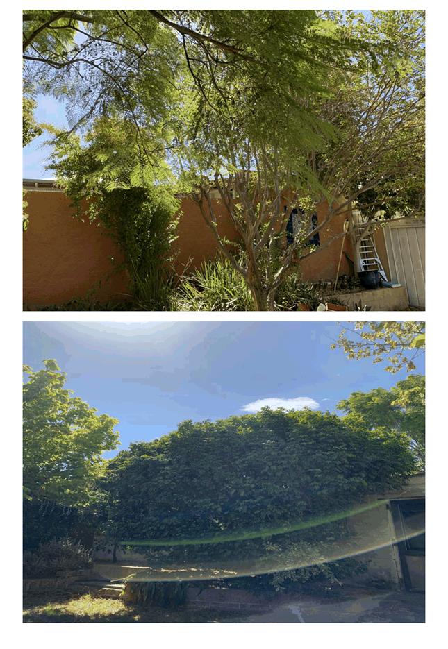
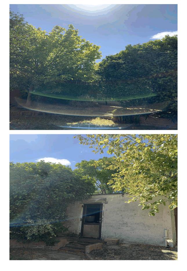
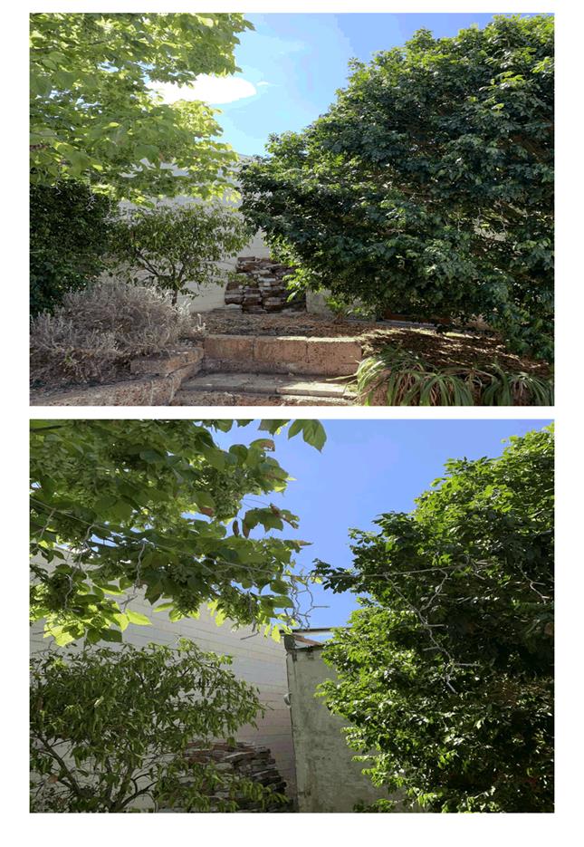
1 - Consultation and Location Map ⇩ ![]()
2. Attachment 2 -
Development Plans Deferral ⇩ ![]()
3. Attachment 3 -
Development Application Plans ⇩ ![]()
4. Attachment 4 -
Applicant's Justification ⇩ ![]()
5. Attachment 5 -
Response Submissions ⇩ ![]()
6. Attachment 6 -
Applicant's Response to Summary of Submissions ⇩ ![]()
7. Attachment 7 -
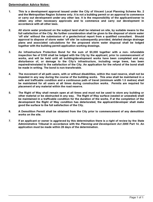
Determination Advice Notes ⇩ ![]()
|
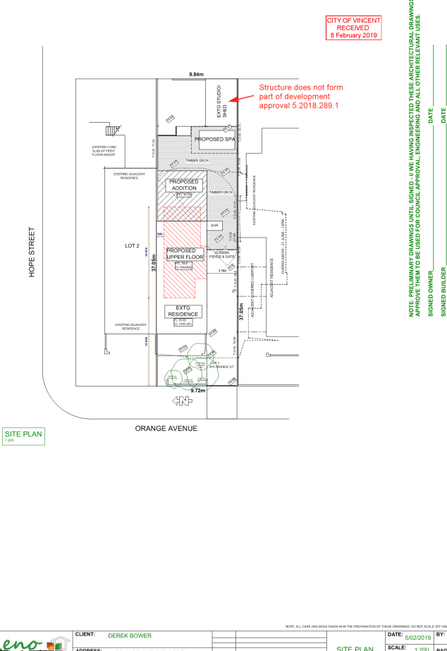
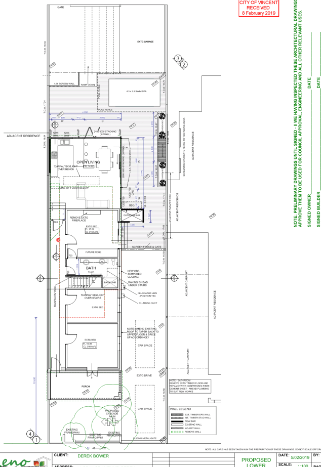
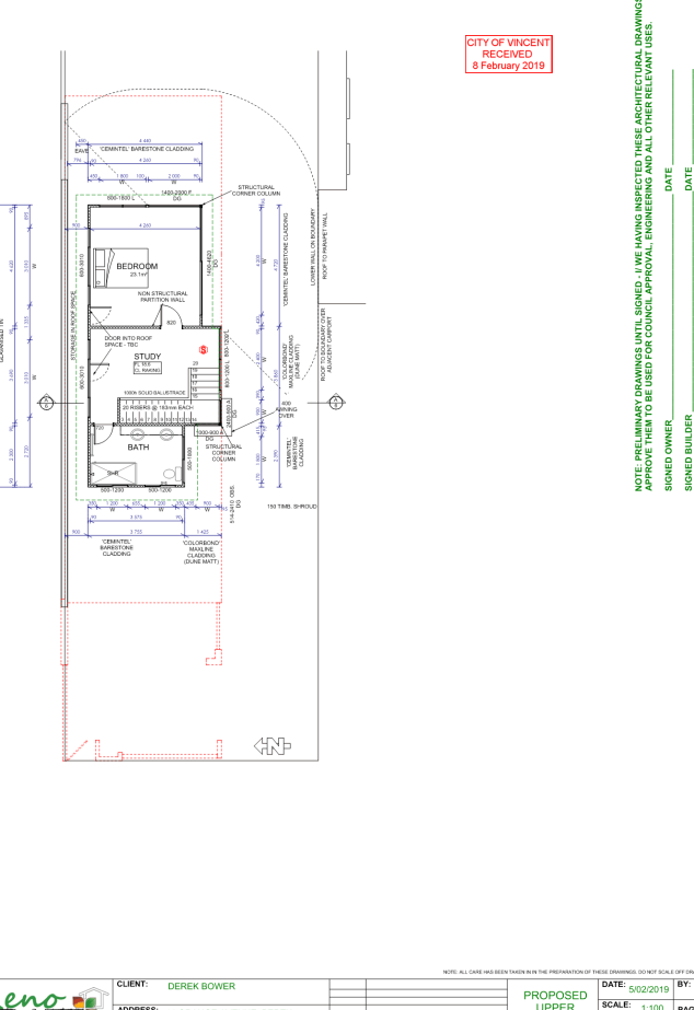
That Council, in accordance with the provisions of the City of Vincent Local Planning Scheme No. 2 and the Metropolitan Region Scheme, APPROVES the development application for a Second Storey Addition to a Single Dwelling at No. 14 (Lot: 1; SP: 12592) Orange Avenue, Perth in accordance with the plans shown in Attachment 3, subject to the following conditions, with the associated determination advice notes in Attachment 7: 1. Extent of Approval This approval only relates to the ‘PROPOSED ADDITION’ and ‘PROPOSED UPPER FLOOR’ to Single Dwelling shown on the approved plans dated 8 February 2019 and does not relate to the ‘PROPOSED SPA’, ‘TIMBER DECK’, ‘EXISTING STUDIO/SHED’ or any other development on the lot, and does not relate to the use of the site for anything other than a Single Dwelling; 2. Development Plans The windows marked ‘L’ on the upper level bedroom and Study shall be permanently fixed to at least 1.6 metres in height measured from the finished floor level to comply with the deemed-to-comply Visual Privacy standards of the Residential Design Codes to the satisfaction of the City; 3. Landscaping 3.1 A detailed landscape and reticulation plan for the development site and adjoining road verge to the City’s satisfaction is be lodged with and approved by the City prior to commencement of the development. The plan shall be drawn to a scale of 1:100 and show the following: · The location and type of existing and proposed trees and plants, with the proposed tree in the front setback area to be based on the City’s tree selection tool; · Areas to be irrigated or reticulated; and · The provision of a minimum 30 percent Canopy Coverage and the inclusion of an additional tree, within the front setback area, as defined by the City’s Policy No. 7.1.1 – Built Form; and 3.2 All works shown in the plans as identified in Condition 2.1 above shall be undertaken in accordance with the approved plans to the City’s satisfaction, prior to occupation or use of the development and shall be maintained thereafter to the satisfaction of the City at the expense of the owners/occupiers; 4. External Fixtures All external fixtures and building plant, including air conditioning units, piping, ducting and water tanks, shall be located so as to minimise any visual and noise impact on surrounding landowners, and shall be screened from view from the street, and surrounding properties to the satisfaction of the City; and 5. Stormwater All stormwater produced on the subject land shall be retained on site, by suitable means to the full satisfaction of the City. |
Purpose of Report:
To consider an application for development approval for a second storey addition and alterations to an existing Single Dwelling at No. 14 Orange Avenue, Perth (subject site).
PROPOSAL:
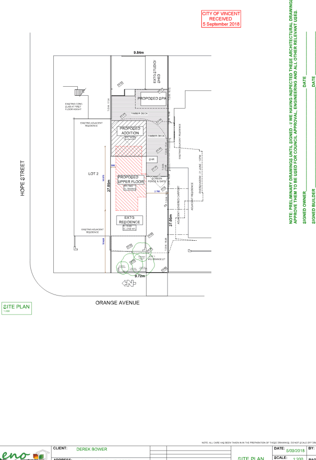
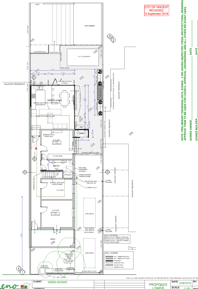
The application proposes ground floor alterations and a second storey addition to an existing Single Dwelling.
Background:
|
Landowner: |
Derek Bower |
|
Applicant: |
Derek Bower |
|
Date of Application: |
2 August 2018 |
|
Zoning: |
MRS: Urban LPS2: Zone: Residential R Code: R50 |
|
Built Form Area: |
Residential |
|
Existing Land Use: |
Single Dwelling |
|
Proposed Use Class: |
P |
|
Lot Area: |
362m² |
|
Right of Way (ROW): |
Yes – 3m wide, drained and sealed |
|
Heritage List: |
No |
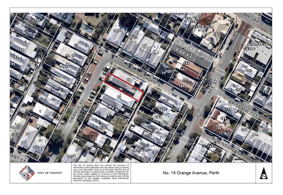
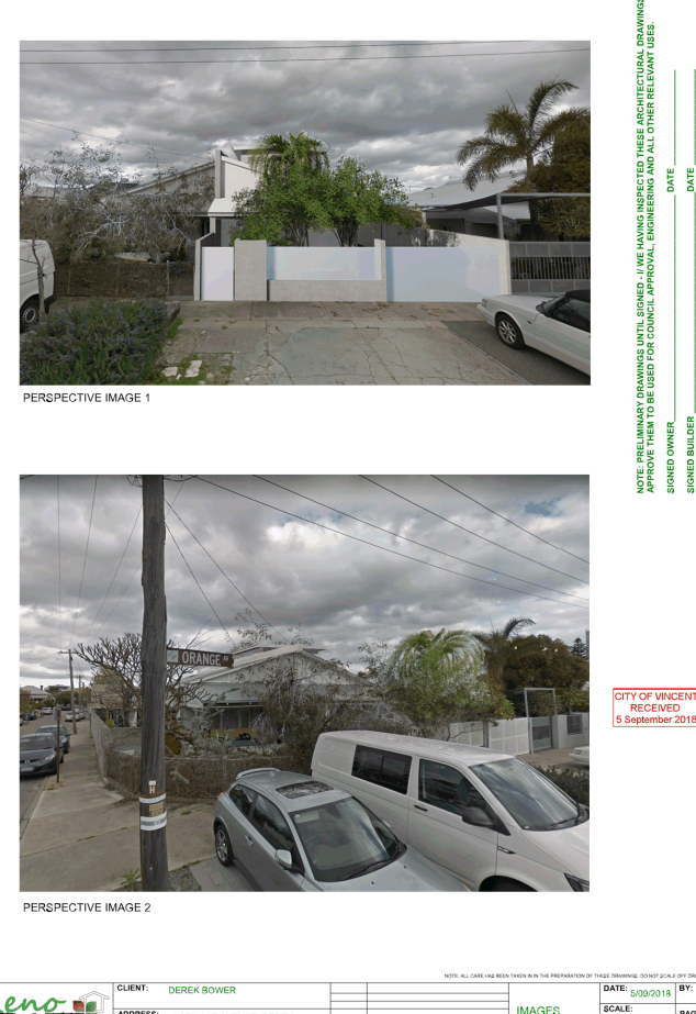
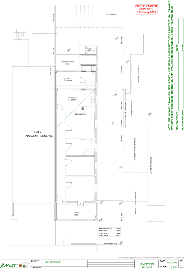
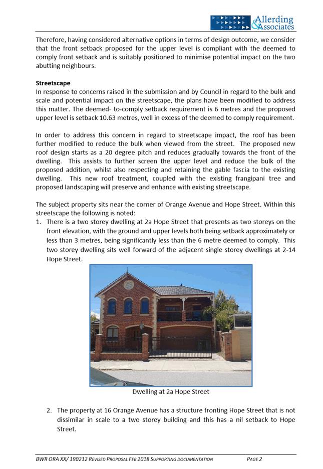
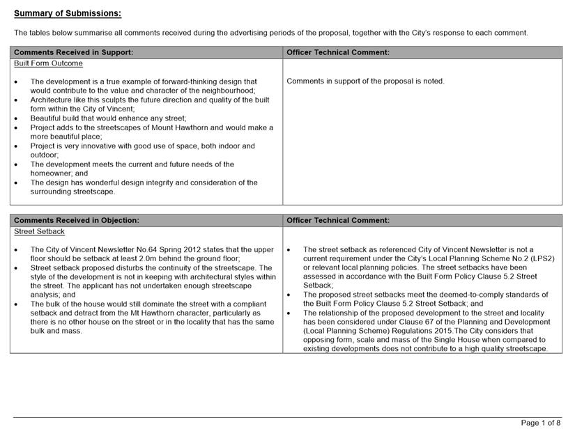
The subject site is located at No. 14 Orange Avenue, Perth, as shown in the location plan included as Attachment 1. The site is bound by Orange Avenue to the west, a right of way to the east and residential properties to the north and south. The subject site comprises of an existing single storey dwelling, which shares a common wall and roof with No. 16 Orange Avenue.
Orange Avenue has been developed with predominantly ‘terrace style’ single storey single houses and grouped dwellings. There are two storey developments including multiple dwellings and commercial developments within the broader area. There are a number of Heritage Listed dwellings located to the east of the subject site (fronting Lake Street) on the opposite side of the right of way.
The subject site is zoned Residential with a density code of R50 under the City’s Local Planning Scheme No. 2 (LPS2). The subject site is located within the ‘Residential’ Built Form Area under the City’s Policy No. 7.1.1 – Built Form (Built Form Policy) and has been assessed against the applicable standards and requirements of the policy.
A previous development application was presented to Council at its Ordinary Council Meeting on 4 April 2018. The application was deferred by Council to enable the applicant time to address Council’s concerns relating to streetscape, setbacks, bulk and scale and visual privacy.
An amended version of the application was presented to Council at its Ordinary Council Meeting on 26 June 2018. The application was refused by Council on the basis that the building height and proposed northern setback were considered to have a detrimental impact on the streetscape.
Following the refusal, the applicant lodged a new development application which differed from the refused application in the following manner:
· The building height was reduced from 7.2 metres to 7.0 metres, which reduced the deemed-to-comply northern lot boundary setback by 100 millimetres and brings the development into compliance with the deemed-to-comply building height standard;
· Additional landscaping was provided within the front setback area; and
· Modifications to the colours and materials on the upper level addition and the rear addition (combination of cladding and incorporation of a lighter colour palette).
The new application was presented to Council at its Ordinary Council meeting on 16 October 2018. Council resolved to defer its decision on the amended development plans to allow the applicant time to pursue a design outcome that is sensitive to the existing streetscape and character of Orange Avenue. The development plans presented to Council on 16 October 2018 that resulted in the deferral are included as Attachment 2.
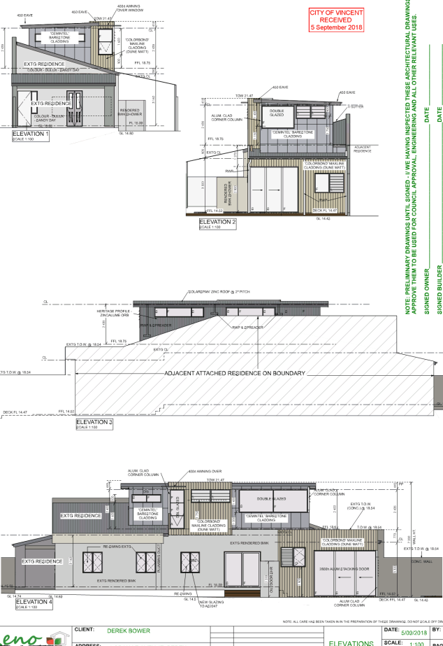
The applicant provided amended development plans that increased the roof height of the existing dwelling on the ground level to partially screen the second storey addition from the street and southern boundary. A copy of the amended development plans has been included as Attachment 3 and justification for the proposal is included as Attachment 4.
Details:
Summary Assessment
The table below summarises the planning assessment of the proposal against the provisions of the City of Vincent LPS2, the City’s Built Form Policy, Policy No. 7.6.1 – Heritage Management – Development Guidelines for Heritage and Adjacent Properties and the State Government’s Residential Design Codes (R Codes). In each instance where the proposal requires the discretion of Council, the relevant planning element is discussed in the Detailed Assessment section following from this table.
|
Planning Element |
Use Permissibility/ Deemed-to-Comply |
Requires the Discretion of Council |
|
Land Use |
ü |
|
|
Street Setback |
ü |
|
|
Building Setbacks/Boundary Wall |
|
ü |
|
Building Height/Storeys |
ü |
|
|
Open Space |
ü |
|
|
Outdoor Living Areas |
ü |
|
|
Landscaping (R Codes) |
ü |
|
|
Privacy |
ü |
|
|
Parking & Access |
ü |
|
|
Solar Access |
ü |
|
|
Site Works/Retaining Walls |
ü |
|
|
External Fixtures |
ü |
|
|
Surveillance |
ü |
|
|
Impact on Adjacent Heritage Buildings |
ü |
|
Detailed Assessment
The deemed-to-comply assessment of the element which requires the discretion of Council is as follows:
|
Lot Boundary Setbacks |
|
|
Deemed-to-Comply Standard |
Proposal |
|
R Codes Clause 5.1.3
Southern Boundary Ground Level – 4.8m
Northern Boundary Level One – 1.5m |
Southern Boundary Ground Level – 3.8m
Northern Boundary Level One – 0.9m |
The above element of the proposal does not meet the specified deemed-to-comply standards and is discussed in the comments section below.
Consultation/Advertising:
Community consultation was undertaken in accordance with the Planning and Development (Local Planning Scheme) Regulations 2015, for a period of 14 days commencing on 29 August 2018 and concluding on 11 September 2018. Community consultation was undertaken by means of written notification being sent to surrounding landowners, as shown in Attachment 1 and a notice on the City’s website.
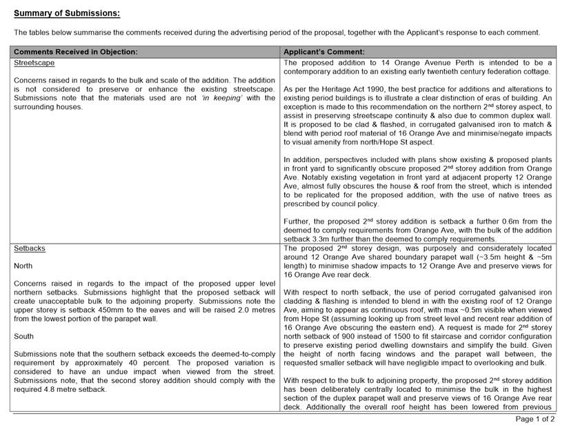
The City received two submissions in objection to the proposal during community consultation. Two submissions in objection to the proposal were also received after community consultation had concluded. A summary of submissions received and Administration’s response to these is included as Attachment 5. The applicant’s response to the summary of submission is included as Attachment 6.
Design Review Panel (DRP):
Referred to DRP: Yes
The application was referred to the Chair of the City’s Design Review Panel on 21 January 2019. The Chair provided the following comments on the proposal:
“The non-compliant setback on the north and south do not appear to have a negative impact aesthetically, or impact on the neighbouring buildings. However, with replanning the applicant should be able to achieve the setback on the north and the south.”
Legal/Policy:
· Planning and Development Act 2005;
· Planning and Development (Local Planning Schemes) Regulations 2015;
· City of Vincent Local Planning Scheme No. 2;
· State Planning Policy 3.1 – Residential Design Codes;
· Policy No. 4.1.5 – Community Consultation;
· Policy No. 7.1.1 – Built Form Policy; and
· Policy No. 7.6.1 – Heritage Management – Development Guidelines for Heritage and Adjacent Properties.
Delegation to Determine Applications:
The development application is being referred to Council as the proposal relates to a matter previously determined by Council.
Risk Management Implications:
There are minimal risks to Council and the City’s business function when Council exercises its discretionary power to determine a planning application.
Strategic Implications:
This is in keeping with the City’s Strategic Community Plan 2018-2028:
“Innovative and Accountable
We are open and accountable to an engaged community”.
SUSTAINABILITY IMPLICATIONS:
Nil.
Financial/Budget Implications:
Nil.
Comments:
Lot Boundary Setbacks
Northern Boundary
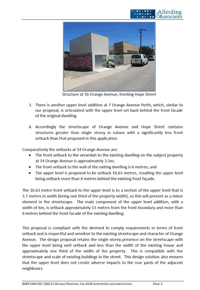
The proposal incorporates a 0.9 metre upper floor setback to the northern boundary in lieu of the deemed‑to‑comply standard of 1.5 metres.
· The subject site shares a 5.5 metres common boundary wall with the adjoining property to the north. The existing boundary wall would screen the majority of the proposed upper level addition, which would protrude 1.2 metres higher than the highest point of the boundary wall.
· The portion of the upper level addition that would be visible above the boundary wall would incorporate cladding to reduce the visual impact. That the northern façade does not incorporate any major openings and would not result in a loss of privacy.
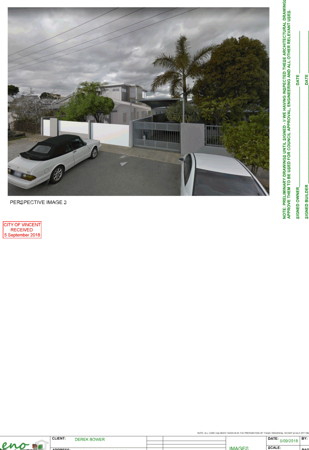
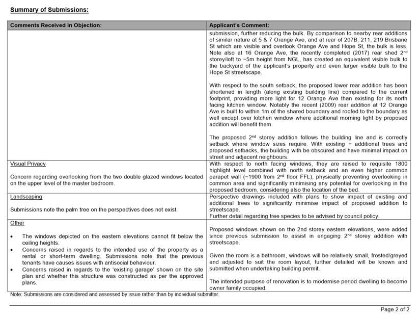
· The development has setback the upper level addition 10.7 metres from the primary street, which exceeds the deemed-to-comply street setback requirement of 6.0 metres. The increased setback is considered to further reduce the visual impact of the lot boundary setback when viewed from the street.
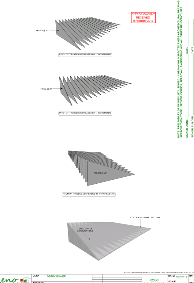
· The proposal has also incorporated a new tapered roof that partially screens the second storey addition from the primary street.
· The proposal incorporates landscaping within the front setback area in the form of a proposed palm tree. Additional landscaping, in the form of a more appropriate tree species, in conjunction with the established frangipani tree would provide sufficient screening to the second storey addition from the street.
The proposed upper level lot boundary setback meets the design principles of the R Codes and is supported.
Southern Boundary
On the ground level, the proposal incorporates a 3.8 metre setback to the main building in lieu of the deemed-to-comply standard of 4.8 metres.
· The existing dwelling on the site has a wall length of 25.4 metres and is setback 3.8 metres from the southern boundary. This application proposes to reconfigure the existing rear portion of the dwelling by introducing a new major opening to the southern façade and reducing the length of the building to 22.0 metres and maintains the current setback of the exiting dwelling to the southern boundary.
· The reduction in the length of the ground floor and introduction of a major opening to a previously solid wall mitigates the impact of building bulk.
· The proposal complies with the visual privacy standards of Clause 5.4.1 of the R Codes.
· The proposal is also compliant with the overshadowing standards of Clause 5.4.2 of the R Codes.
The proposed ground level lot boundary setback meets the design principles of the R Codes and is supported.
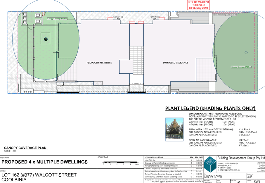
Landscaping
The City’s Built Form Policy requires a minimum of 30 percent canopy cover be provided within the front setback area for applications that propose additions or alterations to existing buildings.
· The subject site has an existing frangipani tree located within the front setback area, which currently provides 27.64 percent canopy cover within the front setback area. The frangipani tree would be capable of achieving the 30 percent canopy cover at full maturity and meets the relevant Policy requirement.
· The application proposes the provision of a palm tree in the front setback area. The palm tree is not on the City’s recommended species list and the City has concerns as to the ability of the palm tree to grow to a height greater than 2.0 metres. It is recommended that a condition be imposed to require an amended landscape plan to be submitted so that an appropriate tree species in line with the City’s recommended species could be provided.
The proposed landscaping meets the design principles of the City Built Form Policy and is supported.
Streetscape and Character
The application was deferred by Council to allow the applicant time to pursue a design outcome that is sensitive to the existing streetscape and character of Orange Avenue. The applicant has provided amended plans changing the roof tapper on the lower level of the existing dwelling. The proposed new roof design starts as a 20 degree pitch and reduces gradually towards the front of the dwelling. This assists to further screen the upper level and reduce the bulk of the proposed addition.
The application proposes a predominantly compliant development which either meets the deemed-to-comply requirements or the design principles of the R Codes and Built Form Policy. The proposal has been assessed against the objectives of the R Codes, LPS2 (Residential zone) and matters to be considered under clause 67 of the Planning and Development (Local Planning Scheme Regulations) 2015.
· The scale and mass of the second storey addition is compatible with the area and provides an appropriate design response for the locality and residential density;
· The subject site is afforded a two-storey building height under the deemed-to-comply standards of the City’s Built Form Policy;
· The development is located adjoining a property with a two storey component over both the dwelling and the garage; and
· The development preserves the existing dwelling located on the subject site and sets back the second storey addition 10.7 metres from the street. This preserves the character of the existing dwelling and contributes to the retention of the existing house stock within the locality.
The development satisfies the objectives of the R Codes, LPS2 (Residential zone) and matters to be considered under clause 67 and is recommended for approval.
TRIM Ref: D18/194926
Author: Stephanie Norgaard, Urban Planner
Authoriser: John Corbellini, Director Development Services
Ward: North
Attachments: 1. Attachment
1 - Location and Consultation Plan ⇩ ![]()
2. Attachment 2 -
Development Plans ⇩ ![]()
3. Attachment 3 -
Administration's Response to Summary of Submissions ⇩ ![]()
4. Attachment 4 -
Applicant's Response to Summary of Submissions ⇩ ![]()
5. Attachment 5 -
Applicant's Response to Design Review Minutes ⇩ ![]()
6. Attachment 6 -
Determination Advice Notes ⇩ ![]()
|
That Council in accordance with the provisions of the City of Vincent Local Planning Scheme No. 2 and the Metropolitan Region Scheme, APPROVES the application for development approval for four Multiple Dwellings at No. 377 (Lot: 162; D/P: 2630) Walcott Street, Coolbinia in accordance with the plans shown in Attachment 2, subject to the following conditions, with the associated determination advice notes in Attachment 6: 1. Development Plans 1.1 The screening provided to the balcony of Unit 1 and Unit 3 shall restrict views into the adjoining property within the 7.5 metre cone of vision in accordance with State Planning Policy 3.1: Residential Design Codes. Screening shall be a minimum height of 1.6 metres from the finished floor level, permanently affixed and a minimum of 75 percent obscure; 1.2 Screening shall be provided to the resident car parking bays to fully conceal the vehicles from view of the right of way to the satisfaction of the City; 2. Landscaping 2.1 A detailed landscape and reticulation plan for the development site and adjoining road verge to the City’s satisfaction shall be lodged with and approved by the City prior to commencement of the development. The plan shall be drawn to a scale of 1:100 and show the following: · The location and type of existing and proposed trees and plants; · Areas to be irrigated or reticulated; · The 1.0 metre x 1.0 metre visual truncation shall be provided as soft landscaping; · A total of 16 percent of the site area as deep soil zone; and · The location of canopy cover at maturity equating to no less than 30 percent of the site; 2.2 All works shown in the plans as identified in Condition 2.1 above shall be undertaken in accordance with the approved plans to the City’s satisfaction, prior to occupation or use of the development and shall be maintained thereafter to the satisfaction of the City at the expense of the owners/occupiers; 3. Boundary Walls The owners of the subject land shall finish and maintain the surface of the boundary walls in a good and clean condition prior to the occupation or use of the development and thereafter to the satisfaction of the City; 4. Schedule of External Finishes Prior to the commencement of development a detailed schedule of external finishes (including materials and colour schemes and details) shall be submitted to and approved by the City. The development shall be finished in accordance with the approved schedule prior to the use or occupation of the development; 5. Stormwater All stormwater produced on the subject land shall be retained on site, by suitable means to the full satisfaction of the City; 6. Clothes Drying Facility All external clothes drying areas shall be adequately screened in accordance with State Planning Policy 3.1: Residential Design Codes prior to the use or occupation of the development and shall be completed to the satisfaction of the City; 7. External Fixtures All external fixtures and building plant, including air conditioning units, piping, ducting and water tanks, shall be located so as to minimise any visual and noise impact on surrounding landowners, and shall be screened from view from the street, and surrounding properties to the satisfaction of the City; 8. Waste Management Plan 8.1 A waste management plan to the satisfaction of the City shall be submitted to, and approved by the City prior to the commencement of development; 8.2 The bin storage area shall be provided as set out in the approved waste management plan; and 8.3 Waste Management for the development shall be undertaken in accordance with the approved waste management plan for the duration of the development; 9. Car Parking and Vehicle Access 9.1 The car parking and access areas (including ramp grading) shall comply with the requirements of AS2890.1; and 9.2 Visual truncations of a minimum dimension of 1.0 metre by 1.0 metre shall be provided at vehicle exit points to the satisfaction of the City; 10. Bicycle Parking A minimum of two bicycle bays are to be provided and installed to the satisfaction of the City in accordance with AS2890.3; 11. Construction Management Plan A Construction Management Plan that details how the construction of the development will be managed to minimise the impact on the surrounding area, to the satisfaction of the City, shall be lodged with and approved by the City prior to the commencement of the development. The Construction Management Plan shall be prepared in accordance with the requirements of the City’s Policy No. 7.5.23 – Construction Management Plans and include traffic and parking management requirements during construction. Construction on and management of the site shall thereafter comply with the approved Construction Management Plan;
12. Right of Way Widening A 0.5 metre section of land shall be provided for right-of-way widening at the time of subdivision, in accordance with the approved development plan. The land required for right of way widening shall be transferred from the land owner to the Crown free of cost for the purpose of widening; and 13. Road Widening (Walcott Street) 13.1 The landowner agrees to remove any landscaping, development or other works at the time when the reserved land is required for the upgrading of Walcott Street at their own expense, if required; and 13.2 The landowner agrees that any improvements made to or loss of amenity will not be taken into consideration in determining any land acquisition cost or compensation which may be payable by Council or the Western Australian Planning Commission at such time as the land is required. |
Purpose of Report:
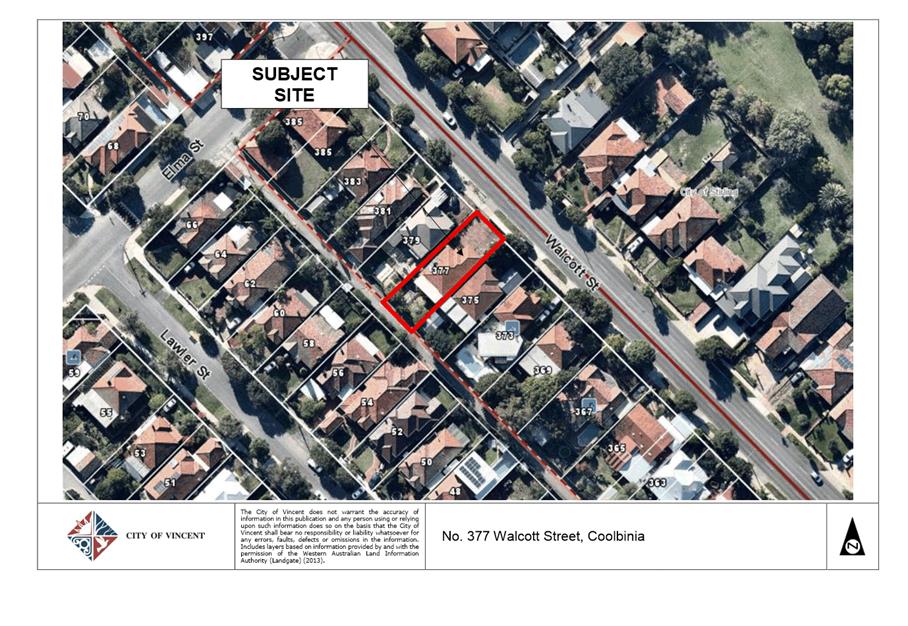
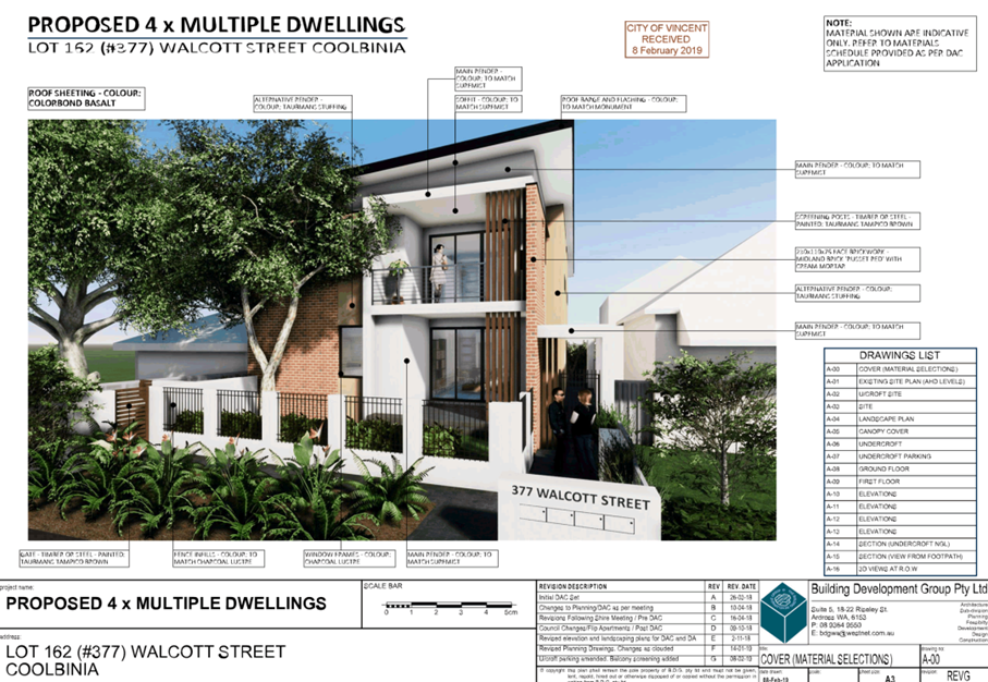
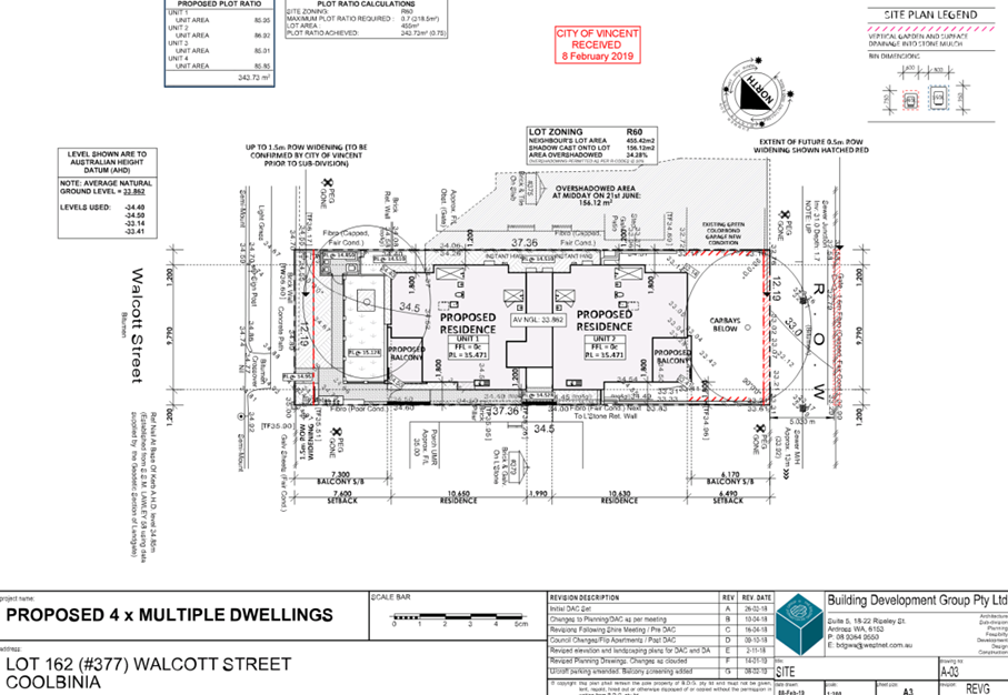
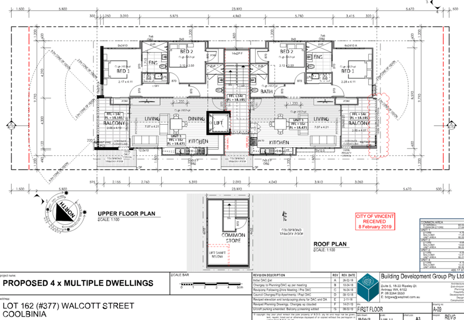
To consider an application for development approval for four Multiple Dwellings at No. 377 Walcott Street, Coolbinia (subject site).
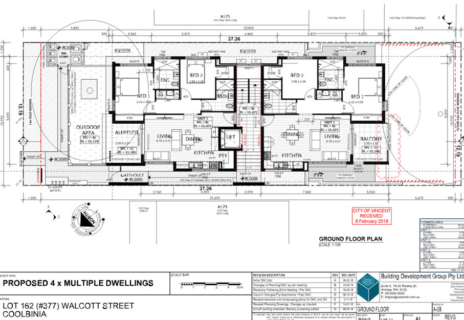
PROPOSAL:
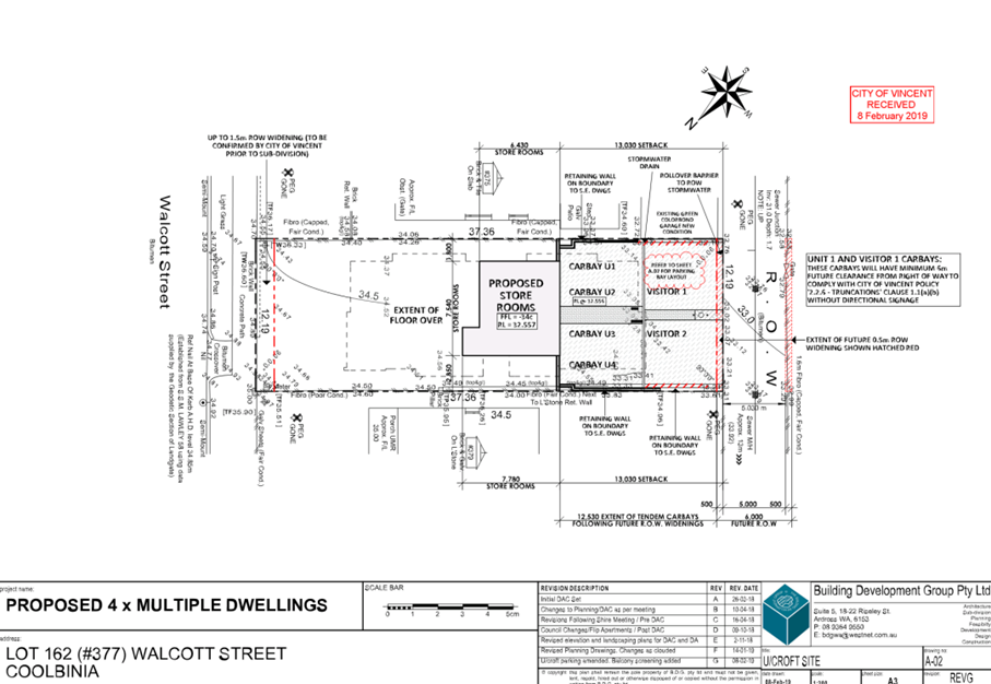
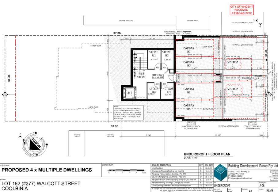
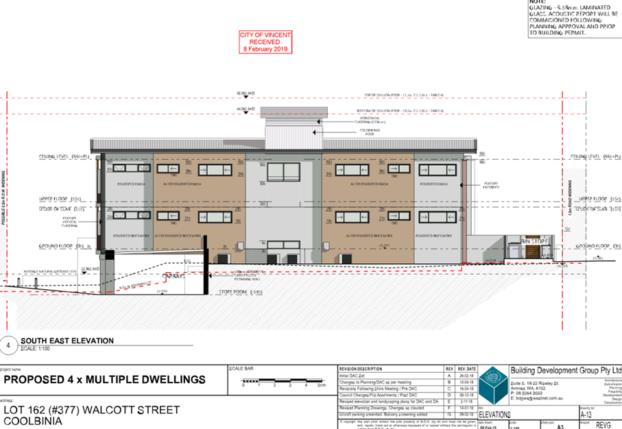
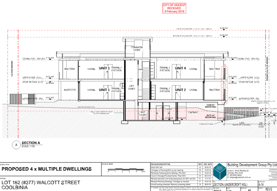
The application proposes the development of four two-bedroom Multiple Dwellings on the subject site. The proposed Multiple Dwellings have a three-storey building height above the existing natural ground level. The application proposes excavation for a portion of the site to facilitate undercroft car parking.
Background:
|
Landowner: |
Building Development Group Pty Ltd |
|
Applicant: |
Building Development Group Pty Ltd |
|
Date of Application: |
7 November 2018 |
|
Zoning: |
MRS: Urban/Other Regional Roads LPS2: Zone: Residential R Code: R60 |
|
Built Form Area: |
Transit Corridor |
|
Existing Land Use: |
Single House |
|
Proposed Use Class: |
Multiple Dwelling |
|
Lot Area: |
455 square metres |
|
Right of Way (ROW): |
Yes, 5.0 metres wide, drained and sealed |
|
Heritage List: |
No |
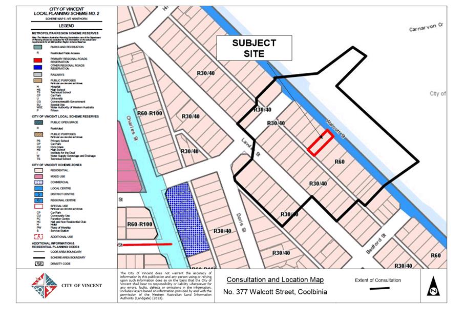
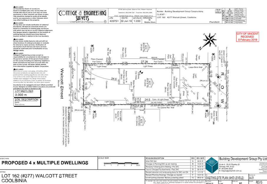
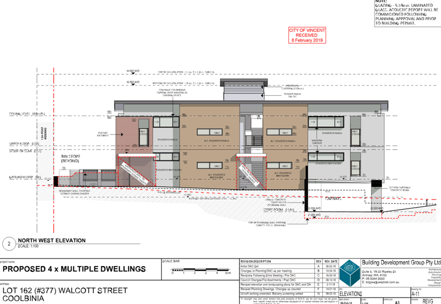
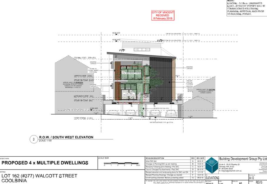
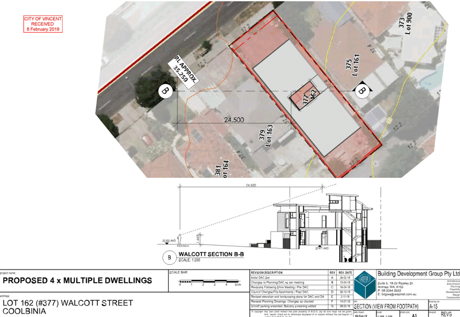
The subject site is located at No. 377 Walcott Street, Coolbinia, as shown on the location plan included as Attachment 1. There is an existing Single House on the subject site.
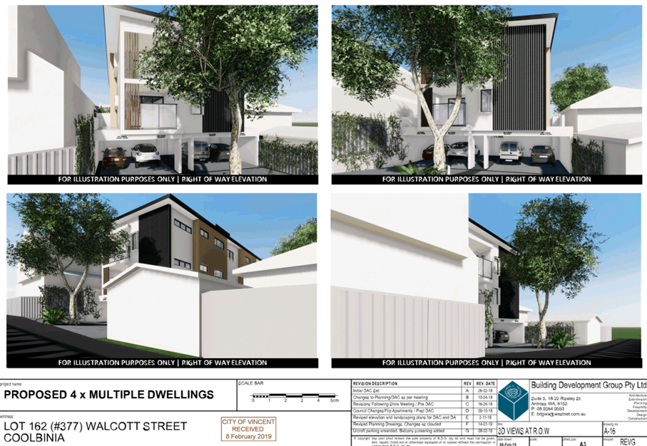
The subject site has frontages to Walcott Street to the north-east and a right of way (ROW) to the south-west. The site is adjoining a Single House to the south-east and a Single House to the north-west. The property to the north-west has a current development approval for the construction of a two-storey Grouped Dwelling. The broader area is generally characterised by single storey Single Dwellings.
The subject site is zoned Residential with a density coding of R60 under the City’s Local Planning Scheme No. 2 (LPS2). The subject site and adjoining properties along Walcott Street are within the Transit Corridor built form area under the City’s Policy No. 7.1.1 – Built Form (Built Form Policy). Walcott Street is reserved as an Other Regional Road (ORR) under the Metropolitan Region Scheme (MRS). The subject site is affected by 1.5 metres of road widening to Walcott Street as per the Department of Planning, Lands and Heritage (DPLH) Land Requirement Plan. The subject site is also subject to the City’s requirement for 0.5 metres of ROW widening.
The development plans are included as Attachment 2.
Details:
Summary Assessment
The table below summarises the planning assessment of the proposal against the provisions of LPS2, the Built Form Policy and the State Government’s Residential Design Codes (R Codes). In each instance where the proposal requires the discretion of Council, the relevant planning element is discussed in the Detailed Assessment section following from this table:
|
Planning Element |
Use Permissibility/ Deemed-to-Comply |
Requires the Discretion of Council |
|
Plot Ratio |
|
ü |
|
Street Setback |
ü |
|
|
Front Fence |
ü |
|
|
Building Setbacks/Boundary Wall |
|
ü |
|
Building Height |
ü |
|
|
Open Space |
ü |
|
|
Outdoor Living Areas |
ü |
|
|
Landscaping (R Codes) |
ü |
|
|
Privacy |
ü |
|
|
Parking & Access |
|
ü |
|
Bicycle Facilities |
ü |
|
|
Solar Access |
ü |
|
|
Site Works/Retaining Walls |
ü |
|
|
Essential Facilities |
ü |
|
|
External Fixtures |
ü |
|
|
Surveillance |
ü |
|
Detailed Assessment
The deemed-to-comply assessment of the elements that require the discretion of Council is as follows:
|
Plot Ratio |
|
|
Deemed-to-Comply Standard |
Proposal |
|
R Codes Clause 6.1.1
Plot Ratio: 0.70 (318.5 square metres) |
Plot Ratio: 0.76 (344.4 square metres) |
|
Lot Boundary Setbacks |
|
|
Deemed-to-Comply Standard |
Proposal |
|
R Codes Clause 6.1.4
North-West
Unit 1: 1.5 metres Unit 2: 1.5 metres Unit 3: 1.7 metres Unit 4: 1.8 metres
|
North-West
Unit 1: 1.2 metres (kitchen) Unit 2: 1.2 metres (kitchen) Unit 3: 1.2 metres (kitchen) Unit 4: 1.2 metres (kitchen) |
|
South-East
Unit 1 and Unit 2 (bedroom 1, stairwell, bedroom 1): 2.4 metres Unit 3 (bathroom, bedroom 2): 1.4 metres Unit 4 (bathroom, bedroom 2): 1.3 metres Unit 3 and Unit 4 (bedroom 1, stairwell, bedroom 1): 3.8 metres |
South-East
Unit 1 and Unit 2 (bedroom 1, stairwell, bedroom 1): 1.8 metres Unit 3 (bathrooms, robe): 1.2 metres Unit 3 and Unit 4 (bedroom 1, stairwell, bedroom 1): 1.8 metres |
|
Design of Car Parking |
|
|
Deemed-to-Comply Standard |
Proposal |
|
R Codes Clause 6.3.4
All parking spaces except visitor car parking bays to be fully concealed from the street of public spaces |
Four resident car parking bays visible from the ROW |
The above elements of the proposal do not meet the specified deemed-to-comply standards and are discussed in the Comments section below.
Consultation/Advertising:
Community consultation was undertaken in accordance with the Planning and Development (Local Planning Scheme) Regulations 2015, for a period of 41 days commencing on 4 December 2018 and concluding on 15 January 2019. The community consultation period was extended to account for the holiday period affecting December and January. The method of consultation included 64 letters being sent to surrounding landowners within a 100 metre radius of the subject property, as shown in Attachment 1.
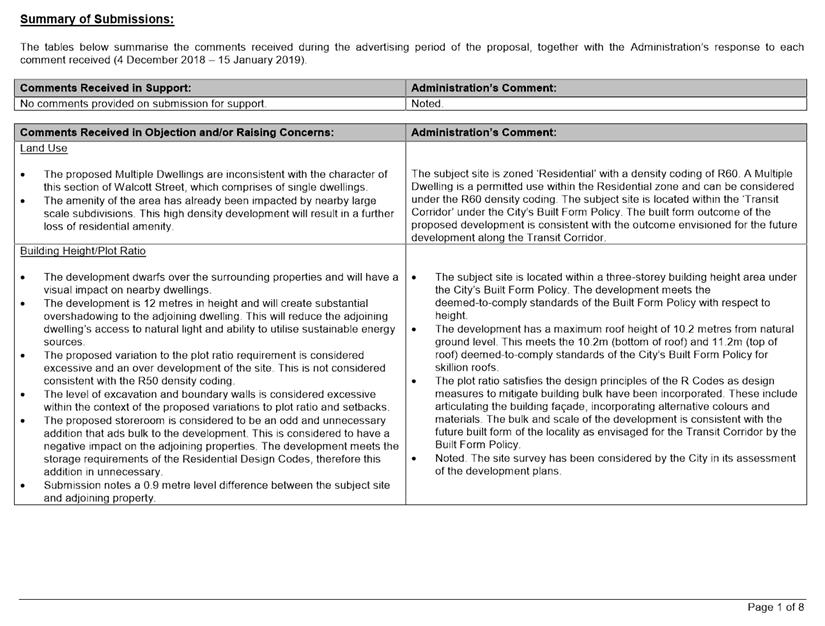
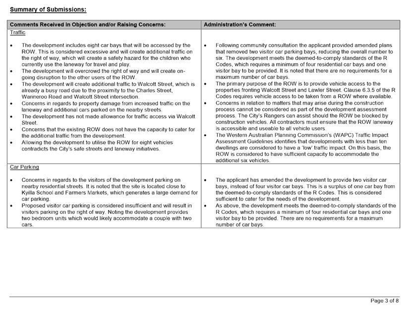
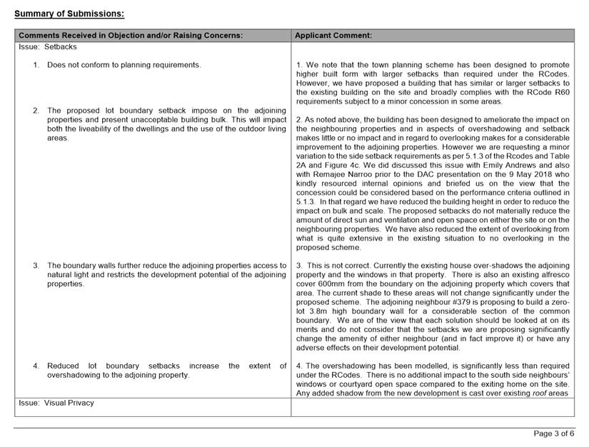
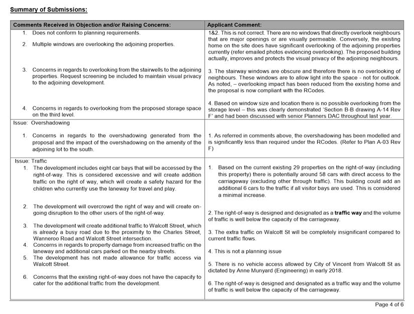
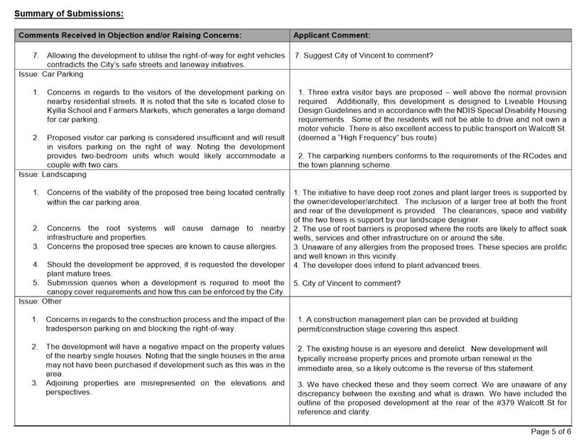
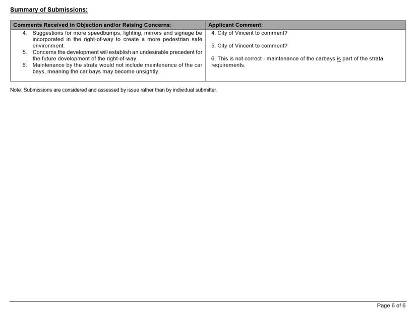
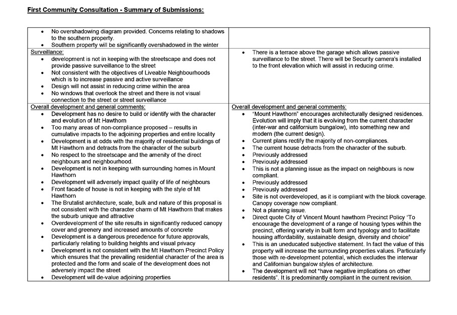
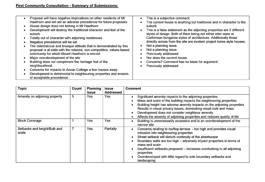
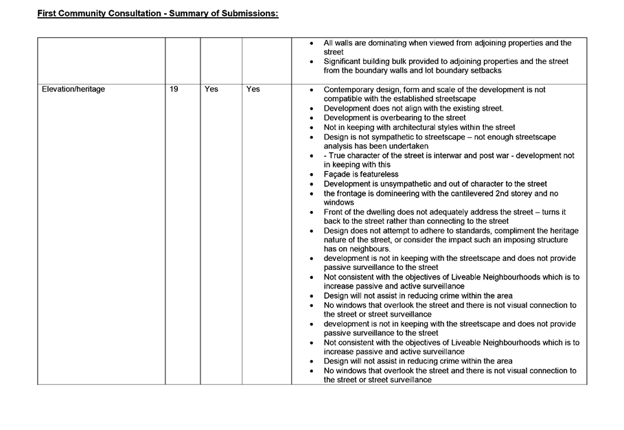
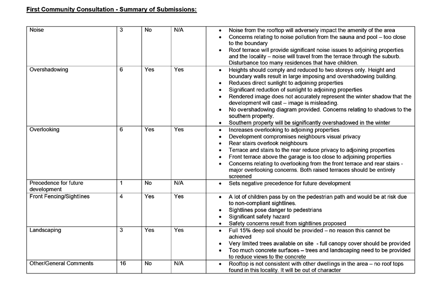
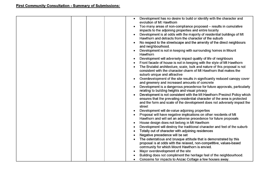
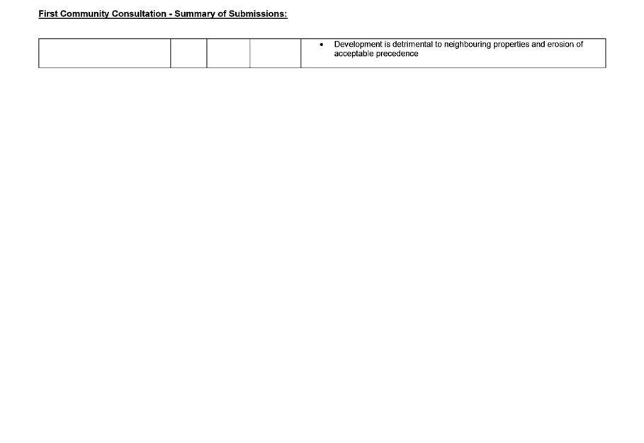
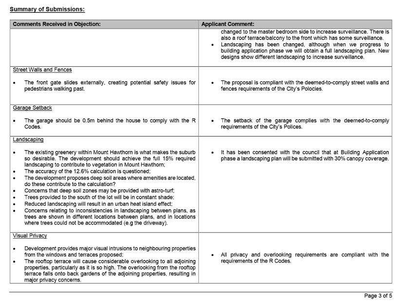
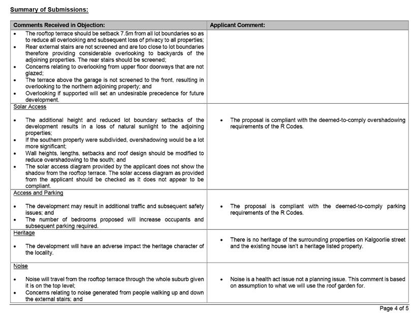
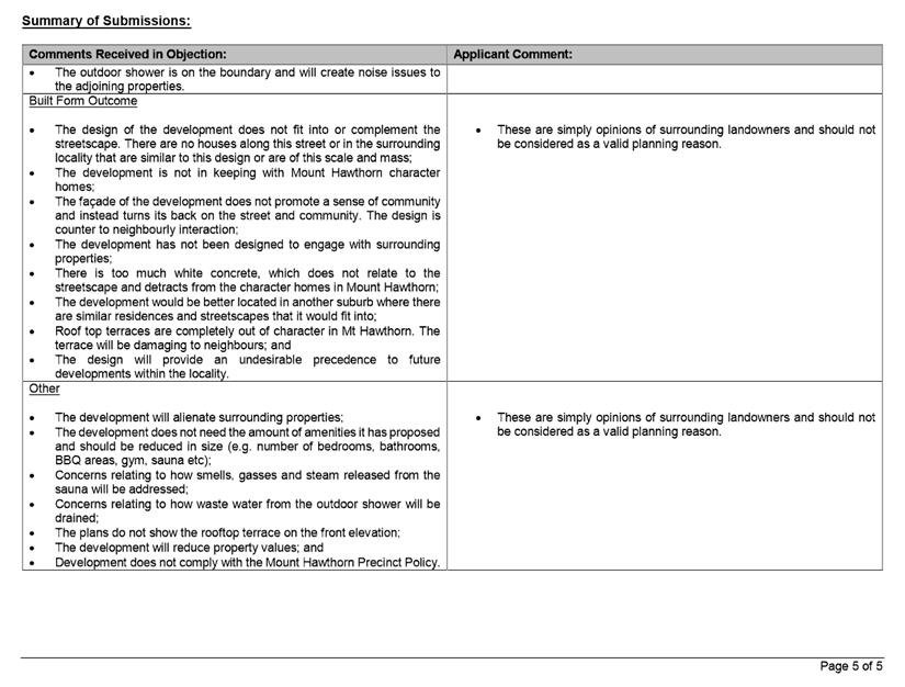
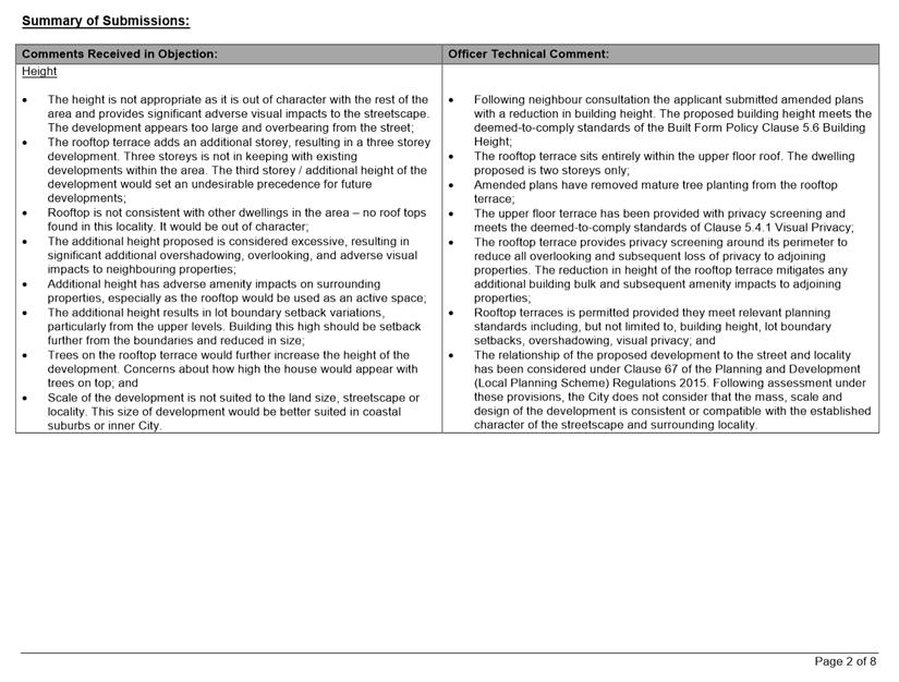
During the community consultation period, the City received one submission in support of the proposal, seven submissions in objection to the proposal and four submissions neither objecting nor supporting to the proposal. The submission received in support of the proposal did not provide specific comments or reasons for the support. The submissions received objecting to the proposal raised the following key concerns:
· Non-compliance with the deemed-to-comply standards of the R Codes;
· Visual impact of the proposal on the nearby properties in terms of bulk and scale;
· Inconsistency of the proposal with the existing single house residential character of the area;
· Impact of the proposal on the usability of the ROW in terms of increased traffic, noise and safety; and
· Impact of the proposal on the adjoining properties in terms of overshadowing and visual privacy.
Following community consultation, the applicant provided amended plans that included an elevator within the development and other minor amendments to the building facades. The amended plans were re-advertised between 4 February and 11 February 2019. The method of community consultation was in the form of written notification to the submitters of the proposal. Following the conclusion of community consultation, the City received two submissions neither objecting nor supporting to the proposal and 15 submissions objecting to the proposal.
The key areas of concern received in objection were the same as those raised in the original submissions.
A summary of the submissions received and Administration’s comment is provided in Attachment 3. The applicant’s response to the summary of submissions is provided in Attachment 4.
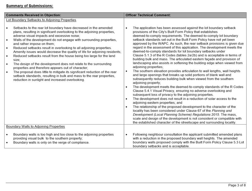
Department of Planning Lands and Heritage (DPLH)
The development application was referred to the DPLH for comments due to the site being affected by a 1.5 metre wide ORR reserve along the Walcott Street frontage. DPLH recommended a condition be included on the development approval requiring the landowner to remove the landscaping and associated minor works located within the road widening area at the time Walcott Street is upgraded.
City of Stirling
The development application was referred to the City of Stirling as the subject site is located on the boundary of the City of Vincent and City of Stirling local government areas. The City of Stirling advised that it had no specific comments to provide on the proposal.
Design Review Panel (DRP):
Referred to DRP: Yes
The proposal was referred to the DRP prior to formal lodgement. The applicant provided a response to the comments provided by the DRP, which is included in Attachment 5. Administration also referred the application to the Chair of the DRP upon lodgement of the development application. The Chair of the DRP noted the following matters consider:
· the roof scape and in particular the impact of the storage structure on neighbouring lots. Consider a roof scape that responds to the neighbouring building and a roof scale that encapsulates the storage structure;
· the location of the bin storage being outside of the front setback area; and
· increasing the sun shading to the north, east and west facing windows.
This is discussed further in the Comments section.
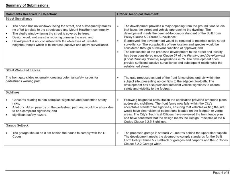
Legal/Policy:
· Planning and Development Act 2005;
· Planning and Development (Local Planning Schemes) Regulations 2015;
· City of Vincent Local Planning Scheme No. 2;
· State Planning Policy 3.1 – Residential Design Codes;
· Policy No. 4.1.5 – Community Consultation;
· Policy No. 7.1.1 – Built Form Policy; and
· Policy No. 7.5.23 – Construction Management Plans.
In accordance with Schedule 2 Clause 76(2) of the Planning and Development (Local Planning Schemes) Regulations 2015 and Part 14 of the Planning and Development Act 2005, the applicant would have the right to apply to the State Administrative Tribunal for a review of Council’s determination.
Delegation to Determine Applications:
This matter is being referred to Council in accordance with the City’s Delegated Authority Register as the proposed development incorporates more than three dwellings and the application received more than five objections during the community consultation period.
Risk Management Implications:
There are minimal risks to Council and the City’s business function when Council exercises its discretionary power to determine a planning application.
Strategic Implications:
This is in keeping with the City’s Strategic Community Plan 2018-2028:
“Innovative and Accountable
We are open and accountable to an engaged community”.
SUSTAINABILITY IMPLICATIONS:
Nil.
Financial/Budget Implications:
Nil.
Comments:
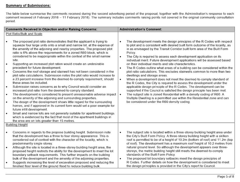
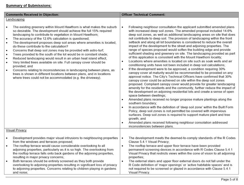
Building Size
The development proposes a plot ratio of 0.76 (344.4 square metres) in lieu of the 0.7 (318.5 square metres) deemed-to-comply standard of the R Codes. In considering the acceptability of the plot ratio, the following is noted:
· The development incorporates design measures to mitigate the impact of building bulk on the streetscape and adjoining properties. This includes the stepping in of the development, setting back the upper level and incorporating varying colours and materials into the building facade;
· The development provides deep soil areas in the front setback and at the rear of the subject site which could accommodate mature tree planting that would provide screening to the development from Walcott Street and the ROW; and
· The bulk and scale of the development is considered to be consistent with the future desired built form outcome of the locality as envisaged by the Transit Corridor built form area of the Built Form Policy. The Transit Corridor built form area permits three-storey building height to facilitate higher density development along major transport routes. The development does not contribute additional bulk due to the design measures discussed above, and is consistent with the intended built form of the area.
The proposal meets the design principles of the R Codes and is supported.
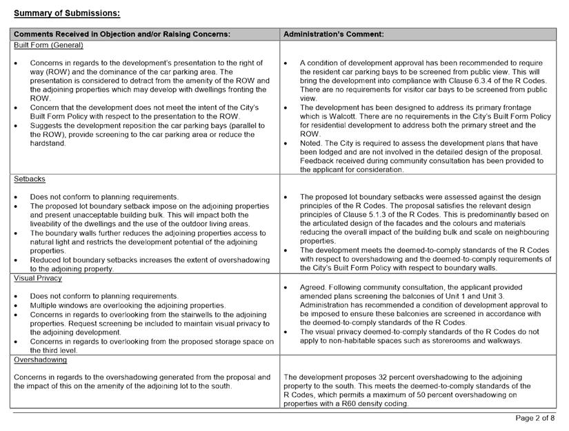
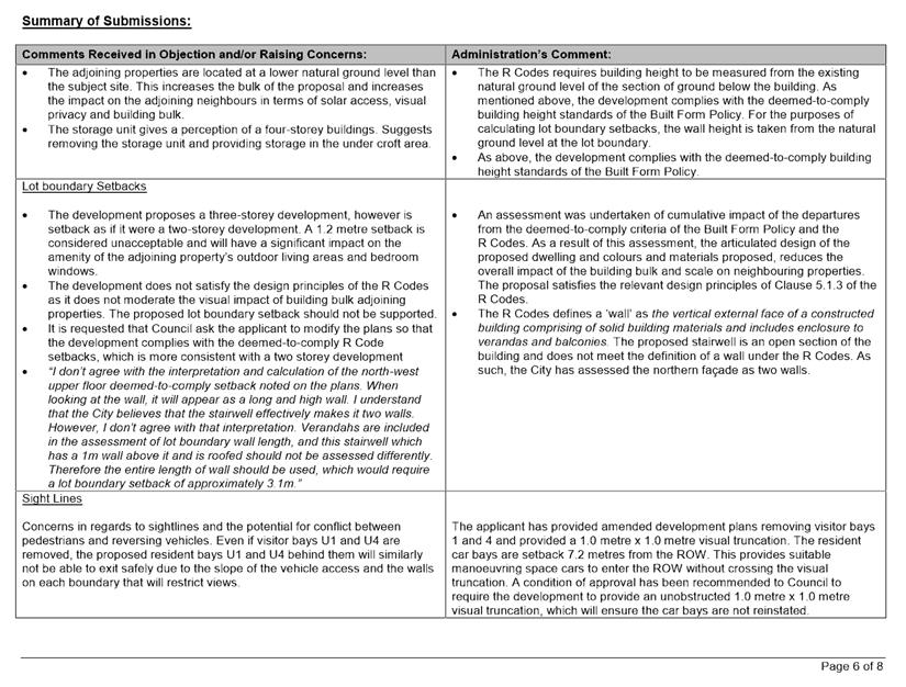
Lot Boundary Setbacks
The development does not meet the deemed-to-comply lot boundary setbacks of the R Codes for sections of the building façade on the north-west and south-east elevations.
· The development provides articulation in the building façade through stepping in sections of the building which reduces the overall bulk of the development to adjoining properties and as viewed from the street;
· The development has incorporated alternating colours and materials on the facades, which include feature brick, two shades of render and glazing. The inclusion of alternative finishes assists in breaking up the bulk of the building façade to the adjoining properties;
· The sections of wall subject to the lot boundary setback variations do not contain any major openings, meaning the proposed lot boundary setbacks do not result in any visual privacy variations to the deemed-to-comply standards; and
· The development meets the deemed-to-comply standards of the R Codes with respect to overshadowing. The setbacks provided are sufficient to allow for ventilation between the existing and proposed buildings.
The proposal meets the design principles of the Built Form Policy and the R Codes with regards to lot boundary setbacks and is supported.
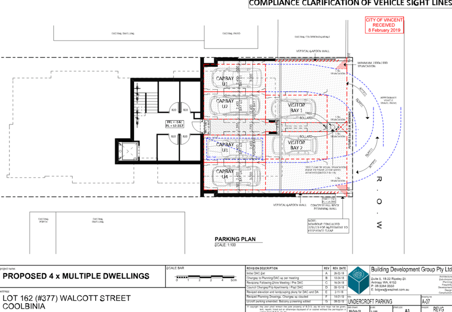
Design of Car Parking Spaces
The R Codes requires all car parking spaces (excluding visitor bays) to be completely screened from the street and/or public spaces. The proposed car parking spaces are setback 7.2 metres from the ROW, behind the two visitor car bays and would still be visible.
· The application proposes four car bays in a side-by-side format which inconsistent with the existing enclosed garage streetscape character of the ROW of enclosed garages;
· The car bays are designed to be in an unsecure ‘open-style’ format and would be directly accessible from the ROW; and
· The City received submissions during the community consultation raising concerns with the development’s presentation to the ROW, the dominance of the car parking area and light spill from the car parking area.
The design of the car parking spaces does not meet the design principles of the R Codes and is not supported. A condition of approval has been recommended to require the resident’s car parking spaces to be screened from the ROW to the satisfaction of the City.
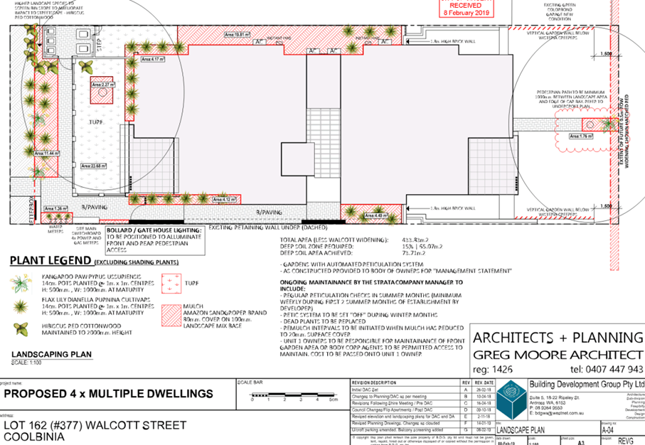
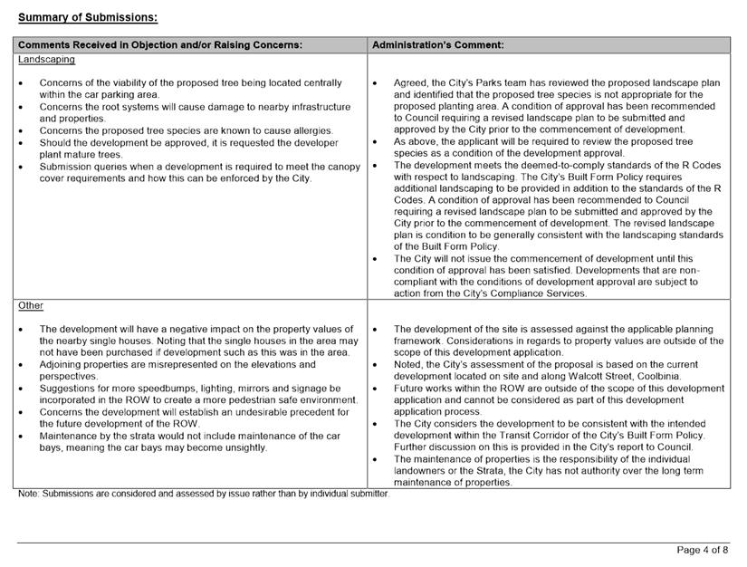
Landscaping
The City’s Built Form Policy requires 15 percent of the site to be provided as deep soil zone and 30 percent of the site to be provided as canopy coverage. The development provides 16 percent deep soil and 27 percent canopy coverage. The open air car parking area is required to provide one shade tree, a minimum of 80 percent canopy coverage and a 1.5 metre landscaping strip along the perimeter. The development provides 80 percent canopy coverage, one shade tree and no 1.5 metre landscaping strip.
· The proposed tree species is London Plane – Plantanus acerifolia is not consistent with the City’s recommended tree species list. The City’s Parks team has advised that this species is capable of growing in excess of that shown on the landscape plan, which may cause damage to infrastructure from the tree’s root systems;
· The development provides a sufficient deep soil area to achieve 30 percent canopy cover with an alternative tree species. An alternate tree species would enable the development to provide the canopy coverage required without impacting on adjoining development and public infrastructure; and
· A 1.5 metre landscaping strip cannot be accommodated along the perimeter of the open air car bays without compromising vehicle manoeuvring. There is an option for the development to provide additional soft landscaping in the visual truncation areas.
The City recommends a condition be imposed requiring a revised landscape and reticulation plan to be submitted and approved by the City prior to the commencement of development. This revised landscape plan is to demonstrate a minimum of 30 percent canopy coverage and soft landscaping within the 1.0 metre x 1.0 metre visual truncation area.
Design Review Panel Comments
The DRP provided comments in regards to the proposed roof form of the upper level, the location of the bin area within the front setback area and the shading of external windows.
· The storage structure protruding from the roof is setback from the building boundaries to minimise the impact of building bulk as viewed from adjoining properties and the street. The development complies with deemed-to-comply building height and overshadowing standards;
· The proposed bin store complies with the R Codes’ deemed-to-comply standards relating to the design and location of bin store areas. Specifically, the bin store area is provided in a convenient location for residents that is enclosed and bins would be screened from view, and has been designed to integrate with the building design by incorporating materials and colours consistent with the development; and Landscaping is proposed to be installed in front of the bin store area to provide screening.
· The applicant has incorporated window shrouds to serve as a shading device.
The proposal has satisfactorily addressed the DRP’s comments.
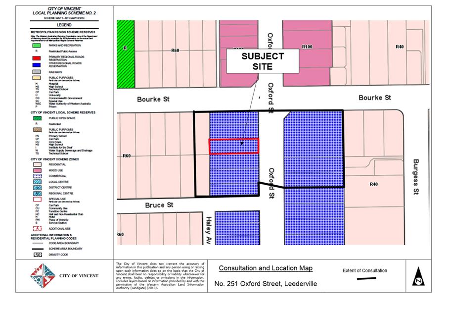
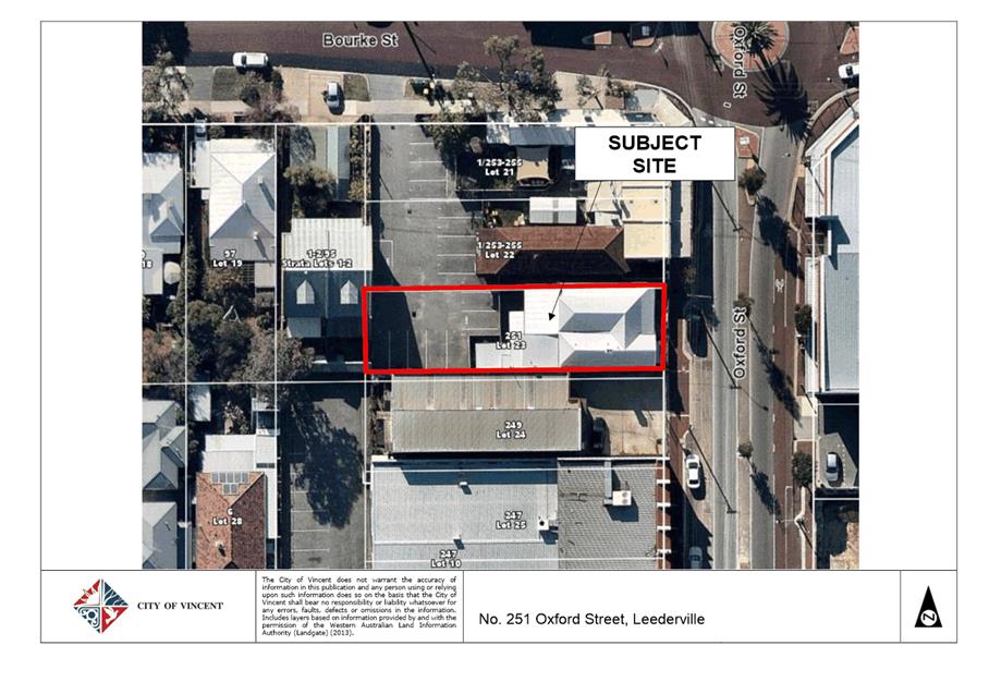
9.3 No. 251 (Lot: 23; D/P: 1033) Oxford Street, Leederville - Change of Use from Therapeutic Massage to Consulting Rooms
TRIM Ref: D19/11648
Author: Stephanie Norgaard, Urban Planner
Authoriser: Joslin Colli, A/Manager Development & Design
Ward: South
Attachments: 1. Attachment
1 - Consultation and Location Map ⇩ ![]()
2. Attachment 2 -
Development Plans ⇩ ![]()
3. Attachment 3 -
Statement of Use ⇩ ![]()
4. Attachment 4 -
Parking Management Plan ⇩ ![]()
5. Attachment 5 -
Vehicle Access Agreement ⇩ ![]()
6. Attachment 6 -
Determination Advice Notes ⇩ ![]()
|
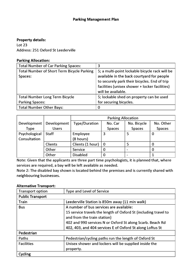
That Council, in accordance with the provisions of the City of Vincent Local Planning Scheme No. 2 and the Metropolitan Region Scheme, APPROVES the application for a proposed Change of Use from Therapeutic Massage to Consulting Room at No. 251 (Lot: 23; D/P 1033) Oxford Street, Leederville, in accordance with the plans provided in Attachment 2, subject to the following conditions, with the associated determination advice notes in Attachment 6: 1. Use of Premises 1.1 This approval relates to a Change of Use from Therapeutic Massage to Consulting Rooms, as shown on the approved plans dated 15 November 2018 and 5 December 2018; 1.2 A maximum of two consultants and two customers shall occupy the building at any one time; 1.3 Customers shall visit the premises by appointment only, with a minimum 10 minute break provided between appointment times; 1.4 The hours of operation shall be in accordance with the City’s Policy No. 7.5.22 – Consulting Rooms, being: · 8:00am to 9:00pm (Monday to Friday); · 8:00am to 5:00pm (Saturday); · 11:00am to 5:00pm (Sunday); 2. Car Parking and Access 2.1 A total of three parking bays shall be provided, each measuring 5.5 x 2.5 metres, clearly marked on the ground and served by a 6 metre wide paved accessway. A minimum of two car bays shall be made available for the exclusive use of customers; 2.2 Prior to the occupation of the development an easement in gross in favour of No. 251 (Lot: 23) Oxford Street, Leederville for the purpose of vehicle access shall be registered on the titles of Nos. 253- 255 (Lots: 21 and 22) Oxford Street, Leederville; The applicant/owner shall pay all costs associated with preparing and registering the easement, including any costs incurred by the City in reviewing the easement; and 2.3 The Parking Management Plan approved as part of this application shall be implemented to the satisfaction of the City prior to the use or occupation of the development; and 3. Bicycle Parking Prior to the occupation/use of the development, a minimum of five long-term bicycle parking bays and five short-term bicycle parking bays shall be provided for the development. Bicycle bays must be provided at a location convenient to either the front of back entrance, publically accessible and within the development site. The bicycle facilities shall be designed in accordance with AS2890.3. |
Purpose of Report:
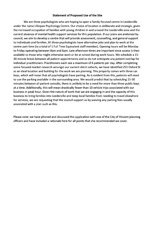
To consider an application for development approval for a change of use from Therapeutic Massage to Consulting Rooms at No. 251 Oxford Street, Leederville (subject site).
PROPOSAL:
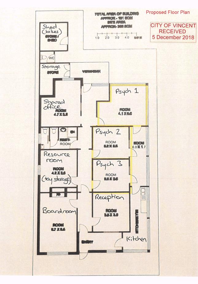
The application proposes to change the use of the subject site from Therapeutic Massage to Consulting Rooms. The Consulting Rooms are proposed to be operated by three part-time psychologists with no more than two psychologists operating from the premises at any one time.
The proposed hours of operation are 8:00am to 6:00pm Monday to Friday and closed on weekends. The consultants propose to see a maximum of six customers each per day, resulting in a maximum of 12 customers visiting the site per day. The application proposes a standard 15 to 30 minute break between patients to reduce the occurrence of overlapping appointment times.
The application does not propose any physical works to the exterior of the building. The development plans for the proposal are included as Attachment 2. The applicant has also provided a statement of use and parking management plan included in Attachment 3 and Attachment 4, respectively.
Background:
|
Landowner: |
Pajoli Pty Ltd and Elsany Pty Ltd |
|
Applicant: |
Matthew Ruggiero |
|
Date of Application: |
15 November 2018 |
|
Zoning: |
MRS: Urban LPS2: Zone: Commercial |
|
Built Form Area: |
Activity Corridor |
|
Existing Land Use: |
Therapeutic Massage |
|
Proposed Use Class: |
P |
|
Lot Area: |
486m² |
|
Right of Way (ROW): |
No |
|
Heritage List: |
No |
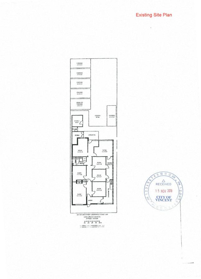
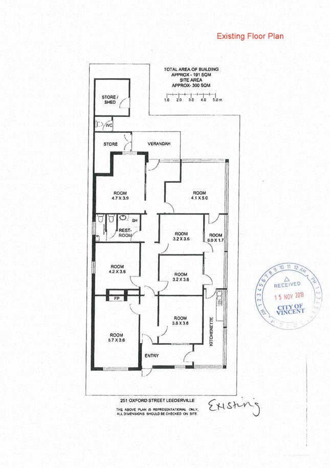
The subject site is located at No. 251 Oxford Street, Leederville and comprises a single storey building. The site is located adjoining a shop to the north, Oxford Street to the east, a motor vehicle repair to the south and grouped dwellings to the west.
The subject site has no existing vehicle access, a car parking area containing six line marked car bays and one loading bay is located at the rear of the site. This car parking area is accessed via the Bourke Street through the carpark of the adjoining lots (No. 253-255 Oxford Street), which connects to Bourke Street.
No. 253-255 Oxford Street, Leederville is owned Elsany Pty Ltd, which is a company owned by the same landowner as the subject site. The director of Elsany Pty Ltd has signed the development application form and provided a written agreement allowing the subject site vehicle access across the site, as shown in Attachment 5.
The landowner of No. 251 and Nos. 253-255 Oxford Street is agreeable to a condition being placed on the development approval for an easement to be put in place across the impacted sites. The easement would formalise the vehicle access arrangement to No. 251 Oxford Street in perpetuity.
The subject site has development approval as a Therapeutic Massage, which was issued by the Minister of Planning on the 26 November 1991.
Details:
Summary Assessment
The table below summarises the planning assessment of the proposal against the provisions of the City of Vincent Local Planning Scheme No. 2 (LPS2), the City’s Policy No. 7.5.22 – Consulting Rooms and the City’s Policy No. 7.7.1 – Non-Residential Development Parking Requirements (Parking Policy). In each instance where the proposal requires the discretion of Council, the relevant planning element is discussed in the Detailed Assessment section following from this table.
|
Planning Element |
Use Permissibility/ Deemed-to-Comply |
Requires the Discretion of Council |
|
Land Use |
ü |
|
|
Hours of Operation |
ü |
|
|
Car Parking |
|
ü |
|
Bicycle Parking |
ü |
|
Detailed Assessment
The deemed-to-comply assessment of the element that requires the discretion of Council is as follows:
|
Car Parking |
|
|
Deemed-to-Comply Standard |
Proposal |
|
11 (10.5) car bays |
3 car bays |
The above element of the proposal does not meet the specified deemed-to-comply standards and is discussed in the comments section below.
Consultation/Advertising:
Community consultation for the proposal occurred for a period of 14 days from 9 January 2019 – 22 January 2019. Community consultation was undertaken by a means of 13 letters being sent to all adjoining landowners as shown in Attachment 1. At the conclusion of the community consultation period, no submissions were received.
Design Review Panel (DRP):
Referred to DRP: No
Legal/Policy:
· Planning and Development Act 2005;
· Planning and Development (Local Planning Schemes) Regulations 2015;
· City of Vincent Local Planning Scheme No. 2;
· Policy No. 7.5.22 – Consulting Rooms;
· Policy No. 7.7.1 – Non-Residential Development Parking Requirements; and
· Policy No. 4.1.5 – Community Consultation.
Delegation to Determine Applications:
In accordance with the City’s Delegated Authority Register approved at Ordinary Meeting of Council held on 26 June 2018, this application for development is being referred to Council as it proposes a parking bay shortfall greater than five bays.
Risk Management Implications:
There are minimal risks to Council and the City’s business function when Council exercises its discretionary power to determine a planning application.
Strategic Implications:
This is in keeping with the City’s Strategic Community Plan 2018-2028:
“Innovative and Accountable
We are open and accountable to an engaged community”.
SUSTAINABILITY IMPLICATIONS:
Nil.
Financial/Budget Implications:
Nil.
Comments:
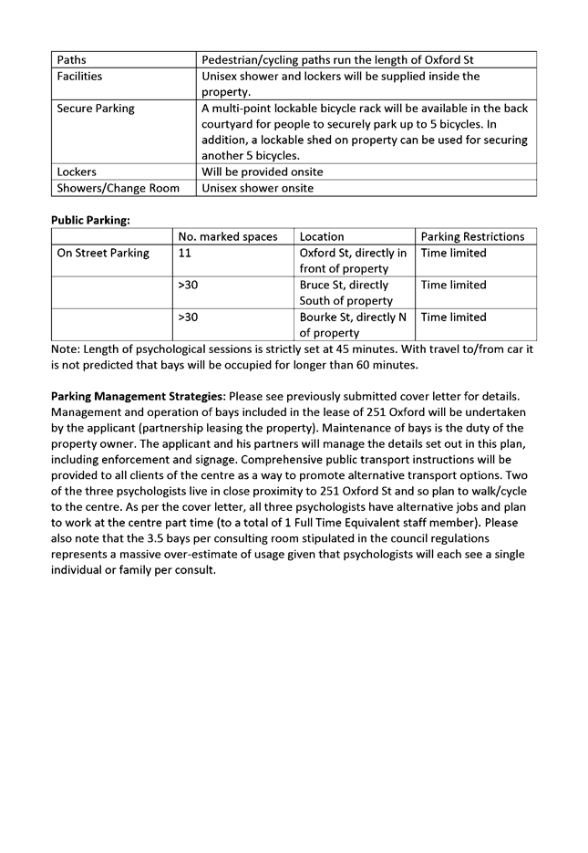
In accordance with the City’s Parking Policy, a Consulting Room is required to provide 3.5 car bays per consultant room provided on-site. The application requires 11 car bays based on the three consultant rooms proposed. The subject site has six car bays located on site, the leasing agreement only allows the development access to three of these car bays. This results in a car parking shortfall of eight car bays.
In considering the proposed car parking shortfall, the following is relevant:
· On-street car parking is available directly adjacent to the subject site along Oxford Street. These on-street car bays are subject to a one hour parking limit and are generally used by visitors to the businesses along this section of Oxford Street;
· The subject site has good access to public transport being located on the Oxford Street high frequency bus route;
· The parking management plan provided by the applicant outlines that there would be the provision of five short term and five long term bicycle parking facilities on the subject site, which would support the existing end of trip facilities, including a bathroom, shower and storage room;
· The development is proposed to operate at a relatively low scale with three consultants working on a part-time basis, equating to one full time employee. A condition of approval has been recommended to ensure no more than two consultants operate out of the premises at any one time, consistent with the definition of Consulting Rooms under the LPS2;
· The statement of use provided by the applicant outlines that there would be a 15 to 30 minute break between appointments, which would reduce the level of overlap between appointment times and allow for a streamline use of the three car bays located at the rear; and
· A condition of approval requiring provision of three bays on site with a minimum of two bays dedicated for customers to the site in addition to a condition requiring visits by appointment only and a scheduled break between appointments will assist with minimising the intensity of development on site and reducing potential impact on surrounding street parking.
The development provides sufficient on-site parking for the patients and practitioners. There is also sufficient on and off-street car parking available in the vicinity of the site, as well as alternative modes of transport including walking, cycling and public transport. The proposed car parking shortfall can be managed and mitigated through the provided parking management plan.
The parking management plan is required to be implemented as a condition of approval. Should a future tenant seek to operate from the subject site under this development approval, the future tenant would need to comply with the conditions of approval, inclusive of the approved parking management plan. An application for development approval would need to be submitted to the City to amend a condition of development approval.
The car parking provided satisfies the objectives of the Non‑Residential Development Parking Policy and is acceptable to service the development without the provision of a cash-in-lieu contribution.
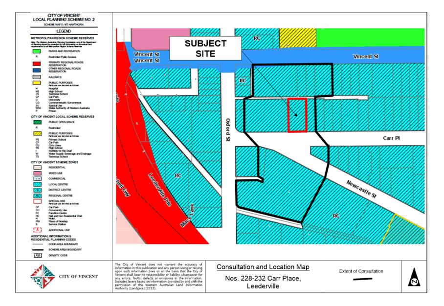
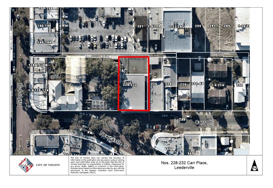
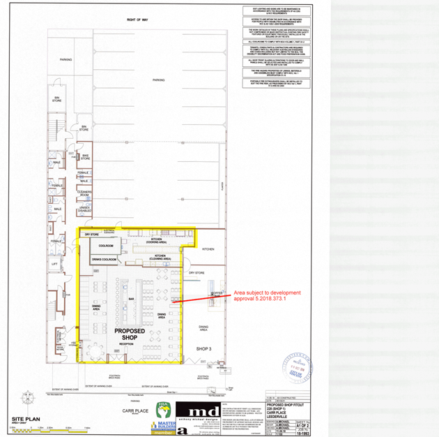
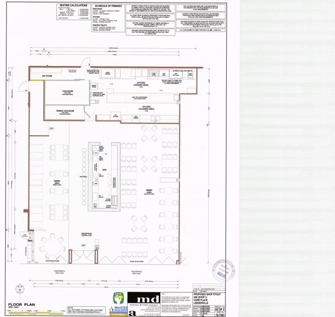
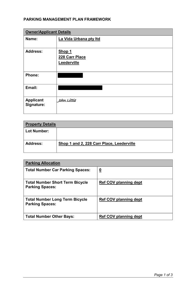
9.4 Shop 1 Nos. 228-232 (Lot: 88; D/P: 38153) Carr Place, Leederville - Change of Use from Eating House to Tavern
TRIM Ref: D18/191040
Author: Stephanie Norgaard, Urban Planner
Authoriser: John Corbellini, Director Development Services
Ward: South
Attachments: 1. Attachment
1 - Location and Consultation Map ⇩ ![]()
2. Attachment 2 -
Development Plans ⇩ ![]()
3. Attachment 3 -
Venue Management Plan ⇩ ![]()
4. Attachment 4 -
Parking Management Plan ⇩ ![]()
5. Attachment 5 -
Summary of Submissions ⇩ ![]()
6. Attachment 6 -
Determination Advice Notes ⇩ ![]()
|
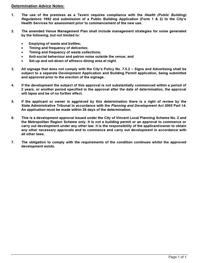
That Council, in accordance with the provisions of the City of Vincent Local Planning Scheme No. 2 and the Metropolitan Region Scheme, APPROVES the application for a proposed Change of Use from Eating House to Tavern at Shop 1, Nos. 228-232 (Lot: 88; D/P: 38153) Carr Place, Leederville, in accordance with the plans provided in Attachment 2, subject to the following conditions, with the associated determination advice notes in Attachment 6: 1. Use of Premises 1.1 This approval relates to a Change of Use from Eating House to Tavern on the plans dated 9 October 2018. It does not relate to any other development on the site; 1.2 A maximum of 172 persons shall occupy the Tavern at any one time; and 1.3 The hours of operation shall be limited to: · 11:30am to 12:00am Monday to Saturday; · 11:30am to 10:00pm Sundays and Public Holidays; and · 11:30am to 12:00am Sundays that fall the day prior to a public holiday. 2. Bicycle Parking A minimum of four short term bicycle bays shall be provided and designed in accordance with AS2890.3 prior to the Tavern use commencing; 3. Venue Management Plan 3.1 An amended Venue Management Plan shall be prepared in accordance with the City’s Policy No. 7.5.7 – Licensed Premises and to the satisfaction of the City, and shall be lodged with and approved by the City prior to the commencement of the use; 3.2 The use shall comply with the approved amended Venue Management Plan at all times to the satifaction of the City; and 4. Waste Management Plan A Waste Management Plan confirming the bin store is of sufficient size and adequate for the waste generated from the proposed Tavern shall be lodged with and approved by the City prior to the commencement of the use. The bin store shall be provided in accordance with the plan approved by the City prior to the use of the Tavern and thereafter maintained to the satisfaction of the City. |
Purpose of Report:
To consider an application for development approval for a change of use from Eating House to Tavern at Shop 1 Nos. 228-232 Carr Place, Leederville (subject tenancy).
PROPOSAL:
The application proposes to change the use of the subject tenancy from an Eating House to a Tavern. The business currently operating from the subject tenancy is La Vida Urbana, a venue that serves Mexican cuisine. The Tavern is proposed to continue to operate as La Vida Urbana.
The Tavern is proposed to operate Monday to Sunday from 11:30am – 12:00am with the exception of public holidays, which will operate within the permitted public holiday trading hours. A maximum of 200 customers and 12 staff members are proposed to be on site at any one time. The application does not propose to modify the external façade of the building.
Background:
|
Landowner: |
Maria Grinceri |
|
Applicant: |
La Vida Urbana |
|
Date of Application: |
9 October 2018 |
|
Zoning: |
MRS: Urban LPS2: Zone: Regional Centre |
|
Built Form Area: |
Town Centre |
|
Existing Land Use: |
Eating House |
|
Proposed Use Class: |
Tavern – ‘A’ use |
|
Lot Area: |
1069m² site area and 180m2 tenancy total floor area |
|
Right of Way (ROW): |
No |
|
Heritage List: |
No |
The subject site is located within the Leederville Town Centre and is in the Entertainment Precinct of the Leederville Town Centre Masterplan & Built Form Guidelines. The subject site comprises of a three-storey mixed use building with 23 on-site car parking bays located to the rear of the building. Twenty of these car parking bays are located behind security gates and currently sign-posted as being reserved for parking associated with other tenancies on-site. The remaining three car bays on-site are not sign-posted and are not located behind security access. The applicant has advised that La Vida Urbana does not have access to any on-site parking bays.
The building contains two eating houses on the ground level and offices on the upper two levels. The site is bound by an unnamed dedicated right of way to the north, Carr Place to the south, a mixed use building to the east and the Leederville Hotel to the west. The area further to the west of the site is characterised by a mix of single houses, grouped dwellings and mixed use developments. The location of the subject site is included in Attachment 1.
The subject site is in single ownership and contained in a single deposited plan. The tenancies located on the subject site are not strata tenancies and the car bays located at the rear of the subject site have not been formally allocated to each tenancy in a strata plan.
A copy of the development plans has been provided as Attachment 2, the applicant’s Venue Management Plan has been provided as Attachment 3 and the applicant’s Parking Management Plan has been included as Attachment 4.
Approval History
A summary of previous development approvals issued for the site is as follows:
· On 26 August 2003, Council at its Ordinary Meeting conditionally approved an application for a three-storey mixed use development comprising of one Eating House, two Shops and two Offices. The subject tenancy was approved as a Shop. The development resulted in an overall car parking shortfall of 5.17 car bays. A cash in lieu contribution for the car parking shortfall was imposed as a condition of approval. The cash in lieu contribution was paid to the City for the car parking shortfall.
· On 26 April 2005, Council at its Ordinary Meeting conditionally approved an application for a change of use from Shop to Eating House that included the subject tenancy. The proposal resulted in the entire development having an overall car parking shortfall of 5.92 car bays. A cash in lieu contribution for the car parking shortfall was imposed as a condition of approval. This application resulted in the former two Shop tenancies and one Eating House on the ground floor of the development being approved as an Eating House.
· On 26 July 2005, Council at its Ordinary Meeting considered an application seeking a reconsideration of the car parking cash in lieu amount imposed as a condition in the 26 April 2005 development approval issued by Council. The cash in lieu contribution for the 5.92 car bays was affirmed by Council.
· The cash in lieu contribution condition imposed as part Council’s decision was appealed to the State Administrative Tribunal. Council subsequently reconsidered the matter at its 13 September 2005 Ordinary Meeting. Council resolved to approve a reduction in the car parking cash in lieu amount to the equivalent of 2.46 car bays. The required cash in lieu amount was paid to the City.
Details:
Summary Assessment
The table below summarises the planning assessment of the proposal against the provisions of the City of Vincent Local Planning Scheme No. 2 (LPS2), the City’s Policy No. 7.7.1 – Non-Residential Development Parking Requirements (Parking Policy) and the City’s Policy No. 7.5.7 – Licensed Premises (Licensed Premises Policy). In each instance where the proposal requires the discretion of Council, the relevant planning element is discussed in the Detailed Assessment section following from this table.
|
Planning Element |
Use Permissibility/ Deemed-to-Comply |
Requires the Discretion of Council |
|
Land Use |
|
ü |
|
Car Parking |
|
ü |
|
Bicycle Parking |
|
ü |
|
Hours of Operation |
|
ü |
Detailed Assessment
The deemed-to-comply assessment of the elements that require the discretion of Council is as follows:
|
Land Use |
|
|
Deemed-to-Comply Standard |
Proposal |
|
Local Planning Scheme No. 2
“P” Use |
“A” Use |
|
Car Parking |
|
|
Deemed-to-Comply Standard |
Proposal |
|
Policy No. 7.7.1 – Non-Residential Development Parking Requirements
Car Bays
0.15 car parking bays per person 31.8 car bays (based on 212 persons on site)
|
Car Bays
Nil available on-site |
|
Bicycle Bays
Short Term: 4 bicycle bays (3.8)
Long Term: 9 bicycle bays (8.4) |
Bicycle Bays
Short Term: Nil
Long Term: 7 bicycle bays |
|
Hours of Operation |
|
|
Deemed-to-Comply Standard |
Proposal |
|
Policy No. 7.5.7 – Licensed Premises Sunday: 7:00am – 10:00pm |
Sunday: 11:30am – 12:00am |
The above elements of the proposal do not meet the specified deemed-to-comply standards and are discussed in the Comments section below.
Consultation/Advertising:
Community consultation was undertaken in accordance with the Planning and Development (Local Planning Schemes) Regulations 2015 for a period of 21 days from 8 November 2018 to 29 November 2018. The method of consultation included a sign being placed on site, a notice being placed in the local newspaper and 59 letters being mailed to all the owners and occupiers of the properties adjoining the subject site, as shown in Attachment 1.
During the community consultation, the City received one submission in support of the proposal and one submission in objection to the proposal. The submission received in support did not provide comments on the proposal. The submission received in objection raised the following concerns:
· Appropriateness of the land use;
· Impact on amenity;
· Antisocial behaviour;
· Car parking; and
· Hours of operation.
A summary of submissions and Administration’s response is provided in Attachment 5.
Design Review Panel (DRP):
Referred to DRP: No
Legal/Policy:
· Planning and Development Act 2005;
· Planning and Development (Local Planning Schemes) Regulations 2015;
· City of Vincent Local Planning Scheme No. 2;
· Leederville Town Centre Masterplan & Built Form Guidelines;
· Policy No. 4.1.5 – Community Consultation;
· Policy No. 7.7.1 – Non-Residential Development Parking Requirements; and
· Policy No. 7.5.7 – Licensed Premises.
In considering the appropriateness of the use, Council shall have regard to the objectives of the District Centre zone under LPS2, as follows
· To provide a community focus point for people, services, employment and leisure that are highly accessible and do not expand into or adversely impact on adjoining residential areas.
· To encourage high quality, pedestrian-friendly, street-orientated development that responds to and enhances the key elements of each District Centre, and to develop areas for public interaction.
· To ensure levels of activity, accessibility and diversity of uses and density is sufficient to sustain public transport and enable casual surveillance of public spaces.
· To ensure development design incorporates sustainability principles, with particular regard to waste management and recycling and including but not limited to solar passive design, energy efficiency and water conservation.
· To ensure the provision of a wide range of different types of residential accommodation, including affordable, social and special needs, high density residential and tourist accommodation, to meet the diverse needs of the community.
· To provide a broad range of employment opportunities to encourage diversity and self-sufficiency within the Centre.
· To encourage the retention and promotion of uses including but not limited to specialty shopping, restaurants, cafes and entertainment.
· To ensure that the City’s District Centres are developed with due regard to State Planning Policy 4.2 – Activity Centres for Perth and Peel.
Delegation to Determine Applications:
The matter is being referred to Council in accordance with the City’s Delegated Authority Register.
Risk Management Implications:
There are minimal risks to Council and the City’s business function when Council exercises its discretionary power to determine a planning application.
Strategic Implications:
This is in keeping with the City’s Strategic Community Plan 2018-2028:
“Innovative and Accountable
We are open and accountable to an engaged community”.
SUSTAINABILITY IMPLICATIONS:
Nil.
Financial/Budget Implications:
Nil.
Comments:
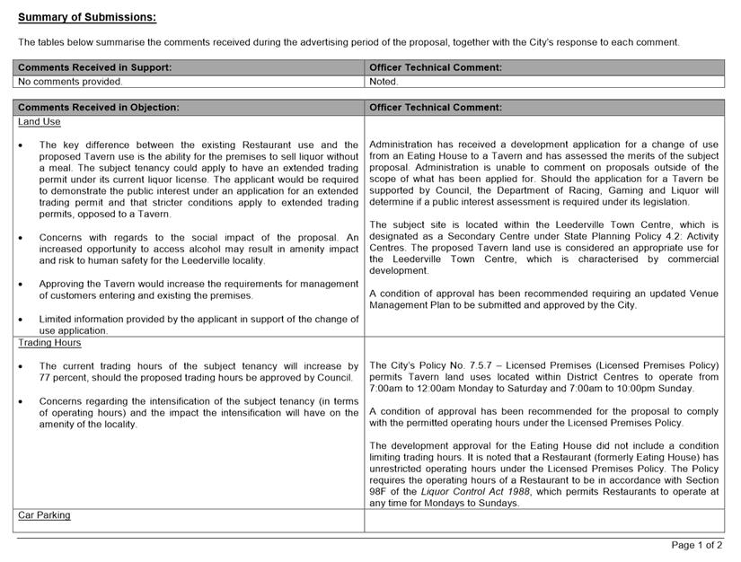
Land Use
The subject site and surrounding area is zoned District Centre under the City’s LPS2. The proposed Tavern use is an ‘A’ listed use within the District Centre zone, meaning the use is not permitted unless Council exercises its discretion.
During the consultation period, a submission was received objecting to the proposed land use and highlighting the lack of information provided by the applicant to justify the operations of the Tavern. The submission also objected to the intensification of the existing Eating House and the impact the proposal will have on the amenity of the surrounding area.
In considering the appropriateness of the proposed use, the following is relevant:
· The subject site has an existing approval for an Eating House, and is located in the Leederville Town Centre, which is characterised by commercial development. This means that the proposal will not encroach into any predominantly residential area;
· The proposed development does not involve any external modifications to the existing building, which provides a high level of glazing to Carr Place and facilitates activity and surveillance to the street;
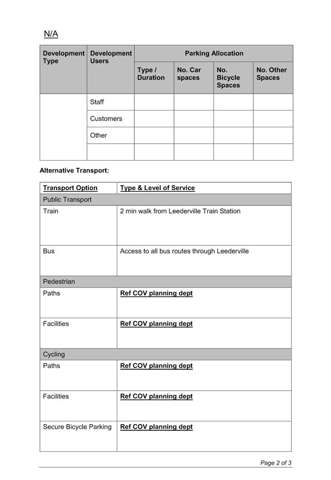
· The proposal does not provide for any on-site car parking which encourages customers and staff to consider utilising alternative modes of transport such as the nearby train station and bus routes;
· The City’s Licensed Premises Policy identifies licensed premises as being concentrated within Town Centre areas and being the most compatible for these uses;
· The site is highly accessible by public transport being located within approximately 250 metres of the Leederville Train Station and 80 metres from the Oxford Street high frequency bus route; and
· The development contributes to the diversity of entertainment uses within the Leederville Town Centre and supports employment opportunities.
Hours of Operation
The operating hours proposed in the application for the Eating House previously approved for this tenancy were Monday to Sunday from 9.00am to 12.00am. Trading hours for an Eating House (now termed Restaurant/Café) are unrestricted under the Licensed Premises Policy.
The City’s Licensed Premises Policy provides a guide for appropriate operating hours in various zones. It does not give any indication for the appropriate hours for Taverns within the Regional Centre zone as the Policy was adopted in 2014, prior to the gazettal of LPS2 which introduced the Regional Centre Zone. It is appropriate to apply the District Centre zone trading hours of the Policy to the Regional Centre zone.
The City’s Licensed Premises Policy permits the following trading hours for Taverns located within the District Centre zone:
· 7:00am – 12:00am for Mondays to Saturdays; and
· 7:00am – 10:00pm for Sundays.
The application proposes the use to operate from 11:30am to 12.00am seven days a week, with the exception of Good Friday, Anzac Day and Christmas Day. The applicant has provided a Venue Management Plan addressing car parking and transport options, hours of operation, patron and anti-social behaviour, noise control and rubbish disposal. The Venue Management Plan is included as Attachment 3.
The trading hours proposed for Sundays are inconsistent with the City’s Licensed Premises Policy requirements and not supported. A condition of approval has been recommended to be imposed aligning the trading hours on Sundays and public holidays with the Licensed Premises Policy.
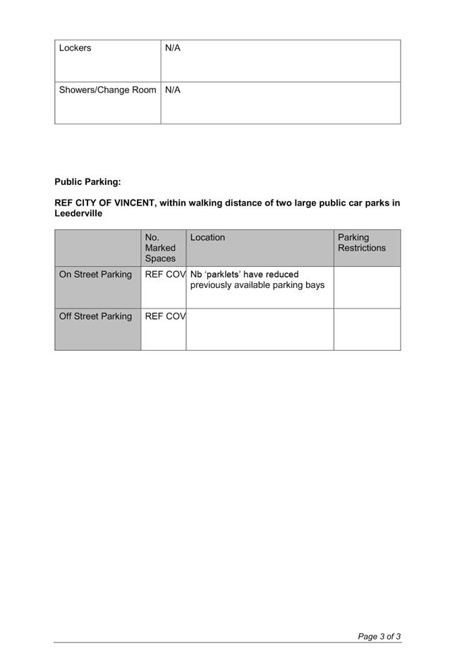
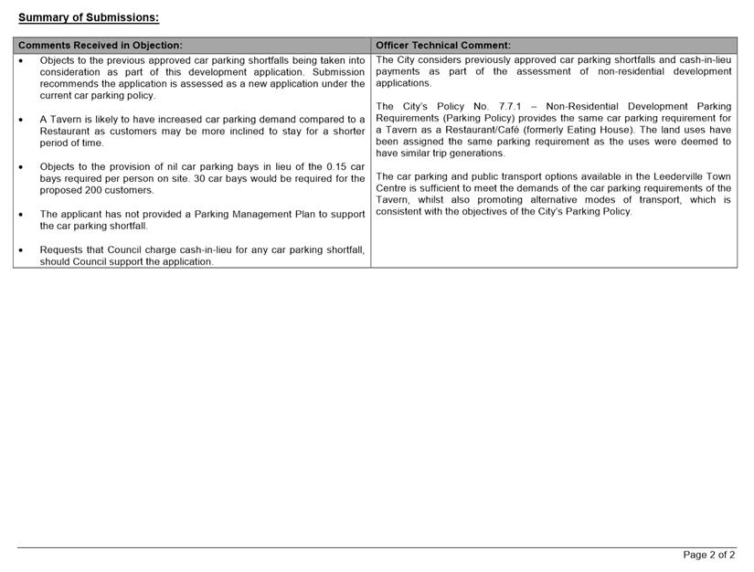
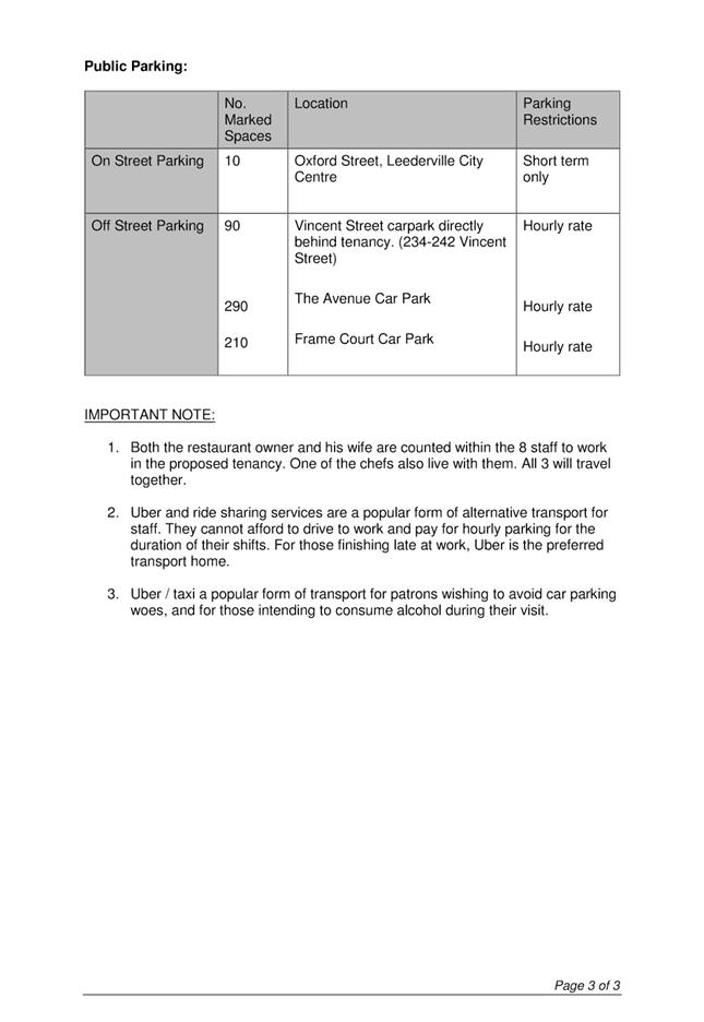
Car Parking
In accordance with the City’s Parking Policy, a Tavern use is required to provide 0.15 car bays per person accommodated on-site. This results in a requirement of 32 (31.8) car bays for the Tavern use based on the proposed maximum capacity of 200 patrons and 12 employees. During the consultation period, a submission was received objecting to the proposal and raising concerns in regards to the provision of car parking and the impact the car parking shortfall will have on the availability of the public and private car parks.
A Parking Management Plan has been prepared and submitted by the applicant. This is included as Attachment 4. The Parking Management Plan identifies that the site is in proximity to the Leederville Train Station and bus routes through Leederville. The Venue Management Plan included in Attachment 3 confirms the site’s access to various modes of transport (public transport, taxis/ride sharing, public car parking, cycling and walking).
The applicant has stated in both the Parking Management Plan and Venue Management Plan that the subject tenancy has no access to the 23 on-site car parking bays. This is inconsistent with the requirements of the previous approvals for the site, which requires the 23 car parking bays to be open for use by all uses on the site. The site is in single ownership and has not been granted strata subdivision approval to allow this. The City is currently investigating the matter with the aim of ensuring that access to the 23 parking bays on site is provided for all uses on site in accordance with the previous approvals.
The subject site paid a cash in lieu contribution for the 5.92 car bays as part of the original Mixed-Use development approval. A subsequent cash-in-lieu contribution of 2.46 car bays was paid as part of the development approval for the Eating House. This was subsequently paid.
The below table provides a comparison between the car parking required for the whole site based on the current Eating House and the proposed Tavern:
|
|
Previous Development Application |
Current Development Application |
|
Office |
9.9 |
9.9 |
|
Eating House |
20.75 (La Vida Urbana and Acai Bros) |
2.47 (Acai Bros) |
|
Tavern |
- |
31.8 |
|
Approved Parking Shortfall |
7.63 (5.92 whole site and 2.46 Eating House) |
7.63 |
|
Parking required for Site |
30.63 bays |
36.54 (37) |
|
Bays provided on site |
23 bays plus cash-in-lieu for 7.63 bays Equivalent of 30.63 bays provided in total |
23 bays plus cash-in-lieu for 7.63 bays Equivalent of 30.63 bays provided in total |
|
Car Parking Shortfall |
Nil |
14 bays |
The car parking requirement for the Eating House under the previous Parking Policy was calculated based on public floor area. The previous development approval did not establish a maximum number of persons permitted to be on site at any given time. The maximum number of persons permitted on site was determined based on the Building Code of Australia (BCA), which set a maximum of 172 persons on site.
The development application proposes to change the use of the subject tenancy to facilitate the sale of alcohol without a meal. The application does not propose to increase the public floor area of the Eating House but does seek to increase the maximum number of persons accommodated on site to 212. The additional 40 persons proposed to be accommodated on site would increase the car parking demand for the site.
The applicant has not adequately demonstrated how this additional car parking demand would be met by the development and has not proposed the payment of cash-in-lieu for the shortfall.
The increased parking shortfall that results from the proposed increase in the number of persons proposed on site is not appropriate, without the payment of cash-in-lieu for the shortfall. This is inconsistent with Council’s previous approvals pertaining to the site and this tenancy. Limiting the premises to the current maximum occupancy of 172 persons would ensure that the development does not increase the parking demand for the site.
The proposed Tavern use would not increase the intensity or demand for car parking from the existing Eating House on site if it was limited to the same maximum number of persons. It is recommended that the application be approved subject to a condition limiting the premises to a maximum of 172 persons at any one time.
Bicycle Parking
The development is required to provide four short term bicycle bays and nine long term bicycle bays for the proposed capacity of 212 persons on site. Should the premises be restricted to a maximum of 172 patrons as recommended, the bicycle parking requirement will be reduced to eight (7.2) long term bays and four short term bays.
The subject site has an enclosed bicycle store that can accommodate seven long term bicycles and separate end of trip facilities for males and females. The seven long term bicycle bays are available to the other tenancies for use. The existing Offices and Restaurant/Café on the subject site operate during business hours, which is outside of the peak operating period for the Tavern. The existing long term bicycle bays are acceptable to service the Tavern and the existing tenancies within the subject site.
There are no short term bicycle bays currently provided for the subject site. A condition of development approval is recommended for the provision of a minimum of four short term bicycle bays.
9.5 Nos. 1/150-154 (Lot: 200; D/P: 50976) Oxford Street, Leederville - Amendment to Existing Approval for Eating House
TRIM Ref: D19/6361
Author: Clair Morrison, Urban Planner
Authoriser: Joslin Colli, A/Manager Development & Design
Ward: North
Attachments: 1. Attachment
1 - Consultation and Location Plan ⇩ ![]()
2. Attachment 2 -
Original Approval 8 May 2005 ⇩ ![]()
3. Attachment 3 -
Development Plans and Parking Management Plan ⇩ ![]()
4. Attachment 4 -
Determination Advice Notes ⇩ ![]()
|
That Council, in accordance with the provisions of the City of Vincent Local Planning Scheme No. 62 and the Metropolitan Region Scheme, APPROVES the application for amendment to development approval for Change of Use from Eating House and Shop to Eating House at Nos. 150-154 (Lot: 200; D/P: 50976) Oxford Street, Leederville, in accordance with the plans shown as Attachment 2, subject to the following conditions, with the associated determination advice notes in Attachment 4: 1. All conditions and advice notes continue to apply to this approval, with the exception of Condition ii, which shall be removed and replaced with the following: ii. The approved Eating House shall not accommodate more than 58 persons on-site at any given time. |
Purpose of Report:
To consider an application for development approval for amendment to approval for eating house at Nos. 150-154 Oxford Street, Leederville.
PROPOSAL:
The application proposes an amendment to approval for Eating House at Nos. 150-154 Oxford Street, Leederville to extend the operating hours, increase the number of persons on site and number of car parking bays required on site.
Background:
|
Landowner: |
Jay-Tee Nominees Pty Ltd |
|
Applicant: |
Planning Horizons |
|
Date of Application: |
27 November 2018 |
|
Zoning: |
MRS: Urban LPS2: Zone: Regional Centre R Code: R-AC3 |
|
Built Form Area: |
Town Centre |
|
Existing Land Use: |
Eating House |
|
Proposed Use Class: |
P |
|
Lot Area: |
493m² |
|
Right of Way (ROW): |
Yes |
|
Heritage List: |
No |
The subject site is located on the eastern side of Oxford Street, which is characterised by restaurants, cafes, and retail properties (facing Oxford Street). The western side of Oxford Street is also characterised by other restaurants, cafes and retail properties facing Oxford Street. The location of the site is included in Attachment 1. Under the City’s Local Planning Scheme No. 2 (LPS2), the subject site and those adjoining it are zoned District Centre.
The City, under delegated authority, conditionally approved alterations and additions to an existing “Shop” and “Eating House”. Through this approval a shortfall of 7.84 car parking bays was approved, without the requirement of a cash-in-lieu payment.
At its meeting 8 March 2005, Council resolved to approve a Development Application for Change of Use from “Shop and Eating House” to “Eating House”. This approval increased the floor area for the “Eating House” and reduced the floor area for the “Shop” for Tenancy One. Under the City’s rescinded Policy No. 7.7.1 – Parking and Access, parking requirements for ‘Eating House’ was determined by the floor area. Under the City’s current Policy No. 7.7.1 – Non-Residential Development Parking Requirements, the parking requirements for Restaurant/Café, the equivalent to “Eating House” is determined by total number of persons. Given the applicant is applying for a total of 58 persons on site, this results in a further departure from the approved parking shortfall.
Details:
The current eating house is known as “Shortlist” and operates as a café. This application seeks to amend the previous development approval issued by Council by increasing the number of total persons permitted on‑site, increasing the operating hours and increasing the minimum required number of car parking spaces.
Summary Assessment
The table below summarises the planning assessment of the proposal against the provisions of the City of Vincent Local Planning Scheme No. 2 (LPS2), the City’s Policy No. 7.1.1 – Built Form, the Policy No. 7.7.1 – Non-Residential Development Parking Requirements and Policy No. 7.5.2 – Licensed Premises. In each instance where the proposal requires the discretion of Council, the relevant planning element is discussed in the Detailed Assessment section following from this table.
|
Planning Element |
Use Permissibility/ Deemed-to-Comply |
Previously approved |
Requires further Discretion |
|
Land Use |
ü |
|
|
|
Parking & Access |
|
|
ü |
|
Bicycle Facilities |
|
|
ü |
|
Ground Floor Design |
|
ü |
|
|
Awnings, Verandahs and Collonades |
|
ü |
|
Detailed Assessment
The deemed-to-comply assessment of the elements that require the discretion of Council are as follows:
|
Car Parking Facilities |
|
|
Deemed-to-Comply Standard |
Proposal |
|
Policy No. 7.7.1 – Non-Residential Development Parking Requirements
0.86 car parking bays |
Nil |
|
Bicycle Facilities |
|
|
Deemed-to-Comply Standard |
Proposal |
|
Policy No. 7.7.1 – Non-Residential Development Parking Requirements
2.4 long term
1.1 short term |
Nil
Nil |
The above elements of the proposal do not meet the specified deemed-to-comply standards and are discussed in the comments section below.
Consultation/Advertising:
Community consultation for the proposal occurred for a period of 14 days from 9 January 2019 to 22 January 2019. Community consultation was undertaken by means of 10 written notifications being sent to all adjoining landowners and occupiers as show in Attachment 1. At the conclusion of the community consultation period, no submissions were received.
Design Review Panel (DRP):
Referred to DRP: No
Legal/Policy:
· Planning and Development Act 2005;
· Planning and Development (Local Planning Schemes) Regulations 2015;
· City of Vincent Local Planning Scheme No. 2;
· Policy No. 4.1.5 – Community Consultation;
· Policy No. 7.1.1 – Built Form Policy;
· Policy No. 7.5.2 – Licensed Premises; and
· Policy No. 7.7.1 – Non-Residential Development Parking Requirements.
Delegation to Determine Applications:
This matter is being referred to Council as the application proposes to amend an application previously determined by Council.
RISK MANAGEMENT IMPLICATIONS:
There are minimal risks to Council and the City’s business function when Council exercises its discretionary power to determine a planning application.
Strategic Implications:
This is in keeping with the City’s Strategic Community Plan 2018-2028:
“Innovative and Accountable
We are open and accountable to an engaged community”.
SUSTAINABILITY IMPLICATIONS:
Nil.
FINANCIAL/BUDGET IMPLICATIONS:
Nil.
Comments:
Land Use
The subject site is approved as an eating house. This land use falls under the definition of ‘Restaurant/Café’ of the LPS2. This land use is a permitted use in the Regional Centre zoning.
The Licensed Premises Policy permits restaurants to operate at any time, with the exception of midnight to 3:00am on Anzac Day. These operating hours are acceptable without any alternative condition being imposed.
The remainder of the Engineering, Building and Health requirements are still applicable through the relevant legislation implemented under the Building Act 2011 and Health Act 1911. The Condition imposing these requirements remains.
Parking
The applicant proposes up to 58 persons at any one time (50 patrons and 8 employees). In accordance with Policy No. 7.7.1 – Non-Residential Development Parking Requirements, this results in a car parking requirement of 8.7 car parking bays, 2.4 long term bicycle bays and 1.1 short term bicycle bays. A shortfall of 7.84 car parking bays was approved by Administration under delegation on 1 December 2004, without the need for a cash-in-lieu payment. The resultant shortfall for the proposed number of persons for this application is 0.86 car parking bays. The applicant has provided a Parking Management Plan in lieu of paying the cash-in-lieu equivalent for the shortfall of parking.
· The eating house use has been operating with a shortfall of 7.84 car parking bays since December 2004. There have been no complaints made to the City in relation to parking within this commercial building.
· This shortfall equates to $4,644.
· The applicant has provided written justification, included in Attachment 2, to justify this shortfall.
· There is approximately 590 publically available off-street car parking bays within 300 metres of the site.
· There is an additional 35 publically available on-street car parking bays along Oxford Street within 300 metres of the site.
· Surrounding land uses include residential with a comprehensive footpath network.
· The subject site is located approximately 300 metres from the Leederville Train Station.
· The closest high frequency bus stop is located approximately 30 metres from the subject site.
· There is four Class bicycle racks within 20 metres of the subject site.
There is a significant amount of parking facilities and alternative transport options surrounding the subject site. The increased number of persons would not detrimentally impact the locality. A cash-in-lieu payment is not required for the area surrounding the subject site.
There are two Class 3 (short term) bicycle racks within 20 metres of the subject site which could accommodate four bicycles. The subject site is within 30 metres of a high frequency bus route. There is inadequate space to accommodate further short- or long-term bicycle facilities within directly adjacent to the tenancy, due to the approved alfresco dining area. The existing bicycle and public transport facilities would be able to accommodate the proposed increase in patrons. A cash-in-lieu payment for bicycle facilities would not benefit this use or the locality.
The City recommends approval for the additional number of persons.
9.6 Nos. 46-52 (Lot: 81; P: 2848) Britannia Road, Mount Hawthorn - Amendment to Existing Approval (Street Fence) for Four Multiple Dwellings: Unauthorised Existing Development
TRIM Ref: D19/6385
Author: Natasha Trefry, Urban Planning Advisor
Authoriser: John Corbellini, Director Development Services
Ward: North
Attachments: 1. Attachment
1 - Consultation and Location Map ⇩ ![]()
2. Attachment 2 -
Extract of Minutes of the Ordinary Meeting of Council 16 December 2014 and
Approved Development Plans ⇩ ![]()
3. Attachment 3 -
Amendment Application Plans ⇩ ![]()
4. Attachment 4 -
Applicant Justification ⇩ ![]()
|
That Council in accordance with the provisions of the City of Vincent Local Planning Scheme No. 2 and the Metropolitan Region Scheme, APPROVES the application to amend the street fence of planning approval 5.2014.597.1 granted on 16 December 2014 for Proposed Demolition of An Existing Single House and Construction of Four Multiple Dwellings and Associated Car Parking at No. 2 (Lot: 81; D/P: 2848) The Boulevarde, Mount Hawthorn, now recognised as Nos. 46 – 52 (Lot: 81; D/P 2848) Britannia Road, Mount Hawthorn, subject to the following conditions: 1. This approval relates to the “390x390 1800h rendered brick slats with 32.50mm gaps piers with 700h low wall and infill panels comprising 65mm slats with 32.50mm gaps” shown in Attachment 3 only. It does not apply to any other development on site; and 2. All other aspects of the approved plans and all conditions and advice notes included in planning approval 5.2014.597.1, granted on 16 December 2014, continue to apply to this approval. |
Purpose of Report:
To consider an application to amend the street fence (unauthorised existing development) of planning approval 5.2014.597.1 for four Multiple Dwellings at Nos. 46 – 52 Britannia Road, Mount Hawthorn.
PROPOSAL:
The application proposes to amend the permeability of the approved street fence at Nos. 46-52 Britannia Road, Mount Hawthorn.
Background:
|
Landowner: |
Tanya Di Prinzio |
|
Applicant: |
Kevin Di Prinzio |
|
Date of Application: |
6 November 2018 |
|
Zoning: |
MRS: Urban LPS2: Residential R Code: R30 |
|
Built Form Area: |
Residential |
|
Existing Land Use: |
Multiple Dwellings |
|
Proposed Use Class: |
Multiple Dwellings |
|
Lot Area: |
570m² |
|
Right of Way (ROW): |
Yes – 5.0 metres in width, sealed and owned by the City of Vincent |
|
Heritage List: |
No |
The subject site is located at the corner of Britannia Road and The Boulevarde, and is comprised of four multiple dwellings. The site is bound by a Right of Way (ROW) to the south, Britannia Road and Britannia Reserve to the east and The Boulevarde to the west. The site and surrounding area is zoned Residential R30 and characterised by single dwelling development. The lot forms part of the Residential built form area in accordance with the City’s Policy No. 7.7.1 – Built Form. A location plan is included as Attachment 1.
On 16 December 2014 Council resolved to grant planning approval for the demolition of an existing house and the construction of four multiple dwellings and associated car parking on the subject site. A copy of this approval is included as Attachment 2.
The approved plans depict a masonry fence with ‘selected infill to shire requirements’ along approximately half the Britannia Road street boundary and for approximately three quarters of The Boulevard street boundary.
On 7 July 2017, a building permit was received seeking to extend the approved street fence for the entire length of the Britannia Street boundary. The additional fence depicted in the building permit application was considered to meet the deemed-to-comply standards of the City’s Policy No. 7.1.1 – Built Form (Built Form Policy) in relation to street walls and fences and was not required to gain development approval. Administration issued the building permit for the extended street fence on 17 July 2017.
Concerns with the permeability and scale of the wall were raised in a compliance matter lodged with the City in April 2018. The City investigated the as constructed fence and noted that the infill was not provided in accordance with the building permit as the panels were not visually permeable. The extension of the fence along the eastern portion of the Britannia Street frontage did not meet the distance between piers deemed-to-comply standard and so also required development approval. The owner was advised to amend the fence to comply with the building permit or to lodge an amended development application seeking approval for the as-constructed infill panels and eastern portion of street fence. The owner lodged an application to amend the existing planning approval on 6 November 2018 for the as‑constructed infill panels and eastern portion of street fence. The application proposes infill panels made up of a series of 65 millimetres slats with 32.5 millimetres gaps between each and an eastern portion of fence with a distance of 1.38 metres between piers. The amendment application plans are included as Attachment 3, with the applicants justification included in Attachment 4.
The previous planning approval issued for the site was addressed as No. 2 The Boulevarde, Mount Hawthorn. Since this approval the address of the property has changed to Nos. 46-52 Britannia Street, Mount Hawthorn.
Details:
Summary Assessment
The table below summarises the planning assessment of the proposal against the provisions of the City of Vincent Local Planning Scheme No. 2 (LPS2), the City’s Policy No. 7.1.1 – Built Form and the R Codes. In each instance where the proposal requires the discretion of Council, the relevant planning element is discussed in the Detailed Assessment section following from this table.
|
Planning Element |
Use Permissibility/ Deemed-to-Comply |
Previously approved |
Requires further Discretion |
|
Street Fence |
|
|
ü |
Detailed Assessment
The deemed-to-comply assessment of the element that requires the discretion of Council is as follows:
|
Street Walls and Fences |
|
|
Deemed-to-Comply Standard |
Proposal |
|
5.10 Street Walls & Fences
Maximum height of solid portion of wall – 1.2m
Fence to be visually permeable above 1.2m, with minimum gaps of 50mm between slats occupying 50% of the surface area.
The distance between piers should not be less than the height of the piers – 1.8m |
Maximum height of solid portion of wall – 0.7m
Fence is not visually permeable above 1.2m, with 32.5mm gaps occupying 34% of the surface area.
The distance between piers is less than the height of the piers – 1.38m |
The above element of the proposal does not meet the specified deemed-to-comply standard and is discussed in the comments section below.
Consultation/Advertising:
Community Consultation was undertaken in accordance with the Planning and Development (Local Planning Scheme) Regulations 2015, for a period of 14 days commencing on 14 January 2019 to 28 January 2019. Community consultation was undertaken by means of written notifications being sent to surrounding landowners, as shown in Attachment 1 and a notice on the City’s website. At the conclusion of the community consultation period, 6 submissions of support and 1 objection were received by the City. The one objection to the development raised the following issues:
· The fence does not comply with the City’s Built Form Policy and should not remain as it is different to what was approved for the development.
· Developer was aware that the fence was non-compliant but installed it anyway.
· The narrow openings are a safety hazard for pedestrians entering and exiting the adjoining right of way. There is increasing use of the ROW and the narrow gaps in the fence obstructs visibility.
· The fence is a safety hazard for pedestrians, especially at night, as it blocks visibility to the development’s carport.
· The fence is a safety hazard for tenants.
· The new fence does not suit the streetscape and intensifies the bulk of the building.
· Changes to development’s façade from the original approved application makes the development look more like an institution, a hospital or prison, rather than four separate units. The fence exacerbates this.
Design Review Panel (DRP):
Referred to DRP: No
Legal/Policy:
· Planning and Development Act 2005;
· Planning and Development (Local Planning Schemes) Regulations 2015;
· City of Vincent Local Planning Scheme No. 2;
· State Planning Policy 3.1 – Residential Design Codes;
· Policy No. 4.1.5 – Community Consultation; and
· Policy No. 7.1.1 – Built Form Policy.
Delegation to Determine Applications:
The matter being referred to Council as the application proposes to amend an application previously determined by Council.
Risk Management Implications:
There are minimal risks to Council and the City’s business function when Council exercises its discretionary power to determine a planning application.
Strategic Implications:
This is in keeping with the City’s Strategic Community Plan 2018-2028:
“Innovative and Accountable
We are open and accountable to an engaged community”.
SUSTAINABILITY IMPLICATIONS:
Nil.
Financial/Budget Implications:
Nil.
Comments:
The application relates to the existing street fence only. The previous planning approval granted by Council included a street fence with ‘selected infill to shire requirements’. These requirements are currently set out in the City’s Built Form Policy and stipulate that street fencing above 1.2 metres in height is deemed-to-comply if it is visually permeable and the distance between the piers is greater than the height of the piers. The street fence proposed is not visually permeable above 1.2 metres as it includes 32.5 millimetre gaps between the slats, in lieu of 50 millimetre gaps, and the gaps take up 32 percent of the surface area of the infill in lieu of 50 percent. The fence addition proposed along the eastern portion of the Britannia Street frontage also includes 1.38 metre space between piers in lieu of the 1.8 metres:
· The solid wall portions of the front fence are 0.7 metres high in lieu of the 1.2 metres maximum height permitted under the built form policy. The 0.7 metre solid portion results in a fence with less bulk than a deemed-to-comply fence with a 1.2 metre solid portion.
· The adjacent properties have Britannia Road as their secondary frontage and include portions of solid fencing facing Britannia Road. The street fencing proposed is not out of character or inconsistent with the surrounding solid walls.
· Britannia Road is classified a local distributor road. The proposed street fence maintains a level of privacy and protection from the impacts of traffic for the dwellings without the need for solid fence.
· The dwellings are opposite Britannia Reserve and include a front porch and courtyard behind the subject fence facing the reserve. The proposed street fence provides an appropriate level of surveillance of the reserve while providing a sense of security and safety for residents.
· The adjoining dwellings includes walls to Britannia Road (as the secondary street for adjoining properties).
· The subject fence is compliant with the visual truncations and sight lines requirements of the R Codes and is safe for both pedestrians and users of the ROW.
· The permeability of the fence allows for surveillance of the street and adjacent Britannia Reserve from the front of the dwellings.
· The dwelling also maintains street surveillance via its entry and major openings on each of the dwellings ground and upper storeys.
· The configuration of the horizontal panels is not visually dominant on the streetscape, particularly given all other aspects of the fence comply.
The proposed street fence satisfies the relevant design principles of the R Codes and is recommended for approval.
TRIM Ref: D19/14892
Author: Karsen Reynolds, Urban Planner
Authoriser: John Corbellini, Director Development Services
Ward: North
Attachments: 1. Attachment
1 - Consultation and Location Map ⇩ ![]()
2. Attachment 2 -
Development Plans ⇩ ![]()
3. Attachment 3 -
Design Review Panel Comments ⇩ ![]()
4. Attachment 4 -
Applicant Response to First Community Consultation Submissions ⇩ ![]()
5. Attachment 5 -
Applicant Response to Second Community Consultation Submissions ⇩ ![]()
6. Attachment 6 -
Administration's Response to Summary of Submissions ⇩ ![]()
7. Attachment 7 -
Applicant Justification ⇩ ![]()
8. Attachment 8 -
Photos of Site and Surrounding Context ⇩ ![]()
9. Attachment 9 -
Streetscape Analysis ⇩ ![]()
|
That Council, in accordance with the provisions of the City of Vincent Local Planning Scheme No. 2 and the Metropolitan Region Scheme, REFUSES the application for a proposed Single House at No. 58 (Lot: 301 & 302; D/P: 34680) Kalgoorlie Street, Mount Hawthorn, in accordance with the plans provided in Attachment 2, for the following reason: 1. As a consequence of the large blank walls to the front façade the proposal: 1.1 results in a bulk, scale and dominating appearance that is not compatible with and complementary to the established residential area in which it is located (Clause 67(m) of the deemed provisions in Schedule 2 of the Planning and Development (Local Planning Schemes) Regulations 2015) and is inconsistent with an objective of the Residential zone under the Scheme; 1.2 would detract from the amenity and character of the residential neighbourhood (Clause 67(n) of the deemed provisions in Schedule 2 of the Planning and Development (Local Planning Schemes) Regulations 2015) and is inconsistent with an objective of the Residential zone under the Scheme; 1.3 is not an appropriate design for the context of place and is inconsistent with Objective 1.3.1(a) of State Planning Policy 3.1: Residential Design Codes; and 1.4 does not does not interact with the street and is inconsistent with Objective 1.3.1(c) of State Planning Policy 3.1: Residential Design Codes. |
Purpose of Report:
To consider an application for development approval for a Single House at No. 58 Kalgoorlie Street, Mount Hawthorn (subject site).
PROPOSAL:
The application proposes a two-storey single house at No. 58 Kalgoorlie Street, Mount Hawthorn.
Background:
|
Landowner: |
Caitlin Kyron |
|
Applicant: |
Konstantine Dean Kyron |
|
Date of Application: |
3 October 2018 |
|
Zoning: |
MRS: Urban LPS2 Zone: Residential R Code: R30 |
|
Built Form Area: |
Residential |
|
Existing Land Use: |
Single House |
|
Proposed Use Class: |
Single House |
|
Lot Area: |
Lot 301: 374 square metres Lot 302: 250 square metres Total Lot Area: 624 square metres |
|
Right of Way (ROW): |
No |
|
Heritage List: |
No |
The subject site is bound by Kalgoorlie Street to the west, and developed residential lots to the north, east and south. The site is currently accommodates a double-storey detached dwelling, which is proposed to be demolished. The surrounding residential developments are single-storey and two-storey single houses. On the opposite side of Kalgoorlie Street are single-storey and two-storey single houses and grouped dwelling developments (refer to the location plan included in Attachment 1). The subject site and adjoining properties are zoned Residential R30 under the City’s Local Planning Scheme No. 2 (LPS2) and have been identified as a Residential Built Form Area as prescribed under the City’s Local Planning Policy No. 7.1.1 – Built Form (Built Form Policy).
An application to amalgamate Lot 301 and Lot 302 into a single lot on a Certificate of Title has been lodged with the Western Australian Planning Commission (WAPC). Administration provided a recommendation for approval for the proposed amalgamation. The WAPC granted conditional approval subject to conditions for the proposed amalgamation on 7 February 2018.
The development application proposes a two storey single dwelling with a roof terrace and double garage. The development plans have been included as Attachment 2.
Details:
Summary Assessment
The table below summarises the planning assessment of the proposal against the provisions of the City of Vincent Local Planning Scheme No. 2 (LPS2), the City’s Policy No. 7.1.1 – Built Form and the State Government’s Residential Design Codes. In each instance where the proposal requires the discretion of Council, the relevant planning element is discussed in the Detailed Assessment section following from this table.
|
Planning Element |
Use Permissibility/ Deemed-to-Comply |
Requires the Discretion of Council |
|
Street Setback |
ü |
|
|
Front Fence |
|
ü |
|
Building Setbacks/Boundary Wall |
|
ü |
|
Building Height/Storeys |
ü |
|
|
Open Space |
ü |
|
|
Outdoor Living Areas |
ü |
|
|
Landscaping |
ü |
|
|
Privacy |
ü |
|
|
Sightlines |
|
ü |
|
Parking and Access |
ü |
|
|
Solar Access |
|
ü |
|
Setback of Garages and Carports |
ü |
|
|
Site Works/Retaining Walls |
ü |
|
|
Essential Facilities |
ü |
|
|
External Fixtures |
ü |
|
|
Surveillance |
ü |
|
|
Outbuildings |
ü |
|
Detailed Assessment
The deemed-to-comply assessment of the element that requires the discretion of Council is as follows:
|
Building Setbacks/Boundary Wall |
|
|
Deemed-to-Comply Standard |
Proposal |
|
Clause 5.1.3 of the R Codes
Northern Boundary
Upper floor terrace privacy screens require a 3.1 metre setback from the northern boundary
|
Upper floor terrace privacy screens provide a 1.5 metre setback from the northern boundary |
|
Southern Boundary
Upper floor rumpus room and spiral stairs requires a 3.3 metre setback from the southern boundary
Rooftop terrace requires a 3.8 metre setback from the southern boundary |
Upper floor rumpus room and spiral stairs provides a 2.1 metre setback from the southern boundary
Rooftop terrace provides a 1.6 metre setback from the southern boundary |
|
Front Fence |
|
|
Deemed-to-Comply Standard |
Proposal |
|
Clause 5.10 of the Built Form Policy
Piers to have a maximum width of 400 millimetres
The distance between piers should not be less than the height of the piers |
Piers propose a maximum width of 1.0 metre
The distance between piers is less than the height of the piers |
|
Sightlines |
|
|
Deemed-to-Comply Standard |
Proposal |
|
Clause 5.2.5 of the R Codes
Walls, fences and other structures to be no higher than 0.75 metres within 1.5 metres of whether walls, fences and other structures adjoin a driveway |
North of the proposed driveway: One pier and fence infill with a height of 1.2 metres is within 1.5 metres of the driveway
South of the proposed driveway: One pier and fence infill with a height of 1.2 metres is within 1.5 metres of the driveway |
|
Solar Access |
|
|
Deemed-to-Comply Standard |
Proposal |
|
Clause 5.4.2 of the R Codes
Shadowing on adjoining properties coded R30 is to be a maximum of 35 percent of the site area |
Shadowing proposed to Lot 303 and Lot 23 to the south of the subject site
Shadow projection to Lot 303: 74.2 percent Shadow projection to Lot 23: 12.3 percent |
The above elements of the proposal does not meet the specified deemed-to-comply standards and are discussed in the comments section below.
Consultation/Advertising:
Community consultation was undertaken in accordance with the Planning and Development (Local Planning Schemes) Regulations 2015, for a period of 14 days commencing on 9 November 2018 and concluding on 22 November 2018. Community consultation was undertaken by means of written notification being sent to surrounding landowners, as shown in Attachment 1 and a notice on the City’s website.
The City received 40 submissions; all objecting to the proposal. A summary of the submissions received and the Applicant’s response is provided in Attachment 4.
Following the first consultation period, the applicant sought to respond to the objections through the submission of amended plans, which involved the following modifications:
· Increased upper floor street setback from 4.9 metres to 7.5 metres and additional detail provided to the façade design;
· Reduction in boundary wall heights;
· Re-design to the southern walls to provide greater articulation and design detail;
· Reduction in the building height from 8.52 metres to 7.6 metres;
· Modifications to the front fence including the reduction of pier widths within vehicle sightline areas;
· Increased deep soil areas from 9.9 percent to 12.6 percent;
· Provision of privacy screens to raised terraces; and
· Increased setback from the rooftop terrace to the northern boundary.
Administration advertised the application for a second time to allow the community to provide feedback on the amended plans. The application was advertised for a period of 16 days between 16 January 2019 and 1 February 2019, to adjoining properties. The standard 14 days for neighbour consultation was extended by two business days due to technical problems on the City’s website.
Following the second advertising period the City received a total of 75 submissions; 34 in support; and 41 objecting to the proposal. A summary of the submissions received and the Applicant’s response is provided in Attachment 5.
A summary of all of the submissions received along with Administration’s comments on each is provided in Attachment 6.
The submissions received during the second advertising period are summarised with their relative locations in the table below.
|
Submissions received during the second advertising period |
Within 100 metres of subject site |
More than 100 metres from subject site |
All submissions |
|
SUPPORT |
0% |
100% |
36.6% |
|
OBJECT |
58.5% |
41.5% |
63.4% |
|
OTHER (not stated/no opinion) |
N/A |
N/A |
N/A |
The concerns raised in the submissions, which reiterated previous concerns received are as follows:
· Development results in building bulk to the street and adjoining properties;
· Adverse amenity impacts to adjoining properties;
· Overlooking provided to adjoining properties;
· Overshadowing provided to adjoining properties;
· Lack of deep soil zones and canopy cover;
· Development is not respectful of the local context;
· Development is not consistent with and does not contribute to the established built form and character of the streetscape and suburb; and
· Overdevelopment of the site.
Design Review Panel (DRP):
Referred to DRP: Yes
The development has been referred to DRP on one occasion following receipt of the application by Administration. Attachment 3 contains the development plans presented to the DRP and an extract of the minutes from the meeting.
The proposal was presented to the DRP on 6 February 2019, with comments raised by the DRP summarised as follows:
· Passive surveillance is important. Mt Hawthorn has a friendly and engaging community. House appears gated and is turning its back on the street;
· Glazing of the study is so far from the right that it is not visible. Look at increasing glazing on the ground floor such as to the study or the mudroom;
· A big window on upper level and flipping the master suite layout would be a good outcome for surveillance and softening the upper floor façade;
· Suggest putting a side window to the front door or could make front door glass to have better interaction between the street and house;
· Consider a perforated garage door. This would provide privacy but also create more transparency;
· No concerns with the contemporary nature. Architectural intent is very bold and strong, however the design does not seem to fit into the area;
· There is insufficient information provided on surrounding context as shown on floorplans, elevations and perspectives. Show the adjoining buildings to illustrate how the proposal responds to the surrounding context;
· Look at adding in additional materials to the front façade such as brickwork to relate to the local context.
· Review and amend building height to comply; and
· Look at planting choices within the front setback area, such as fruit trees, to provide greater depth and to draw the eye into the site.
The applicant submitted amended plans to on the 7 February 2018 in response to DRP comments, which involved the following modifications:
· Increased deep soil zones provided on site;
· Garage door amended from a solid door to perforated mesh;
· Front door to the dwelling amended from obscured glass to visually permeable glass;
· Additional circle window provided to the ground floor study;
· Building height reduced to meet relevant deemed-to-comply standards;
· Front fence materiality amended to white brickwork with rendered piers;
· Upper floor master suite floor plan amended to allow for increased surveillance to the street from the openings on the front facade; and
· Tree species to the front setback area amended to reflect DRP recommendations.
Comments received from the DRP have been discussed in the Comments section of this report.
Legal/Policy:
· Planning and Development Act 2005;
· Planning and Development (Local Planning Schemes) Regulations 2015;
· City of Vincent Local Planning Scheme No. 2;
· State Planning Policy 3.1 – Residential Design Codes;
· Policy No. 4.1.5 – Community Consultation; and
· Policy No. 7.1.1 – Built Form Policy.
The City is to have due regard to the matters contained under Clause 67 of the Planning and Development (Local Planning Scheme) Regulations 2015 and the objectives of the R Codes and relevant zone when exercising its discretion. An assessment of the matters and objectives relevant to this proposal is provided within the comments section of this report.
Matters to be considered
The following matters set out in Schedule 2, Clause 67 of the Planning and Development (Local Planning Schemes) Regulations 2015 are relevant matter Council is to have due regard to as part of determining this application:
m) the compatibility of the development with its setting including the relationship of the development to development on adjoining land or on other land in the locality including, but not limited to, the likely effect of the height, bulk, scale, orientation and appearance of the development;
n) the amenity of the locality including the following –
(i) environmental impacts of the development;
(ii) the character of the locality; and
(iii) social impacts of the development.
The following objective of the Residential zone under City’s LPS2 is a relevant consideration for Council to have due regard to when determining this application:
· To enhance the amenity and character of the residential neighbourhood by encouraging the retention of existing housing stock and ensuring new development is compatible within these established areas.
The following objectives of the R Codes matter are relevant matters that Council is to have due regard to when determining this application:
· To provide residential development of an appropriate design for the intended residential purpose, density, context of place and scheme objectives;
· To encourage design consideration of the social environmental and economic opportunities possible from new housing and appropriate response to local amenity and place; and
· To encourage design which considered and respects heritage and local culture.
In accordance with Schedule 2, Clause 76(2) of the Planning and Development (Local Planning Schemes) Regulations 2015 and Part 14 of the Planning and Development Act 2005, the applicant would have the right to apply to the State Administrative Tribunal for a review of Council’s determination.
The deemed-to-comply rear lot boundary standards set out in the Built Form Policy have not been approved by the Western Australian Planning Commission (WAPC). As a result, the assessment would only have ‘due regard’ to those deemed-to-comply rear setbacks approved by Council in the Built Form Policy.
The deemed-to-comply landscaping standards set out in the Built Form Policy have not been approved by the Western Australian Planning Commission (WAPC), which have instead issued approval for a modified set of deemed-to-comply landscaping standards that are similar to those set out in Design WA but which have not been approved by Council. As a result, the assessment would only have ‘due regard’ to those deemed-to-comply landscaping approved by Council in the Built Form Policy.
Delegation to Determine Applications:
This matter is being referred to Council for determination as the proposal has received more than five objections during the City’s community consultation period.
Risk Management Implications:
There are minimal risks to Council and the City’s business function when Council exercises its discretionary power to determine a planning application.
Strategic Implications:
This is in keeping with the City’s Strategic Community Plan 2018-2028:
“Innovative and Accountable
We are open and accountable to an engaged community”.
SUSTAINABILITY IMPLICATIONS:
Nil.
Financial/Budget Implications:
Nil.
Comments:
As detailed within the table above, discretion is required for various elements. The proposed development has been considered against the relevant objectives and design principles below.
Lot Boundary Setbacks
North
The application involves an upper floor setback of 1.5 metres from the terrace (located to the front of the property) to the northern lot boundary. The terrace requires a 3.1 metre setback.
In considering the acceptability of the lot boundary setback proposed, the following is noted:
· The City received neighbour concerns in relation to overlooking from the terrace; over development of the site; and building bulk impacts;
· The upper floor terrace screens are adjacent the adjoining northern adjoining properties open space area. The portion of open space that the screens abut is not the primary outdoor living area of the northern property, to which is located to the rear of their property. The favourable location of the upper floor terrace reduces any adverse amenity impacts to the northern property;
· While the minimum setback from the terrace privacy screens is 1.5 metres, the structure is curved, and pulls away from the northern boundary to a maximum setback of 5.4 metres. The increasing setback from the screens to the northern boundary is assists in the reduction of building bulk when viewed from the northern adjoining property;
· The proposal involves a mature tree forward of the privacy screens as well as climbers to grow over the solid walls. Landscaping in this location would soften the appearance of the solid screens when viewed from the adjoining northern property and would assist in the reduction of solid blank walls and subsequent adverse visual impacts;
· There would be no overshadowing and subsequent loss of sunlight to the northern adjoining property due to the favourable location and orientation of the terrace. Buildings have been setback sufficiently so as to allow ventilation to flow between properties. The reduced setback contributes to a more effective use of building space in an area where there would be no adverse impact on the adjoining property, particularly in relation to access to sunlight or ventilation; and
· The terrace meets the deemed-to-comply standards for Clause 5.4.1 Visual Privacy of the R Codes. The terrace does not result in any overlooking and resultant loss of privacy to the northern adjoining property.
South
The application provides an upper floor setback of 2.1 metres from the rumpus room / spiral stairs from the southern lot boundary in lieu of the 3.3 metre required setback.
In considering the acceptability of the southern lot boundary setback proposed, the following is noted:
· The City received submissions that raised concerns with the aesthetic impact and bulky appearance of the building as a result of the reduced setbacks, and adverse impacts relating to amenity, overlooking and overshadowing;
· The southern elevation provides an articulated façade with a range of openings and minor projections that assists in mitigating building bulk. The building has also incorporated landscaping around the perimeter of the site to further soften the building edge. These details proposed break up the appearance of solid blank walls when viewed from the adjoining southern property;
· The roof terrace sits entirely within the upper floor roof space, removing any additional building bulk impacts;
· The majority of the shadow from the development falls to the southern adjoining properties driveway, northern setback area that contains major openings, rear open space area, and roof space. The affected major openings on the southern adjoining property would remain shadowed if the setback were to comply and the reduced setback does not further reduce sunlight to these openings. The shadow that falls to the open space area to the rear of the southern property does not fall to the primary outdoor living area, to which is situated to south of the adjoining property. The patio located to the southern property is not shadowed from the proposed development. The southern adjoining properties outdoor living area would continue to receive adequate direct sunlight to the building and open space areas; and
· The upper floor facing south provides minor openings only and the rooftop terrace privacy provides 1.6 metre privacy screens around its perimeter. The subject walls meet the deemed-to-comply standards for Clause 5.4.1 Visual Privacy of the R Codes and do not result in any overlooking and resultant loss of privacy to the southern adjoining property.
East
The application has been assessed against the lot boundary setback provisions of the City’s Built Form Policy that establishes deemed-to-comply requirements. The deemed-to-comply boundary wall and lot boundary setback standards set out in the Built Form Policy have not been approved by the WAPC. These provisions are given due regard in the assessment of this application.
The Built Form Policy requires 6.5 metre lot boundary setbacks to the rear boundary.
The application provides a minimum setback of 1.1 metres from the ground floor to the rear boundary, and a minimum setback of 4.0 metres from the upper floor to the rear boundary.
In considering the acceptability of the rear lot boundary setbacks proposed, the following is noted:
· The City received submissions that raised concerns with the aesthetic impact and bulky appearance of the building as a result of the reduced setbacks, and adverse impacts relating to amenity, overlooking and overshadowing;
· The development meets the deemed-to-comply standards for lot boundary setbacks under Clause 5.1.3 of the R Codes (tables 2a/2b) and is acceptable in terms of building bulk and mass;
· The eastern elevation provides an articulated façade, due to the external stairs stepping back from the eastern boundary. The building has also incorporated landscaping along the eastern lot boundary of the site to further soften the building edge. The adjoining eastern properties that have views to the eastern walls also have mature plantings along their rear boundary that would restrict visibility of the proposed development. Photos of the development as viewed from the adjoining eastern properties (No. 55 The Boulevard and No. 57 The Boulevard) is included in Attachment 9.
· The roof terrace sits entirely within the upper floor roof space, moderating any perceived impacts of building bulk when viewed from the eastern property;
· The development complies with deemed-to-comply standards for Clause 5.4.1 Visual Privacy of the R Codes and does not result in any overlooking and resultant loss of privacy to the eastern adjoining properties. The external stairs do not fall under the R Code definitions of ‘major openings’ and ‘active habitable spaces’ and is not required to be screened in accordance with Clause 5.4.1 Visual Privacy and
· The articulation, design detail and required privacy screening provided to the rear elevation, as well as the landscaping incorporated into the rear setback area removes all adverse amenity impacts to adjoining properties. For the above reasons, the development meets the objectives of the R Codes and the Residential zone of LPS2 and having regard to the matters set out in Clause 67(m) and (n) of the Deemed Provisions, is acceptable development.
The lot boundary setbacks proposed satisfy the relevant design principles and local housing objectives of the R Codes and Built Form Policy, and are acceptable.
Street Walls and Fences
The development proposes front fencing to the primary street that contains maximum pier widths of 1.0 metre in lieu of 400 millimetres. The distance between piers is also less than the height of the piers.
In considering the acceptability of the street walls and fences, the following is noted:
· The reduced distance between piers and increased width of piers is attributed to the provision of a letter box and metre box within the front fence as well as the fence providing curved design details. The fence remains to be open in style and compliant in height;
· The fence is visually permeable along the entire primary street frontage, ensuring active street surveillance and maintaining relationships between the public and private domain;
· The fence is predominantly setback 1.5 metres from the street boundary and provides 700 millimetre high planter boxes in front of the fencing which would accommodate landscaping. The application proposes soft landscaping to be provided within the 1.5 metre setback and planter boxes, including one tree, which would soften the appearance of the fence when viewed from the street and would significantly contribute to the streetscape; and
· The front fence is compatible with the proposed single dwelling and existing fences within the established streetscape in terms of style and materials, incorporating rendered brickwork and wrought iron infill. The design and style of the fence would positively contribute to existing fences within the street.
The front fence proposed satisfies the relevant design principles and local housing objectives of the R Codes and Built Form Policy, and is acceptable.
Sightlines
The development proposes structures higher than 750 millimetres within 1.5 metres of the proposed driveway.
In considering the acceptability of the sightlines, the following is noted:
· The development proposes piers with a 350 millimetre diameter and visually permeable fencing within northern and southern driveway sightline areas. The reduced width of the piers proposed and visually permeable infill ensures that the driveway would maintain sufficient sightlines where it intersects with the adjacent footpath to ensure visibility and safety;
· The City’s technical officers have reviewed proposal and confirm that fencing has been provided in a manner that enables a safe view of the pedestrian and vehicular traffic for vehicles leaving the property boundary;
· Solid portions of wall higher than 750 millimetres have been setback 1.5 metres from the driveway and street boundary so as to ensure that vehicles could account for on-coming pedestrians and vehicles at the contact point; and
· The fence infill and gate that falls within the truncation area would be conditioned to provide a 1:4 infill ratio to further ensure sufficient sightlines.
The sightlines proposed satisfy the relevant design principles of the R Codes, and are acceptable.
Landscaping
The Built Form Policy sets a deemed-to-comply standard of 15 percent of the site to be set aside for deep soil zones (areas of soil that allows for mature plants and tree growth) and 30 percent canopy coverage at maturity.
The development provides 14.6 percent of the site to be set aside as deep soil zones. The applicant has not provided a Landscape Plan that sufficiently demonstrates whether the canopy cover standard has been satisfied.
In considering the acceptability of the landscaping proposed, the following is noted:
· The City received objections during community consultation with concerns relating to reduced deep soil zones and canopy cover and the subsequent adverse impacts this would provide to the locality such as reduced vegetation cover and increased urban heat island effect;
· The proposed landscaping within the street setback reduces the overall impact of the proposal on the public street;
· The development proposes functional landscaping with a large range of plant species and vegetation. The proposal has incorporated a variety of species to the front setback area, such as fruit trees to create interest and soften the building when viewed from the street. The choice of species within the front setback sufficiently address DRP comments received;
· The landscaping is provided to the front setback area, side setback areas, rear setback area, and on the rooftop terrace. The provision of pockets of landscaping around the site provides a soft edge to the building form and creates a sense of open space between buildings and the street;
· The application proposes the remove and replace the existing verge tree to Kalgoorlie Street. Administration recommends a condition be imposed for the replacement of the verge tree. The provision of a replacement verge tree would provide a good level of landscaping amenity for residents/occupants and the community; and
· Administration’s technical officers confirm that the 30 percent canopy cover could be achieved in the deep soil zones provided on site. Compliant canopy cover would provide for greater landscaping amenity for the residents and the community, further reduce the impact of the development on adjoining residential lots and create a sense of open space between dwellings. It is recommended that Council impose a condition on any approval requiring a landscaping plan to be submitted prior to commencement of development to achieve a compliant canopy coverage in accordance with Clause 5.14 of the Built Form Policy. The applicant has provided their written consent to this condition.
The landscaping area provided satisfies the relevant design principles of the Built Form Policy, and is acceptable subject to a condition requiring 30 percent canopy coverage be delivered for the site.
Solar Access
The R Codes permit 35 percent shadowing to adjoining properties coded R30. The development involves 74.2 percent shadowing to Lot 303 and 12.3 percent to Lot 23, both of which are to the south of the subject site.
In considering the acceptability of the solar access proposed, the following is noted:
· The City received objections during community consultation with concerns relating to the amount of shadowing proposed to adjoining properties and subsequent loss of direct sunlight;
· While the shadow projection falls across two lots to the south of the subject site, there is only one single house (No. 56 Kalgoorlie Street Mount Hawthorn) constructed across the two lots affected. The two lots have not been recently subdivided, and have existed in their current form for a number of decades. The immediately affected lot (Lot: 303) is 248 square metres and does not meet current site area requirements for a R30 coded site. It is also likely that this lot would be largely overshadowed from a compliant development due to its unfavourable location, dimensions and orientation. If Lot 303 and Lot 23 were to be amalgamated to a total site area of 751 square metres, the proposed development would shadow 33 percent of the site and would meet the deemed-to-comply requirements for Clause 5.4.2 Solar Access of the R Codes. The development provides a sufficient shadow projection to the adjoining southern site.
The solar access provided satisfies the relevant design principles R Codes, and is acceptable.
Interaction with the Street
A number of the submissions received during the consultation period raised concerns regarding the built form outcome and the development not being consistent with the existing and desired streetscape.
The development proposes a high quality and contemporary design and meets either the deemed-to-comply standards or design principles of the R Codes and Built Form Policy.
The large blank walls to the front façade and screening of the upper floor terrace result in a proposed development which would have limited passive surveillance and not interact with the street. The bulk, mass and scale of the proposal appears dominant and obtrusive to the streetscape and are not in keeping with the scale and character of the established streetscape or locality.
The development does not meet the objectives of the R Codes or the Residential zone of LPS2 and having regard to the matters set out in Clause 67(m) and (n) of the Deemed Provision, is not acceptable development.
TRIM Ref: D19/10022
Author: Karsen Reynolds, Urban Planner
Authoriser: John Corbellini, Director Development Services
Ward: North
Attachments: 1. Attachment
1 - Consultation and Location Map ⇩ ![]()
2. Attachment 2 -
Development Plans ⇩ ![]()
3. Attachment 3 -
Design Review Panel Meeting Minutes ⇩ ![]()
4. Attachment 4 -
Environmentally Sustainable Design Report ⇩ ![]()
5. Attachment 5 -
Determination Advice Notes ⇩ ![]()
|
That Council in accordance with the provisions of the City of Vincent Local Planning Scheme No. 2 and the Metropolitan Region Scheme, APPROVES the development application for four Multiple Dwellings at No. 24 (Lot: 4023; D/P: SWAN) Ellesmere Street, North Perth in accordance with the plans shown in Attachment 2, subject to the following conditions, with the associated determination advice notes in Attachment 5: 1. Development Plans The northern windows of Bed 1 and Bed 2 in Unit 4 shall be permanently fixed to at least 1.6 metres in height measured from the finished floor level to comply with the deemed-to-comply Visual Privacy standards of the Residential Design Codes to the satisfaction of the City; 2. Landscaping 2.1 A detailed landscape and reticulation plan for the development site and adjoining road verge to the City’s satisfaction shall be lodged with and approved by the City prior to commencement of the development. The plan shall be drawn to a scale of 1:100 and show the following: · The location and type of existing and proposed trees and plants; · Areas to be irrigated or reticulated; · The provision of a minimum 39 percent Canopy Coverage (including areas inside and outside the lot boundaries), as defined by the City’s Policy No. 7.1.1 – Built Form; and · The retention of trees located within the London Street road widening area; and 2.2 All works shown in the plans as identified in Condition 2.1 above shall be undertaken in accordance with the approved plans to the City’s satisfaction, prior to occupation or use of the development and maintained thereafter to the satisfaction of the City at the expense of the owners/occupiers; 3. Arborist Report An Arborist Report detailing the retention requirements of the trees located within the London Street future road widening to the City’s satisfaction shall to be lodged with and approved by the City prior to the commencement of the development. The development shall be undertaken in accordance with the retention requirements set out in the approved Arborist Report;
4. Boundary Walls The owners of the subject land shall finish and maintain the surface of the boundary walls in a good and clean condition prior to the occupation or use of the development and thereafter to the satisfaction of the City; 5. Schedule of External Finishes Prior to the commencement of development a detailed schedule of external finishes (including materials and colour schemes and details) shall be submitted to and approved by the City. The development shall be finished in accordance with the approved schedule prior to the use or occupation of the development; 6. Stormwater All stormwater produced on the subject land shall be retained on site, by suitable means to the full satisfaction of the City; 7. Clothes Drying Facility All external clothes drying areas shall be adequately screened in accordance with the Residential Design Codes prior to the use or occupation of the development and shall be completed to the satisfaction of the City; 8. Waste Management Plan 8.1 A waste management plan to the satisfaction of the City shall be submitted to, and approved by the City prior to the commencement of development; 8.2 The bin storage area shall be modified as required by the waste management plan; and 8.3 Waste Management for the development shall be undertaken in accordance with the approved waste management plan for the duration of the development; 9. Car Parking and Access 9.1 The car parking and access areas (including the mechanical turntable) shall be sealed, drained, paved and line marked in accordance with the approved plans and is to comply with the requirements of AS2890.1 prior to occupation or use of the development and thereafter to the satisfaction of the City; 9.2 Vehicle and pedestrian access points are required to match into existing footpath levels; and 9.3 All new crossovers shall be constructed in accordance with the City’s Standard Crossover Specifications; 10. Bicycle Parking A minimum of two bicycle bays are to be provided and installed in accordance with AS2890.3 prior to the occupation or use of the development; 11. Street Walls and Fence The infill panels of the front fencing shall be 75 percent visually permeable, in accordance with the requirements of the Residential Design Codes, to the satisfaction of the City; and 12. Construction Management Plan A Construction Management Plan that details how the construction of the development will be managed to minimise the impact on the surrounding area, to the satisfaction of the City, shall be lodged with and approved by the City prior to the commencement of the development. The Construction Management Plan shall be prepared in accordance with the requirements of the City’s Policy No. 7.5.23 – Construction Management Plans and include traffic and parking management requirements during construction. Construction on and management of the site shall thereafter comply with the approved Construction Management Plan. |
Purpose of Report:
To consider an application for development approval for four Multiple Dwellings at No. 24 Ellesmere Street, North Perth (subject site).
PROPOSAL:
The application proposes a two storey development comprising of four three-bedroom Multiple Dwellings on the subject site.
Background:
|
Landowner: |
Tiger Development WA Pty Ltd |
|
Applicant: |
Sovereign Building Company Pty Ltd |
|
Date of Application: |
9 October 2018 (amended plans submitted 13 February 2019) |
|
Zoning: |
MRS: Urban/Other regional roads LPS2: Zone: Residential R Code: R40 |
|
Built Form Area: |
Residential |
|
Existing Land Use: |
Single House |
|
Proposed Use Class: |
Multiple Dwelling |
|
Lot Area: |
787m2 including the ORR widening area |
|
Right of Way (ROW): |
Not applicable |
|
Heritage List: |
No |
The subject site is located at No. 24 Ellesmere Street, North Perth, as shown on the location plan included as Attachment 1. There is an existing Single House on the subject site.
The subject site has frontages to Ellesmere Street to the south and London Street to the west. The site is adjoining a Single House to the north and a Single House to the east. The broader area is generally characterised by single storey and double storey Single Dwelling and Grouped Dwelling developments.
The subject site is zoned Residential with a density coding of R40 under the City’s Local Planning Scheme No. 2 (LPS2). The subject site and adjoining properties along London Street are within the Residential built form area under the City’s Policy No. 7.1.1 – Built Form (Built Form Policy) and also have a density coding of R40 under the City’s LPS 2. The adjoining properties to the east of the site along Ellesmere Street are within the Residential building form area under the Built Form Policy, and have a density coding of R30/R40 under LPS2.
London Street is reserved as an Other Regional Road (ORR) under the Metropolitan Region Scheme (MRS). The ORR reserve fall over the western portion of the subject site, affecting an area 3.0 metre wide as per the Department of Planning, Lands and Heritage (DPLH) Land Requirement Plan.
The City received a development application seeking the approval for the construction of four multiple dwellings on the subject site on 9 October 2018. The applicant agreed in writing to extend the statutory timeframe in which to determine the application to 5 March 2018 as the City required additional information. The final plans were received by the City on 20 December 2018. The amended development plans the subject of this report are included as Attachment 2.
The application involves a mechanical turntable to allow for vehicles to enter the street in a forward gear. The City’s technical officers have reviewed the mechanical turntable specifications as provided as part of the application and have confirmed that car parking spaces and manoeuvring areas have been designed and provided in accordance with Australian Standard 2890.1 (as amended).
Details:
Summary Assessment
The table below summarises the planning assessment of the proposal against the provisions of the City of Vincent Local Planning Scheme No. 2 (LPS2), the City’s Policy No. 7.1.1 – Built Form and the State Government’s Residential Design Codes. In each instance where the proposal requires the discretion of Council, the relevant planning element is discussed in the Detailed Assessment section following from this table.
|
Planning Element |
Use Permissibility/ Deemed-to-Comply |
Requires the Discretion of Council |
|
Density/Plot Ratio |
|
ü |
|
Street Setback |
|
ü |
|
Street Walls and Fences |
|
ü |
|
Building Setbacks/Boundary Wall |
ü |
|
|
Building Height/Storeys |
|
ü |
|
Open Space |
ü |
|
|
Outdoor Living Areas |
ü |
|
|
Landscaping |
ü |
|
|
Privacy |
ü |
|
|
Parking & Access |
|
ü |
|
Bicycle Facilities |
ü |
|
|
Solar Access |
ü |
|
|
Site Works/Retaining Walls |
ü |
|
|
Essential Facilities |
ü |
|
|
External Fixtures |
ü |
|
|
Surveillance |
ü |
|
|
Outbuildings |
ü |
|
Detailed Assessment
The deemed-to-comply assessment of the elements that require the discretion of Council is as follows:
|
Plot Ratio |
|
|
Deemed-to-Comply Standard |
Proposal |
|
R Codes Clause 6.1.1
Plot Ratio: 0.6 (472.2 square metres) |
Plot Ratio: 0.61 (476.5 square metres) |
|
Street Setback |
|
|
Deemed-to-Comply Standard |
Proposal |
|
Policy No. 7.1.1 - Built Form Clause 5.2
Primary street setback required: 7.1 metres |
Ground floor primary street setback proposed: 6.5 metres to the feature wall and 7.9 metres to the building line
The proposed upper floor primary street setback meets the deemed-to-comply standards |
|
Street Walls and Fences |
|
|
Deemed-to-Comply Standard |
Proposal |
|
Policy No. 7.1.1 - Built Form Clause 5.10
Piers to have a maximum width of 400 millimetres
The distance between piers should not be less than the height of the piers |
Piers propose a maximum width of 1.0 metre
The distance between piers is less than the height of the piers
|
|
Building Height |
|
|
Deemed-to-Comply Standard |
Proposal |
|
Policy No. 7.1.1 - Built Form Clause 5.6
2 storeys permitted Top of external wall (roof above) permitted: 6.0 metres |
2 storeys proposed Top of external wall (roof above) proposed: 6.1 metres |
|
Parking & Access |
|
|
Deemed-to-Comply Standard |
Proposal |
|
R Codes Clause 6.3.5
Access to on-site car parking spaces to be provided from the secondary street |
Access to on-site car parking spaces proposed from the primary street |
|
Environmentally Sustainable Design |
|
|
Deemed-to-Comply Standard |
Proposal |
|
Policy No. 7.1.1 – Built Form Clause 1.8
No deemed-to-comply standard. Local housing objectives and design principles assessment requiring 5 Star Green Star Rating or Life Cycle Assessment to be achieved |
The applicant provided an Environmentally Sustainable Design report (ESD), included in Attachment 4.
The ESD demonstrates a minimum 63 percent greenhouse gas reduction and 56 percent water reduction |
The above elements of the proposal do not meet the specified deemed-to-comply standards and is discussed in the Comments section below.
Consultation/Advertising:
Community consultation was undertaken in accordance with the Planning and Development (Local Planning Scheme) Regulations 2015, for a period of 14 days commencing on 9 January 2019 and concluding on 23 January 2019. The method of consultation included nine letters being sent to adjacent affected properties of the subject property (refer to Attachment 1).
During the community consultation period, the City received one submission in support of the proposal and no submissions objecting to the proposal. The submission received supporting the proposal provided the following comments:
· No specific issues with the development in general or towards items that do not meet the ‘deemed to comply’ standards; and
· Support for the retention of the existing trees to London Street.
Department of Planning Lands and Heritage (DPLH):
The development application was referred to the DPLH for comments due to the site being affected by 3.0 metres of the London Street ORR reserve. DPLH provided a non-objection to the proposed development on regional transport grounds subject to all access to the site being obtained from Ellesmere Street.
Design Review Panel (DRP):
Referred to DRP: Yes
The development has been referred to DRP on two occasions, once prior to lodgement on 22 August 2018, and once following receipt of the application by Administration on 13 December 2018. Refer to Attachment 3 for the development plans presented to the DRP and an extract of the minutes from each meeting.
Following the receipt of the DRP comments, the applicant, in December 2018, submitted amended plans for the City’s assessment. The amended plans received have sufficiently addressed the comments above regarding landscaping, façade materiality, scale, and access to the development. The amended plans received have resulted in a greater level of compliance with the deemed-to-comply standards and design principles of the R Codes (refer to Attachment 2).
Legal/Policy:
· Planning and Development Act 2005;
· Planning and Development (Local Planning Schemes) Regulations 2015;
· City of Vincent Local Planning Scheme No. 2;
· State Planning Policy 3.1 – Residential Design Codes;
· Policy No. 4.1.5 – Community Consultation; and
· Policy No. 7.1.1 – Built Form Policy.
Delegation to Determine Applications:
This matter is being referred to Council in accordance with the City’s Delegated Authority Register as the proposed development incorporates more than three dwellings.
Risk Management Implications:
There are minimal risks to Council and the City’s business function when Council exercises its discretionary power to determine a planning application.
Strategic Implications:
This is in keeping with the City’s Strategic Community Plan 2018-2028:
“Innovative and Accountable
We are open and accountable to an engaged community”.
SUSTAINABILITY IMPLICATIONS:
Nil.
Financial/Budget Implications:
Nil.
Comments:
Building Size
The development proposes a plot ratio of 0.61 (476.5 square metres) in lieu of the 0.6 (472.2 square metres) deemed-to-comply standard of the R Codes. The plot ratio proposed satisfies the relevant design principles of the R Codes and is acceptable for the following reasons:
· The development incorporates design measures so as to mitigate building bulk impacts, including the setting back of the upper floors, the provision of articulated facades through the use of major and minor openings, balconies, vertical feature walls, contrasting materials, different roof typologies, and the incorporation of landscaping. These design details provided to the development address concerns raised by the DRP specifically relating to the scale of the development compared to adjoining properties. The design details ensure that the scale and mass of the development is reduced and consistent with the locality;
· The development provides deep soil areas in the front setback and at the rear of the subject site which could accommodate mature tree planting that would provide screening to the development from adjoining properties as well as Ellesmere Street and London Street;
· The development meets all ‘deemed-to-comply’ standards for lot boundary setbacks. This combined with the fact that both adjoining properties include blank walls and car parking areas facing the subject site ensures that the development would not impact on the adjoining properties in terms of bulk; and
· The bulk and scale of the development is considered to be consistent with the future desired built form outcome of the locality as envisaged by the Residential built form area of the Built Form Policy.
Street Setback
The street setback proposed satisfies the relevant design principles and local housing objectives of the R Codes and Built Form Policy and is acceptable for the following reasons:
· The subject site has a deemed-to-comply primary street setback standard of 7.1 metres, which is based on the three adjoining properties to the east of the subject site. The street setback on the adjoining properties varies between from 5.0 metres to 8.8 metres. The development proposes a ground floor setback of 6.5 metres. The upper floor proposes a deemed-to-comply setback of 7.4 metres.
· The minimum street setback of 6.3 metres is measured from the Ellesmere Street boundary to the ground floor brickwork feature wall, which is less than one metre wide. The brickwork feature wall does not fall under the definition of ‘minor projection’ of the R Codes as the projection exceeds 750 millimetres. The street setback to the ground floor building line (laundry wall) is 7.9 metres, which increases to 8.7 metres to the entry / meals / living room of Unit 1.
· The development provides balconies and large windows facing Ellesmere Street, which assist in reducing the prominence of the solid blank walls and adds detail and articulation in the façade, assisting in moderating the impact of the building bulk and scale. The proposal incorporates a range of materials and finishes including face brick, and elements of contrasting render. The incorporation of a face brick element and sand render responds to the existing developments along Ellesmere Street and within the broader North Perth area. The colours and materiality provided sufficiently address concerns raised by the DRP in relation to the development being in keeping with the neighbourhood context.
· The proposal incorporates landscaping within the street setback which includes mature trees. This vegetation softens the appearance of the dwelling and would contribute to the amenity of the street.
· Requiring an increased street setback would result in reduced articulation to the front façade, through the removal of the feature brick wall, or reduced internal living areas to the front unit. The proposed street setback facilitates a more functional development that does not detract from the streetscape character.
· The articulated vertical red brick feature wall also addresses concerns raised by the DRP in relation to providing vertical elements, articulation and relating to existing neighbouring developments in terms of materials and scale.
Building Height
The building height proposed satisfies the relevant design principles and local housing objectives of the R Codes and Built Form Policy and is acceptable for the following reasons:
· The development proposes a wall height (pitched roof above) of 6.1 metres in lieu of the permitted wall height (pitched roof above) of 6.0 metres. The top of pitched roof height and top of concealed roof height meet the deemed-to-comply standards of the Built Form Policy.
· The increase in height is attributed to the natural ground level of the site which has a gradual fall from the eastern boundary to the western boundary, with the lowest portion of the site being located to the north-west corner of the site.
· The maximum wall height of the development as viewed from London Street varies from a maximum of 6.1 metres to the north-west of the site to 6.0 metres to the south-west of the site. The development provides a compliant wall height of 5.8 metres when viewed from Ellesmere Street. The development also provides compliant wall heights when viewed from the northern and eastern adjoining properties.
· The development incorporates a range of materials including brickwork and contrasting sand finish renders, which are featured materials in the immediate streetscapes. The development also incorporates concealed feature walls to the roof form and provides articulation through varying setbacks when viewed from the street and adjoining properties. The materials and finishes address the character of the site context. The heights proposed is consistent with existing two storey dwellings within the locality. The provided articulation, design and materials provided to the façade relate to the surrounding context and provide design detail to sufficiently address concerns raised from the DRP.
· The development meets the deemed-to-comply lot boundary setbacks and lot boundary walls, reducing the impact of building bulk to adjoining properties and ensuring the development is consistent with the development potential in the area.
· The finished floor levels proposed have been stepped with the natural ground level of the site, subsequently reducing the overall height of the buildings. The development also responds to the natural features of the site as minimal fill is required.
· All overshadowing from the development falls within the parent property and verge areas, ensuring adjoining properties have access to direct sunlight.
Street Walls and Fences
The development proposes front fencing to the primary street that contains maximum pier widths of 1.0 metre in lieu of 400 millimetres. The distance between piers is also less than the height of the piers. The street walls and fences proposed satisfy the relevant design principles and local housing objectives of the R Codes and Built Form Policy and is acceptable for the following reasons:
· Only three piers have a greater width than the deemed-to-comply standards and provide for the letter boxes on the primary street front fence as well as the fence angling with the curved corner truncation of the site.
· The reduced distance between piers only occurs where the fence angles with the curved corner truncation of the site.
· The fence remains to be open in style and is stepped with the natural ground level to ensure compliant fence heights.
· The fence is visually permeable along the entire primary and secondary street frontages, ensuring active street surveillance and maintaining relationships between the public and private domains to both streetscapes.
· The front fence is compatible with the proposed development and existing streetscape in terms of style and materials, incorporating red face brick, render and wrought iron infill. The design and style of the fence would positively contribute to existing fences within the street.
Landscaping
The proposal provides 15 percent deep soil zone which meets the standards of the Built Form Policy.
The applicant has not provided a Landscape Plan designed by a registered Landscape Architect to sufficiently demonstrate whether the canopy cover standard has been satisfied. There is an opportunity for the development to provide complaint tree canopy cover on site. The applicant has agreed to a condition being imposed requiring 39 percent canopy cover to meet Council’s Policy standards. The 39 percent canopy cover includes areas inside and outside the lot boundaries. Comments received from the City’s Parks and Urban Green Business Unit confirm that the 39 percent canopy cover could be achieved in the deep soil zones provided on site. Compliant canopy cover would provide amenity to the development and its occupants, and would satisfy the local housing objectives and design principles of the City’s Built Form Policy.
Parking and Access
The development proposes vehicle access from the primary street (Ellesmere Street) in lieu of the secondary street (London Street). The vehicle access proposed satisfies the relevant design principles of the R Codes and is acceptable for the following reasons:
· Under the Western Australian Road Hierarchy Ellesmere Street is categorised as a Local Road and London Street is categorised as a District Distributor A. Vehicle access has been proposed from Ellesmere Street as the lower classification road. Access provided from Ellesmere Street is preferable in this instance given it carries the lowest volume of traffic, noting this preference is consistent with requirements of DPLH as discussed earlier on the Consultation section of this report.
· The proposal involves the provision of one single crossover, being 3.0 metres in width. The single crossover is consistent with that existing on site and ensures the access way is not visually and physically intrusive to the streetscape.
· The location and width of the proposed access point is appropriate and would assist in allowing for a consistent streetscapes which is open and landscaped and is not dominated by vehicle parking.
· The development proposes pedestrian access from all units to London Street, ensuring that both street frontages are sufficiently activated. The pedestrian access points to London Street also reduce potential conflicting movements between vehicles, pedestrians and cyclists.
Environmentally Sustainable Design
The City’s Built Form Policy requires an Environmentally Sustainable Design (ESD) Report to be submitted, demonstrating the following:
P1.8.1 It maximises passive solar heating, cooling, natural ventilation and light penetration to reduce energy consumption;
P1.8.2 It is capable of recovery and re-use of rainwater, storm water, grey water and/or black water for non-potable water applications;
P1.8.3 Climate moderation devices can be incorporated to reduce passive solar gain in summer and increase passive solar gain in winter; and
P1.8.4 The development is capable of either achieving (i) a 5 star Green Star rating or (ii) a 50 percent reduction in global warming potential and a 25 percent reduction in water use.
The applicant has provided an ESD report to address the above provisions (refer to Attachment 4). The report demonstrates that the development is capable of achieving the City’s greenhouse gas and water reduction benchmarks.
The Report lists the design strategies that demonstrates that the development is capable of achieving the City’s greenhouse gas and water reduction benchmarks, and includes considerations for elements including but not limited to, lighting efficiency, natural ventilation, access to sunlight, water usage and solar systems. The report has been reviewed by the City and sufficiently addresses the design principles and local housing objectives of Clause 1.8 of the Built Form Policy, and is acceptable.
TRIM Ref: D18/196511
Author: Hoping Au, Heritage Officer
Authoriser: John Corbellini, Director Development Services
Attachments: 1. Attachment
1 - Heritage Assessment - No. 3 Mignonette Street, North Perth ⇩ ![]()
|
That Council, pursuant to Section 45 of the Heritage of Western Australia Act 1990 and Clause 9 of Schedule 2 of the Planning and Development (Local Planning Schemes) Regulations 2015, ENTERS No. 3 (Lot: 18) Mignonette Street, North Perth onto the City’s Municipal Heritage Inventory and Heritage List as Management Category B – Conservation Recommended. |
Purpose of Report:
To consider entering No. 3 (Lot: 18) Mignonette Street, North Perth onto the City’s Municipal Heritage Inventory (MHI).
Background:
The City’s MHI was first introduced in 1995 and aims to protect places that have cultural heritage value as assessed under the City’s policy framework. The City’s MHI has always been identical to the City’s Heritage List (adopted under a local planning scheme), as such, reference in this report to MHI can be interpreted to also be a reference to the Heritage List.
On 13 September 2018, the City received a nomination from the owner of No. 3 Mignonette Street, North Perth to enter the subject place onto the MHI.
Details:
Administration has assessed the nomination and prepared a Heritage Assessment in accordance with the City’s Local Planning Policy No. 7.6.2 – Heritage Management – Assessment.
The subject dwelling was one of the first constructed along Mignonette Street, which forms part of the first phase of the subdivision of North Perth, known as Christmas Hill. This subdivision was first advertised for private sale in 1895 by S. Herman & T.W. Williams and the dwelling at No. 3 Mignonette Street first appeared on the WA Post Office Directories in 1913.
The dwelling is a modest, tuck-pointed red brick dwelling with a corrugated metal roof, constructed circa 1912. It is a single storey symmetrical dwelling with a high-pitched hipped roof, typical of working class Federation Bungalow style residences, and is one of a set of two identical dwellings. Whilst some of the elements at the front façade have been restored or altered, the original shell of the building and a number of key features are completely intact.
The place has a moderate degree of authenticity by continuing to maintain a significant amount and quality of its original features. The place is a good example of the pattern of suburban development from the time when North Perth was first developed. The site has moderate cultural heritage value and aligns with “Management Category B – Conservation Recommended”.
The full Heritage Assessment is contained in Attachment 1.
Consultation/Advertising:
In accordance with the City’s Policy No. 7.6.5 – Heritage Management – Amendments to the Municipal Heritage Inventory, consultation was undertaken for a period of 14 days in a local newspaper and on the City’s website from 10 November 2018 until 24 November 2018. Notification was also sent to the State Heritage Office and local precinct groups. Adjoining landowners were notified by post and had no objections.
One submission was received from the State Heritage Office; noting the proposed amendment to the MHI but advising that it does not provide specific comments on the inclusion of new places on MHIs as they are controlled by Local Governments.
Legal/Policy:
· Heritage of Western Australia Act 1990;
· Local Planning Policy No. 7.6.2 - Heritage Management – Assessment; and
· Local Planning Policy No. 7.6.5 – Heritage Management – Amendments to the Municipal Heritage Inventory (MHI).
Risk Management Implications:
It is low risk to the City’s operations to enter a property onto the Municipal Heritage Inventory.
Strategic Implications:
This is in keeping with the City’s Strategic Community Plan 2018-2028:
“Sensitive Design
Our built form character and heritage is protected and enhanced.”
Comments:
Given that it is one of the earliest houses constructed along the street during the 1910s, the place makes a significant contribution to the streetscape and character of the area and warrants entry onto the MHI as “Management Category B – Conservation Recommended”.
TRIM Ref: D19/17013
Author: Rana Murad, Place Manager
Authoriser: Stephanie Smith, Manager Policy and Place
Attachments: 1. Attachment
1 - Policy No 2.2.13 - Parklets ⇩ ![]()
2. Attachment 2 -
Preliminary Draft Track Changed Version of Policy No. 2.2.13 - Parklets ⇩ ![]()
3. Attachment 3 -
Draft Policy No. 2.2.13 - Parklets for Advertising ⇩ ![]()
|
That Council: 1. AUTHORISES the Chief Executive Officer to advertise the draft revised Policy No. 2.2.13 – ‘Parklets’ included as Attachment 3 for public comment for a period of 21 days in accordance with the City’s Policy No. 4.1.1 – ‘Policy Manual – Adoption and Review of Policies’; 2. NOTES that at the conclusion of the community consultation period any submissions received would be presented to Council for consideration; and 3. AUTHORISES the Chief Executive Officer to issue a Section 40 Certificate for Pinchos Bar De Tapas (Pinchos) located at Nos. 112 – 124 Oxford Street, Leederville and Jus Burgers located at No. 743 Newcastle Street, Leederville, until such time that a report is presented to Council in accordance with Recommendation 2. |
Purpose of Report:
To consider providing public notice of the proposed amendment to Policy No. 2.2.13 – Parklets (Parklets Policy).
BACKGROUND:
Council endorsed Policy 2.2.13 – Parklets (Parklets Policy) at its Meeting on 22 September 2015, included as Attachment 1. The Parklets Policy includes a provision on page 12 stating that smoking and the consumption of alcohol in parklets is not permitted.
Since the endorsement of the Parklets Policy, four City parklets and six sponsored parklets have been constructed. Of the sponsored parklets two are adjacent to businesses that currently hold a liquor license, namely Pinchos Bar De Tapas (Pinchos) located at Nos. 112 – 124 Oxford Street, Leederville and Jus Burgers located at No. 743 Newcastle Street, Leederville. None of the City’s parklets are currently located adjacent to businesses that hold a liquor license.
The City has been approached by both of the owners of Pinchos and Jus Burgers requesting support for an application for a liquor license to be granted by the Department of Racing Gaming and Liquor (DRGL) in their sponsored parklets. The proposals seek to further activate these parklets and align the service of food and alcoholic beverages with the nearby outdoor eating areas on the adjoining footpath. The City is currently unable to support the liquor license applications as Council’s position set out in the Parklets Policy prohibits the consumption of alcohol.
Administration is proposing to amend the Parklets Policy to remove the provision that prohibits the consumption of alcohol in parklets. This would allow the City to support liquor license applications and a liquor license to be granted by the DRGL for the Pinchos and Jus Burgers parklets. Administration is also proposing to include guidance in the Parklets Policy on the circumstances where the City would support such an application.
Details:
The proposed Amendment to the Parklets Policy includes the following changes.
1. Alcohol Consumption
It is proposed to amend the Parklets Policy to allow Administration the discretion to support an application to license a parklet. In doing so, it is proposed to amend part 12 of the current policy to include criteria for when the City may support an application to license a parklet. The criteria would allow Administration to exercise discretion when considering an application for a liquor license and would ensure that the licensing of a parklet would not have a detrimental impact to the amenity of the area. It would ensure that the parklet is licensed in conjunction with an existing business who would be responsible for the service of alcohol as stated in their liquor license.
2. Operating Hours
The DRGL set the permitted trading hours for licensed venues under the Liquor Control Act 1988. The City may have also imposed conditions on a development approval relating to operating hours of a business. The parklets are public spaces within the road reserve and should remain accessible to all. Allowing the service of alcohol in these spaces may deter some users. To allow for the service of alcohol as well as ensure that the space is publically accessible, a limitation on the operating hours for the service of alcohol is proposed. This would be on a case by case basis depending on the business and their current operating hours. This would allow for businesses hosting a parklet to serve alcohol but maintain the public accessibility of the space.
3. Advertising of Liquor License Applications for Parklets
Currently, the Parklets Policy requires community consultation for any new parklet by means of:
· Written correspondence being sent to affected businesses and residents;
· Notice on the City’s website; and
· Notice in the window of the business proposing the parklet.
It is proposed to require advertising in the same manner and form discussed above for any existing parklet that applies for a liquor license.
Under this proposed approach service of alcohol would fall under the respective liquor license held by the business owners. The parklets would remain open to the public at all times.
4. Administrative Changes
For ease of use administrative changes have been made to part 12 of the Parklets Policy. Additional headings have been included to separate the requirements and to clearly articulate the management associated with hosting a parklet.
A track changed version of the Parklets Policy has been included as Attachment 2 and a clean version has been included as Attachment 3.
Consultation/Advertising:
The formal advertising period is pursuant to Part 2 of the City’s Policy No. 4.1.1 – Adoption and Review of Policies which requires a 21 day advertising period by means of written notification to affected properties as determined by the City and a newspaper advert. To satisfy the requirements of the City’s policy the advertising period would be 21 days and include:
· Written notification to landowner/occupiers within the City’s town centres;
· Notice in the Perth Voice and Guardian Express once per week for four weeks;
· Notice on the City’s website and social media; and
· Discussion with the City’s Business Advisory Group and town teams.
The DRGL, with the City’s support, is able to issue a time limited license to allow for the serving of alcohol. It is proposed to grant the Chief Executive Officer an exemption from the current policy provision to allow Pinchos and Jus Burgers to obtain liquor licenses as a trial during public consultation on the Policy amendment. It is proposed to present the outcome of the community consultation to a Council Meeting in 2019.
Legal/Policy:
· Liquor Control Act 1988;
· Policy No. 2.2.13 – Parklets; and
· Policy No. 4.1.1 – Adoption and Review of Policies.
Risk Management Implications:
Low: It is low risk for the City to prepare an amendment to a City Policy for the purpose of advertising for public comment.
Strategic Implications:
1. This is in keeping with the City’s Strategic Community Plan 2018-2028:
Thriving Places
We are recognised as a City that supports local and small business
We encourage innovation in business, social enterprise and imaginative uses of space, both public and private
Our physical assets are efficiently and effectively managed and maintained
SUSTAINABILITY IMPLICATIONS:
Nil.
Financial/Budget Implications:
Nil.
Comments:
The proposed amendment to the Parklet Policy would allow parklet hosts to further activate the space and add vibrancy to the public realm by attracting more users to parklets. This would support local businesses and attract visitors to the City’s town centres. The proposed criteria would ensure that the consumption of alcohol in parklets is in conjunction with an approved business such as a restaurant and the business owner would assume responsible service of alcohol in accordance with their liquor license and any conditions included in the parklet agreement. Any business owner hosting a parklet is still required to comply with any development approval conditions relating to operating hours and patron numbers.
Given that the City is the landowner, the DRGL would require the City’s consent prior to the issuing of a liquor license. The City is able to recommend a time limitation on a liquor license application and as the landowner may at any point revoke its support. This gives the City the ability to monitor the licensed parklets and ensure that there is no negative impact on the area.
TRIM Ref: D19/23202
Authors: Georgia Lawrence, Place Manager
Jordan Koroveshi, Coordinator Policy & Place
Authoriser: John Corbellini, Director Development Services
Attachments: 1. Attachment
1 - Analysis of Part 5 of Policy No. 2.2.8 ⇩ ![]()
2. Attachment 2 -
Proposed Amendments to Policy No. 2.2.8 ⇩ ![]()
3. Attachment 3 -
Amended Policy No. 2.2.8 - Laneways and Rights of Way ⇩ ![]()
4. Attachment 4 -
Road Naming Procedure ⇩ ![]()
|
That Council: 1. NOTES that, in accordance with Section 26 of the Land Administration Act 1997, Landgate, on behalf of the Minister for Lands, is responsible for the naming of roads in Western Australia, and Landgate’s document ‘Policies and Standards for Geographical Naming in Western Australia’ governs road naming; 2. ADOPTS Policy No. 2.2.8 – Laneways and Rights of Way included as Attachment 3, which includes criteria to guide the Administration’s future recommendations on road naming to Landgate and enables the naming of roads within the City of Vincent to be administered in accordance with Landgate’s document ‘Policies and Standards for Geographical Naming in Western Australia’; and 3. NOTES that the City’s ‘Road Naming Procedure’, included as Attachment 4, aligns with Landgate’s document ‘Policies and Standards for Geographical Naming in Western Australia’, and will guide Administration’s future naming of roads within the City. |
Purpose of Report:
To consider amending Policy No. 2.2.8 to include criteria for road naming and align the City’s approach to road naming with Landgate’s Policies and Standards for Geographical Naming in Western Australia (Landgate’s Policies and Standards).
Background:
In 2015, the City commenced a project to name a number of unnamed roads in Mount Lawley and Highgate, in consultation with the local community. This project was called ‘Name the Lanes’. Throughout this project, it was evident that Part 5 of Council’s Policy No. 2.2.8 – Laneways and Rights of Way (Policy No. 2.2.8) was inconsistent with Landgate’s approach to road naming. On 1 May 2018, Council adopted Volume 1: Vincent Town Centre Place Plans which identified a requirement to review Part 5 of Policy No. 2.2.8.
Details:
As part of the Name the Lanes project, the City undertook a review of the applicable naming requirements. The review found that:
· The majority of Part 5 of Policy No. 2.2.8 is redundant as it is already covered by Landgate’s Policies and Standards;
· There are inconsistencies with Landgate’s Policies and Standards with regards to transparency and consultation with surrounding residents and Aboriginal groups;
· There are inconsistencies with the Local Government Act 1995 with regards to Absolute Majority decisions; and
· It contains unnecessary provision relating to notifications, installation of nameplates, and recording historic information, which are administrative in nature and not required in a Council Policy.
A full analysis of each existing clause in Part 5 of Policy No. 2.2.8 is included as Attachment 1.
To address the policy inconsistencies and duplications, Policy No. 2.2.8 is proposed to be amended to remove the process for naming rights of way and laneways and include a set of Road Naming Criteria. The Road Naming Criteria has been developed to provide guidance around the City’s expectations for road names. The Road Naming Criteria and proposed amendments are illustrated in Attachment 2 and the amended Policy No. 2.2.8 is included as Attachment 3.
To clarify the process for road naming, Administration has drafted an Administrative Procedure, which aligns with Landgate’s Policies and Standards. The Procedure sets out Landgate’s requirements for road naming in a succinct, legible format and references the Road Naming Criteria outlined in amended Policy No. 2.2.8. A full copy of the Road Naming Procedure is included as Attachment 4.
Consultation/Advertising:
The City’s Policy No. 4.1.1 – Adoption and Review of Policies does not require public consultation where an amendment is administrative in nature. Landgate’s Policies and Standards override the requirements in Part 5 of Policy No. 2.2.8 so revising these requirements is considered an administrative amendment and does not require consultation.
Legal/Policy:
· Land Administration Act 1997;
· Local Government Act 1995;
· Policies and Standards for Geographical Naming in Western Australia (Landgate); and
· Policy No. 4.1.1 – Adoption and Review of Policies.
Risk Management Implications:
Low: The proposed recommendations present a low risk to the City.
Strategic Implications:
This matter is in keeping with the City’s Strategic Community Plan 2018-2028:
“Connected Community
· We have enhanced opportunities for our community to build relationships and connections with each other and the City
· Our many cultures are celebrated
· We recognise, engage and partner with the Whadjuk Noongar people and culture”
SUSTAINABILITY IMPLICATIONS:
Nil.
Financial/Budget Implications:
Nil.
Comments:
The proposed Road Naming Criteria would provide guidance around the City’s expectations for road names and the proposed Road Naming Procedure would set out the process for road naming as required by Landgate’s Policies and Standards. This process will be followed for future road name applications that the City progresses.
It is intended that a full review of the Policy will be undertaken as part of the preparation of a Right of Way Hierarchy Study/Strategy, as required by item 2.4 of the 2018/19 Corporate Business Plan.
TRIM Ref: D19/21338
Author: Yvette Plimbley, Manager Waste and Recycling
Authoriser: Yvette Plimbley, Manager Waste and Recycling
Attachments: 1. Business
Case and Project Plan ⇩ ![]()
2. Consultation and
Communications Strategy ⇩ ![]()
|
That Council: 1. APPROVES: 1.1 the Business Case for the adoption of a three bin Food Organics/Garden Organics (FOGO) system for the City of Vincent, subject to the potential amendments arising as a result of the Consultation findings; and 1.2 the proposed Consultation and Communications Strategy; 2. REQUESTS: 2.1 Administration presents the results of the Consultation back to Council; and 2.2 Further financial modelling to be presented to Council on the implications of the adoption of a FOGO system, as it becomes available. |
Purpose of Report:
For Council to approve the Business Case and Consultation & Communications Strategy for the introduction of a three bin Food Organics/Garden Organics (FOGO) system for the City of Vincent.
Background:
The City recently adopted the new Waste Strategy 2018 – 2023 with a Vision of “Zero waste to landfill by 2028”. The City’s current diversion from landfill is around 42%. The City will not achieve this vision without significant changes to current waste management practices.
The Strategy recognises that currently around 55% of a typical Vincent rubbish bin is organic waste. Project 1 of the Strategy was an options appraisal to consider ways that this organic material could be diverted from landfill.
At the 11 December Council Meeting, Council supported in principle the future adoption of a three bin Food Organics/Garden Organics (FOGO) system for the City of Vincent in line with the State Waste Strategy 2030 as below:
“That Council:
1. SUPPORTS in principle the future adoption of a three bin Food Organics/Garden Organics (FOGO) system for the City of Vincent in line with the draft State Waste Strategy;
2. REQUESTS:
2.1 Administration to prepare a comprehensive business case for implementation of a three bin Food Organics/Garden Organics (FOGO) system to be presented to Council in March 2019;
2.2 Administration to prepare a consultation plan to seek community input on the future adoption of a FOGO system;
2.3 Administration to investigate external funding options to support the adoption of a FOGO system including through the Waste Authority’s Better Bins Program; and
2.4 further financial modelling to be presented to Council on the implications of the adoption of a FOGO system.”
This report presents the Business Case and proposed Consultation and Communications Strategy. (Items 2.1 and 2.2 above).
Details:
The roll out of the FOGO service is provisionally scheduled to commence October 2020, to coincide with the expiry of existing collections/processing contracts. Whilst the majority of the one-off costs will be incurred in the 2020/21 financial year, as the Consultation and Communications Campaign is required to commence several months ahead of the physical roll out, a proportion of estimated $80k marketing budget will be required in the 2019/20 financial year. These anticipated costs will be included as part of the 2019/20 budget process.
The proposed implementation details are outlined in the attached Business Case and Project Plan (Attachment 1).
The financial appraisal remains high level. It not possible to present a more detailed financial modelling at this stage, as many items, such as contracted collection costs, recycling and FOGO processing costs and bin supply/delivery costs are subject to Tender – the timing of which is outlined in the overarching Project Management Plan.
Financial modelling will be updated as tendered rates become available, and will be used to inform the annual budget process (for 2020/21). A breakdown of the service introduction costs and the assumptions made are included in the Business Case.
Consultation/Advertising:
It is essential that the City develops a comprehensive public engagement and communications strategy to inform, educate and promote any major service change.
The proposed Consultation and Communications Strategy is attached (Attachment 2).
This strategy utilises best practice principles and incorporates lessons learnt from other local governments.
Legal/Policy:
The introduction of an organic bin aligns with the City’s Waste Strategy 2018-2023 and its aim to achieve “Zero waste to landfill through maximising recovery and avoidance”.
It also aligns with the new Western Australia Waste Strategy 2030 that mandates “A consistent three bin kerbside collection system, which includes separation of food organics and garden organics from other waste streams, to be provided by all local governments in the Perth and Peel region by 2025 and supported by State Government through the applications of financial mechanisms.”
Legislation: The Waste Avoidance and Resource Recovery Act 2007.
Risk Management Implications:
Medium: Community acceptance of a three bin FOGO scheme. It is essential to undertake a comprehensive communications campaign to inform, educate, and promote any new scheme and encourage good waste diversion behaviours.
Medium: Community concern regarding bin storage. As part of the project implementation, the City will undertake property assessments to identify bin storage considerations for the City’s variable housing stock/block sizes. An action plan will be developed for each identified category, and Waste Officers will, on request, undertake additional site visits to assess complex sites. A MUD’s trial will be running concurrently, which will also identify and address various implementation considerations, including communication strategies and storage.
Medium: Lack of established FOGO processing infrastructure. This will develop as more Councils move to a FOGO system. Talis Consultants have estimated that there are seven Councils in the Perth and Peel region that have approved or are close to approving the adoption of a FOGO system.
Medium: MRC cost increases. As member councils remove their residual waste from the MRC facilities, this adversely impacts the remaining member councils as gate fees increase. It is estimated that for every 10,000 tonnes removed, the gate fee increases in the region of $5 per tonne. Failure to divert waste would incur even higher costs as MRC gate fees and the landfill levy continue to rise.
Strategic Implications:
This is in keeping with the City’s Strategic Community Plan 2018-2028:
Enhanced Environment
We have improved resource efficiency and waste management by delivering a contemporary and sustainable waste service that minimises waste generation and increases recovery, reuse and recycling.
SUSTAINABILITY IMPLICATIONS:
Separation of organic waste at source to allow recovery of clean organics is high on the Waste Hierarchy and is a considerably better environmental outcome than sending organic material to landfill.
Financial/Budget Implications:
The financial appraisal remains high level and includes a number of rate assumptions provided by Talis Consultants. This modelling for the preferred FOGO three bin system shows the one off rollout costs to be $1,413,556 with an additional annual cost of circa $43,000.
The one-off rollout cost in year one includes the cost of additional bins to be delivered to each household, a full time education officer to cover the roll-out of the new service and marketing and education costs associated with the proposed Consultation and Communications Strategy. It is anticipated that costs will be spread over the 2019/20 and 2020/21 financial years, as it is proposed that consultation and communications commence in July 2019 – ahead of the October 2020 proposed roll out.
The ongoing cost includes the collection and processing costs for the organics and residual streams, as well as ongoing bin maintenance and education. The cost of the impact of the reduction in tonnage sent to MRC (which results in a rise of the MRC gate fee) has been included.
The impact of an increase in landfill levy has not been modelled as future rises in the levy have still to be confirmed by State Government. The impact of remaining with the current two bin system, assuming a conservative $5/tonne levy increase, would result in additional costs to the current two bin service of circa $27,000. This demonstrates that the cost of continuing with the existing service is likely to be more expensive than moving to a three bin FOGO service.
There may be the opportunity to apply for Better Bins Grant funding which is currently up to $30 per participating household; potentially offsetting the one-off costs by $390,000 (if received for the City’s 12,986 low and medium density dwellings). This opportunity has not been included in the modelling as the deadline for applications under the existing scheme was December 2018 and there has been no confirmation of funding beyond this date. This opportunity would be further explored by Administration as part of the implementation process and modelling would be updated as necessary. This additional modelling will be used to inform the annual budget process.
Due to current limited FOGO processing facilities, the processing rate used is conservative, and it is anticipated that this rate will reduce as the market develops further. Industry professionals are predicting that the rates will be around $100 per tonne, which would afford the City a further $190,000 saving on annual operational costs.
The option of processing FOGO at the Resource Recovery Facility (RRF) operated by Mindarie Regional Council at Neerabup has not been considered for the purposes of this business case. Options for the future operation of the RRF for the remainder of the contract term are currently being considered. The RRF processes mixed waste with high organic content to produce a soil conditioner. One of the options being considered is re-purposing the RRF as a FOGO processing plant to reflect the reducing organic content in mixed waste as member councils make the transition to three bin systems. This option may well emerge as the preferred option over continuing to process mixed waste and will be considered by MRC and its member councils in the context of the best outcome (financial and environmental) for the remainder of the RRF contract term. The City as a member council will be involved in that decision and the RRF may as a result emerge as an option for processing FOGO.
All options modelled assume no changes to other waste services although it is recommended that all services are reviewed after rollout so that the impact of the change on other waste services can be measured. For example a FOGO bin rollout may well cause migration of organic material from the bulk verge green waste service which could result in further changes to that service.
It not possible to undertake more detailed financial modelling at this stage, as many items, such as contracted collection costs, recycling and FOGO processing costs and bin supply/delivery costs will be subject to Tender – the timing of which is outlined in the overarching Project Management Plan (Attachment 1).
Financial modelling will be updated as tendered rates become available, and will be used to inform the annual budget process (for 2020/21).
A breakdown of the high level modelling and the assumptions made are included in the Business Case.
The Waste and Recycling team continue to drive efficiency in the service already achieving significant savings in annual operational costs in 2018/19. These savings could be used to replenish the waste reserve in 2018/19 and 2019/20 in preparation for the roll out in October 2020.
Comments:
It is recommended that Council approves the business case for the adoption of a three bin Food Organics/Garden Organics (FOGO) system for the City of Vincent, in accordance with the proposed Business Case & Project Management Plan (Attachment 1) and the associated Consultation & Communications Strategy (Attachment 2).
TRIM Ref: D19/12153
Author: Meluka Bancroft, A/Manager Governance, Property and Contracts
Authoriser: Kerryn Batten, Director Corporate Services
Attachments: 1. Minutes
of Annual General Meeting of Electors - 29 January 2019 ⇩ ![]()
2. Image of graffiti
in Highgate - provided by elector ⇩ ![]()
|
That Council:
1. RECEIVES the Minutes of the Annual General Meeting of Electors held on Tuesday 29 January 2019, included as Attachment 1; and
2. NOTES and ENDORSES the responses provided by Administration to the General Business motions carried at the Annual General Meeting of Electors held on Tuesday 29 January 2019 for the reasons outlined in the report. |
Purpose of Report:
To receive the minutes of the City’s Annual General Meeting of Electors (AGM), held on 29 January 2019, and to consider the general business motions carried at the AGM.
Background:
The AGM was held in the City of Vincent Council Chambers on Tuesday 29 January 2019. There were 11 electors present together with Council Members, City employees and one member of the press. Nine general business motion were carried at the meeting as follows, as set out below.
Motion 1:
Given that the City has committed to taking a proactive approach to Character retention, I wish to suggest that the Cleaver Precinct be considered as a suitable area to trial any suggested approach to engage and assist residents in identifying Character Retention Areas.
Motion 2:
The City of Vincent develop a masterplan for Robertson Park as soon as possible, and that it be based on meaningful consultation with local residents and the broader community to ensure that the environmental, recreational, cultural and heritage values of Robertson Reserve are respected, developed and maintained.
Motion 3:
In order to ensure that community submissions are given the due respect that they deserve, we request that where the community provides submissions on non-planning issues, those complete submissions are attached to any report going to council with only the redactions of inappropriate or defamatory language, or which may identify a person who does not wish to be identified, and that the administration’s response is included for every point made.
Motion 4:
That the agendas for all Council workshops be published on the City’s web site and that the workshops be open to the public, subject to the normal provisions regarding confidentiality for personal reasons or to protect the City’s commercial interests.
Motion 5:
We request that future budgets contain more details about the operating budgets so that the community has greater visibility as to where their money is being spent, and to allow the community and Council to better assess financial performance. The breakdown should include, as a minimum, employee costs (e.g. insurance, stationary, training etc.), and individual programs, projects or activities undertaken by each section.
Motion 6:
We request that the Community Consultation Submission form for planning items revert the previous layout which included columns for ‘Design Principles or Objectives’ and ‘Deemed-to-Comply’ standards, rather than the current practice of having a column headed “Required”.
Motion 7:
That the Chief Executive Officer be requested to make public the draft minutes of all Council and committee meetings within three business days of the meeting rather than the current practice of releasing them at the latest time allowed for in the Act.
Motion 8:
That the administration investigate producing meeting agendas in the format that allows community members to just download the report they are interested in, and that a simple index be provided on the web which provides links to individual items.
Motion 9:
The City of Vincent adopt planning precincts with public plans as part of its future planning processes.
The following questions were also read by the Mayor at the AGM on behalf of an elector:
· I submitted a query to the City on 11 October 2018 regarding the two way implementation on William St from Newcastle St to Brisbane St. The Council Member Request number is D18/151352. I have not received anything further to date.
· Does the City have any strategies to reduce graffiti within the City? The laneways around Highgate are of particular concern. Please see photo attached (Attachment 2).
· Given the City currently spends approximately $500,000 in external legal fees, the City could make some significant savings by hiring an in-house lawyer. Local Governments that do have in-house lawyers are Wanneroo, Joondalup, Stirling, Rockingham, Canning, Kwinana, Melville, Busselton and Town of Claremont.
The full minutes of the AGM are included as Attachment 1.
Details:
Administration’s response to each of the above-mentioned motions from the AGM are set out below:
Motion 1: Character retention in Cleaver precinct
Director Development Services:
The City is currently undertaking an investigation into implementing a proactive approach to character retention within the City of Vincent as part of Item 5.5 of the Corporate Business Plan.
As part of this investigation, the City has undertaken a comprehensive review of all streets within the City to determine which streets are considered to be intact character streets worthy of protection. The ‘Cleaver Precinct’ is bounded by Loftus Street, Vincent Street, Charles Street and Newcastle Street. There are a number of streets within the Cleaver Precinct that have been identified as being intact character streets worthy of protection. Additionally, there are two streets within the Cleaver Precinct which are already included within the Character Retention Areas and Heritage Areas Policy. These are Janet Street, which is designated as a Heritage Area, and Carr Street, which is identified as a Character Retention Area.
Following the review of streets within the City, Administration is now undertaking a review of the Character Retention Areas and Heritage Areas Policy with the objective of simplifying the policy and streamlining the process for including Character Retention or Heritage Areas within the policy. The draft policy and Administration’s proposed approach to designating Character Retention and Heritage Areas will be provided to Council for comment once finalised.
Following communication with Council Members, the City will undertake widespread community consultation on both the draft policy as well as the proposed approach for including new streets within the revised Character Retention Areas and Heritage Areas Policy. At that stage, the City will engage with Cleaver Precinct residents to discuss the potential mechanisms available.
Motion 2: Masterplan for Robertson Park
Director Community Engagement:
The City will consider prioritising a master plan for Robertson Park following the completion of the current work on the Banks Reserve master plan, Leederville Oval master plan and the implementation of the Public Open Space Strategy. The City is committed to undertaking meaningful consultation with the community on matters that affect them and any future master planning processes would include an extensive and considered stakeholder engagement plan.
Motion 3: Submissions on non-planning issues
Director Community Engagement:
The City is working on a project related to improving and managing community consultations and reporting on them. This is included in the current Corporate Business Plan – Item 3.4 - Prepare a Community Engagement Charter for implementation through policy. Administration along with Council will consider how this notice of motion could be practically managed as part of the consultation process.
Motion 4: Council workshop processes
Director Corporate Services:
Administration will prepare a procedure to govern the purpose and conduct of workshops and similar forums, which will facilitate greater transparency and accountability. The procedure is proposed to be presented to Council at the 2 April 2019 Ordinary Meeting, which provides the community with an opportunity to consider and comment on Council workshop processes.
Motion 5: Operating budget details
Director Corporate Services:
The City currently meets all compliance obligations for the published budget and continues to monitor reporting of other local governments to identify opportunities for improving the format and content of budget information. Administration will develop a reporting format and content that promotes transparency and accountability in the lead up to publishing the City’s 2019-20 budget.
Motion 6: Community consultation for planning items
Director Development Services:
Administration’s practice in undertaking community consultation for development applications has been to include the requirements of the deemed-to-comply provision that are not being met.
The Residential Design Codes (R Codes) set out that the requirements of the R Codes that can be met by satisfying the deemed-to-comply provisions or by satisfying the design principles. A design principles assessment requires the exercise of judgement by the decision maker.
Administration will review and update its community consultation correspondence and practice to include both the applicable deemed-to-comply requirement and corresponding design principles, together with a brief explanation that a development can demonstrate compliance with the R Codes via these two pathways. This will ensure that community members are better informed of relevant considerations in making their submissions.
Motion 7: Publishing Council meeting minutes
Director Corporate Services:
The unconfirmed minutes of all Council and committee meetings will be published on the City’s website within three business days of the meeting, unless otherwise advised by the Chief Executive Officer, in which case reasons for the delay will be published on the City’s website.
Motion 8: Briefing and Council meeting agenda format
Director Corporate Services:
The current format for publishing the briefing and council agenda on the City’s website provides an index of all the reports, with links to each report, but does not allow an individual report to be downloaded.
Administration will investigate whether the briefing and meeting agendas can be published in a format that allows individual reports to be downloaded.
Motion 9: Planning precincts
Director Development Services:
The City is currently undertaking an investigation into implementing a proactive approach to character retention and precinct planning within the City of Vincent as part of Item 5.5 of the Corporate Business Plan.
The basis of this investigation will identify high value and high risk precincts where additional planning is required to ensure that development occurs that is valued by the community. Administration is currently undertaking a process of identifying precincts and concurrently reviewing the existing planning framework with the objective of simplifying the Character Retention Areas and Heritage Areas policy and streamlining the process for protecting Character and/or Heritage.
The draft policy and Administration’s proposed approach to character and precinct planning will be provided to Council for comment once finalised.
The City will undertake widespread community engagement on any proposed approach to character retention and precinct planning throughout the development, finalisation and implementation phases.
Administration’s responses to the three questions raised at the AGM are set out below:
Question 1: Two way implementation on William Street from Newcastle Street to Brisbane Street
Director Engineering Response:
With any road works or changes that are likely to impact traffic in and around the CBD there is a CBD Coordination Group (Group) whose task is to minimise potential disruption.
The City’s two-way project has been submitted to the Group and is tentatively scheduled to be undertaken in the April/June 2019. The relevant Main Road’s approvals are in place, quotes from the various contractors received and discussions have been held with the City of Perth.
However, before this can occur the Water Corporation contractors are about to commence work on replacing the 300dia cast iron water main within the north bound bus lane in Beaufort Street from Roe Street to Walcott Street. The works will effectively reduce Beaufort Street to a single lane north bound. The two-way project will not proceed until the Water Corporation has completed works past Bulwer Street to minimise any disruption that would be created by the two-way change.
Question 2: Graffiti reduction strategies
Director Engineering Response:
The City has a full-time, dedicated Graffiti Officer. The City has a dual pronged graffiti remediation strategy, responding to both resident requests/reports as well as pro-active, scheduled work identified by City officers during site inspections, visits, and while undertaking core duties.
Priority is given to the remediation of racist or offensive graffiti. The City is unable to remove Graffiti from private property (including external walls and garages) unless owner permission is given. The examples highlighted would not be removed unless expressly requested to do so by the owner.
Question 3: Request for in house lawyer at the City
The City does not have an in house lawyer. The City requires a diverse range of legal services which may not be able to be provided by a single officer. Administration will consider this further to ensure funds spent on legal advice represent value for money.
Consultation/Advertising:
Nil.
Legal/Policy:
The AGM of the City of Vincent was held in accordance with section 5.27 of the Local Government Act 1995 (the Act). Section 5.33(1) of the Act requires that all decisions made at an Electors’ Meeting are to be considered at the next practicable Ordinary Meeting of Council, which is the 5 March 2019 meeting.
Council must consider the motions from the AGM but is not obliged to make a decision on all or any of those Motions. If Council chooses to make a decision in response to an AGM Motion then reasons for that decision need to be recorded in the Minutes of the Council Meeting.
Risk Management Implications:
Failure to consider decisions made at the AGM would mean that the City has not complied with section 5.33 of the Local Government Act 1995.
Strategic Implications:
This is in keeping with the City’s Strategic Community Plan 2018-2028:
Innovative and Accountable
We are open and accountable to an engaged community
Our community is satisfied with the service we provide
Our community is aware of what we are doing and how we are meeting our goals
SUSTAINABILITY IMPLICATIONS:
Nil.
Financial/Budget Implications:
TRIM Ref: D19/14679
Authors: Vanisha Govender, Manager Financial Services
Nirav Shah, Coordinator Financial Services
Authoriser: Kerryn Batten, Director Corporate Services
Attachments: 1. 2019/2020
Budget Workshop Calendar ⇩ ![]()
|
That Council: 1. REVIEWS the budget workshop calendar for 2019/2020; and 2. As part of this budgeting workshop process, DEFERS the implementation of a separate waste charge to be included in the 2019/2020 budget. |
Purpose of Report:
This report provides Council with the 2019/20 budget workshop calendar, which highlights key dates and activities to ensure the budget process is undertaken in a timely manner. A copy of the current budget calendar is shown at Attachment 1.
One of the items identified in the upcoming budget process is consideration of a separate waste charge. This report outlines the advantages and disadvantages of separating out the cost of waste as a charge on the rates notices from 2019/2020.
Background:
Details:
Budget timeframes
The City commenced its planning phase of the 2019/2020 budget in November 2018. Administration has prepared a detailed budget calendar which indicates the key milestones that needed to be achieved. The budget workshops are one of the key planning areas that evolved from the budget planning phase. There are 6 budget workshops planned for the year:
· Workshop 1 – Budget process overview and timeline, separate waste charge discussion, asset management plans update and councillor/community budget submission process
· Workshop 2 – Capital and new operating initiatives
· Workshop 3 – Workforce plan, fees and charges, Councillor budget submissions, capital and new operating initiatives
· Workshop 4 - Operating budget, rating strategy, finalise Councillor budget submissions, final capital budget submissions, events and arts funding
· Workshop 5 - Carry forward works, other outstanding items
· Workshop 6 – Draft financial budgets
Separate waste charge
The 2019/20 budget process will be conducted in a structured way to produce a timely and prudent outcome. A key decision in the 2019/20 budget process is related to the potential separation of charges associated with waste management.
The City recently adopted its Waste Strategy 2018 – 2023 (“Waste Strategy”) with a vision of “Zero waste to landfill by 2028”. The strategy establishes various measures to increase resource recovery whilst reducing waste to landfill and overall waste generation. The strategy outlines ten projects which will assist the City in achieving cost-effective, sustainable and contemporary waste services.
Project 9 of the Waste Strategy is the Separate Waste Charge Options Appraisal. The City currently provides waste and recycling services as part of total rates payments by ratepayers. Identification of a separate waste charge facilitates the City charging for additional waste services through a series of differently costed packages created to incentivise positive waste behaviour change.
Administration has conducted an in depth analysis of the costs and revenues related to waste management to determine options for a separate waste charge. A summary of the four options is below:
|
Option 1 - Commercial/Residential waste only |
$ 336.99 |
|
|
Option 2 - Including CoV public litter bins |
$ 356.78 |
|
|
Option 3 - Including bulk verge collection |
$ 360.17 |
|
|
Option 4 - Including all waste management |
$ 379.96 |
Option 1 - Commercial/Residential waste only
Option 1 excludes bulk verge collection and the collection and maintenance of public litter bins around the City.
Option 2 - Including City of Vincent public litter bins
Option 2 includes the collection and maintenance of public litter bins around the City, but excludes the current bulk verge collection service.
Option 3 - Including bulk verge collection
Option 3 includes the current bulk verge collection service, but excludes the collection and maintenance of public litter bins around the City.
Option 4 – Including all waste collection
Reflects the current level of service provision which includes bulk verge collection and the collection and maintenance of public litter bins around the City.
Advantages and disadvantages of adoption of a separate waste charge in 2019/20
The advantages to the City if it proceeded with a separate waste charge for the 2019/20 budget include:
1. The transparency of the cost of waste management would be immediately apparent to ratepayers on their rates notices. This could lead to improved waste management behaviour by ratepayers and residents if they considered there could be an associated reduction in waste management costs.
2. Increases or decreases in costs of waste management in future years would be made more transparent to ratepayers through the process of analysing and charging waste management costs in each consecutive year.
The following are some of the disadvantages of implementation of a separate waste charge in the City’s 2019/20 budget:
1. The separate waste charge would result in 88% of pensioners paying an average of $170 more in rates as a result of a reduction in their rates rebate. However the City would not receive equivalent income increases as the rates rebate is funded by State government.
2. The City would need to implement changes to its rating system (Authority), to enable it to separate the waste and rates charges. This transition would take up to six months and could result in a later distribution of rates notices and collection of related rates income.
3. The City is considering the introduction of a third bin through its Waste Strategy. The City does not have enough information to determine the impact on the separate waste charge if the third bin is introduced. The waste charge could go up or down, but it would not be directly related to better waste management behaviour by residents in the first instance as capital, interest and other costs would impact the waste charge.
Consultation/Advertising:
Not applicable.
Legal/Policy:
Not applicable.
Risk Management Implications:
Low
Strategic Implications:
This is in keeping with the City’s Strategic Community Plan 2018-2028:
Innovative and Accountable
Our resources and assets are planned and managed in an efficient and sustainable manner.
Our community is aware of what we are doing and how we are meeting our goals.
Our community is satisfied with the service we provide.
We are open and accountable to an engaged community.
SUSTAINABILITY IMPLICATIONS:
Transparent communication of costs of waste management is likely to result in increased awareness of the importance of implementing sustainable waste management practices.
Financial/Budget Implications:
Including a separate waste management charge would have implications for the development and finalisation of the rate setting statement and overall budget. Rates income would be lower and Fees and Charges would increase.
There would be direct costs associated with implementing a separate waste charge including systems changes and staff time to manage the communication and ratepayer queries.
TRIM Ref: D19/16525
Author: Nirav Shah, Coordinator Financial Services
Authoriser: Kerryn Batten, Director Corporate Services
Attachments: 1. Investment
Report ⇩ ![]()
|
That Council NOTES the Investment Report for the month ended 31 January 2019 as detailed in Attachment 1. |
Purpose of Report:
To advise Council of the nature and value of the City’s investments as at 31 January 2019 and the interest earned year to date.
Background:
Surplus funds from day to day operational requirements are invested in bank term deposits for various terms, to facilitate maximum investment returns in compliance with good governance, legislative requirements and Council’s Investment Policy No 1.2.4.
Details of investments included in Attachment 1 which comprises:
· Investment performance and policy compliance charts;
· Investment portfolio data;
· Investment interest earnings; and
· Current investment holdings.
Details:
The City’s investment portfolio is diversified across several financial institutions in accordance with the approved Investment Policy.
Total funds held as at 31 January 2019, including on call in the City’s operating account were $42,109,674; compared to $39,498,741 for the period ending 31 January 2018 in the prior year. The increased amount in total funds is as a result of an increase in rates revenue because the 2018/2019 rates instalment notices were issued a month earlier compared to the prior year.
Total term deposit investments for the period ending 31 January 2019 were $35,225,189 compared to $38,667,039 for the prior month end, and $36,147,499 for the period ending 31 January 2018 in the prior year. There has been current period reduction in the frequency of investments, whilst the City’s investment policy and processes are being reviewed. Notwithstanding this, the City’s total investment earnings excluding the Leederville Gardens Inc. Surplus Trust income, is higher than the year to date budget estimate by $50,998 (11.17%).
The following table shows funds under management for the previous and current years:
|
Month |
2017/18 |
2018/19 |
||
|
Ended |
Total funds held |
Total term deposits |
Total funds held |
Total term deposits |
|
July |
$23,433,728 |
$21,212,649 |
$26,826,861 |
$23,990,516 |
|
August |
$30,161,860 |
$27,714,651 |
$44,327,708 |
$37,499,275 |
|
September |
$40,305,364 |
$37,944,911 |
$44,209,274 |
$40,651,147 |
|
October |
$41,087,462 |
$38,947,823 |
$44,463,021 |
$41,180,325 |
|
November |
$41,716,473 |
$39,482,047 |
$44,188,761 |
$42,678,504 |
|
December |
$38,768,084 |
$37,065,389 |
$40,977,846 |
$38,667,039 |
|
January |
$39,498,741 |
$36,147,499 |
$42,109,674 |
$35,225,189 |
|
February |
$39,217,278 |
$36,665,928 |
|
|
|
March |
$36,377,700 |
$34,622,001 |
|
|
|
April |
$33,647,074 |
$31,177,278 |
|
|
|
May |
$30,338,407 |
$28,712,736 |
|
|
|
June |
$28,409,157 |
$24,687,341 |
|
|
Total accrued interest earned on investments as at 31 January 2019 is:
|
|
Adopted Budget |
YTD Budget |
YTD Actual |
% of YTD Budget |
|
Municipal |
$420,000 |
$309,600 |
$343,493 |
110.95% |
|
Reserve |
$246,060 |
$147,000 |
$164,105 |
111.64% |
|
Sub-total |
$666,060 |
$456,600 |
$507,598 |
111.17% |
|
Leederville Gardens Inc. Surplus Trust* |
$0 |
$0 |
$81,391 |
N/A |
*Interest estimates for Leederville Gardens Inc. Surplus Trust were not included in the 2018/19 Budget as actual interest earned is held in trust and restricted.
The City has obtained a weighted average interest rate of 2.40% for current investments including the operating account; and 2.75% excluding the operating account. The Reserve Bank 90 days Accepted Bill rate for January 2019 was 2.07%.
Sustainable investments
The City’s Investment Policy states that preference “is to be given to investments with institutions that have been assessed to have no current record of funding fossil fuels, providing that doing so will secure a rate of return that is at least equal to alternatives offered by other institutions”. Administration currently uses Marketforces.org.au to assist in assessing whether a bank promotes non-investment in fossil fuel related entities. 31.81% of the City’s investments were held in institutions considered non-fossil fuel lending by Marketforces.org.au as at 31 January 2019.
Administration notes that Sustainable Platform has been engaged to undertake an accreditation assessment of the City’s sustainability practices and policies and has provided a high level review of the City’s investments in non-fossil fuel and other industries potentially considered contentious. This work will lead to a review of the City’s investment policies in early 2019.
Consultation/Advertising:
Nil.
Legal/Policy:
The power to invest is governed by the Local Government Act 1995.
6.14. Power to invest
(1) Money held in the municipal fund or the trust fund of a local government that is not, for the time being, required by the local government for any other purpose may be invested as trust funds under the Trustees Act 1962 Part III.
(2A) A local government is to comply with the regulations when investing money referred to in subsection (1).
(2) Regulations in relation to investments by local governments may —
(a) make provision in respect of the investment of money referred to in subsection (1); and
[(b) deleted]
(c) prescribe circumstances in which a local government is required to invest money held by it; and
(d) provide for the application of investment earnings; and
(e) generally provide for the management of those investments.
Further controls are established through the following provisions in the Local Government (Financial Management) Regulations 1996:
19. Investments, control procedures for
(1) A local government is to establish and document internal control procedures to be followed by employees to ensure control over investments.
(2) The control procedures are to enable the identification of —
(a) the nature and location of all investments; and
(b) the transactions related to each investment.
19C. Investment of money, restrictions on (Act s. 6.14(2)(a))
(1) In this regulation —
authorised institution means —
(a) an authorised deposit‑taking institution as defined in the Banking Act 1959 (Commonwealth) section 5; or
(b) the Western Australian Treasury Corporation established by the Western Australian Treasury Corporation Act 1986;
foreign currency means a currency except the currency of Australia.
(2) When investing money under section 6.14(1), a local government may not do any of the following —
(a) deposit with an institution except an authorised institution;
(b) deposit for a fixed term of more than 3 years;
(c) invest in bonds that are not guaranteed by the Commonwealth Government, or a State or Territory government;
(d) invest in bonds with a term to maturity of more than 3 years;
(e) invest in a foreign currency.
To further guide the prudent and responsible investment of the City’s funds, Council has adopted the City’s Investment Policy No. 1.2.4, which delegates the authority to invest surplus funds to the Chief Executive Officer or his delegate.
Administration has established guidelines for the management of the City’s investments, including maximum investment ratios as shown in the following table:
|
Short Term Rating (Standard & Poor’s) or Equivalent |
Direct Investments Maximum % with any one institution |
Managed Funds Maximum % with any one institution |
Maximum % of Total Portfolio |
|||
|
Policy |
Actual |
Policy |
Actual |
Policy |
Actual |
|
|
A1+ |
30% |
21.8% |
30% |
Nil |
90% |
51.6% |
|
A1 |
25% |
5.9% |
30% |
Nil |
80% |
5.9% |
|
A2 |
20% |
16.6% |
n/a |
Nil |
60% |
42.5% |
Risk Management Implications:
Moderate: Funds are invested with various financial institutions with high long term and short term ratings (Standard & Poor’s or equivalent), after obtaining three quotations for each investment. Investment funds are spread across various institutions and invested as term deposits of between one and twelve months, to spread risk.
Strategic Implications:
This is in keeping with the City’s Strategic Community Plan 2018-2028:
Innovative and Accountable
Our resources and assets are planned and managed in an efficient and sustainable manner.
Our community is aware of what we are doing and how we are meeting our goals.
Our community is satisfied with the service we provide.
We are open and accountable to an engaged community.
SUSTAINABILITY IMPLICATIONS:
Nil.
Financial/Budget Implications:
The financial implications of this report are as noted in the detail section of the report. Overall Administration concludes that appropriate and responsible measures are in place to protect the City’s financial assets and to ensure the accountability of management.
TRIM Ref: D19/17787
Author: Nikki Hirrill, Accounts Payable Officer
Authoriser: Kerryn Batten, Director Corporate Services
Attachments: 1. Payments
by EFT & BPAY January 2019 ⇩ ![]()
2. Payments
by Cheque January 2019 ⇩ ![]()
3. Payments
by Credit Card January 2019 ⇩ ![]()
|
That Council RECEIVES the list of accounts paid under delegated authority for the period 01 January 2019 to 31 January 2019 as detailed in attachment 1, 2 and 3 as summarised below:
|
Purpose of Report:
To present to Council the expenditure and list of accounts paid for the period 01 January 2019 to
31 January 2019.
Background:
Council has delegated to the Chief Executive Officer (Delegation No. 1.14) the exercise of its power to make payments from the City’s Municipal and Trust funds. In accordance with Regulation 13(1) of the Local Government (Financial Management) Regulations 1996 a list of accounts paid by the Chief Executive Officer is to be provided to Council, where such delegation is made.
The list of accounts paid must be recorded in the minutes of the Council Meeting.
Details:
The Schedule of Accounts paid for the period 01 January 2019 to 31 January 2019, covers the following:
|
FUND |
CHEQUE NUMBERS/ BATCH NUMBER |
AMOUNT |
|
Municipal Account (Attachment 1, 2 and 3) |
|
|
|
EFT and BPAY Payments |
2353 - 2365 |
$2,369,526.96 |
|
Cheques |
82476 - 82483 |
$13,582.78 |
|
Sub Total |
|
$2,383,109.74 |
|
|
|
|
|
Payroll by EFT |
January 2019 |
$1,209,579.99 |
|
|
|
|
|
Bank Charges and Other Direct Debits |
|
|
|
Lease Fees |
|
$108,923.77 |
|
Loan Repayments |
|
$201,043.80 |
|
Bank Charges – CBA |
|
$26,002.55 |
|
Credit Cards |
|
$7,182.24 |
|
Total Bank Charges and Other Direct Debits (Sub Total) |
$343,152.36 |
|
|
|
|
|
|
Total Payments |
|
$3,935,842.09 |
consulting/advertising:
Not applicable.
Legal/Policy:
Regulation 12(1) and (2) of the Local Government (Financial Management) Regulations 1996 refers, i.e.-
12. Payments from municipal fund or trust fund, restrictions on making
(1) A payment may only be made from the municipal fund or the trust fund —
· if the local government has delegated to the CEO the exercise of its power to make payments from those funds — by the CEO; or
· otherwise, if the payment is authorised in advance by a resolution of Council.
(2) Council must not authorise a payment from those funds until a list prepared under regulation 13(2) containing details of the accounts to be paid has been presented to Council.
Regulation 13(1) and (3) of the Local Government (Financial Management) Regulations 1996 refers, i.e.-
13. Lists of Accounts
(1) If the local government has delegated to the CEO the exercise of its power to make payments from the municipal fund or the trust fund, a list of accounts paid by the CEO is to be prepared each month showing for each account paid since the last such list was prepared -
· the payee’s name;
· the amount of the payment;
· the date of the payment; and
· sufficient information to identify the transaction.
(3) A list prepared under sub regulation (1) is to be —
· presented to Council at the next ordinary meeting of Council after the list is prepared; and
· recorded in the minutes of that meeting.
Risk Management Implications:
Low: Management systems are in place which establish satisfactory controls, supported by the internal and external audit functions.
Strategic Implications:
This is in keeping with the City’s Strategic Community Plan 2018-2028:
Innovative and Accountable
Our resources and assets are planned and managed in an efficient and sustainable manner.
Our community is aware of what we are doing and how we are meeting our goals.
Our community is satisfied with the service we provide.
We are open and accountable to an engaged community.
SUSTAINABILITY IMPLICATIONS:
Not applicable.
Financial/Budget Implications:
All Municipal Fund expenditure included in the list of payments is in accordance with Council’s Annual Budget.
TRIM Ref: D19/21008
Author: Nirav Shah, Coordinator Financial Services
Authoriser: Kerryn Batten, Director Corporate Services
Attachments: 1. Financial
statements as at 31 January 2019 ⇩ ![]()
|
That Council RECEIVES the financial statements for the month ended 31 January 2019 as shown in Attachment 1. |
Purpose of Report:
To present the statement of financial activity for the period ended 31 January 2019.
Background:
Regulation 34 (1) of the Local Government (Financial Management) Regulations 1996 requires a local government to prepare each month a statement of financial activity including the sources and applications of funds, and as compared to the budget.
Details:
The following documents, included as Attachment 1, comprise the statement of financial activity for the period ending 31 January 2019:
|
Note |
Description |
Page |
|
|
|
|
|
1. |
Statement of Financial Activity by Program Report and Graph |
1-3 |
|
2. |
Statement of Comprehensive Income by Nature or Type Report |
4 |
|
3. |
Net Current Funding Position |
5 |
|
4. |
Summary of Income and Expenditure by Service Areas |
6-67 |
|
5. |
Capital Expenditure and Funding and Capital Works Schedule |
68-80 |
|
6. |
Cash Backed Reserves |
81 |
|
7. |
Rating Information and Graph |
82-83 |
|
8. |
Debtor Report |
84 |
|
9. |
Beatty Park Leisure Centre Financial Position |
85 |
Comments on the statement of financial activity as at Attachment 1:
Operating Revenue
There is a difference in classification of revenue reported by Program and by Nature or Type. Operating revenue by Program reporting includes ‘Profit on sale of assets’, however this is excluded in the Nature or Type report and ‘Rates revenue’ is added.
Revenue by Program is lower than budget by 1% ($77,884). This was due to a reduction in revenue within the “Recreation & Culture” program of $ 272,711 (5%). Notwithstanding this, there was an improvement in other areas, mainly within the ‘Community amenities’ program ($232,919) due to an increase in collection of development application panel fees that helped achieve a better net position compared to last month.
Operating revenue as presented in the ‘Nature or Type’ report is showing an unfavourable net variance of $130,828. The negative variance was mainly contributed by:
· Rates revenue collection being lower by $251,033 due to a reduction in interim rates; and
· Other revenue mainly reimbursements being lower by $187,493.
On the other hand, an increase in collection of ‘fees & charges’ and ‘interest charges’ compensated for the reduction of revenue in other areas, improving the net variance to an acceptable level.
Operating Expenditure
The expenditure by program is reflecting an under spend of $1,228,876 against the YTD budget. Most areas except the ‘Transport’ program reflected an under spend. This was mainly due to savings realised and some works having not commenced as yet.
The YTD actual expenditure compared to the budgeted amount for the ‘Transport’ program was over by $276,374 (4%). The main reason for this unfavourable variance was work commencing ahead of schedule.
The operating expenditure listed under the Nature or Type report reflects a favourable variance of 4%, with the largest variances seen in:
· Materials and Contracts ($1,559,973 favourable), where the variance is due to timing of works and receipt of invoices; and
· Depreciation on non-current assets ($506,469 unfavourable), where the variance was due to the revaluation of non-current assets undertaken last financial year. This will be adjusted in the mid-year budget review.
Opening surplus bought forward - 2018/19
The actual opening net surplus position brought forward for 2018/19 is $5,524,405 as stated in the audited 2017/2018 financials. The estimated budgeted opening surplus position for 2018/19 was $4,829,483. The opening surplus has now been adjusted in the financial accounts.
Surplus balance – 2018/19
There is currently a surplus of $23,066,006 compared to the year to date budget surplus of $19,311,503.
Content of statement of financial activity
An explanation of each report in the Statement of Financial Activity (Attachment 1), along with some commentary, is below:
1. Statement of Financial Activity by Program Report (Note 1 Page 1)
This statement of financial activity shows operating revenue and expenditure classified by Program.
2. Statement of Comprehensive Income by Nature or Type Report (Note 2 Page 4)
This statement of financial activity shows operating revenue and expenditure classified by Nature or Type.
3. Net Current Funding Position (Note 3 Page 5)
‘Net current assets’ is the difference between the current assets and current liabilities, less committed assets and restricted assets.
4. Summary of Income and Expenditure by Service Areas (Note 4 Page 6 – 64)
This statement shows a summary of operating revenue and expenditure by service unit including variance commentary.
5. Capital Expenditure and Funding Summary (Note 5 Page 65 - 77)
The following table is a summary of the ‘2018/2019 Capital Expenditure Budget by Program’ as at 31 January 2019 which compares year to date budget with actual expenditure to date. The full capital works program is listed in detail in Note 5 of Attachment 1.
|
|
Current Budget |
YTD |
YTD |
Remaining Budget |
|
|
$ |
$ |
$ |
% |
|
Land and Buildings |
2,663,391 |
1,314,754 |
707,180 |
73.4% |
|
Infrastructure Assets |
7,592,643 |
5,013,891 |
2,267,992 |
70.1% |
|
Plant and Equipment |
2,949,925 |
940,133 |
650,901 |
77.9% |
|
Furniture and Equipment |
1,217,958 |
880,958 |
266,379 |
78.1% |
|
Total |
14,423,917 |
8,149,736 |
3,892.452 |
73.0% |
|
FUNDING |
Current Budget |
YTD |
YTD |
Remaining Budget |
|
|
$ |
$ |
$ |
% |
|
Own Source Funding - Municipal |
10,465,323 |
5,388,446 |
2,595,716 |
75.2% |
|
Cash Backed Reserves |
1,605,763 |
826,763 |
274,714 |
82.9% |
|
Capital Grant and Contribution |
1,872,868 |
1,672,564 |
832,728 |
55.5% |
|
Other (Disposals/Trade In) |
479,963 |
306,963 |
189,295 |
60.6% |
|
Total |
14,423,917 |
8,149,736 |
3,892,452 |
73.0% |
Note: Detailed analysis is included on page 65 - 77 of Attachment 1.
6. Cash Backed Reserves (Note 6 Page 78)
The Cash Backed Reserves schedule details movements in the reserves, including transfers and funds used, and compares actual results with the annual budget. The balance as at 31 January 2019 is $12,273,844.
7. Rating Information (Note 7 Page 79 – 80)
The notices for rates and charges levied for 2018/19 were issued on 26 July 2018.
The Local Government Act 1995 provides for ratepayers to pay rates by four instalments. The due dates for each instalment are:
|
First Instalment |
31 August 2018 |
|
Second Instalment |
31 October 2018 |
|
Third Instalment |
04 January 2019 |
|
Fourth Instalment |
04 March 2019 |
The rates debtors balance as at 31 January 2019 is $5,912,043 (this includes deferred rates of $104,528). This represents a favourable position in comparison to the same time last year i.e. 15.53% of collectable income compared to 15.58% at the same time last year.
8. Receivables (Note 8 Page 81)
Receivables of $2,133,276 are outstanding as at 31 January 2019, of which $1,804,549 has been outstanding over 90 days. The outstanding amount over 90 days comprises of:
· $1,440,842 (79.8%) relates to unpaid infringements (plus costs) over 90 days. Infringements that remain unpaid for more than two months are sent to Fines Enforcement Registry (FER), which then collects the outstanding balance for a fee.
Due to the age analysis of infringement debtors, as at 30 June 2018 Administration increased the provision of doubtful debts for infringement debtors and has also transferred a significant amount ($1,066,403) of infringement debtors to long term debtors;
· $184,583 (10.2%) relates to Cash in Lieu car Parking. The City has entered into special payment arrangements over more than one year for some cash in lieu parking debtors; and
· $179,124 (9.9%) relates to Other Receivables, refer to attachment - page 81.
Administration has been following up outstanding items which relate to Other Receivables by issuing reminders when they are overdue and initiating formal debt collection when payments remain outstanding over longer periods of time.
9. Beatty Park Leisure Centre – Financial Position Report (Note 9 Page 82)
As at 31 January 2019 the operating deficit for the centre was $924,220 in comparison to the year to date budgeted deficit of $1,086,243.
10. Explanation of Material Variances (Note 4 Page 6 – 64)
All material variances as at 31 January 2019 have been detailed in the variance comments report in Attachment 1.
The materiality thresholds used for reporting variances are 10% and $20,000. This means that variances will be analysed and separately reported when they are more than 10% (+/-) of the year to date budget or where that variance exceeds $20,000 (+/-). This threshold was adopted by Council as part of the budget adoption for 2018/19 and is used in the preparation of the statements of financial activity when highlighting material variance in accordance with Financial Management Regulation 34(1) (d).
Consultation/Advertising:
Not applicable.
Legal/Policy:
Section 6.4 of the Local Government Act 1995 requires a local government to prepare an annual financial report for the preceding year and other financial reports as prescribed.
Regulation 34 (1) of the Local Government (Financial Management) Regulations 1996 requires the local government to prepare a statement of financial activity each month, reporting on the source and application of funds as set out in the adopted Annual Budget.
A statement of financial activity and any accompanying documents are to be presented at an Ordinary Meeting of the Council within two months after the end of the month to which the statement relates.
Section 6.8 of the Local Government Act 1995, specifies that a local government is not to incur expenditure from its Municipal Fund for an additional purpose except where the expenditure is authorised in advance by an absolute majority decision of Council.
Risk Management Implications:
Low: Provision of monthly financial reports fulfils a statutory requirement.
Strategic Implications:
This is in keeping with the City’s Strategic Community Plan 2018-2028:
Innovative and Accountable
Our resources and assets are planned and managed in an efficient and sustainable manner.
Our community is aware of what we are doing and how we are meeting our goals.
Our community is satisfied with the service we provide.
We are open and accountable to an engaged community.
SUSTAINABILITY IMPLICATIONS:
Not applicable.
Financial/Budget Implications:
Ordinary Council Meeting Agenda 5 March 2019
TRIM Ref: D19/19354
Author: Vanisha Govender, Manager Financial Services
Authoriser: Kerryn Batten, Director Corporate Services
Attachments: 1. Statement
of Comprehensive Income by Nature or Type ⇩ ![]()
2. Statement of
Comprehensive Income by Program ⇩ ![]()
3. Rate Setting
Statement ⇩ ![]()
4. Cash backed
reserves ⇩ ![]()
5. Capital budget
amendments ⇩ ![]()
|
That Council ADOPTS BY AN ABSOLUTE MAJORITY the mid-year budget review for the 2018/2019 financial year as detailed in this report and Attachments 1 – 5, in accordance with Regulation 33A of the Local Government (Financial Management) Regulations 1996. |
Purpose of Report:
To consider and adopt the proposed mid-year budget amendments for 2018/2019 financial year.
Background:
The Local Government Act 1995 and Regulation 33A of the Local Government (Financial Management) Regulations 1996 require that a local government undertakes a review of its annual budget for that year between 1 January and 31 March.
The budget review must then be submitted to the Department of Local Government, Sport and Cultural Industries (the Department) within 30 days after Council has made its determination. The Department does not prescribe a format for the budget review, however the Regulations prescribe that the review must –
(a) consider the local government’s financial performance in the period beginning on 1 July and ending no earlier than 31 December in that financial year; and
(b) consider the local government’s financial position as at the date of the review; and
(c) review the outcomes for the end of that financial year that are forecast in the budget.
Details:
A detailed review has been undertaken based on the actual year to date income and expenditure to 31 December 2018, with projections made to forecast the likely end of financial year result compared to the current budget.
Based on the input from across the organisation, various adjustments have been proposed. The ‘proposed revised budget 2018/2019’, which is inclusive of previously endorsed amendments by Council together with recommendations from the mid-year review, is detailed in the following attachments:
· Statement of Comprehensive Income by Nature or Type (Attachment 1);
· Statement of Comprehensive Income by Program (Attachment 2); and
· Rate Setting Statement (Attachment 3).
For comparison purposes, the above statements include the following data:
· Previous year actuals 2017/2018: the actual income and expenditure for the previous financial year;
· Current year budget 2018/2019: the original budget, including amendments subsequently approved by Council;
· Proposed revised budget 2018/2019: the new proposed revised budget after accounting for any new budget amendments;
· Budget increase or decrease: the net difference between the current year budget 2018/2019 and the proposed revised budget 2018/2019 and;
· Year to date (YTD) actuals 2018/2019: actual income and expenditure recorded for the period 1 July 2018 to 20 January 2019.
Operating budget:
The forecast net result from operations, as detailed in Attachment 1 and Attachment 2, is a deficit of $1,994,689 as a result of the proposed budget amendments of $1,832,479. Some of the major variances include:
|
|
Current Budget 2018/19 $ |
Proposed Revised Budget 2018/19 $ |
Budget Increase/ (Decrease) 2018/19 $ |
Comment
|
|
REVENUE |
|
|
|
|
|
Rates |
34,711,485 |
34,561,485 |
(150,000) |
Decrease in the projection of interim rates by $150K. |
|
Operating grants, subsidies and contributions |
756,566 |
659,633 |
(96,933) |
Decrease in cash in lieu contributions (CIL) of $80K as a result of credit notes processed from the CIL debtors clean-up. |
|
Fees and charges |
19,259,366 |
19,411,921 |
152,555 |
$210K |
|
Interest earnings |
941,260 |
961,260 |
20,000 |
Anticipate an increase in interest earnings from outstanding rates debtors. |
|
Other revenue |
1,541,630 |
1,462,365 |
(79,265) |
Recoverable works reduced by $50K due to lower amount of works requested and $35,000 reduction in LGIS Bonus as this has been applied as a credit to the City's insurance expenditure instead of a reimbursement. |
|
Profit on Assets Held for Sale (TPRC Joint Venture) |
583,333 |
333,333 |
(250,000) |
Reduction in the anticipated proceeds for land sales from Tamala Park. |
|
EXPENSES |
|
|
|
|
|
Materials and contracts |
(18,509,006) |
(18,626,616) |
(117,610) |
"Reduction of $295K for Marketing programs ($130K transferred to other budget lines). Transfer of IT projects from Capital to Operating has resulted in an increase of expenditure of $300K. Increase of tipping costs $142K due to projected expenditure to be higher than estimates and a decrease in recycling costs of $90K from savings of new Suez contract. |
|
Utility charges |
(1,852,150) |
(1,912,150) |
(60,000) |
Increase in gas costs at BPLC due to geothermal break down during the year. |
|
Depreciation on non-current assets |
(10,289,210) |
(11,157,341) |
(868,131) |
Due to revaluation of infrastructure assets last financial year. |
|
Other expenditure |
(3,012,660) |
(3,360,475) |
(347,815) |
Increased expenditure for the reimbursement of rate income as a result of incorrect rates exemption applied $280K, bad debts increased by $60K (UGP and library debtors) |
Rate setting statement position
As shown in the Rate Setting Statement (Attachment 2), the overall impact of all proposed budget amendments is a projected budget surplus of $195,807. A grant of $200,000 has been restricted for the bike network plan resulting in a proposed deficit of $4,193.
Capital Budget Amendments:
As a consequence of the review of the capital works program, the proposed revised capital budget is projected to be $12,551,049, which represents a reduction of $470,941. Full details of capital budget amendments are listed on Attachment 5.
Reserve Transfers
The total reserves for 2018/2019 including the budget amendments are included in Attachment 4. Budgeted transfers from reserves are proposed to be increased by $390,715 from the Asset Sustainability Reserve. This is to predominantly fund the installation of solar panels for the Administration, Depot, Beatty Park and Library buildings and also other capital works.
Transfers to Reserves are forecast to decrease by $250,000 due to the anticipated reduction of proceeds from Tamala Park.
New Borrowings
The capital expenditure for the solar panel installation has been reduced from $428,000 to $335,513 due to the tender resulting in a lower than expected cost. The required funding for this project has been reduced by the equivalent amount. As noted above, the Asset Sustainability Reserve has fully funded the borrowings of $335,513, hence the reduction of borrowings on the Rate Setting Statement (Attachment 3).
Consultation/Advertising:
The Chief Executive Officer, Directors and Managers, as well as other Officers where required, have been consulted and involved in the detailed review.
Legal/Policy:
The Local Government Act 1995 requires that a budget review be undertaken each financial year, in the period between January and March of a financial year.
Regulation 33A of the Local Government (Financial Management) Regulations 1996 requires:
(1) Between 1 January and 31 March in each financial year a local government is to carry out a review of its annual budget for that year.
(2A) The review of an annual budget for a financial year must –
(a) consider the local government’s financial performance in the period beginning on 1 July and ending no earlier than 31 December in that financial year; and
(b) consider the local government’s financial position as at the date of the review; and
(c) review the outcomes for the end of that financial year that are forecast in the budget.
(2) Within 30 days after a review of the annual budget of a local government is carried out it is to be submitted to the council.
(3) A council is to consider a review submitted to it and is to determine* whether or not to adopt the review, any parts of the review or any recommendations made in the review.
*Absolute majority required.
(4) Within 30 days after a council has made a determination, a copy of the review and determination is to be provided to the Department.
Risk Management Implications:
Low: Undertaking a Budget review in the period between January and March in any financial year is in compliance with the Local Government Act (1995).
Strategic Implications:
The mid year budget review is in keeping with the City’s Strategic Community Plan 2018-2028:
Innovative and Accountable
Our resources and assets are planned and managed in an efficient and sustainable manner
Our community is aware of what we are doing and how we are meeting our goals
We are open and accountable to an engaged community
SUSTAINABILITY IMPLICATIONS:
Not applicable.
Financial/Budget Implications:
The overall effect of the various budget amendments would result in a budget surplus of $195,807 for 2018/2019 making the overall result a deficit of $4,193. $200,000 of this surplus would be restricted funds for the bike network plan for 2019/2020.
TRIM Ref: D19/30966
Author: Meluka Bancroft, A/Manager Governance, Property and Contracts
Authoriser: Kerryn Batten, Director Corporate Services
Attachments: 1. City
of Vincent - Compliance Audit Return 2018 ⇩ ![]()
|
That Council: 1. ADOPTS the City of Vincent’s Compliance Audit Return for the period 1 January 2018 to 31 December 2018; and 2. AUTHORISES the Compliance Audit Return in 1. above to be certified by the Mayor and Chief Executive Officer in accordance with Regulation 15 of the Local Government (Audit) Regulations 1996. |
Purpose of Report:
To adopt the City's Compliance Audit Return for 2018 (CAR).
Background:
Section 7.13(1)(i) of the Local Government Act 1995 (Act) requires local governments to undertake an audit of compliance “in the prescribed manner and in a form approved by the Minister”. In accordance with section 7.13(1)(i), the Department of Local Government, Sport and Cultural Industries (Department) requires that all local governments complete a CAR by 31 March 2019.
In accordance with Regulation 14(3a) of the Local Government (Audit) Regulations 1996 (Audit Regulations), the Audit Committee reviewed the CAR at its meeting held on 26 February 2019 and resolved:
“That the Audit Committee RECOMMENDS that Council adopts the Local Government Statutory Compliance Audit Return for the period 1 January 2018 to 31 December 2018.”
Details:
The 2018 CAR contains the following compliance categories:
· Commercial enterprises by Local Governments;
· Delegation of power/duty;
· Disclosure of interest;
· Disposal of property;
· Elections;
· Finance;
· Integrated planning and reporting
· Local Government employees;
· Official conduct; and
· Tenders for providing goods and services.
The CAR includes seven “optional” questions about integrated planning. Answering these questions has identified that the City’s asset management and workforce plans are outdated, and as a result Administration is in the process of developing new plans.
The CAR process has also identified that the City’s current process for appointing authorised persons does not ensure that authorised persons are appropriately trained and aware of their legislative responsibilities. Administration has commenced a review and update of the appointment of authorised persons’ process.
Consultation/Advertising:
Not applicable.
Legal/Policy:
Regulation 14 of the Audit Regulations requires that the Audit Committee reviews the completed CAR and reports the results to Council. Regulation 15 requires that once Council adopts the CAR, a certified copy is submitted to the Department by 31 March of the following year. A certified copy means a copy which is signed by the Mayor or President and the CEO.
Risk Management Implications:
Low: Adoption of the CAR fulfils a regulatory requirement.
Strategic Implications:
This is in keeping with the City’s Strategic Community Plan 2018-2028:
Innovative and Accountable
We are open and accountable to an engaged community.
Our resources and assets are planned and managed in an efficient and sustainable manner.
SUSTAINABILITY IMPLICATIONS:
An effective system of compliance auditing helps to ensure that the City is sustainable in the long term.
Financial/Budget Implications:
Nil.
TRIM Ref: D19/30982
Author: Meluka Bancroft, A/Manager Governance, Property and Contracts
Authoriser: Kerryn Batten, Director Corporate Services
Attachments: 1. Minutes
- Audit Committee - 26 February 2019 ⇩ ![]()
2. Minute
Attachments - Audit Commitee - 26 February 2019 (including LGIS review, CAR
report and internal audit scope) ⇩ ![]()
|
That Council: 1. RECEIVES this report from the Audit Committee meeting of 26 February 2019 and the minutes of that meeting at Attachment 1; and 2. NOTES the recommendations of the Audit Committee in respect to the City’s Compliance Audit Return 2018, which is the subject of a separate item on this Council agenda. |
Purpose of Report:
To report to Council the proceedings of the Audit Committee at its meeting held on 26 February 2019 in accordance with clause 2.21(1) of the City’s Meeting Procedures Local Law 2008.
Background:
The City’s Audit Committee is a statutory committee of Council, established in accordance with section 7.1A of the Local Government Act 1995. The primary objectives of the Audit Committee are to:
· accept responsibility for the annual external audit; and
· liaise with the local government’s internal and external auditors so that Council can be satisfied with the performance of the local government in managing its affairs.
The Audit Committee meets approximately every two months and comprises of two external independent members and four Council Members.
Details:
At its meeting on 26 February 2019, the Audit Committee considered eight agenda items as follows:
5.1 Appointment of Audit Committee Chairperson and Deputy Chairperson
5.2 LGIS’ review of the City's Asbestos Register
5.3 Office of the Auditor General entrance meeting
5.4 Audit Committee meeting dates and times for 2019
5.5 Local Government Statutory Compliance Audit Return
5.6 Non-compliance of disposal of Records
5.7 Payroll internal audit scope document
5.8 Review of the City of Vincent audit log
A summary of the discussion relating to several of the above items is included below:
Item 5.1 - Appointment of Audit Committee Chairperson and Deputy Chairperson
The Audit Committee elected Cr Dan Loden as Chairperson and Ms Elizabeth Hunt as Deputy Chairperson for a period expiring at the November 2019 local government ordinary election.
Item 5.2 – LGIS’s review of the City's Asbestos Register
The Audit Committee considered LGIS’ report detailing the review of the City’s asbestos register, and discussed the implications of the report with representatives of LGIS. It was acknowledged that the City is currently in breach of the Occupational Safety and Health Act 1984 and Occupational Safety and Health Regulations 1996 (OSH legislation) as it has not developed and implemented an asbestos management plan in accordance with the Code of Practice for the Management and Control of Asbestos in Workplaces [NOHSC: 2018 (2005)]. In recognition of this, the City has engaged LGIS to prepare an asbestos management plan and update the City’s asbestos register, as required by the OSH legislation. This commenced on the 25 February 2019.
The Audit Committee requested that the City obtains legal advice in respect to asbestos related liability, particularly relating to liability and risks associated with the City being aware of or identifying asbestos containing material on private property, including fences abutting City freehold or Crown land. The Audit Committee requested that Administration reports back to the Audit Committee at its 9 April 2019 meeting.
Item 5.5 - Non-compliance of disposal of Records
The Audit Committee considered the implications of email and other electronic records being deleted on employee departure from the City. This practice had come to the attention of Administration in early February 2019. The Audit Committee acknowledged the many risks this practice exposed the City to including in relation to FOI applications and the loss of corporate knowledge.
Administration will investigate the non-compliance further and implement effective control measures as a result.
The Audit Committee requested that this item be added the City’s audit log to ensure follow-up until resolution.
Consultation/Advertising:
Nil.
Legal/Policy:
Clause 2.21 of the City’s Meeting Procedures Local Law 2008 states:
“2.21 Presentation of committee reports
(1) Every committee is to cause:-
(a) a report with recommendations and suitable preamble;
(b) minutes of the committee’s proceedings and transactions;
to be presented to the Council by the presiding member of each committee concerned, or in his or her absence, a member of the committee in the form of a motion; “That the report be received and the recommendation be adopted”.
(2) No objection to the receipt of a report of any committee, or any part of it, shall be raised when such reports are presented to the Council, except for reasons arising out of such reports.
(3) The presiding member is to:-
(a) put the motion that the report be received;
(b) call for a motion to be moved by any member pursuant to clause 5.6(1), with the exception of item (a) of that clause, with respect to any recommendation contained in the report;
(c) put the motion that the recommendation be adopted in relation to the recommendations contained in the report, apart from a recommendation or recommendations which are the subject of a motion by a member pursuant to the preceding item of this sub-clause; and
(d) ensure that the motions are debated and dealt with in accordance with these Standing Orders in relation to a recommendation or those recommendations in the report which are the subject of a motion or motions by a member or members pursuant to clause 5.6.”
Regulation 16(c) of the Local Government (Audit) Regulations 1996 states:
“16. Audit committee, functions of
An audit committee —
(c) is to review a report given to it by the CEO under regulation 17(3) (the CEO’s report) and is to —
(i) report to the council the results of that review; and
(ii) give a copy of the CEO’s report to the council.
Regulation 17 of the Local Government (Audit) Regulations 1996 states:
17. CEO to review certain systems and procedures
(1) The CEO is to review the appropriateness and effectiveness of a local government’s systems and procedures in relation to —
(a) risk management; and
(b) internal control; and
(c) legislative compliance.
(2) The review may relate to any or all of the matters referred to in subregulation (1)(a), (b) and (c), but each of those matters is to be the subject of a review at least once every 2 calendar years.
(3) The CEO is to report to the audit committee the results of that review.”
Risk Management Implications:
Low: Reporting the outcomes of the Audit Committee meeting on 26 February 2019 to Council aligns with good corporate governance.
Strategic Implications:
This is in keeping with the City’s Strategic Community Plan 2018-2028:
Innovative and Accountable
Our resources and assets are planned and managed in an efficient and sustainable manner.
We are open and accountable to an engaged community.
SUSTAINABILITY IMPLICATIONS:
Nil.
Financial/Budget Implications:
Nil.
TRIM Ref: D19/4736
Authors: Wayne Grimes, Senior Community Projects Officer
Philippa Baker, Community Projects Officer
Authoriser: Michael Quirk, Director Community Engagement
Attachments: 1. Banks
Reserve Masterplan Design Report ⇩ ![]()
2. Banks Reserve
Masterplan Design Guidelines ⇩ ![]()
|
That the Council: 1. NOTES the submissions received during the public comment period in relation to the Draft Banks Reserve Master Plan; 2. ADOPTS the Banks Reserve Master Plan and associated Design Guidelines as shown in Attachments 1 and 2; and 3. AUTHORISES Administration to consult with the Whadjuk Working Party, the local community, and other relevant stakeholders regarding the potential co-naming or renaming of Banks Reserve in accordance with the Policies and Standards for Geographical Naming in Western Australia. |
Background:
The draft Banks Reserve Master Plan was finalised in October 2018 and at the Ordinary Council Meeting on 13 November 2018 the City’s Chief Executive Officer was authorised to advertise the Plan for public comment for a period of 14 days. At the Ordinary Council Meeting on 11 December 2018, it was resolved that Council:
“1. DEFERS the motion from item 12.1 Draft Banks Reserve Master Plan – Public Comment Feedback until the Council Meeting on 5 February 2019 and Administration to advise respondents of the meeting date.”
The public comment period was extended to 16 January 2019 although given the need to thoroughly assess submissions received during the public comment period it was not practical to present a Report to the Ordinary Council Meeting on 5 February 2019.
Details:
During the extended public comment period between 14 December 2018 and 16 January 2019, several areas of interest emerged:
Flora and Fauna Impacts
Concerns were raised regarding the potential impact of any Reserve improvements on fauna inhabiting Banks Reserve. Administration acknowledges the importance of retaining flora and fauna within the Reserve, and can confirm that a detailed flora and fauna survey will be undertaken in consultation with the Department of Biodiversity, Conservation and Attractions prior to commencement of the detailed design phase to directly inform subsequent design and works phases. Key outcomes from this flora and fauna survey will then be included within the Master Plan Design Guidelines.
Multi-Purpose Court
There was a perception amongst some respondents that the proposed multi-purpose court was a full sized court that may attract significant usage. It should be noted that only a mini-court is proposed, and therefore the graphic within the draft Master Plan has been amended to provide greater clarity. The proposed mini-court is intended to be multipurpose to enable a range of modified activities including basketball and netball.
Active Zone and Oval Perimeter Path
Concerns were raised regarding the impact, and potential reduction, of open space that would remain within the Active Zone as a result of eco-zoning and installation of an oval perimeter path. The Active Zone is approximately 21,500 sqm and it is anticipated that the eco-zoning and pathway would utilise approximately 4,000 sqm leaving approximately 17,500 square metres of unrestricted open space. The proposed eco-zoning is considered essential to separate active zone users, including young children and dogs, from the main pathway that accommodates high numbers of cyclists. Eco-zoning also enables reduced groundwater use. The introduction of eco-zoning does not represent any net loss of public open space.
Dog Exercise Area
Banks Reserve is highly popular for dog walking and dog exercise, and concerns were raised that implementation of the Master Plan would lead to changes to the current ability to exercise dogs off leash. Administration can confirm that there is no intention to change or amend current activities and the Reserve will remain an approved dog exercise area where dogs are allowed off leash when the reserve is not being used for an approved activity.
Car Parking
Information was sought on the outcomes of the proposed Summers Street Car Park improvements, in particular, clarity of the number of parking bays being created. Administration can confirm that this car park is being formalised and upgraded to include 15 parking bays, one ACROD bay and one motor cycle bay that represents a reduction from the existing 20 informal parking bays.
The Banks Plaza includes realignment and reconstruction of the existing car park that currently services the pavilion. Subject to the proposed Pavilion demolition, this car park area would accommodate approx. 20 parking bays compared to the current 12 parking bays.
Comments were also received regarding the number, location and design of parking bays on Joel Terrace. These parking bays will be subject to detailed design only should community demand and a business case result in the proposed new community facility proceeding. A total of 46 bays are included within the Master Plan, 32 with a new car park extension and 14 angled bays on Joel Terrace, aligned with likely capacity of the new community facility. All comments received will be further considered at that time and the car parking design will be subject to consultation with adjacent residents.
Banks Reserve Pavilion
Numerous comments were received regarding the current and potential utilisation of the Banks Reserve Pavilion. While the Pavilion has been assessed as being in ‘fair’ condition it does not meet current accessibility and public building standards. Many of the building components are rapidly nearing end of life with required works to bring the Pavilion up to a reasonable standard being extensive and costly. It would cost approx. $500,000 simply to bring the Pavilion up to a reasonable, compliant standard without achieving any functional improvements. Approximately $35,000 is spent per annum on building maintenance but this does not address the current accessibility or public building deficiencies. It is anticipated that these building maintenance costs will continue to increase over time as the building components reach end of life.
Administration has again assessed current Pavilion utilisation (2018 data provided below). While the facility occupancy rate is quite high this is primarily due to the existing Kiddies Learning Hub Pty Ltd Licence Agreement that expires on 28 June 2019. Facility occupancy is significantly lower when Kiddies Learning Hub usage is excluded.
|
Total Usage Hours (including Kiddies Learning Hub) |
Occupancy Rate |
Total Usage Hours (excluding Kiddies Learning Hub |
Occupancy Rate |
|
2,427.5 |
43% |
447.5 |
8% |
Kayak Storage Shed
Queries were raised regarding usage and management of the proposed kayak storage shed. These specific arrangements are yet to be determined although Administration anticipates that a licence agreement would be established with the Perth Paddlers and Kayak Club with accompanying conditions.
Consultation/Advertising:
Public Comment
During preparation of the Master Plan there were 1,553 visitations to the project page on the Engagement HQ portal with 840 visitations during the public comment period. A total of 232 people then downloaded the draft Master Plan and 110 people visited the online survey. A total of 54 submissions were received during the public comment period with 31 in support of the draft Master Plan, 12 being opposed to the draft Master Plan, and 11 unsure. All submissions included a variety of feedback, both positive and negative, that has been comprehensively assessed by Administration.
The following table summarises the key feedback received during the entire public comment period including the initial 14 November 2018 to the 28 November 2018 period and the extended 14 December 2018 to 16 January 2019 period.
The following consultation methods were utilised to raise community awareness during the public comment period:
· Project page and online survey on the City’s Engagement HQ portal;
· Posts on the City’s social media channels;
· Public Notice in The Guardian and Perth Voice local newspapers;
· Direct emails to previous survey respondents, Project Reference Group and other stakeholders consulted during preparation of the Master Plan;
· Public Notices on the digital screens at the City’s Administration & Civic Centre, Beatty Park Leisure Centre and Vincent Library & Local History Centre;
· Postcards delivered to all residents located within a 400 metre radius of Banks Reserve;
· Onsite signage at Banks Reserve; and
· Notice in the City’s e-Newsletter.
The comments related to each of the Master Plan zones, as reported to Council at the December 2018 meeting:
|
BANKS PLAZA |
||
|
|
Comments Received |
Administration Response |
|
1. |
Keep the existing hall or a new enclosed structure that could be used all year round and for a wider range of activities than the Plaza. There is plenty of open space in the Reserve for people to use. There are too few community halls as it stands. An unnecessary addition that will create a harsh unnatural zone.
Maybe modernisation of the facility but really that’s all. Is the removal of the facility only to justify the later building of the second stage.
Toilet facilities should be updated.
The proposed car park does not align with the objective retain and maintain natural features of the site or the use of subtle design features
The graphic makes the toilet block seem to be the focus of the plaza. More work is needed to ensure that the toilets are an ancillary component and not the focus – possibly relocate them, out of the way but visible.
There appears to be no justification for removing the existing facility.
The approach is particularly puzzling given that the City has previously talked about the environmental benefits of adapting and reusing buildings.
Do not understand how the well-used facility has become a problematic venue.
There is minimal support for demolishing the community hall and the toilets attached to the building.
Looks great. A wonderful new community place.
Some realignment of the existing car park could be undertaken at an early stage and this monitored to see whether there is an increase in the usage of the car park as the redevelopment progresses.
The current buildings and toilet block need upgrading so very necessary work.
The existing buildings and toilet facilities could have a spruce up and some improvements but to knock them down because the maintenance is too expensive is wrong. |
The existing community facility is nearing the end of its useful asset life and no longer compliant with accessibility requirements or current building standards. Adaptive re-use and refurbishment of the existing building was investigated but not considered to be a cost effective nor a good functional outcome.
The Plaza is intended to facilitate improved activation including events, pop-up vendors and informal recreation. This partially sheltered space would be sympathetically designed to allow flexible use by the community. Consideration will also be given to ensuring the design adheres to Crime Prevention through Environmental Design principles.
The proposed future car park remains subject to further feasibility and business case investigations. |
|
2. |
More seating and BBQ’s as well as a parenting facility within the toilet and an outdoor shower are required. Improvements to picnic tables and shade are required.
More areas for family gatherings are supported.
Important that more covered seating/BBQ tables are available for eating or other activities.
Will there be bike repair stations? |
The Master Plan proposes additional seating, BBQ amenities, a new toilet facility and improved shade within the Plaza area. The proposal for an outdoor shower can be considered during detailed design of the proposed toilet facility/kayak storage area.
Bike racks and bike repair facilities will be considered within this zone. |
|
3. |
Install a small ferry capable jetty for future usage given the proximity to Optus Stadium and Claisebrook.
The impact of beach erosion will need to be considered should river access by kayakers increase. |
Both the Plaza and Boardwalk zones have incorporated opportunities for better access and to interact with and view the Swan River. This was a key aim of the master plan, in addition to connecting people with the beach and spit areas and maintaining the neighbourhood feel of Banks Reserve.
Administration and the Project Reference Group identified these access options as less intrusive than a formal jetty. This is further reinforced given that there are two jetties situated close to Banks Reserve, and Administration is currently assessing community demand given their poor condition.
Consultation with the Department of Biodiversity, Conservation and Attractions (River and Estuaries Division) during the detailed design phase will ensure necessary consideration and mitigation of any erosion implications. |
|
4. |
Concerned about the lighting level as this should be sensitive especially at night as it will affect both fauna and local residents.
It is not in the interests of the Reserve to provide such lighting as it will only encourage anti-social behaviour. If lighting is upgraded it should be turned off by 8pm at night.
Lighting along the dual use path to Summers Street is appropriate. |
Throughout the Master Plan development and consultation process the safety of park users was highlighted as a concern and provided the basis for improved lighting.
Consultation with the Department of Biodiversity, Conservation and Attractions (River and Estuaries Division) during the detailed design phase will ensure necessary consideration and mitigation of any unintended fauna impacts.
Lighting times can be managed to balance any adverse impacts for adjacent residents. |
|
5. |
Pop up container cafe looks rather small for the expected higher volume of people. A proper café or kiosk should be considered.
Seating, umbrellas and shelter is required.
Would be better to provide power and water connection for a trailer/movable coffee/restaurant van instead of the container so that more businesses could be assessed for viability. This could even be during summer evenings when special events are held at Banks Reserve.
A pop up café is OK. I'm not in favour of a permanent café facility. |
The proposed pop-up café has been identified as the most viable option and subject to commercial analysis may lead to a more permanent style facility in the future.
The Master Plan proposes additional seating and improved shade within the Plaza area. |
|
6. |
Duck faeces will need to be regularly removed from the hardstand and decking areas. |
Noted. Effective asset management and maintenance of the reserve remains an important City responsibility. |
|
7. |
Not supportive of the proposed parking changes. Provide access for deliveries and ACROD permit holders but keep other motorists out.
Local people should be encouraged to walk to the park and non-locals have access to public transport options.
I do not support the retention of the existing car park. If the ‘formal’ part of the existing infrastructure is removed (i.e. demolition of the hall) then I don’t see a need for this car park.
The recently adopted POS Strategy has identified Banks Reserve as a “neighbourhood park” which is defined as having a catchment of a “10 minute walk”. The masterplan should accept that is the adopted vision for the area – not a park that requires people to drive to it. If the POS Strategy is wrong, then change that, don’t ignore it.
The small carpark at this northern end should be limited to mainly ACROD parking and short-term parking for people dropping off equipment (for picnics etc.).
There is considerable local opposition is to the building of a car park adjacent to the mud brick residences that adjoined the houses opposite Bream Cove in Joel Terrace. |
Development of the Plaza area, including removal of the existing community pavilion, will provide the opportunity to realign the car parking bays and improve both safety and accessibility.
The Master Plan focuses on improving existing car parking rather than significantly increasing car parking.
As a ‘neighbourhood’ public open space it is agreed that walking and cycling access should be promoted.
The reference in the POS Strategy that a neighbourhood park is a 10-minute walk is related to provision of public open space within that distance. |
|
8. |
Do not support decking area, prefer existing grass. This will introduce a trip/slip hazard, detract from the natural atmosphere and increase maintenance and cleaning costs.
I would prefer to see more shade on the open deck nearer the river, not just around the toilets.
Concern that the visuals presented in the Draft Plan seem to show the timber decking extending up to the beach which would mean some of the trees on the beach foreshore would need to be removed. |
The portion of the Plaza area with proposed decking has somewhat limited area grass growth as it is underneath large trees which provide shade. The decking would allow the space to be better utilised while maximising the shade provided by the trees.
Comment is noted and a balanced approach and appropriate action will be taken. |
|
9. |
Doubtful that kayak storage area will be used given the risk to damage to equipment and ease of transporting equipment. Unless a club is involved kayak storage is unlikely to be used. Will there be a fee for kayak storage? Object to money being spent for the benefit of a small number of people.
Kayak storage is not necessary when everyone who owns a kayak has the means to transport them home to their own private storage area.
Kayaks and canoes mostly enter the river from the Summers Street end.
Overall good ideas. One suggestion: many kayakers actually paddle surf skis. Surf skis are up to 6.5 m in length. Please consider making the kayak storage facility wide enough to accommodate this kind of surf ski.
Like the concept of the Banks Plaza upgrade.
I question if there is a need for canoe/kayak storage.
The need should be established before embarking on providing canoe storage and river access.
I’m not convinced that a canoe storage ‘shed’ is justified, and certainly not in the middle of the plaza. |
The proposed kayak storage has been included in the Master Plan based upon consultation with a local club who currently use the Reserve and River. It is anticipated that the storage area will assist with growth of the club and opportunities for the wider community to engage in this recreational activity. The club will be required to enter into a licence/lease agreement with the City with associated costs and responsibilities. |
|
10. |
Too close to residential dwellings, move to Summers Street end. |
The Plaza area has been proposed where the existing community pavilion is located. Relocation to the Summers Street end of the reserve is not practicable given the existing vegetation and is not consistent with consultation inputs during preparation of the Master Plan. |
|
11. |
Pop-up café is not required as people bring their own food and drink. This would not be viable except when there is an event/function at the Reserve.
Improved drainage in the car park is required. |
The pop-up café has been proposed to determine viability at the reserve.
Any drainage issues will be dealt with during the Plaza detailed design and construction phases. |
|
12. |
Not sure why the existing toilets would be demolished as a priority when the rest of the building is not proposed for immediate demolition. |
The poor condition and need to upgrade the toilets was identified as a high priority due to both safety and amenity concerns. A contemporary, modular toilet is proposed until construction of the new toilet facility is completed. |
|
BANKS PROMENADE |
||
|
|
Comments Received |
Administration Response |
|
13. |
Ok if regenerated area left alone.
The existing trees at the foreshore of the Banks Plaza area must be protected and retained, these are the trees between the river and the existing buildings and car parks in this location. |
The Master Plan aims to maintain the natural environment while improving opportunities to access and interact with the river. Revegetated areas will be maintained where possible with additional plantings to replace any lost vegetation through the establishment of the boardwalk.
Consultation with the Department of Biodiversity, Conservation and Attractions (River and Estuaries Division) during the detailed design phase will ensure effective management of vegetation. |
|
14. |
Support in general but unsure of the need for a 4-metre wide path and it is doubtful that the path can be widened without damaging the roots of mature trees.
Love the idea of getting more vegetation along the path.
Excellent upgrade to existing pathway.
Good idea to separate commuters from dogs and pedestrians |
The proposed widening of the path to 4 metres is to comply with Department of Transport standards as the path is classified as a Recreational Shared Path. This will assist with reducing conflicts between cyclists and pedestrians which was highlighted throughout the community consultation process as an issue. |
|
15. |
This will be a welcome improvement. Please ensure that the revegetation is no higher than half a metre as this will allow for river glimpses across the Reserve. Planting vegetation along the side of the path will increase congestion as at present people can move off the path onto the grass.
Support the vegetation to provide a barrier between the open oval and the path and reduce conflict between cyclists and dogs and wandering children. |
The low-level vegetation is proposed as a physical barrier to reduce conflict between dogs, cyclists and pedestrians while ensuring that sight lines and river views can still be achieved. |
|
16. |
The rumble zones may not be aggressive enough to slow cyclists so speed humps may need to be investigated.
Cyclists do not have time to read signage when passing, however techniques are required to ensure they are aware when entering this shared space.
Consider the cycle path should be routed to go behind the proposed toilets and cafe (away from the river) so that cyclists are not crossing where many pedestrians are walking. Since it is proposed to remove the existing building, this is the chance to redesign the area to remove the greatest problem.
It is crazy having a bike path going through the active plaza.
Conflicts because of the existing path alignment have previously been identified. It is a problem and will only get worse.
Consideration was previously given to running the path between the building and Walters Brook, then through the car park. It was dismissed as there wasn’t enough space next to the building and it would just lead to conflicts with people coming out of the toilets.
If the southern side of the building was demolished then a viable option would be to route the cycle portion of the DUP to the west of the plaza and then along Walters Brook, while allowing the pedestrians to continue through the plaza.
The objective should be to provide a safe path for cyclists rather than a speedy route for commuters.
Good idea to use the reclaimed bush. The three points of access between the boardwalk and walking/riding path may result in more danger rather than minimising it. Possibly widening the path in this area to allow a separate bike/walking path would be more sensible.
Ensure adequate signage and/or restricting measures are implemented to reduce speed of cyclists through this area.
A wider path with a clearly marked bike/walking area is a good idea. |
As the path is highly utilised by cyclists and such activity is encouraged, the use of speed humps is not the preferred method to reduce speeds. Path markings and rumble strips will indicate the area is a shared space and low-level vegetation along the path will reduce crossing points and conflict zones. This will allow cyclists to move through the reserve while improving awareness of pedestrian activity.
A ‘honeycomb’ treatment to the crossing areas has also been included to encourage all users to recognise the area as a shared space. This treatment in combination with reduced crossing points and additional path width was the preferred approach. While complete separation of pedestrians and cyclists was considered it was not pursued given the establishment of new active zones within the Reserve and community feedback to limit additional concrete pathways.
Further consultation will occur with the City’s Urban Mobility Advisory Group through the detailed design phase to ensure an effective, contemporary outcome.
A separate pedestrian only path is proposed for around the oval. |
|
BANKS ACTIVE ZONE |
||
|
|
Comments Received |
Administration Response |
|
17. |
Seating options and contained areas for families/children, including BBQ’s, are required.
The mini court and playground should be fenced so that dog owners can still exercise dogs without disturbing activity.
The curved wall bench seating is not necessary. Individual bench seats would be a less obtrusive and cheaper option. |
Amenities for families and children are proposed within the Active Zone. As Banks Reserve is an approved dog exercise area the upgraded playground will be fenced.
The curved seating has been included to provide both a functional element and a barrier between other reserve activities. The design and cost of these elements will be further investigated during the Active Zone detailed design phase. |
|
18. |
Would like to see nature play areas like Braithwaite Park in Mount Hawthorn with wooden structures, no plastic elements, water play etc.
Ensure that swings are provided and retain the roundabout as these are well used.
The zone for younger children should be fenced due to the proximity to the dog exercise area. |
The Master Plan Design Guidelines dictate that natural elements are to be utilised within the upgraded playground.
Specific play elements will be identified through the Active Zone detailed design phase. |
|
19. |
Although there is a mention of the very popular dog exercise area there are no attempts to provide a specific area of interest to dogs such as sand for digging. |
The need for dog specific elements was not identified during Master Plan consultation with feedback primarily relating to minimising conflict between dogs, pedestrians and cyclists.
The broader Dog Exercise Strategy/Policy as identified within the City’s Public Open Space Strategy will better inform the provision of such amenities throughout Vincent. |
|
20. |
Support in general but why there is no outdoor exercise equipment. The existing equipment provides little benefit but upgraded equipment would be highly utilised.
Will the adult exercise equipment be returned/upgraded as this is well used and is an important and practical application for the health/wellbeing of the community. |
Upon investigating the quality, capital and maintenance costs and relatively low usage of the outdoor exercise equipment it was decided not to include any upgrades within the Master Plan.
As an alternative, other recreational opportunities including the mini court are proposed within the Active Zone. |
|
21. |
The oval path will provide an area for riding of bikes and scooters that will create conflict with dogs/dog owners.
Adequate east west access across the site is already provided. The concrete pathway will only cause additional heat areas, reduce park usage for sporting activities and dog walking/play areas.
The oval path reduces the size of the oval – high cost for no gain. It will interfere with the use of the goal posts and people running up and down the reserve slope.
The path would diminish the serviceable area of grass and dissect the park from its bushland fringe. The Reserve is not large enough for this to be practical.
There are drainage issues on the oval.
Landscaping in general terms is supported with grass surfaces being managed to a higher horticultural and drainage standard.
Concern the limestone path will limit the use of the bank.
Space is lost for dog activity.
I don't see the benefit of creating a track around the outside of the oval as it will reduce the grass area without adding any functionality. |
The proposed oval path within the Active Zone is compacted limestone and purposefully designed for walking. The path directly responds to community feedback regarding conflict between pedestrian and cyclists and the need for a pedestrian only option.
The primary purpose of the path is a recreational circuit for pedestrians that links to the Banks Boardwalk.
A large, open grassed area has been retained to enable passive, unstructured recreation activities and dog exercise.
The area identified as being prone to flooding and poor drainage has been identified for eco-zoning. |
|
22. |
There is no mention of an off leash dog walking and play area. This is currently a major use pattern of the oval and we are disappointed that there has been no allowance made for dog owners to exercise their dogs.
I note that there is no specific acknowledgement that Banks Reserve is a dog off lead park. It is important that it remain such.
This park is widely known as a dog exercise park. It is regularly used by hundreds of dog owners both local and visitors.
Will there be dog facilities? |
Banks Reserve will be maintained as a dog exercise area. The need for dog specific elements was not identified during Master Plan consultation with feedback primarily relating to minimising conflict between dogs, pedestrians and cyclists.
The broader Dog Exercise Strategy/Policy as identified within the Public Open Space Strategy will better inform the provision of such amenities throughout Vincent.
|
|
23. |
The removal of cricket nets and replacement with a basketball court will disadvantage children in the area. There is a full sized basketball court in Claisebrook Cove.
Tennis hit-up wall and volleyball posts should be included in the active recreation spaces. The current basketball facility for shooting hoops is popular with children of all ages as it is not at full height.
The intensity and space required for the Active Zone is of concern. There is limited space in this location for the basketball court. Please limit hard surfaces which may have a negative impact on tree roots.
Looks good. It looks like the cricket nets are gone?
Looks logical and inviting.
There are basketball courts available for use less than a 3 minute drive away at Claisebrook cove, which hardly gets used. |
A basketball area already exists at Banks Reserve and the Master Plan identifies the opportunity to convert this to a multi-purpose mini court that can accommodate a broader range of modified, recreational activities.
The recently completed Public Open Space Strategy has identified a significant gap in the provision of recreational infrastructure for children and young people. |
|
24. |
Access for food trucks and other vehicles for events appears restricted due to revegetation at reserve entry points. |
Specific vehicle access requirements will be further considered and refined during the Active Zone and Banks Plaza detailed design phase. |
|
25. |
The impact of 8,600 people from events is grossly exaggerated as most of the Optus Stadium users travel directly from the Windan Bridge to East Perth Station or up Summers Street.
Very few people will use the path to cross the reserve when they can walk diagonally. |
The pedestrian statistics have been sourced from the Public Transport Authority and it is acknowledged that many of these pedestrians will not necessarily access Banks Reserve. Although there remains an opportunity to provide pop-up activities on Optus Stadium event days to activate the Reserve. |
|
26. |
Remove the fire pit as it will only encourage anti-social behaviour late at night. Preference would be for a BBQ and seating area.
The fire pit is a vandalism risk and the obscured area outweighs benefits. It presents a fire risk to the adjacent rubberized play area and natural foliage.
Fire pit is a waste of space. They are banned for safety reasons.
Is a fire pit feasible? It would be better to call it a talking circle rather than raise expectations that people can come along and have open fires.
I’m concerned about the ongoing use and safety and maintenance of the planned fire pit. |
Administration has investigated designs that allow the fire pit to be effectively managed and locked when not in use prior to inclusion within the Master Plan.
The fire pit location was incorporated into the amphitheatre area in order to facilitate cultural activities and events at the Reserve |
|
WALTERS BROOK |
||
|
|
Comments Received |
Administration Response |
|
27. |
More proposed desecration of a renewed natural environment that has been beautifully enhanced by recent planting.
The bridge structure is unnecessary, a waste of money and would break up the replanted natural vegetation around the brook. The peaceful seclusion would be lost as with the bridge the brook becomes an annex of the car park.
The Walter’s Brook crossing is unnecessary and will damage the regenerated vegetation.
Create nature learning area on Walter's Brook. It is important that activities consider all members of the community.
Will it lose some of its appeal and go back to being a drain again?
Good to see the waterway cared for as well as pedestrians.
Extra bridge is a good idea.
Great work. Support artwork, interpretive/culture story telling.
The current bridge serves its purpose perfectly well.
While the revegetation of the edges of Walters Brook are likely to provide some phytoremediation (Administration – technique using living plants to clean up air, soil and water) as mentioned in the report, it is limited due to the brook being quite straight through this section. If a small loop could be created, through which water would flow during low-flow conditions, with a straight-through path for high-flow conditions, not only would phytoremediation be increased, but this could also provide an interesting area for nature learning within the active zone.
May be worth considering changing course of brook to slow the flow, to improve effects of planting.
A beautiful living stream well designed and looked after a credit to the City of Vincent.
I support the small bridge – easier access to toilets and reducing cyclist/pedestrian conflict.
Good idea to create a second (pedestrian only - not for cyclists) crossing point. |
The new crossing point at Walter's Brook is proposed to alleviate the current bottleneck at the existing crossing and provide a connection between the Banks Plaza and Banks Active Zone.
A number of safety concerns associated with toilet access and poor sight lines were highlighted during Master Plan consultation. The bridge will assist with addressing these issues.
Consultation with the Department of Biodiversity, Conservation and Attractions (River and Estuaries Division) during the detailed design phase will ensure necessary consideration and mitigation of any flora and fauna impacts in addition to engagement and learning opportunities. |
BANKS BOARDWALK |
||
|
|
Comments Received |
Administration Response |
|
28. |
Will damage the regenerated vegetation that has taken years to grow.
Preservation of the riverine environment is important to limit disturbance to flora and fauna. The length of the boardwalk along the foreshore will be invasive.
The boardwalk will encourage people going to the foreshore but some areas along the foreshore could be protected for water birds and other native fauna, minimising potential impacts from human usage.
Improved river views are unnecessary as the path along the river gives plenty of river views. Consideration must be given to wildlife.
Is this going to be an asset that is expensive and difficult to maintain.
Why build an extra path next to the current path through vegetation, which helps frame the entire area.
While a boardwalk will provide controlled access through the revegetation areas, I have some concerns that it may result in people (and particularly dogs) accessing the area, by leaving the boardwalk, and damaging the vegetation and disturbing wildlife.
Don't destroy the trees, birds, artefacts that are living peacefully.
Ensure no damage to plantings. Access to plants and water is the main attractor for this park. Good to see them so thoughtfully celebrated in this plan.
Excellent use of raised deck to protect trees and make the water’s edge more accessible. |
The Master Plan aims to strike a balance between protecting vegetation while providing improved access and interaction with the river.
Community feedback received during preparation of the Master Plan identified the riverside location and features to enhance interaction with the river as a major opportunity.
Consultation with the Department of Biodiversity, Conservation and Attractions (River and Estuaries Division) during the detailed design phase will ensure necessary consideration and mitigation of any flora and fauna impacts.
As part of this detailed design, the City will ensure a flora and fauna survey is completed in conjunction with the Department of Biodiversity, Conversation and Attractions, which will inform detailed design, in addition to providing education and awareness opportunities.
The City will consider maintenance and repair costs during detailed design and the selection of materials. |
|
29. |
Areas to easily launch kayaks, stand-up paddleboards etc. and more areas for picnics where children can access the river are supported.
There is no specific mention of river access via a sandy beach so that kids/dogs can play.
Worried about access to the beach and river.
Looks good, must retain beach area as much as possible - for kayaking, wadding etc.
Access to the beach area for kayaks is important.
Good idea, as long as beach area is not affected. |
The small, existing beach area on the foreshore is to be retained and both the Banks Plaza and Boardwalk Zones aim to enhance accessibility to the river. Additional amenities for families and children are also proposed within the Banks Plaza and Active Zones. |
|
30. |
Concerned about the boardwalk surface as the steel mentioned will have holes which may negatively impact dog claws and paws. |
The boardwalk remains subject to a detailed design phase and this concern has been noted for consideration given that Banks Reserve is a designated dog exercise area. |
|
31. |
Due to the number of people that fish here another extension to the river from the centre/crossing point of 'the bow' is preferable. By providing fishing spots it encourages people to look after the river. |
This opportunity has not yet been captured within the Master Plan but aligns with the intent to improve access and interaction with the river.
This concept will be further investigated with the Department of Biodiversity, Conservation and Attractions (River and Estuaries Division) during the Banks Boardwalk detailed design phase. |
|
32. |
Supportive of the boardwalk if people can walk through the area without compacting the ground.
Existing amenity should still be maintained for cyclists.
Pedestrians and bikes should be separated like in South Perth and Victoria Park. These arrangements work really well and there is nothing like that north of the river. |
Multiple options to manage conflict between pedestrians and cyclists have been investigated during preparation of the Master Plan, including advice from the Department of Transport.
One of the key aims of the Master Plan is not to separate these two groups but rather reduce points where conflict occurs, hence the low plantings at access points along the path.
Key design elements and options for the boardwalk and paths will be further investigated through the detailed design phase upon adoption of the Master Plan. |
|
OVAL AND BANK |
||
|
|
Comments Received |
Administration Response |
|
33. |
Not planting out the bank area and along Joel Terrace seems a missed opportunity to replace the existing ugly fence.
The opportunity has been missed to revegetate areas of the western bank with low-growing local species and some additional trees. Sometimes the wider benefits of beauty and biodiversity need to be considered over the loss of views for a small number of properties. |
During preparation of the Master Plan local residents identified the importance of keeping the top of the reserve open to improve passive surveillance. |
|
34. |
Soccer and/or football goals posts should be installed. |
The soccer goal will be retained. Further sporting infrastructure has not been included in the Master Plan as there is a focus on spaces and amenities to support passive recreation activities. |
|
35. |
A set of stairs or path leading up to Westralia Street from the southern side of the bank to provide access towards East Perth station should be included.
Better access from the road would be good, possibly down one side of the bank. |
Additional access points were investigated during preparation of the Master Plan, however the steep gradient would require a significant infrastructure solution. A pathway from Joel Terrace near the playground is preferred due to the more gradual incline. |
|
36. |
The soccer goals are well utilised but will be negatively impacted by the oval path. Barriers may be required so that cyclists, walkers and joggers are not hit with balls. The goals with the hill behind work well so the ball rolls back. |
The soccer goals will be retained, however at the time of the oval path construction they may be relocated or redesigned if the current location causes conflict. |
|
NEW FACILITY OPPORTUNITY |
||
|
|
Comments Received |
Administration Response |
|
37. |
Unnecessary waste of money and will impact residents overlooking park.
The new facility should not be on Joel Terrace. It would be better placed at the Summers Street end, as would the plaza. The location of the new facility will require more discussion with the community.
The existing building should be retained and renovated as it has potential for use by a broad section of the community.
Would rather keep the existing building as I am concerned that ‘next steps’ will not happen and we will have lost a facility that has the potential to be used for a variety of community purposes.
Why demolish building (2021) prior to a new facility feasibility plan (2022) – refurbishment is preferred over replacement.
There is no need for expansion of the pavilion facility as it is rarely used and there are other facilities not far away in the City of Vincent
The existing facility is patronised by a Montessori playschool, yoga classes and other community meetings. It is a valued community facility.
Contrary to the comments in the Master Plan the present facility is very well utilised. Small community halls unattached to religious institutions are rare in Vincent and need to be preserved.
We are concerned about noise, intensity and activities to be generated from this new facility. |
The new facility opportunity remains subject to future feasibility and business case investigations, and envisaged to be a potential future stage of the Master Plan.
Feedback received during preparation of the Master Plan highlighted that the current facility design, location and condition did not meet community needs. The building does not comply with current accessibility and compliance standards and is nearing the end of its useful asset life.
Facility usage statistics demonstrate limited utilisation.
|
|
38. |
Great concept but am concerned about the extended car parking. Far better to have more parking on the Summer Street side of the Reserve rather than removing trees and having a car dominated entrance.
There is a lot of public transport servicing the area so this should be encouraged rather than additional car parking areas. Mature trees should not be lost for additional car parking.
More parking is not required. There is plenty of parking at both ends of the reserve and on Joel Terrace.
Parking provision is currently sufficient except for during major events.
Additional parking and lighting on Joel Terrace will negatively impact adjacent residents. This will ruin the quiet, simple ambience enjoyed by all visitors to the reserve.
High-level lighting will not discourage vandalism or any other criminal activity as those who are inclined to undertake anti-social behaviour would find it more convenient.
If a community/commercial facility is built later then that is the time to consider parking. This is particularly relevant as there is no certainty about such a facility.
It was my understanding that the placing of the car park adjacent to the residences if it was to occur at all was in a very late stage of the redevelopment programme.
I have concerns about increased lighting and the impact on diurnal/nocturnal animals in this natural area. |
The new facility opportunity, including the associated car parking, remains subject to future feasibility and business case investigations and envisaged to be a potential future stage of the Master Plan.
The Master Plan focuses on improving existing car parking rather than significantly increasing car parking. As a ‘neighbourhood’ public open space it is agreed that walking and cycling access should be promoted. The Summers Street parking area is to be consolidated and formalised to create 17 bays rather than the current, informal parking area.
Feedback received during preparation of the Master Plan highlighted safety concerns, and provided the basis for improved lighting. Lighting locations and times will consider the proximity of adjacent residences. |
|
39. |
Angled parking on the eastern side of Joel Terrace is not supported as it encroaches into the Reserve. The area is routinely used for commuter parking. |
Any additional parking associated with the new facility opportunity is intended to be located on the edge of reserve, including Joel Terrace, rather than within the reserve. On-street parking occupancy directly informs the need for any parking restrictions in response to commuter parking. |
|
GENERAL COMMENTS |
||
|
|
Comments Received |
Administration Response |
|
40. |
The bulk of the works should be undertaken simultaneously as conducting works over several years will just prolong the inconvenience to users.
The kayak storage and pop-up container café should be brought forward if possible.
The first priority should be to replace the outdated building/toilets with a new building comprising a community hall, toilets and café. This should be located next to the Summers Street car park.
The high priority implementation steps will not add much to the Reserve. It seems ridiculous to demolish the current hall and toilets before having funds to replace them with a new structure.
The recreational shared path should be identified as a high priority issue within the Master Plan.
The City of Vincent may wish to commence a staged development and then after the first stage to hold some further consultation with the local community and to ask their response to the redevelopment and what they would like to see happen next. |
Master Plan implementation remains subject to consideration within the City’s annual budget process and Long Term Financial Plan. Implementation priorities have been determined based upon a combination of current asset condition, community priorities and practical staging.
|
|
41. |
Not sure how the Plan relates to Noongar history. The Reserve has always attracted Aboriginal people. There is a need to retain and strengthen that and do our bit for reconciliation.
Keep the serenity of what Reconciliation Park means to all cultures including the Noongar current symbols. |
A comprehensive analysis of the reserve has been undertaken to reaffirm its cultural significance and directly inform the Master Plan elements. This has included consultation with Noongar Elders and the Whadjuk Working Party, and that dialogue will continue through the implementation phase. |
|
42. |
Allocate funds to upgrade the Summers Street jetty. It has always been well utilised and it’s sad to see its degradation and closure.
Funds could be better used for restoration of the two jetties within the Banks Precinct. |
The jetty closure has strengthened the importance of providing opportunities for the community to interact with the river and this is a key focus within the Master Plan. Reconstruction and reopening of the jetty remains subject to the City’s annual budget review process and consideration of community benefits. |
|
43. |
Do not change the name of the Reserve. People who live around the park should have some say on what it should be called.
I strongly object to changing the name, particularly when it is suggested to change it to some made up name that could be just as relevant to a large number of sites along either of the metropolitan rivers.
Do not understand why the name "Warndoolier" was not the recommended name for this park. It is the name shown on old maps, and I consider it provides the greatest "sense of place" as that name refers to this area and nowhere else.
The park should be co-named rather than re-write history and abandon more recent history.
I'm delighted to see the Whadjuk Working Party and Aboriginal elders involved in this process. I'd be very happy to see Banks Reserve renamed, or once again named, in Noongar language. |
Any renaming or co-naming of the Reserve will remain subject to a separate process as per the various policies and standards for geographical naming in Western Australia. Community consultation is an essential part of that process. |
|
44. |
Money would be better spent on finding a use for the East Perth Power Station.
Should the Power Station be used for residential development it would be appropriate for the City of Vincent to advocate that some of the site be used for community space and public open space to reduce pressure on Banks Reserve.
Future Aboriginal aspects should not be committed to until the Power Station use is known as it may be a double up. |
The East Perth Power Station site is controlled by the State Government. Both the Metropolitan Redevelopment Authority and Western Power were consulted during preparation of the Master Plan and there are currently no confirmed development plans or timelines for the site. |
|
45. |
Money should not be allocated for a rehash of a park that local residents want to keep the same. A few upgrades are required but nobody wants to see this beautiful, natural park turned into an amusement/tourist drive in, drive out venue.
There seems to be an opinion that the current Banks Reserve is underutilized and these new modifications will enhance and improve the reserve. As a daily user of the Reserve I am not of that opinion and feel efforts should be made to retain as much of the natural environment as possible.
This park is beautiful and peaceful and residents and visitors appreciate it for these attributes. There is no need to shrink the green space.
The Plan appears too controlled resulting in very high maintenance costs for the City. Less is better. Trying to cram everything in would change the nature of the park.
Councillors should visit the park to understand current use – it is a meeting place for those who often have very little social interaction.
Banks Reserve is a unique place because of its simple, understated ambience that results from minimalist man-made structures and fantastic revegetation efforts that have rejuvenated the foreshore and the brook.
The dog park is a magnet that brings a range of people together from within and outside the Vincent community and fosters these relationships. The proposed changes in the Master Plan will only damage not enhance the way the reserve is used and loved by locals.
It would create another dimension right in the opposite direction than the peace and reconciliation intent.
I don’t see the requirement for urbanising an area that has a natural enjoyable beauty.
I love the proposal. I think I would enjoy this place more if the Master Plan is realised.
Generally happy with the desired outcomes, support better lighting and equitable access.
Banks Reserve serves a wonderful purpose in its current format. Yes it could do with some sprucing up but not to the extreme level proposed. The design team have done a great job with this proposal, please keep them leading the next steps.
Good to have a mid and long term plan. |
The Master Plan provides a coherent and coordinated vison to guide the future development and management of Banks Reserve. It has been prepared based upon the range of ideas, views and comments provided through community consultation.
The consultation process included surveys, workshops, pop-ups at community events, meetings with key stakeholder groups, onsite analysis of reserve usage and site and cultural significance analysis. All feedback was considered and incorporated where possible and practical; however such projects always attract a wide range of views. |
|
46. |
The plan is silent in terms of the ongoing problem with traffic on Joel Terrace. The number of cars and speed of traffic must be addressed before increased use of Banks Reserve is encouraged. |
The Master Plan focuses on improving existing car parking rather than significantly increasing car parking. As a ‘neighbourhood’ public open space it is agreed that walking and cycling access should be promoted.
Traffic and car parking concerns have been noted and will be investigated further as part of the City’s Integrated Transport Strategy in 2018/19 and 2019/20. |
|
47. |
The Plan does not fully support the ‘Reconciliation Statement’ made not that long ago and captured on a plaque in the park. The natural beauty was to be retained but the Plan includes significant hard landscape works |
The Master Plan recognises that Banks Reserve is a significant site for Aboriginal people, and has consulted with Noongar Elders and the Whadjuk Working Party.
The Master Plan aims to achieve improved amenity and functionality while retaining natural features and environmental assets. |
|
48. |
The Plan does not estimate operational costs after development and what kind of maintenance standard will be provided. |
The City’s Asset Management and Parks Teams have been involved throughout the Master Plan process. Maintenance implications and life-cycle costs will inform decision making during the subsequent detailed design phases.
It is acknowledged that effective asset management and maintenance of the Reserve remains an important City responsibility. |
|
49. |
More parking would be better along the switchyard off Summers Street.
The Summers Street car park is often flooded so should be a priority for drainage works and resurfacing.
Summers Street car park should be improved to reduce traffic into the park and maintain the concept of open space.
The Summers Street parking area should retain river access for people wanting to launch kayaks at that end of the reserve. |
The Summer Street car park is essential to support Banks Reserve and the river foreshore generally. Upgrades have been identified as a high priority with funding included in the City’s 2018/19 capital works budget.
|
All those who provided Master Plan feedback (and provided contact details), including those who attended Public Question Time at the Ordinary Council Meeting on 11 December 2018, have been advised that the matter is being considered at the Council Briefing Session on 26 February 2019 and Ordinary Council Meeting on 5 March 2019.
Whadjuk Working Party
The Draft Banks Reserve Master Plan was presented to the Working Party on 21 November 2018 and no major concerns or comments were put forward. The key outcome was that members of the Working Party expressed a desire to share stories and experiences of their time in the East Perth area. These stories will add significant value to the interpretive features and design elements at Banks Reserve and Administration has committed to liaising with the Working Party to ensure this occurs.
The area now known as Banks Reserve was first called Walter’s Brook (early 1800’s – late 1800’s) named after an early landowner Walter Boyd Andrews. From the late 1890’s it was known as the Swan Street Reserve, taking its name from the main street into the park and in 1963 it was renamed Banks Reserve after Perth City Councillor Ronald Banks. Banks Reserve is located on culturally significant land and the ‘Sense of Place Study’ undertaken by Len Collard to inform the Master Plan reaffirmed that the area is known as ‘Warndoolier.’ That Study identified that other place names which capture the thematics of Whadjuk Noongar cultural knowledge and significance of the area could be considered.
The City must engage with the Working Party prior to progressing any proposed renaming or co-naming of the Reserve as well as the local community and adhere to both the Land Administration Act 1997 and the Polices and Standards for Geographical Naming in Western Australia.
Legal/Policy:
Policy No. 4.1.5 – Community Consultation.
Risk Management Implications:
Medium: The Banks Reserve Master Plan has been prepared based on a comprehensive site planning and community consultation process. The recent public comment process has attracted a broad range of views and perspectives, both positive and negative, which now require consideration by both Council and Administration. While feedback from the public comment period has not led to any amendments to the Master Plan, much of it is valid and will be further assessed during the detail design phases that follow Council adoption.
Strategic Implications:
The Draft Banks Reserve Master Plan aligns with the following actions within the City’s Strategic Community Plan 2018-2028 as follows:
“Enhanced Environment
The natural environment contributes greatly to our inner-city community. We want to protect and enhance it, making best use of our natural resources for the benefit of current and future generations.
Accessible City
We want to be a leader in making it safe, easy, environmentally friendly and enjoyable to get around Vincent
Connected Community
We are diverse, welcoming and engaged community. We want to celebrate what makes us unique and connect with those around us to enhance our quality of life
Thriving Places
Our vibrant places and spaces are integral to our identity, economy and appeal. We want to create, enhance and promote great places and spaces for everyone to enjoy.”
SUSTAINABILITY IMPLICATIONS:
The Draft Banks Reserve Master Plan aligns with the City’s Sustainable Environment Strategy 2011-2016 as follows:
“6. Re-establish, conserve and enhance floral and faunal biodiversity, native vegetation, green spaces and green linkages within the City.
6.3.1 Continue to replant areas of City-owned land with local plant and tree species to increase food and habitat areas, including native fringing vegetation as faunal habitat areas.
6.3.4 Identify cultural ties between the indigenous flora/fauna and the local Aboriginal people, with a view to establishing indigenous cultural gardens.
6.3.9 Continue to ensure that information and signage incorporates information relating to the history, function and ecology of wetlands, as appropriate.”
Financial/Budget Implications:
The Draft Master Plan includes proposed works and staged delivery over a number of financial years’, subject to consideration within the annual budget process and the long-term financial plan. The total estimated cost for implementation of the Banks Reserve Master Plan is $4,985,000 or $2,485,000 excluding the new community facility, which remains subject to further feasibility and business case development. It should be noted that the Master Plan order of magnitude cost estimates will be further refined through the project detailed design and procurement phases.
COMMENTS:
Banks Reserve is a highly valued public open space. This has been reaffirmed through the level of community engagement during preparation of the Master Plan and the range of feedback received during the recent public comment period. The Master Plan provides a coherent and coordinated vison to guide the future development and management of the Reserve, and implementation will ensure that community benefits from this high-quality natural asset are maximised.
Responses received throughout the public comment period were generally in support of the Master Plan although there were a number of submissions that were not supportive and/or raised concerns regarding specific elements. Many of these concerns will be further considered and addressed through the detailed design phase for each Master Plan element. Other specific concerns have been comprehensively reviewed by Administration, and when balanced with key project findings and community feedback received during preparation of the Master Plan, no amendments or changes are necessary.
It is recommended that Council adopt the Draft Banks Reserve Master Plan and Design Guidelines as shown in Attachments 1 and 2. While the Master Plan includes advice on the potential renaming or co-naming of Banks Reserve this still requires further analysis, dialogue with the Whadjuk Working Party, and consultation with the local community. It is recommended that Council authorise Administration to progress potential renaming or co-naming in accordance with the Policies and Standards for Geographical Naming in Western Australia, and Council Policy No. 4.1.18 – Naming of City Facilities, Streets, Parks, Reserves and Buildings
TRIM Ref: D19/11225
Author: Sandra Watson, Manager Community Partnerships
Authoriser: Michael Quirk, Director Community Engagement
Attachments: 1. Robertson
Park - Areas of Concern ⇩ ![]()
2. Robertson Park -
Utilised Areas ⇩ ![]()
|
That Council; 1. RECEIVES the community consultation feedback regarding the proposed inclusion of Robertson Park in the State Tennis Centre Business Case being prepared by the Department of Local Government, Sport & Cultural Industries; 2. NOTES the decision of the Department of Local Government, Sport and Cultural Industries to not include Robertson Park amongst the shortlisted sites for the State Tennis Centre; and 3. REQUESTS that the Chief Executive Officer consider timing/funding options for the proposed Robertson Park Development Plan within the City’s Corporate Business Plan, Annual Budget and Long Term Financial Plan. |
Purpose of Report:
To advise Council of the results of the community consultation process conducted by the Department of Local Government, Sport & Cultural Industries (the Department) regarding the proposed inclusion of Robertson Park amongst the shortlisted sites within the State Tennis Centre Business Case.
Background:
At the Ordinary Council Meeting on 13 November 2018, it was resolved:
“That Council:
1. PROVIDES in principle support for the inclusion of Robertson Park amongst the shortlisted sites within the State Tennis Centre Business Case being prepared by the Department of Local Government, Sport and Cultural Industries;
2. REQUESTS that the Department of Local Government, Sport and Cultural Industries and Tennis West consult with residents/businesses immediately surrounding Robertson Park regarding the State Tennis Centre proposal;
3. REQUIRES the Department of Local Government, Sport & Cultural Industries to consider and respond to feedback received from residents/businesses immediately surrounding Robertson Park within the State Tennis Centre Business Case; and
4. REQUESTS that the Chief Executive Officer present a report back to the Ordinary Council meeting on 5 February 2019 including feedback received from residents/businesses immediately surrounding Robertson Park as the basis for further decision making regarding support for the proposed State Tennis Centre.”
The abovementioned consultation was undertaken to enable both the Department and Tennis West to explain the scale and function of the proposed State Tennis Centre, articulate the impacts and benefits to the local community, present and discuss the preliminary concept plan, document key feedback and issues, and respond directly to any resident queries.
Details:
The Department delivered two public information sessions and released an online survey in December 2018 seeking views about the possible inclusion of Robertson Park within the State Tennis Centre Business Case. The first public information session was held on 13 December 2018 with nine community members in attendance and the second public information session was held on 19 January 2019 with 60 community members in attendance. A project bulletin and invitation to attend the information sessions were sent to all residents and businesses located within a 400 metre radius of Robertson Park.
Throughout the consultation period an online survey and key project information was available on the City’s Imagine Vincent engagement portal. A total of 61 people completed the online survey with 11 supporting the proposal and 50 not supporting the proposal. There were also a number of submissions received as written correspondence rather than the online survey, and while some submissions were in support of the proposal, again the majority were not in support of the proposal.
Given the range of concerns raised by residents following the first public information session the consultation period was extended to 31 January 2019. The table below summarises the key feedback received by the Department and the City through the public information sessions, online survey and written submissions:
|
Key Issue |
Administration Response |
|
Impact of car parking/lack of car parking |
This was by far the biggest area of concern raised by the community. Key concerns were that parking is already an issue in the area, the potential impact of State Tennis Centre visitors on event days, where the parking would be located, and potential impact on park amenity.
Given proximity to the Perth CBD and location on Fitzgerald Street it is acknowledged that parking management would be a key issue associated with the proposed State Tennis Centre that would require innovative and effective management. |
|
Increased traffic |
Similar to the comments received regarding car parking the key concerns raised were that traffic congestion is already an issue in the area, the potential impact of additional State Tennis Centre traffic on event days, and potential impact of increased traffic on park amenity.
Again, given proximity to the Perth CBD and location on Fitzgerald Street it is acknowledged that traffic management would be a key issue associated with the proposed State Tennis Centre that would require effective management. |
|
Loss of trees and useable Public Open Space |
Concerns were raised regarding the potential loss of ‘heritage/significant trees’ in and around the proposed State Tennis Centre site and the potential loss of accessible public open space.
The concept presented by the Department was an artist’s impression only depicting potential site layout given that Robertson Park was amongst several shortlisted sites. The City had already advised the Department that existing trees would need to be retained where possible and additional tree planning would likely be necessary. The Department was also advised that the proposed State Tennis Centre footprint would need to be maintained within the current Robertson Park tennis courts lease area particularly given the findings and outcomes of the City’s Public Open Space Strategy. These matters were to be further investigated and refined if Robertson Park was identified as the preferred site for the State Tennis Centre. |
|
Robertson Park too small for the proposed development |
Concerns were expressed that the existing Robertson Park tennis courts lease area was too small for the proposed State Tennis Centre footprint.
The concept presented by the Department was an artist’s impression only depicting potential site layout given that Robertson Park was amongst several shortlisted sites. Administration advised the Department that the proposed State Tennis Centre footprint would need to be maintained within the current Robertson Park tennis courts lease area and the Department has reaffirmed that the site was indeed large enough to accommodate the Centre. |
|
Extra light spill from floodlights |
Concerns were raised regarding the increased tennis activity that would require extended use of floodlights and the associated light spill that would negatively impact nearby residents.
It is acknowledged that the State Tennis Centre would attract additional usage including night time usage that would require floodlights. The Department advised that the floodlights would be latest technology with very low light spill. |
|
Increased ‘heat’ from concrete |
The increased heat impact from the proposed hard tennis courts compared to the existing grass tennis courts was identified as an issue for nearby residents and park users.
By their very nature tennis hardcourts would generate more heat compared to grass tennis courts although there are also a range of functional and maintenance benefits associated with this change. |
|
Increased noise |
Concerns were raised regarding additional noise that would be created by the State Tennis Centre and the subsequent impact on adjacent residences and businesses as well as park users.
While the Robertson Park tennis courts already generate noise it is acknowledged that events at the State Tennis Centre may increase noise impacts at certain times. The concept presented by the Department was an artist’s impression only depicting potential site layout given that Robertson Park was amongst several shortlisted sites. Detailed site design and noise management were to be further investigated and refined if Robertson Park was identified as the preferred site for the State Tennis Centre. |
|
Loss of grass courts |
The conversion of existing grass courts to hard courts was identified as an issue both from a heat and amenity perspective.
The conversion of grass courts to hard courts has been identified as a key priority within the Tennis West Strategic Facilities Plan, and provides a range of functional and maintenance benefits. This conversion could arguably have a negative impact on park aesthetics. |
|
Loss of dog exercise area |
Robertson Park is currently an approved off leash dog exercise area and concerns were raised that the State Tennis Centre would lead this being changed.
The proposed State Tennis Centre was to be maintained within the existing Robertson Park tennis courts lease area with the remaining park areas unimpacted. There was no intention to modify the existing approved off leash dog exercise area. |
|
Potential removal of playground |
The potential removal of the existing playground was noted and not supported.
While the initial artist’s impression showed the State Tennis Centre impacting the playground area the Department reissued the concept design confirming that playground would remain in-situ. Again, specific site design was to be further investigated and refined if Robertson Park was identified as the preferred site for the State Tennis Centre. |
|
Loss of amenity/impact on house values |
General comments were received that the increased noise, congestion and activity at Robertson Park would potentially impact amenity in the local area and subsequently housing values.
The State Tennis Centre would inevitably increase activity at Robertson Park. Administration cannot speculate on negative or positive impacts to housing values in the surrounding area. |
|
Changes in access to tennis courts |
Concerns were expressed that location of the State Tennis Centre at Robertson Park would mean that access for grassroots/community tennis would decrease.
The Department and Tennis West assured residents at the public information sessions that community access to the tennis courts would be maintained, including the online ‘book a court’ system. |
|
Heritage/cultural site signifiance |
The negative impact of the State Tennis Centre on site heritage and Aboriginal signifance were raised as concerns.
These important considerations were identified by the Department through the initial site analysis, and would be further investigated and responded to appropriately if Robertson Park was identified as the preferred site. |
|
Other |
A range of other issues were raised during the community consultation including access to public transport or lack of, and the proposed size and scale of the indoor tennis court facility.
The Department advised that public transport availability along Fitzgerald Street had been assessed and further transport options would be identified if Robertson Park was identified as the preferred site. The proposed State Tennis Centre remained subject to more detailed design and necessary development approvals to ensure appropriate size, scale and location. |
At the public information session held on 19 January 2019, Administration sought direct feedback from residents to identify key areas of concern and how the park is currently utilised. This feedback overlayed on aerial maps of Robertson Park has been provided as Attachments 1 and 2. The information will be maintained and further analysed by Administration as the basis for any future planning of Robertson Park.
Importantly, during the community consultation phase the Department formally advised that in response to the community sentiment and concerns raised Robertson Park would no longer be included amongst the shortlisted sites within the State Tennis Centre Business Case.
At the Annual General Meeting of Electors on 29 January 2019 a motion was carried that the City of Vincent develop a master plan for Robertson Park as soon as possible. Administration will present Council with options to prioritise a development plan for Robertson Park through the 2019/20 budget and forward planning workshops. Although it should be noted that the Leederville Oval Master Plan will not be completed until late 2019 and the City’s current Corporate Business Plan identifies that the Woodville Reserve Master Plan is to be undertaken in the 2019/20 financial year.
It is proposed that a ‘development plan’ rather than a ‘master plan’ be prepared for Robertson Park to ensure consistency with the key actions in the Public Open Space Strategy adopted by Council in December 2018. Based upon the complexity of any given public open space the Strategy differentiates between a master plan (high complexity), development plan (medium complexity) and landscape plan (low complexity). That level of complexity has been determined based on a range of factors including number of users, existing infrastructure, surrounding land uses, alignment with minimum levels of service, classification on the public open space hierarchy, and projected future community demands. A development plan still represents a comprehensive study that will ensure a well-informed outcome underpinned by consultation with local community. A range of short, medium and long term actions can then be considered within the City’s Corporate Business Plan, Annual Budget and Long Term Financial Plan.
Consultation/Advertising:
Consultation was undertaken in accordance with Council Policy No. 4.1.5 – Community Consultation which requires consultation to take place with residents of a selected target area in the case of major reserve development proposals. This included the provision of a project bulletin to residents/businesses located within a 400 metre radius of Robertson Park and two public information sessions. Key project information and an online survey was also available through the City’s Imagine Vincent engagement portal.
Consultation should generally be avoided between the mid-December to mid-January period and for that reason, the process commenced early December with the first public information session held on 13 December 2018 and the second session held on 19 January 2019. The consultation period was initially due to close on 20 January 2019 following the second public information session on 19 January 2019, however due to extent of concerns received the consultation period was extended to 31 January 2019.
Legal/Policy:
Policy No. 4.1.5 – Community Consultation.
Risk Management Implications:
Low: Inclusion of Robertson Park amongst the shortlisted sites within the State Tennis Centre Business Case was regarded as low risk given that such approval would not represent a binding commitment to the development of the State Tennis Centre at that location.
Strategic Implications:
Consideration of the proposal for inclusion of Robertson Park in the State Tennis Centre Business Case aligns with the following priorities and outcomes within the City’s Strategic Community Plan 2018-2028:
“Connected Community
Our community facilities and spaces are well known and well used
Thriving Places
Our physical assets are efficiently and effectively managed and maintained
Innovative and Accountable
We are open and accountable to an engaged community.”
SUSTAINABILITY IMPLICATIONS:
Nil.
Financial/Budget Implications:
Costs associated with community consultation were met by the Department and within existing Administration operational budgets.
COMMENT:
In response to feedback received during the community consultation period to the Department has already advised that Robertson Park will no longer be considered amongst the shortlisted sites within the State Tennis Centre Business Case. As per the City’s Public Open Space Strategy, a development plan is required for Robertson Park to guide future use, management and development of the site albeit without a State Tennis Centre. This includes the tennis courts and associated amenities that require capital improvements and negotiation of new lease arrangements. It is recommended that the Chief Executive Officer consider funding/timing options for preparation of this development plan within the context of the City’s Corporate Business Plan, Annual Budget and Long Term Financial Plan.
TRIM Ref: D19/23170
Author: John Paton, Manager - Office of the CEO
Authoriser: David MacLennan, Chief Executive Officer
Attachments: 1. Current
Policy 4.1.7 - Organisational Structure and Designation of Senior Employees ⇩ ![]()
2. Amended Policy
4.1.7 - Organisational Structure and Designation of Senior Employees ⇩ ![]()
|
That Council APPROVE the amendments to Policy 4.1.7 Organisational Structure and Designation of “Senior Employees” as detailed in Attachment 2. |
Purpose of Report:
To consider a review of the Organisational Structure and Designation of “Senior Employees” Policy No 4.1.7 (Policy).
Background:
Council adopted Policy 4.1.7 on 9 February 2010 to formalise the Council’s adopted position relating to the (then) Town’s administration organisational structure and designation of “Senior Employees”. At its Ordinary Meeting of Council on 8 November 2011, Council approved a change to the organisational structure, increasing the number of directors from three to four, which had a consequential impact on section 1 of the Policy (Attachment 1).
Details:
The Policy has not been updated since 2011 and as a consequence, whilst the number of directorates has remained at four, the following changes to the name of three of the directorates has not been reflected in the Policy:
Previous Directorate Name Current Directorate Name
Technical Services Directorate Engineering Directorate
Planning Services Directorate Development Services Directorate
Community Services Directorate Community Engagement Directorate
In addition, in February 2019 the organisation was consulted on the appropriateness and relevance of the name of the Engineering Directorate. Given the range of services provided by that directorate, the staff poll resulted in ‘Infrastructure and Environment’ being selected as better reflecting the nature of the directorate.
The Policy has been reviewed and the only changes proposed are to amend the organisational structure chart listed in section 1 to reflect the current directorate names and rename the position of “Director” to “Executive Director” (see Attachment 2).
Consultation/Advertising:
Organisation wide consultation has occurred on the change of name to the Infrastructure and Environment Directorate.
Legal/Policy:
Local Government Act 1995 (the Act)
Section 5.2 of the Act deals with administration of local governments and states:
The council of a local government is to ensure that there is an appropriate structure for administering the local government.
Section 5.37 of the Act deals with Senior employees, with the following subclauses being relevant:
(1) A local government may designate employees or persons belonging to a class of employee to be senior employees.
(2) The CEO is to inform the council of each proposal to employ or dismiss a senior employee, other than a senior employee referred to in section 5.39(1a), and the council may accept or reject the CEO’s recommendation but if the council rejects a recommendation, it is to inform the CEO of the reasons for its doing so.
Risk Management Implications:
Nil
Strategic Implications:
This is in keeping with the City’s Strategic Community Plan 2018-2028:
Innovative and Accountable
We are open and accountable to an engaged community
SUSTAINABILITY IMPLICATIONS:
N/A
Financial/Budget Implications:
N/A
Comments:
Nil.
TRIM Ref: D19/22489
Author: John Paton, Manager - Office of the CEO
Authoriser: David MacLennan, Chief Executive Officer
Attachments: 1. Corporate
Business Plan 2018/19 - 2021/22 ⇩ ![]()
|
That Council RECEIVES the Progress Report for the City of Vincent Corporate Business Plan 2018/19 – 2021/22 included as Attachment 1. |
Purpose of Report:
To consider a progress update on the City’s Corporate Business Plan 2018/19 – 2021/22 (see Attachment 1).
Background:
Council adopted the City of Vincent Corporate Business Plan 2018/19 – 2021/22 (CBP) at its meeting of 26 June 2018 (Agenda Item 13.3). This report represents the first progress update on the CBP since its adoption.
Details:
As part of the City’s recently introduced project management framework, a ‘Project on a Page’ (POAP) or ‘Program on a Page’ (PROAP) has been created for each of the CBP items, except those deemed an operational task. Each POAP and PROAP will be used to report on the progress of each item, including an overall health tracker (health - time, cost, quality). This information has been used to assist Administration to review the status of each CBP item, as at 20 February 2019, and the results of that review are included in the Progress Update Table included as Attachment 1.
The Table in Attachment 1 includes the same action item information as contained in the CBP, except for inclusion of the following two columns:
· An Overall Health column with a colour coded dot applied to each line item, to enable the reader to identify “at a glance” the project status or health, as follows – a green dot denotes the project has been completed or is on track; an orange dot denotes ‘caution’ as the item has been delayed/extended or there is a cost/quality risk; and a red dot would denote the project is at risk of not being completed (at this stage there are no red dots); and
· A “Progress Update” column provides commentary on the progress of each CBP item.
Where no action was required or planned in the CBP for a particular project in 2018/19, the “Progress Update” column states “No action required in 2018/19” and a dash (-) is shown in the right-hand at a glance ‘health” column.
The CBP reflects a significant amount of work to be undertaken by the City over the course of four years. Of the 58 projects listed in the CBP, 50 are listed for commencement or completion in 2018/19 and therefore have a resourcing implication on the organisation. Based on the health tracker, 30 of the items are on track and 20 are reflecting caution mainly due to a likely delay in finalising the item, with several still awaiting clarity on the funding requirement for future years.
Consultation/Advertising:
All relevant staff have contributed to the Progress Update Table shown in Attachment 1.
Legal/Policy:
Requirements relating to the review of the CBP are set out in Regulation 19DA of the Local Government (Administration) Regulations 1996, with the following sub-regulations relevant:
(4) A local government is to review the current corporate business plan for its district every year.
(5) A local government may modify a corporate business plan, including extending the period the plan is made in respect of and modifying the plan if required because of modification of the local government’s strategic community plan.
The annual review of the CBP will occur separately to this progress report and prior to or concurrent with Council’s adoption of the 2019/20 Budget.
Risk Management Implications:
Low: This Progress Update does not propose any additional initiatives or change to the City’s Corporate Business Plan.
Corporate business planning helps to manage risk to the City of Vincent by ensuring that commitments align with Council’s strategic direction and are sufficiently matched to the City’s resourcing capability to deliver projects and services successfully.
Strategic Implications:
This is in keeping with the City’s Strategic Community Plan 2018-2028:
Innovative and Accountable
Our community is aware of what we are doing and how we are meeting our goals
SUSTAINABILITY IMPLICATIONS:
N/A
Financial/Budget Implications:
The Corporate Business Plan priorities are reflected in the Annual Budget for 2018/19 and Long Term Financial Plan for future financial years.
Comments:
As stated on page 7 of the CBP, the CBP is not a representation of all the City’s planned efforts and activities. Rather, it reflects the key strategic initiatives to be undertaken that will contribute to achieving Council’s priorities adopted in the Strategic Community Plan 2018 - 2028. As part of the proposed review of the CBP, it is intended to broaden its scope to incorporate functional responsibilities and key elements in the range of services provided to better reflect the overall service delivery to the community.
TRIM Ref: D18/195005
Author: Emma Simmons, Governance and Council Support Officer
Authoriser: David MacLennan, Chief Executive Officer
Attachments: 1. Statistics
for Development Applications as at end of January 2019 ⇩ ![]()
2. Street
Tree Removal Information ⇩ ![]()
3. Minutes
of the Safer Vincent Advisory Group Meeting held on 21 November 2018 ⇩ ![]()
4. Minutes
of the Children and Young People Advisory Group Meeting held on 10 December
2018 ⇩ ![]()
5. Minutes
of the Design Review Panel Meeting held on 16 January 2019 ⇩ ![]()
6. Minutes
of the Design Review Panel Meeting held on 23 January 2019 ⇩ ![]()
7. Minutes
of the Mindarie Regional Council Meeting held on 7 February 2019 ⇩ ![]()
8. Minutes
of the Children and Young People Advisory Group Meeting held on 4 February 2019
⇩ ![]()
9. Register of Legal Action and Prosecutions Register Monthly - Confidential
10. Register
of State Administrative Tribunal (SAT) Appeals – Progress Report as at 15
February 2019 ⇩ ![]()
11. Register
of Applications Referred to the MetroWest Development Assessment Panel –
Current ⇩ ![]()
12. Register
of Applications Referred to the Design Review Panel – Current ⇩ ![]()
13. Register
of Petitions - Progress Report - March 2019 ⇩ ![]()
14. Register
of Notices of Motion - Progress Report - March 2019 ⇩ ![]()
15. Register
of Reports to be Actioned - Progress Report - March 2019 ⇩ ![]()
|
That Council RECEIVES the Information Bulletin dated March 2019.
|